Bow Echo
28-05-2025
07:27 AM
1 min read
Bow Echo Latest News
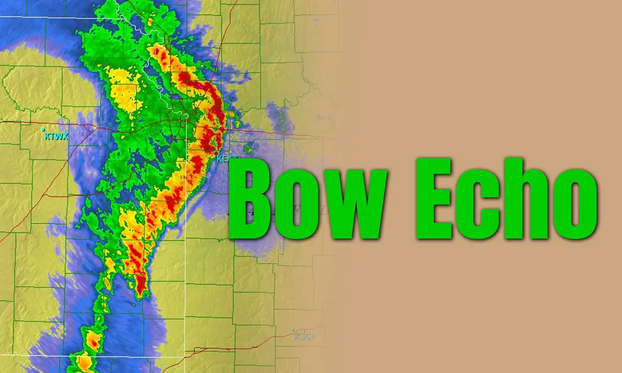
The intense storms that hit Delhi recently looked like a crescent or an archer’s bow which in technical terms are called “bow echoes.”

About Bow Echo
- A bow echo is essentially a line of storms, also called a squall line, on the radar that looks like a bow. Note that this squall line can sometimes be embedded in a larger squall line.
- A bow echo can extend from 20 km to 100 km, and last between three and six hours.
- The term was coined in the 1970s by Ted Fujita, a Japanese American meteorologist known for developing the scale to classify tornadoes.
Formation of Bow Echo
- When rain-cooled air comes down to the ground, and spreads out horizontally. As this happens, a boundary called the gust front is created between the rain-cooled air and warm-moist air on the surface.
- This front pushes up the warm-moist air into the atmosphere, which forms new thunderstorms.
- These new thunderstorms produce more rain, thereby creating more rain-cooled air, which helps the gust front to maintain its strength.
- As this process keeps repeating itself, there comes a point when there is an inflow of air on the trailing side of the line of storms and bends it like an archer’s bow.
- The cycle lasts as long as new thunderstorms keep forming at the front, helping the system grow and move forward with strong winds.
- Bow echoes are not a new phenomenon. In 2022, a bow echo was formed over Delhi and Noida. However, it was short-lived, lasting for an hour, and produced winds of up to 100 kmph.
Bow Echo FAQs
Q1: What is a decharo?
Ans: A derecho (pronounced similar to "deh-REY-cho") is a widespread, long-lived wind storm that is associated with a band of rapidly moving showers or thunderstorms
Q2: What are the different types of bow echoes?
Ans: Three primary initial modes of bow-echo formation are (i) weakly organized cells, (ii) squall lines, and (iii) supercells.
Source: IE