Bulletin of the Atomic Scientists (BAS)

Bulletin of the Atomic Scientists (BAS)

Bulletin of the Atomic Scientists Latest News

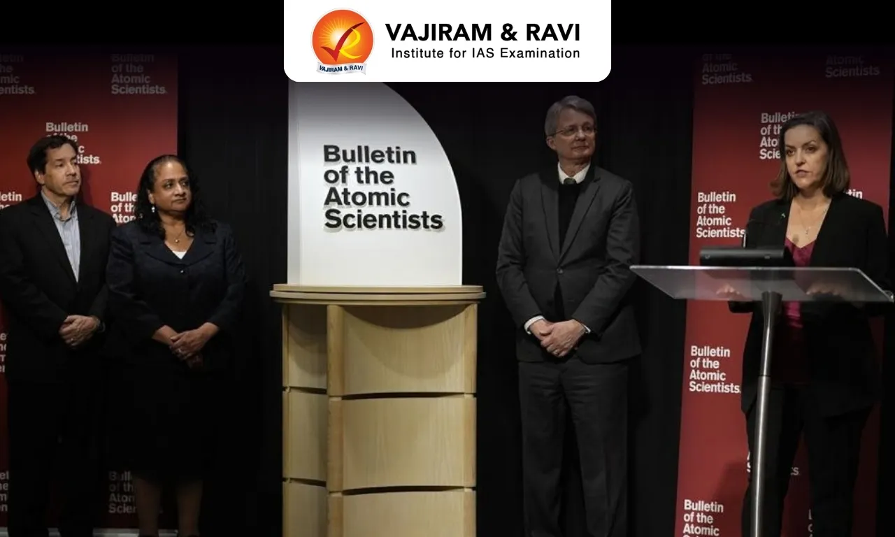
A new assessment published by the regarded Bulletin of the Atomic Scientists (BAS) says India continues to modernise and expand the systems that can deliver nuclear weapons, even as New Delhi maintains its long standing doctrine of no first use.

About Bulletin of the Atomic Scientists 

  • It is an independent, nonprofit organization that sought to warn the public about the danger of nuclear weapons. 
  • The Bulletin was founded by a group called the Atomic Scientists of Chicago in September 1945 at the University of Chicago. 
  • Its founding members and sponsors were scientists who had contributed to the development of the first atomic bombs as part of the Manhattan Project, including physicists Albert Einstein, J. Robert Oppenheimer, and Eugene Rabinowitch. 
  • The Bulletin focuses on three main areas: nuclear risk, climate change, and disruptive technologies.  
  • It pursues its goals through media products, starting in 1945 as a mimeographed newsletter, then a magazine, and now as an online publication. 
  • Today, the Bulletin’s website, premium magazine, videos, iconic Doomsday Clock, and regular events help advance actionable ideas to reduce existential threats. 

Key Facts about Doomsday Clock

  • To convey the particular peril posed by nuclear weapons, the BAS devised the Doomsday Clock in 1947.  
  • It is a symbolic clock adopted by atomic scientists to show how close human beings are considered to be to a global catastrophe, with midnight standing for annihilation, or “doomsday.”.
  • It is recognized as a universal symbol of threats to humanity from a variety of sources: nuclear and other weapons of mass destruction, climate change, and disruptive technologies. 
  • The Doomsday Clock appeared on the Bulletin’s first cover when it transitioned from a newsletter to a magazine. 
  • Its original setting was seven minutes to midnight.  Since its invention in 1947, the clock has been reset 27 times. 
  • In January 2026 the clock was set to 85 seconds before midnight, the closest it has ever been to doomsday.

News: NDTV

Bulletin of the Atomic Scientists FAQs

Q1: What is the Bulletin of the Atomic Scientists (BAS)?

Ans: It is an independent, nonprofit organization that seeks to warn the public about the dangers of nuclear weapons and other existential threats.

Q2: When was the Bulletin of the Atomic Scientists founded?

Ans: September 1945.

Q3: Where was the Bulletin of the Atomic Scientists founded?

Ans: At the University of Chicago.

Q4: Who were among the founding members and sponsors of the Bulletin of the Atomic Scientists?

Ans: Scientists involved in the development of the first atomic bombs under the Manhattan Project, including Albert Einstein, J. Robert Oppenheimer and Eugene Rabinowitch.

Q5: Which organization publishes the Doomsday Clock?

Ans: Bulletin of the Atomic Scientists.

Sal Heartwood Borer

Sal Heartwood Borer

Sal Heartwood Borer Latest News

The Sal trees in Dindori forests of Madhya Pradesh are witnessing a major infestation of the sal heartwood borer this year, compelling the government and local communities to undertake a mega exercise to tackle the pest.

About Sal Heartwood Borer

  • It is a beetle of the order- Coleoptera, family-Cerambycydae. 
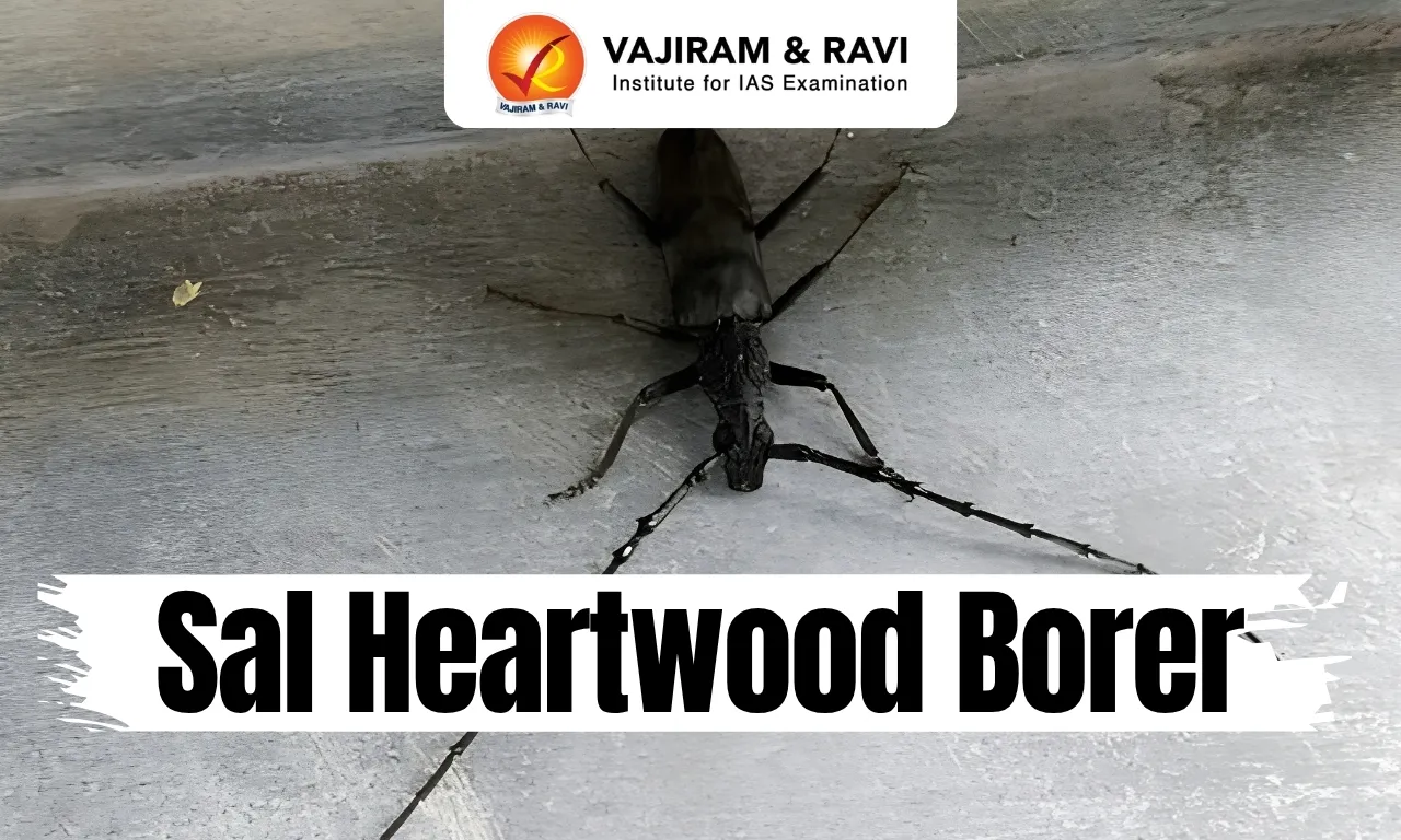
    • Hoplocerambyx spinicornis, commonly known as the sal heartwood borer, is a destructive pest first recorded as a threat to the trees in 1897.
  • Appearance: It looks dark brown in color and is about the size of a human finger.
  • It is the most devastating insect pest responsible for catastrophic damage of sal forests of the country.
  • It causes extensive damage to sal trees both in standing as well as freshly felled timbers.
  • The attack of the borer is considered epidemic when the sal trees affected are more than 1% of the total number of trees.

Key Facts about Sal Tree

  • Sal, or Shorea robusta, is among the dominant tree species of central India’s dry deciduous forests.
  • Distribution: It is found naturally in Uttarakhand, Terai region of Uttar Pradesh, Jharkhand, Odisha, Madhya Pradesh, Chhattisgarh and West Bengal.
  • Required Climatic Conditions for Sal Tree
    • Temperature: It can tolerate temperatures as high as 40-45°Celcius in summers and as low as 5°Celcius in winters.
    • Soil: It can be grown in the plains, provided there is light loamy soil with good drainage and the area receives approximately 1000 mm – 3000 mm of annual rainfall.
    • Climate: It requires a warm and humid climate and can thrive at altitudes up to 1500 metres above the sea level.

Uses of Sal Tree

  • Sal timber has historically been prized for construction and for railway sleepers because of its strength and resistance to decay.
  • Sal seed pressed for oil and used in cooking and in the soap and confectionery industries;
  • Sal leaves, stitched into plates and bowls sold across local markets; and resin tapped from the trunk, used as dhoop in religious offerings.

Source: IE

Sal Heartwood Borer FAQs

Q1: What is Sal Heartwood Borer?

Ans: It is a beetle of the order- Coleoptera, family-Cerambycydae. 

Q2: What is the scientific name of Sal Heartwood Borer?

Ans: Hoplocerambyx spinicornis

Tuvalu Island

Tuvalu

Tuvalu Latest News

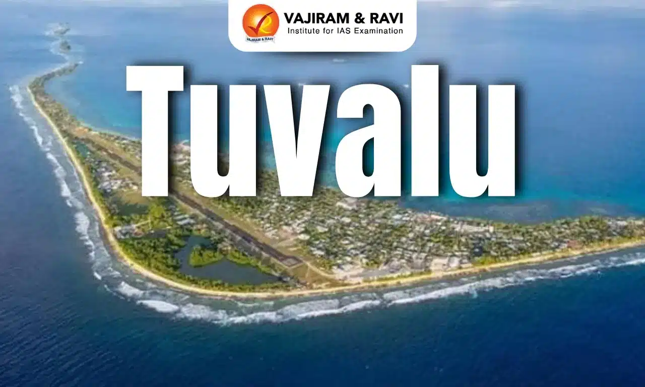
Scientists fear the entire Tuvalu archipelago could be unliveable by the end of the century as it is impacted by climate change.

About Tuvalu

  • Location: It was formerly known as the Ellice Islands, is a Polynesian island country in the west-central Pacific Ocean. 
  • It is the 4th smallest country in the world with 26 sq.km. of land.
  • It sits about halfway between Australia and Hawaii. 
  • Neighboring Countries: Its neighbours include Kiribati, to the north, and Fiji, to the south. 
  • It comprises nine islands (four reef islands and five coral atolls). 
  • Nanumanga, Niutao, and Niulakita are the three main islands that make up Tuvalu. 
  • Capital: The Funafuti atoll is the capital of Tuvalu and is also the most populous among all the 9 atolls.
  • Climate: There are no rivers. Tuvalu’s climate is hot and rainy.
  • Economy: A small quantity of copra is produced for export, the sale of stamps accounts for modest earnings, and fees are collected from foreign fishing fleets, but the country depends heavily on foreign aid.

Source: PIB

Tuvalu FAQs

Q1: Where is Tuvalu located?

Ans: Pacific Ocean

Q2: Which are the main islands of Tuvalu?

Ans: Nanumanga, Niutao, and Niulakita are the three main islands that make up Tuvalu.

Petroglyphs

Petroglyphs

Petroglyphs Latest News

A team of archaeologists recently discovered petroglyphs engraved on a granite rock near the recently restored umbrella stone site at Peralam-Kozhummal in Kannur district, Kerala.

About Petroglyphs

  • Petroglyphs (also known as rock engravings) are symbolic images sculpted or engraved on the surface of rocks by removing material from its surface layer with instruments of superior hardness.
  • The word ‘’petroglyph’’ is derived from two Greek words, ‘’petros’’ meaning “stone,” and ‘’glyphein’’ meaning “to carve.“
  • The techniques used to create these images include pecking, incising, abrading, sculpting, polishing, drilling, and scratching. 
  • These processes remove part of the rock and therefore are different from images simply painted or drawn on rock, which are called petrographs.
  • Because petroglyphs are carved into rock, they tend to last longer than petrographs. 
  • Petroglyphs took two primary forms, as images either appear as scratches or deeper visible indentations on rock. 
  • Petroglyphs are typically associated with prehistoric populations. These carvings often depict animals, people, geometric shapes, and symbolic images that offer insights into the social and religious lives of ancient peoples. 
  • They can be found on every continent throughout the world, except Antarctica.
    • However, they are especially concentrated in Africa, South America, North America (mainly in the southwestern United States), Siberia, Australia, and Europe (Scandinavia, Spanish Galicia, Ireland, and Italy).
  • Example of Petroglyph Site in India: Edakkal Caves in Wayanad, Kerala.
    • Significance:
    • They are among the earliest forms of art to have existed and are therefore considered the foundation of art. 
    • Ancient peoples also used petroglyphs as a form of communication or writing. 
    • For example, some petroglyphs clearly indicated the borders between tribal lands, and others were astronomical markers and maps. 
    • Additionally, some petroglyphs served as musical instruments and were known as “rock gongs.”.

News:TH

Petroglyphs FAQ's

Q1: What are petroglyphs?

Ans: Petroglyphs are symbolic images carved or engraved on rock surfaces by removing material from the rock.

Q2: What techniques are used to create petroglyphs?

Ans: Pecking, incising, abrading, sculpting, polishing, drilling and scratching.

Q3: How are petroglyphs different from petrographs?

Ans: Petroglyphs are carved or engraved by removing rock material, whereas petrographs are images painted or drawn on rock surfaces.

Q4: In which regions are petroglyphs particularly concentrated?

Ans: Africa, South America, North America, Siberia, Australia and Europe.

Desert National Park

Desert National Park (DNP)

Desert National Park Latest News

In a major milestone for the conservation of the critically endangered Great Indian Bustard (GIB), the Union Environment Minister released two captive-bred male GIBs into the wild at Sam in the Desert National Park, Jaisalmer, Rajasthan.

About Desert National Park

  • Location: It is located in the Thar Desert near the town of Jaisalmer, in Rajasthan.
  • It is one of the largest national parks in the country, covering an area of over 3160 sq. km.
  • Topography: The substantial part of the park is on a landscape, which comprises a lakebed of extinct salt lakes and thorny scrub and a considerable area consists of sand dunes. 
  • Climate: The area falls in the extreme hot and arid region of the very low rainfall zone (<100mm) of the country.
  • One of the most interesting features of this park is the presence of fossils from the Jurassic Period.
  • Vegetation
    • The vegetation of a major part of the arid region of the Thar falls under the thorn forest type.
    • The vegetation is quite sparse with open grassland, thorny bushes, plantations and dunes as the broad habitat types.
  • Lakes: There are three main lakes in this Park- Rajbaugh Lake, Malik Talao Lake and Padam Talao.
  • Flora: The rich flora of the park consists of dhok, ronj, salai and palm trees. The vegetation is sparce, and patches of sewan grass and aak shrub can be seen.
    • Khejri (Prosopis cineraria) is commonly found, which is revered and protected by the local communities, especially the ‘Bishnois’.
  • Fauna: Blackbuck, Chinkara, Desert fox, Bengal Fox, Indian Wolf, Desert Cat, Hare etc. Reptiles are also found in abundance and they include spiny –tailed lizard, monitor lizard, saw scaled-viper, Russel viper , Karit.
  • The Great Indian Bustard is one magnificent bird found in relatively fair numbers.

Source: PIB

Desert National Park FAQs

Q1: Where is Desert National Park located?

Ans: It is located in Rajasthan

Q2: Which lakes are found in Desert National Park?

Ans: Rajbaugh Lake, Malik Talao Lake and Padam Talao.

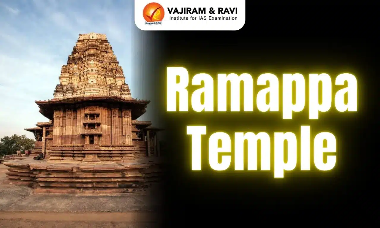
Ramappa Temple

Ramappa Temple

Ramappa Temple Latest News

Recently, the Kakatiya Heritage Trust has expressed concern over a proposed open-cast mining project by Singareni, alleging that it could pose a threat to the UNESCO World Heritage-listed Ramappa Temple and Ramappa Lake.

About Ramappa Temple

  • Location: It is located in the state of Telangana.
  • It was constructed in 1213 AD during the reign of the Kakatiya Empire by RecharlaRudra, a general of Kakatiya king Ganapati Deva.
  • It is also known as the Rudreswara Temple and its presiding deity here is RamalingeswaraSwamy.
  • The temple got its name Ramappa because of its chief sculptor Ramappa.
  • Ramappa Temple is probably the only temple in India that is named after the architect.
  • In 2021, the temple was inscribed as a UNESCO World Heritage Site as “Kakatiya Rudreshwara (Ramappa) Temple, Telangana”.

Architectural Features of Ramappa Temple

  • It features decorated beams and pillars of carved granite and dolerite with a distinctive and pyramidal Vimana (horizontally stepped tower) made of lightweight porous bricks.
    • The temple stands on a 6 feet high star-shaped platform with walls, pillars and ceilings adorned with intricate carvings.
  • Earthquake-proof: Made out of clay mixed with acacia wood, chaff and myrobalan fruit (a family of amla), the bricks used in building the gopuram of the temple are light enough to float on water.
  • Using this technique has made the temple light, meaning, in case of a natural event like an earthquake, the probability of it collapsing would be very low.
  • Sandbox technique: The temple construction was done using the sandbox technique. This is a technique where the foundation pit is filled with a mixture of sand-lime, jaggery and black myrobalan fruit.
  • This mix acts as a cushion in case of earthquakes. 

Source: TH

Ramappa Temple FAQs

Q1: Where is Ramappa Temple located?

Ans: Telangana

Q2: When was Ramappa Temple constructed?

Ans: It was constructed in 1213 AD during the reign of the Kakatiya Empire by RecharlaRudra, a general of Kakatiya king Ganapati Deva.

G7 Group

G7

G7 Group Latest News

Recently, the Group of Seven (G7) countries agreed to release 100 million barrels of diesel and crude oil from emergency reserves. 

About G7 Group

  • It is an informal grouping of seven of the world’s advanced economies.
  • Members: Canada, France, Germany, Italy, Japan, the United Kingdom, and the United States.
  • Evolution
    • It was founded in 1975 in response to the oil crisis. 
    • Russia was a member from 1998, the group temporarily became the G8.
    • In 2014, the group returned to the G7 format. 
  • The G7 originally dealt exclusively with issues related to the development of the global economy. 
  • Major Focus Area: It now covers the entire spectrum of global issues, such as foreign and security policy, trade, climate, and development.
  • Governance
    • There is no firmly established secretariat, procedural guidelines, or administrative structures. 
    • Presidency: Its presidency rotates each calendar year among the member states. The EU does not hold the rotating presidency of the G7.
    • The changing agenda and thematic priorities of the G7 are determined by the respective presidency. 
    • Decisions are usually taken by consensus.

Source: Reuters

G7 Group FAQs

Q1: What are the members of G7 Group?

Ans: Canada, France, Germany, Italy, Japan, the United Kingdom, and the United States.

Q2: Which are the major topics G7 Group discuses?

Ans: It now covers the entire spectrum of global issues, such as foreign and security policy, trade, climate, and development.

Enquire Now