


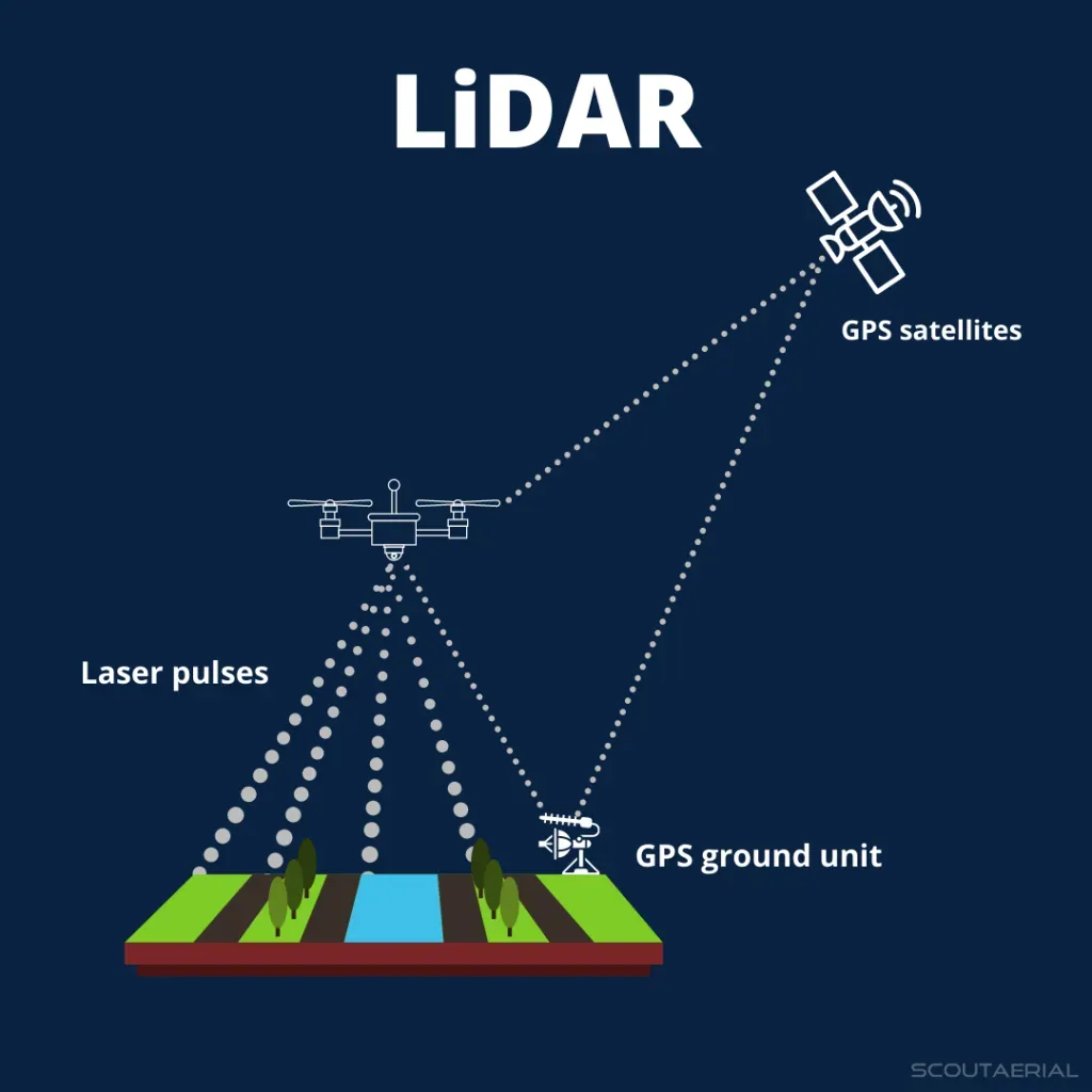
About LiDAR:
- The Light Detection and Ranging (LiDAR) is a remote sensing technology that uses light in the form of a pulsed laser to measure ranges (or variable distances) of a sensor, usually mounted aboard an aircraft, to Earth’s surface.
- LiDAR data can be used to create high-resolution 3-D models of ground elevation with a vertical accuracy of upto 10 cm.
- Working
- LiDAR instrumentation comprises a laser, a scanner, and a GPS receiver.
- The rapidly firing laser travels to the ground where it hits vegetation, building, and various topographic features. This light is reflected or scattered, and recorded by the LiDAR sensor.
- The system calculates the light pulses’ two-way travel time to arrive at the distance between the terrain and the sensor.
- It processes this information with Global Positioning System (GPS) and Inertial Measurement System (IMS) data, to create an elevation map of Earth.
- LiDAR data is initially collected as a “point cloud” of all individual points reflected from everything on the surface, including structures and vegetation.
- The specific of how much light energy was returned to the sensor allows further identification of different features, such as vegetation, buildings, etc. For example, tree canopies, however dense they may be, allow some light to pass through and hit the ground.
- Its data can be further refined to produce what scientists call a “bare earth” Digital Elevation Model, in which structures and vegetation are stripped away.
- Applications
- It is used to generate precise, three-dimensional information about the shape of the Earth and its surface characteristics.
- This is obviously very useful information for geographers, policy makers, conservationists, and engineers.
- It has also shown potential as a tool of archaeological discovery.
Q1: What is Archaeology?
It is the study of human activity through the recovery and analysis of material culture. The archaeological record consists of artifacts, architecture, biofacts or ecofacts and cultural landscapes.
News: How remote sensing system LiDAR helped discover a lost Mayan city


 Last updated on Oct, 2026
→ UPSC 2027 Notification will be released on 13 January 2027 at upsconline.nic.in.
→ Check Nobel Prize 2026 Winners List here.
→ Download PIB PRiSM Monthly Magazine 2026 here.
→ Check UPSC Monthly Current Affairs Magazine The Recitals here.
→ Check out the latest UPSC Syllabus here.
→ Download UPSC Model Answers for Mains 2026
→ UPSC Mains Question Paper 2026 is out now for Essay & GS Paper 1, 2, 3 & 4.
→ UPSC Calendar 2027 has been released.
→ Enroll in Vajiram & Ravi’s UPSC Mains Test Series 2027 for structured answer writing practice, expert evaluation, and exam-oriented feedback.
→ Join Vajiram & Ravi’s UPSC Mentorship Program 2027 for personalized guidance, strategy planning, and one-to-one support from experienced mentors.
→ Go through the UPSC Mains Previous Year Papers to enhance your preparation.
→ UPSC has released UPSC Toppers List 2025 with the Civil Services final result on its official website.
→ Also check Best UPSC Coaching in India








