


About Floodplain
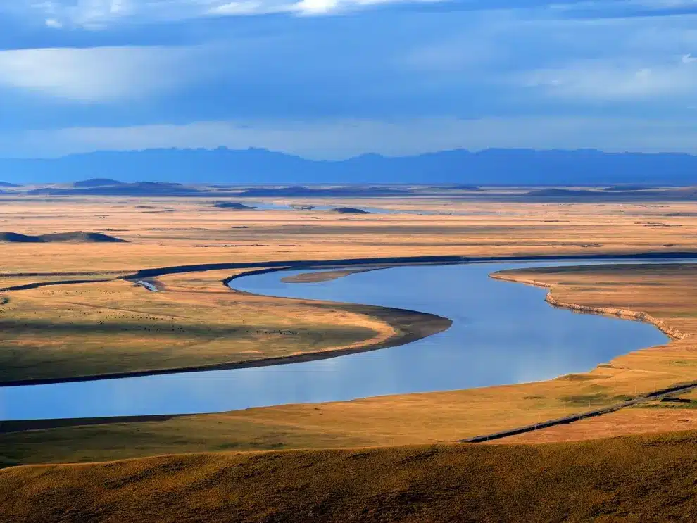
- A floodplain is a generally flat area of land next to a river or stream.
- It is composed of unconsolidated sedimentary deposits (alluvium) and is subject to periodic inundation by the stream.
- It stretches from the banks of the river to the outer edges of the valley.
- A floodplain consists of two parts.
- The first is the main channel of the river itself, called the floodway. Floodways can sometimes be seasonal, meaning the channel is dry for part of the year.
- Beyond the floodway is the flood fringe. It is the land between the banks of the floodway and the valley wall, or anywhere the valley land starts to rise.
- How do floodplains form? Floodplains develop in two common ways: erosion and deposition (also known as aggradation).
- When rivers start to meander, curving from side to side, the water erodes the banks of the river and creates a wide, flat area around the sides.
- When the river floods, either because of heavy rainfall or ice melting upstream, it floods its banks.
- The water that moves out of the floodway and into the fringes loses the force that was carrying much of the sediment acquired from erosion upstream and deposits it on the surrounding land.
- The portions of the river that have been consistently flooded will naturally start to build a bank up again.
- As sediment is deposited over time, most of it is deposited where the land elevates out of the river bed and creates a bank where one had previously eroded.
- These deposits flanking the river are called fluvial terraces and can tell geologists a lot about where floodplains used to be before the banks built up.
- Floodplains are absent where downcutting of rivers is dominant.
- Importance:
- The deposition of sediment that happens in floodplains can be the source of major fertility.
- This sediment is usually built up of alluvium, or silt, which is considered some of the richest soil, containing nutrients like potash, phosphoric acid, and lime.
Q1) What are sedimentary deposits?
Sedimentary deposits are mineral deposits that are formed through the accumulation of sediments on or near the Earth’s surface. These deposits can contain a variety of minerals, including metal ores, coal, and industrial minerals such as limestone, salt, and gypsum.
Source: Committee plans to define river floodplain by April 18


 Last updated on Oct, 2026
→ UPSC 2027 Notification will be released on 13 January 2027 at upsconline.nic.in.
→ Check Nobel Prize 2026 Winners List here.
→ Download PIB PRiSM Monthly Magazine 2026 here.
→ Check UPSC Monthly Current Affairs Magazine The Recitals here.
→ Check out the latest UPSC Syllabus here.
→ Download UPSC Model Answers for Mains 2026
→ UPSC Mains Question Paper 2026 is out now for Essay & GS Paper 1, 2, 3 & 4.
→ UPSC Calendar 2027 has been released.
→ Enroll in Vajiram & Ravi’s UPSC Mains Test Series 2027 for structured answer writing practice, expert evaluation, and exam-oriented feedback.
→ Join Vajiram & Ravi’s UPSC Mentorship Program 2027 for personalized guidance, strategy planning, and one-to-one support from experienced mentors.
→ Go through the UPSC Mains Previous Year Papers to enhance your preparation.
→ UPSC has released UPSC Toppers List 2025 with the Civil Services final result on its official website.
→ Also check Best UPSC Coaching in India








