Sinhagad Fort Latest News
A 100-foot tall saffron flag will be erected by the Pune Municipal Corporation (PMC) at Sinhagad Fort in honour of Chhatrapati Shivaji Maharaj and the Maratha Empire.
About Sinhagad Fort
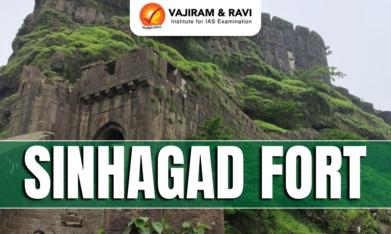
- Sinhagad, earlier known as ‘Kondhana’, is a fortress located near Pune, Maharashtra.
- It perched on an isolated cliff of the Bhuleswar range of the Sahyadri Mountains, 1,312 m above sea level.
- It was built in a strategic location and was surrounded by several other forts like Torna Fort, Purandar Fort, and Rajgad Fort.
Sinhagad Fort History
- Sinhagad Fort has a rich history dating back over 2,000 years.
- It was originally known as Kondhana and was named after the sage Kaundinya.
- It has changed hands multiple times, with rulers from different dynasties leaving their mark.
- Mohammed bin Tughalak captured the fort from the Koli tribal chieftain, Nag Naik, in 1340 CE.
- In 1496 CE, Malik Ahmad, the founder of the Nizam Shahi dynasty, took control of the fort.
- Nearly 200 years later, the Maratha leader Shahaji Bhonsale captured the fort.
- In 1647 CE, Shivaji held the stronghold.
- In 1665 CE, as per the Treaty of Purandar, Shivaji handed over Sinhagad to the Mughals.
- The fort’s famous chapter unfolded in 1670 when Chhatrapati Shivaji Maharaj orchestrated a daring mission to reclaim the fort from the Mughals.
- The Battle of Sinhagad was led by the fearless Tanaji Malusare ( Shivaji’s favorite general), who, along with his brave warriors, scaled the steep cliffs under the cover of darkness.
- Despite putting up a fierce fight, Tanaji succumbed to his injuries.
- When Shivaji Maharaj heard of Tanaji’s sacrifice, he famously remarked, “Gad ala, pan Sinha gela” (The fort is won, but the lion is lost).
- In honor of his valiant warrior, Shivaji Maharaj honoured the fort with the name Sinhagad Fort, or Lion’s Fort.
- The battle has led to an unforgettable victory for the Marathas over the Mughal Army.
- The fort remained under the control of the Marathas until 1818 CE, when it was surrendered to the British after the Third Anglo-Maratha War.
- The fort was later used as a retreat for many European residents of Pune.
Sinhagad Fort Architecture
- It is a marvel of Maratha architecture and engineering.
- It comprises a strong fortified wall which runs for almost 2 miles.
- The fort features two main entrances—the Pune Darwaza, facing Pune, and the Kalyan Darwaza, opening towards the Konkan region—both showcasing intricate stonework and strategic placement for enhanced security.
- It has an advanced water storage system, which includes ancient rainwater harvesting techniques and natural reservoirs that ensure a continuous water supply.
- The fort has several bastions, ramparts, walls, and gates that enclose its premises.
- The fort also houses a temple dedicated to Goddess Kali, a brewery, some military sheds, and the tombs of Rajaram Chhatrapati (Shivaji’s youngest son) and Tanaji Malusare.
News: IE
Sinhagad Fort FAQs
Q1: Where is Sinhagad Fort located?
Ans: Near Pune in Maharashtra.
Q2: When did Chhatrapati Shivaji Maharaj take control of Sinhagad Fort?
Ans: In 1647 CE.
Q3: Who led the Battle of Sinhagad in 1670 CE?
Ans: Tanaji Malusare, a trusted general of Chhatrapati Shivaji Maharaj.
Q4: Why was Kondhana renamed Sinhagad Fort?
Ans: Shivaji Maharaj renamed it in honour of Tanaji Malusare's sacrifice. Sinhagad means the “Lion's Fort”.
Q5: Following which war was Sinhagad Fort surrendered to the British in 1818 CE?
Ans: The Third Anglo-Maratha War.