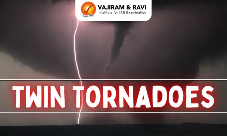
Twin Tornadoes refer to two tornadoes that occur simultaneously in close proximity, often developing from the same supercell thunderstorm. They may rotate around a common center or form independently within the same storm system. Although relatively rare, twin tornadoes are highly destructive and demonstrate the complexity of atmospheric dynamics.
Twin Tornadoes
- Twin Tornadoes refer to the occurrence of two separate tornadoes forming simultaneously within the same supercell thunderstorm or a cluster of severe thunderstorms.
- Although they originate from the same weather system, each tornado develops its own rotating column of air and may follow a different path.
- In some situations, the two tornadoes appear to rotate around one another, while in others they move independently across nearby areas.
- This behaviour depends on the internal circulation of the parent thunderstorm and the surrounding atmospheric conditions.
- Twin tornadoes are different from multiple-vortex tornadoes. In a multiple-vortex tornado, several smaller vortices rotate inside a single large tornado, whereas twin tornadoes involve two separate tornadoes existing at the same time.
- Because two tornadoes strike nearby locations simultaneously, they can affect a much larger geographical area, increasing the scale of destruction and making rescue operations more difficult than during a normal tornado event.
- The formation of twin tornadoes requires an unusual combination of strong atmospheric instability, high moisture content, powerful wind shear, and a persistent rotating supercell, making them one of the rarest forms of severe weather.
Tornado
- A tornado is a rapidly rotating column of air that extends from the base of a cumulonimbus cloud to the Earth’s surface. It is among the most violent and destructive weather phenomena found on Earth.
- Tornadoes are commonly known as twisters, whirlwinds, or sometimes simply funnels because of their characteristic funnel-shaped appearance.
- They are formed during severe thunderstorms, where rapidly rising warm air and strong atmospheric rotation combine to create an intense spinning column of air.
- Tornadoes usually occur together with heavy rainfall, lightning, thunder, hailstorms, and strong gusty winds, making them part of a broader severe weather system.
- Although most tornadoes travel along a relatively narrow path, the destruction within that path can be catastrophic.
- Buildings may collapse, vehicles may be lifted or overturned, trees may be uprooted, and flying debris becomes one of the leading causes of injuries and fatalities.
- The strongest tornadoes can produce wind speeds exceeding 500 km/h, making them capable of causing devastation within just a few minutes.


Why are Twin Tornadoes So Rare?
- Rare Atmospheric Conditions: Twin tornadoes are extremely rare because they require a unique combination of atmospheric conditions that rarely occur together. While many severe thunderstorms produce a single tornado, the formation of two separate tornadoes at the same time is highly uncommon.
- Formation from the Same Storm: Twin tornadoes develop when two independent tornadoes form simultaneously from the same supercell thunderstorm. Although they originate from one parent storm, each tornado has its own rotating circulation (mesocyclone) and follows a separate path.
- Movement Pattern: The two tornadoes may travel side by side, move in different directions, or briefly appear to rotate around one another before separating. Their movement depends on the internal circulation of the parent storm.
- Specific Weather Requirements: Their formation requires very high atmospheric instability, a large supply of warm and moist air, strong vertical wind shear, and a long-lasting rotating supercell. Since all these conditions must occur simultaneously, twin tornadoes are rarely observed.
- Energy Distribution: In most cases, a powerful thunderstorm concentrates its energy into producing one large and intense tornado. It is uncommon for the storm to generate enough energy to sustain two separate tornadoes at the same time.
- Occlusion (Hand-Off) Process: Twin tornadoes usually form during the occlusion or hand-off stage of a supercell. As the first tornado begins to weaken due to the inflow of cooler air, the storm may simultaneously generate a second rotating circulation, allowing both tornadoes to exist together for a short time.
- Overlap Window: There is usually only a brief overlap period during which both tornadoes remain on the ground together. This short-lived stage requires an exceptionally energetic atmosphere, making true twin tornadoes even rarer.
- Fujiwhara Effect: After both tornadoes form, they may interact through the Fujiwhara Effect, where two nearby rotating tornadoes orbit around a common centre. In many cases, the stronger tornado weakens or absorbs the smaller one.
- Short Duration: True twin tornadoes usually remain active together for only a few minutes, making them extremely rare and difficult to observe, forecast, and study.
- Twin Tornadoes vs Multiple-Vortex Tornadoes: Twin tornadoes consist of two separate tornadoes developing from the same storm, whereas a multiple-vortex tornado is one large tornado containing several smaller rotating vortices within it.
Formation of Twin Tornadoes
The formation of Twin Tornadoes is a rare and complex process that occurs within a powerful supercell thunderstorm. Unlike ordinary tornadoes, twin tornadoes develop when the parent storm is able to produce two separate rotating circulations (mesocyclones) at nearly the same time.
- Formation of a Supercell Thunderstorm
- The process begins with the formation of a supercell thunderstorm, which develops when warm, moist air near the Earth’s surface rises rapidly and meets cold, dry air at higher altitudes. This creates strong atmospheric instability, providing the energy needed for severe storms.
- Development of Strong Wind Shear
- Wind shear, which is the change in wind speed and direction with height, causes the rising air to rotate. Strong updrafts inside the thunderstorm tilt this horizontal rotation into a vertical rotating column, forming a mesocyclone, the rotating core of a supercell.
- Formation of the First Tornado
- As the mesocyclone strengthens, a funnel cloud develops beneath the storm. When this rotating funnel extends from the cloud to the ground, it becomes the first tornado.
- Development of a Second Mesocyclone
- During the occlusion (hand-off) stage, the first tornado gradually weakens as cooler air wraps around it. If the atmosphere remains highly unstable, the supercell may generate a second mesocyclone while the first tornado is still active.
- Formation of Twin Tornadoes
- The newly formed second mesocyclone produces another tornado before the first one disappears. As a result, two separate tornadoes exist on the ground simultaneously, creating a Twin Tornado event.
- Interaction Between the Two Tornadoes
- The two tornadoes may move side by side, travel independently, or briefly rotate around one another due to the Fujiwhara Effect. Eventually, one tornado usually weakens, merges with the other, or dissipates as the storm continues its life cycle.
- Dissipation
- Twin tornadoes usually remain active together for only a short period because maintaining two separate tornadoes requires an extremely energetic atmosphere. Once the storm loses energy, both tornadoes gradually weaken and disappear.
Conditions Necessary for Tornado Formation
- The formation of tornadoes depends on the interaction of several atmospheric conditions rather than a single weather factor. All these conditions must occur together for a tornado to develop.
- Warm and moist air near the ground acts as the primary energy source, while cold and dry air at higher levels creates the instability needed for powerful thunderstorm development.
- Strong wind shear helps generate atmospheric rotation, while powerful updrafts strengthen that rotation and convert it into a vertically rotating column.
- Most destructive tornadoes develop from supercell thunderstorms, which are highly organised rotating thunderstorms capable of sustaining intense atmospheric circulation for long periods.
Characteristics of Tornadoes
- Tornadoes usually appear as a funnel-shaped cloud, although sometimes only rotating dust and debris are visible when condensation is limited.
- Their colour depends on the surrounding environment and the amount of dust, soil, moisture, and debris they pick up. They may appear white, grey, brown, black, or even reddish.
- The width of a tornado can range from only a few metres to more than 3 kilometres, while their path length may extend for several kilometres.
- Most tornadoes survive for less than 10 minutes, but stronger tornadoes can remain active for over an hour and travel much longer distances.
- In the Northern Hemisphere, tornadoes usually rotate counter-clockwise, whereas in the Southern Hemisphere, they generally rotate clockwise due to the influence of large-scale atmospheric circulation.
- Most fatalities occur because of high-speed flying debris, collapsing buildings, and overturned vehicles rather than direct contact with the tornado itself.
Types of Tornadoes
- Supercell Tornadoes
- Supercell tornadoes are the strongest, largest, and most destructive type of tornadoes. They develop from supercell thunderstorms, which contain a rotating updraft called a mesocyclone. Most of the world’s violent tornadoes belong to this category.
- Landspouts
- Landspouts are relatively weak tornadoes that form without a mesocyclone. They usually develop during the early stages of thunderstorm formation and are generally short-lived, causing comparatively less damage.
- Waterspouts
- Waterspouts are tornado-like rotating columns of air that develop over oceans, seas, lakes, or rivers. Some waterspouts move onto land and transform into ordinary tornadoes capable of causing damage.
- Multiple-Vortex Tornadoes
- Multiple-vortex tornadoes contain two or more smaller rotating vortices inside one larger tornado. These smaller vortices rotate around the main circulation and often produce highly uneven but extremely severe damage along the tornado’s path.
Global Distribution of Tornadoes
- Twisters (tornadoes) are not evenly distributed across the world. They occur more frequently in regions where warm, moist air meets cold, dry air, creating strong atmospheric instability, wind shear, and powerful thunderstorms.
- The United States records the highest number of tornadoes in the world due to the frequent collision of different air masses. It experiences more than a thousand tornadoes every year, making it the global hotspot for tornado activity.
- The Central Plains of the United States, popularly known as “Tornado Alley”, is the most tornado-prone region. States such as Texas, Oklahoma, Kansas, Nebraska, and South Dakota frequently witness powerful tornadoes formed by severe supercell thunderstorms.
- In recent years, the Southeastern United States, known as “Dixie Alley”, has also become a major tornado-prone region. States like Alabama, Mississippi, Louisiana, Tennessee, and Georgia experience frequent and often deadly tornadoes, many of which occur at night.
- Bangladesh is considered the most tornado-prone country in the Indian subcontinent. Its hot, humid climate and frequent severe thunderstorms make it highly vulnerable to destructive tornadoes, especially during the pre-monsoon season.
- Argentina, particularly the Pampas region, is another important tornado-prone area. Here, the interaction between warm tropical air and cold polar air frequently produces severe thunderstorms capable of generating tornadoes.
- Canada experiences the second-highest number of tornadoes in the world after the United States. Most tornadoes occur in the southern provinces during the warmer months when atmospheric conditions become favourable.
- Australia, South Africa, and several parts of Europe also experience tornadoes occasionally. Although less frequent and generally weaker than those in the United States, these tornadoes can still cause considerable damage.
- Tornadoes have been reported on every continent except Antarctica. The extremely cold climate of Antarctica does not provide the warm, moist air required for the formation of severe thunderstorms and tornadoes.
Tornadoes in India
- Twisters (tornadoes) are rare in India compared to countries like the United States, but they occur under favourable weather conditions and can cause significant damage.
- Most tornadoes in India are associated with pre-monsoon thunderstorms, locally known as Nor’westers (Kal-Baishakhi), which mainly occur during April and May.
- The most vulnerable regions are West Bengal, Odisha, Bihar, Jharkhand, Assam, and other Northeastern states, where warm, moist air from the Bay of Bengal interacts with hot continental air.
- Indian tornadoes are generally short-lived and smaller than those in the United States, but they can still produce strong winds capable of damaging houses, crops, trees, and infrastructure.
- Due to their sudden formation and limited early warning systems, tornadoes can cause considerable loss of life and property, especially in rural areas.
- India has witnessed several notable tornadoes, including the 2010 Bihar Tornado, along with major events in West Bengal and Odisha.
- Waterspouts are also occasionally observed over rivers, lakes, and coastal waters, particularly along the eastern coast.
- Although India is not a major tornado-prone country, its eastern and northeastern regions remain vulnerable during the pre-monsoon season, highlighting the need for better forecasting and disaster preparedness.

 Last updated on Sep, 2026
→ UPSC 2027 Notification will be released on 13 January 2027 at upsconline.nic.in.
→ Check out the latest UPSC Syllabus here.
→ Download UPSC Model Answers for Mains 2026
→ UPSC Mains Question Paper 2026 is out now for Essay & GS Paper 1, 2, 3 & 4.
→ UPSC Calendar 2027 has been released.
→ Enroll in Vajiram & Ravi’s UPSC Mains Test Series 2027 for structured answer writing practice, expert evaluation, and exam-oriented feedback.
→ Join Vajiram & Ravi’s UPSC Mentorship Program 2027 for personalized guidance, strategy planning, and one-to-one support from experienced mentors.
→ Go through the UPSC Mains Previous Year Papers to enhance your preparation.
→ UPSC has released UPSC Toppers List 2025 with the Civil Services final result on its official website.
→ Also check Best UPSC Coaching in India
Twin Tornadoes FAQs
Q1. What are Twin Tornadoes?+
Q2. How are Twin Tornadoes different from Multiple-Vortex Tornadoes?+
Q3. Why are Twin Tornadoes so rare?+
Q4. How do Twin Tornadoes form?+
Q5. What causes a Tornado to form?+
Tags: geography geography notes twin tornadoes