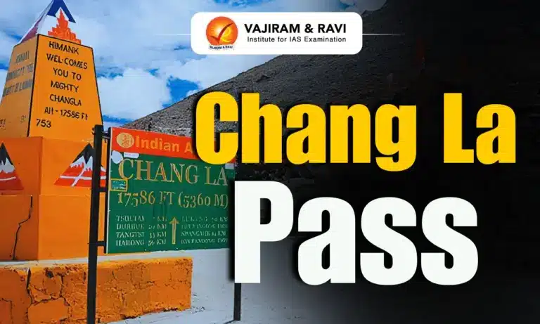
Chang La Pass is a high mountain pass located in Ladakh within the Greater Himalaya Range. It lies on the strategic road linking Leh with Pangong Lake through the Shyok River Valley. The pass is an important transport corridor, supports defence movement, scientific research and regional connectivity and serves as a major gateway towards the Changthang Plateau. Because of its extreme elevation, harsh weather conditions and strategic location, Chang La remains one of the most significant high altitude mountain passes in northern India.
Chang La Pass
In the Ladakhi Tibetic language, “Chang” means South and “La” means Pass. Therefore, Chang La literally translates to “Southern Pass.” Although a temple at the pass is dedicated to Changla Baba, historical interpretation states that the pass name existed earlier. The belief that the pass was named after the saint is considered a later popular tradition.
Chang La Pass Features
Chang La Pass is one of the highest motorable mountain passes in Ladakh and plays an important geographical, strategic, scientific and transport role in the Himalayan region.
- Location: Chang La Pass is situated in Ladakh State within the Greater Himalaya Range. It is traversed by the road connecting the Indus Valley with Pangong Lake.
- Altitude: It has a height of 5,360 metres (17,590 feet).
- Geographical position: The pass lies between Leh and the Shyok River valley. It forms a major mountain crossing that enables movement across the rugged eastern Himalayan terrain of Ladakh.
- Weather: Chang La experiences severe cold, heavy snowfall during winter and prolonged snow cover. Seasonal freezing and thawing directly affect road quality and demand continuous maintenance by road agencies.
- Road connectivity: Chang La lies on the Leh-Karu-Sakti-Zingral-Chang La-Durbuk-Tangtse-Pangong Lake motorable road. This corridor is the principal route connecting Leh with Pangong Lake through eastern Ladakh.
- Connection with National Highway: Karu, located on Leh-Manali NH-3, Connects Chang La and Pangong Lake with Leh and the rest of India, making it an important road junction for regional accessibility.
- Alternate road corridor: In September 2021, the Border Roads Organisation (BRO) opened another asphalt road connecting Zingral and Tangtse through Ke La Pass at 5,669.28 metres (18,600 feet) and Taruk (Tharuk), improving road redundancy and mobility.
- Shyok River Valley: Chang La Pass is located between Leh and the Shyok River Valley in the Greater Himalaya.
- Nearest Settlements: Zingral is the nearest inhabited settlement to the pass, while Tangtse is the nearest town. Both settlements support movement and logistics along this high altitude corridor.
- Changpa community: The Changthang region beyond the pass is traditionally inhabited by the Changpa, a nomadic pastoral community known for seasonal migration across the Himalayan plateau.
- Regional landscape: The pass is surrounded by snow covered peaks, barren mountains, deep valleys and cold desert terrain, reflecting the distinctive high altitude geography of eastern Ladakh.


Chang La Pass Significance
The key highlighting importance of the Chang La Pass has been listed below:
- Strategic importance: The road over Chang La is one of the key mountain routes used for movement between Leh and eastern Ladakh. It supports civilian transport as well as logistical requirements in remote Himalayan areas.
- Shyok River Valley: The pass being located near the valley, makes this geographical position an important mountain crossing linking the Indus Valley with eastern Ladakh through a high altitude corridor.
- Defence research facility: The Defence Research and Development Organisation (DRDO) operates the world’s highest research station at Chang La, established at an elevation of approximately 5,384 metres (17,664 feet) for high altitude scientific research. It studies technologies and systems suitable for extreme cold, low oxygen and high altitude environments, providing valuable support for operations in Himalayan regions.
- Gateway to Changthang: Chang La serves as the principal gateway to the Changthang Plateau, an extensive high altitude plateau spread across the Himalayas and known for its cold desert environment.
- Access to Nubra region: The pass also functions as an important gateway for movement towards the Nubra region, increasing its significance for transportation and regional connectivity across eastern Ladakh.
- Access to Pangong Lake: Chang La is the principal road crossing for reaching Pangong Lake, one of India’s largest high altitude lakes, making the pass an essential transport link rather than merely a mountain crossing.
- Tourism: A temple dedicated to Changla Baba stands near the summit. Although popularly associated with the origin of the pass name, linguistic evidence indicates that the geographical name predates the local tradition.

 Last updated on Sep, 2026
→ UPSC 2027 Notification will be released on 13 January 2027 at upsconline.nic.in.
→ Asian Games 2026 are being held in Aichi-Nagoya, Japan, from 19 September to 4 October.
→ Check out the latest UPSC Syllabus here.
→ Download UPSC Model Answers for Mains 2026
→ UPSC Mains Question Paper 2026 is out now for Essay & GS Paper 1, 2, 3 & 4.
→ UPSC Calendar 2027 has been released.
→ Enroll in Vajiram & Ravi’s UPSC Mains Test Series 2027 for structured answer writing practice, expert evaluation, and exam-oriented feedback.
→ Join Vajiram & Ravi’s UPSC Mentorship Program 2027 for personalized guidance, strategy planning, and one-to-one support from experienced mentors.
→ Go through the UPSC Mains Previous Year Papers to enhance your preparation.
→ UPSC has released UPSC Toppers List 2025 with the Civil Services final result on its official website.
→ Also check Best UPSC Coaching in India
Chang La Pass FAQs
Q1. Where is Chang La Pass located?+
Q2. What is the altitude of Chang La Pass?+
Q3. Which two places does Chang La Pass connect?+
Q4. Why is Chang La Pass strategically important?+
Q5. What does the name Chang La mean?+
Q6. What kind of research is carried out at Chang La Pass?+
Tags: chang la chang la pass history