Equal Earth Map Latest News
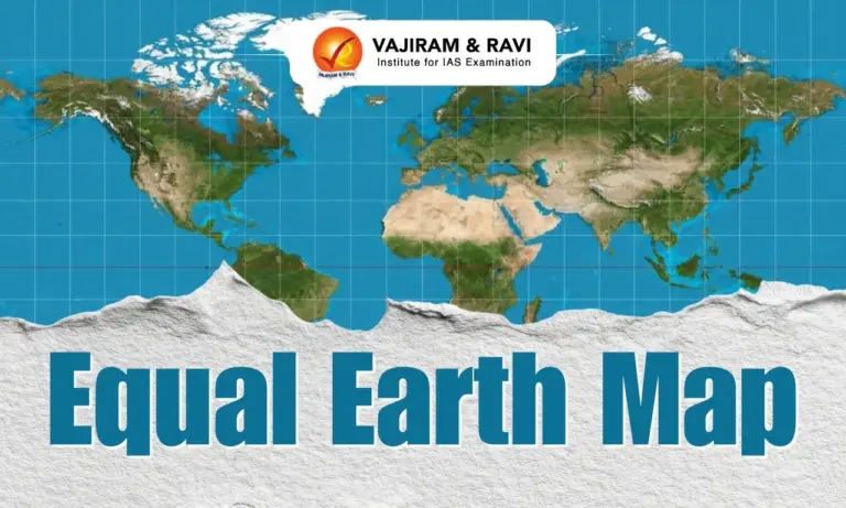
- The United Nations General Assembly has adopted a resolution to move away from the 16th-century Mercator map towards the Equal Earth projection, which shows Africa’s true size more accurately.
- The Togo-led resolution was supported by 164 countries, including India. The United States voted against it and six countries abstained. Since UN resolutions are not binding, it remains to be seen whether governments, organisations and classrooms will actually adopt the new map.
- India backed the resolution while drawing a firm line on the depiction of Jammu and Kashmir and Ladakh.
Why No Flat Map Can Be Perfect
- The Earth is not a perfect sphere. It bulges at the equator because of its spin, is warped by the Moon’s gravity, and is further shaped by continents and oceans.
- The most accurate representation is therefore a spheroid, a three-dimensional shape formed from a two-dimensional ellipse.
- A globe is the best model, but carrying one around is impractical. This is where map projections come in.
- A projection is the transformation of the Earth’s three-dimensional surface onto a two-dimensional map.
- Every flat map must distort at least one of four properties:
- Area: how large a landmass is relative to others
- Shape: the true outline of a country
- Distance: the actual space between two points
- Direction: the correct compass bearing between locations


Types of Map Projections
- Projections are classified by the property they preserve:
- Conformal projections preserve angles and local shapes (e.g. Mercator).
- Equal-area projections preserve relative areas (e.g. Equal Earth).
- Equidistant projections preserve distance.
- Compromise projections balance distortions in area, shape, distance and direction without preserving any one exactly (e.g. Robinson, Winkel Tripel).
- The choice of projection depends entirely on the purpose of the map. Experts caution that one type of map should not be directly compared with another designed for a different purpose.
Origins of the Mercator Projection
- The Mercator map was introduced in 1569 by Gerardus Mercator, a Flemish geographer from present-day Belgium.
- It is a conformal, cylindrical projection, created as if the Earth’s surface were unwrapped from a cylinder around the globe.
- Its greatest strength lies in navigation. It represents rhumb lines (lines of constant compass bearing) as straight lines. A sailor drawing a straight line from Mumbai to Muscat on a Mercator map could hold the same compass direction throughout the voyage.
- By the 18th century, this made it the standard projection for navigation. It was also easy to construct, since all parallels and meridians are straight lines.
The Distortion Problem
- On the Mercator grid, longitudes are evenly spaced, but the gaps between latitudes widen towards the poles.
- This is deliberate. To preserve shapes, the stretching of parallels is matched exactly with the stretching of meridians. The result is that landmasses far from the equator appear much larger than they are.
- The most famous example is Africa, which appears similar in size to Greenland. In reality, Greenland is 14 times smaller and roughly the size of the Democratic Republic of the Congo. Antarctica also appears far larger than its true size.
The Colonial Lens
- Critics argue that the Mercator projection reflects a Western-centric worldview. It helped Western cartographers map their own towns, cities and roads with ease.
- They described the Greenwich-anchored world map as an example of Western cultural hegemony. They argued that the projection served as a political tool during the Scramble for Africa, when European powers partitioned the continent.
The Long Search for a Better Map
- Several alternatives have emerged over the centuries:
- Gall-Peters projection: First presented by Scottish clergyman James Gall in 1855, and popularised by German historian Arno Peters in 1973. It preserves area accurately but makes landmasses look stretched or squashed.
- Robinson projection (1963): Devised by geographer Arthur H. Robinson to balance size and shape and solve the “Greenland problem”. It is a compromise projection with meridians curving gently towards the poles.
- Winkel Tripel projection (1921): Created by German cartographer Oswald Winkel to reduce distortion across area, distance and direction. In 1998, it replaced the Robinson projection in National Geographic Society maps, followed by schools, textbooks and the World Bank.
The Equal Earth Map
- Developed in 2018 by an international team of cartographers, Equal Earth is an equal-area projection.
- It preserves the relative areas of landmasses while allowing some distortion of shape and distance. Its meridians curve gently towards the poles.
- Supporters say it corrects the visual diminishing of the Global South, including South Asia, and helps reverse “colonial” perceptions of Africa.
- It is best suited for thematic and statistical data, such as population density, climate impacts and resource distribution. For classrooms and research, it offers mathematically accurate depiction of area.
Which Projection to Use
- Navigation and direction: Conformal projections like Mercator.
- Thematic and statistical data: Equal-area projections like Equal Earth.
- General reference and world maps: Compromise projections like Robinson or Winkel Tripel.
- Polar or single-point studies: Azimuthal or planar projections, which project the Earth onto a flat plane from a central point.
- Adoption in Practice – The World Bank already uses Winkel Tripel or Equal Earth for static maps and is phasing out Mercator on web maps. Google Maps offers a choice between Mercator and a 3D globe view on desktop, but Mercator remains the default on its mobile app.
Conclusion
- The UN’s adoption of the Equal Earth map is a symbolic step towards a fairer representation of the world. Yet no flat map can be perfect, and every projection serves a specific purpose.
- The real shift will depend on whether governments, institutions and classrooms embrace the change and challenge long-held perceptions shaped by Mercator.
Source: IE

 Last updated on Sep, 2026
→ UPSC 2027 Notification will be released on 13 January 2027 at upsconline.nic.in.
→ Check out the latest UPSC Syllabus here.
→ Download UPSC Model Answers for Mains 2026
→ UPSC Mains Question Paper 2026 is out now for Essay & GS Paper 1, 2, 3 & 4.
→ UPSC Calendar 2027 has been released.
→ Enroll in Vajiram & Ravi’s UPSC Mains Test Series 2027 for structured answer writing practice, expert evaluation, and exam-oriented feedback.
→ Join Vajiram & Ravi’s UPSC Mentorship Program 2027 for personalized guidance, strategy planning, and one-to-one support from experienced mentors.
→ Go through the UPSC Mains Previous Year Papers to enhance your preparation.
→ UPSC has released UPSC Toppers List 2025 with the Civil Services final result on its official website.
→ Also check Best UPSC Coaching in India
Equal Earth Map FAQs
Q1. What is the Equal Earth Map?+
Q2. Why has the UN adopted the Equal Earth Map?+
Q3. How is the Equal Earth Map different from Mercator?+
Q4. What are the advantages of the Equal Earth Map?+
Q5. Is the Equal Earth Map suitable for navigation?+
Tags: Equal Earth Map mains articles upsc current affairs upsc mains current affairs