Ghatiana Karnataka

Ghatiana Karnataka

Ghatiana Karnataka Latest News

A beat forester from Mookambika Wildlife Sanctuary, Udupi has scientifically described a new freshwater crab species, Ghatiana Karnataka.

About Ghatiana Karnataka

  • It is a new species of freshwater crab.
  • It was discovered from Mookambika Wildlife Sanctuary in Karnataka.
  • It is the 15th species of the Ghatiana family to be discovered in the Western Ghats, and eight of them, including the latest one, are endemic to Karnataka.
    • Ghatiana is a genus of freshwater crabs found among the Western Ghats in India. 
  • Unlike the other species of Ghatiana that are hard to find during the dry seasons, Ghatiana Karnataka was recorded in all the seasons.
  • Habitat:
    • They live near perennial streams and in evergreen or semi-evergreen forests. 
    • During the monsoon, they can be found on laterite rocks, and during other seasons, inside the tree cavities that are moist.
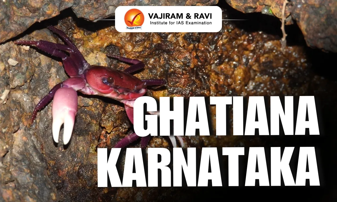
  • It has a dark purple body and light pink claws, which are distinct from the seven other species of Ghatiana that were discovered in Karnataka.

News: DH

Ghatiana Karnataka FAQs

Q1: What is Ghatiana Karnataka?

Ans: Ghatiana Karnataka is a newly discovered species of freshwater crab.

Q2: Where was Ghatiana Karnataka discovered?

Ans: It was discovered in the Mookambika Wildlife Sanctuary in Karnataka.

Q3: What is the body colour of Ghatiana Karnataka?

Ans: It has a dark purple body.

Q4: What is the colour of the claws of Ghatiana Karnataka?

Ans: Its claws are light pink.
Kuril Islands

Kuril Islands

Kuril Islands Latest News

Russian President Vladimir Putin has visited the disputed Kuril Islands for the first time, travelling to Iturup as Moscow's relations with Japan remain deeply strained over Russia's war in Ukraine.

About Kuril Islands

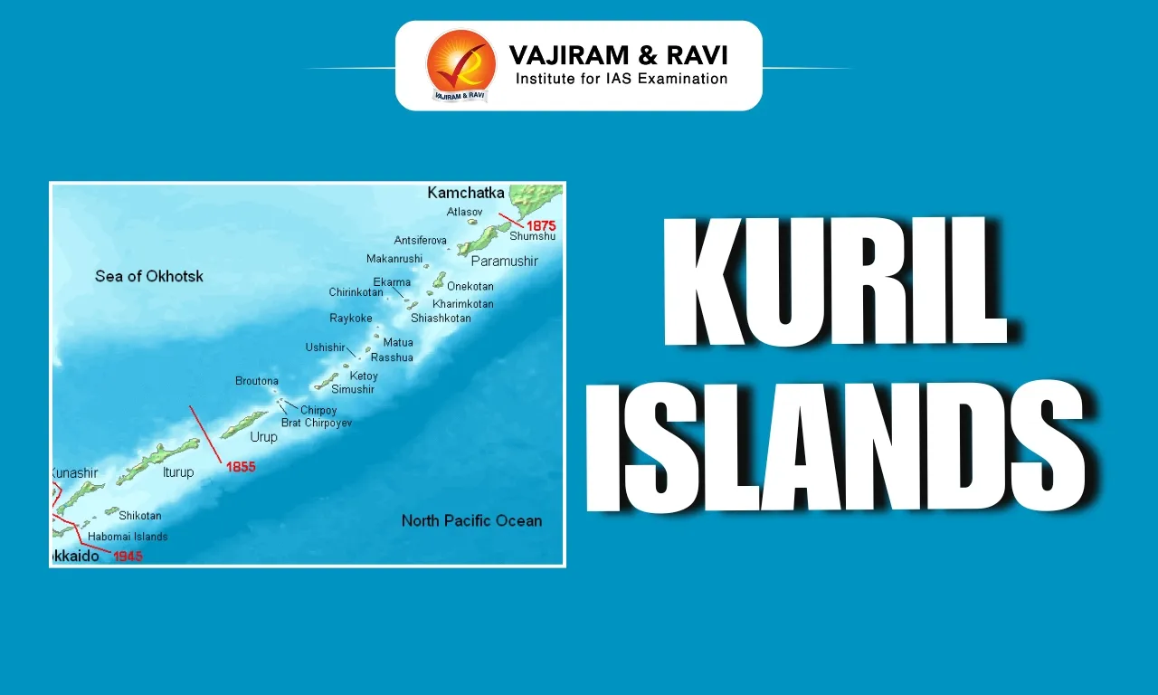
  • The Kuril Islands is an island group in the Russian Far East that forms the boundary between the Pacific Ocean and the Sea of Okhotsk. 
  • The archipelago, administered as part of Sakhalin Oblast (Russia), extends for about 1,300 kilometers from the Kamchatka Peninsula’s (Russia) southern tip to Hokkaido’s (Japan) northeastern corner. 
  • The archipelago comprises 56 islands and several islets and rocks and covers over 15,600 sq.km. 
  • The islands are divided into the Greater and Lesser Kuril Chains and have a total population of over 20,000 people. 
  • These are part of the Pacific Ring of Fire belt and have over 100 volcanoes, of which 35 are said to be active volcanoes along with hot springs.
  • The climate in the islands is severe, with long, cold, snowy winters and cool, wet, foggy summers.  
  • Vegetation ranges from tundra on the northern islands to dense forest on the larger southern islands. 
  • The principal centers are the towns of Kurilsk on Iturup, the largest island, Severo-Kurilsk on Paramushir, and Yuzhno-Kurilsk on Kunashir. 
  • Although Russia administers all the Kuril Islands, some islands are at the heart of the Russo-Japanese feud known as the Kuril Islands dispute. 
  • Japan considers the four southernmost islands as part of its Northern Territories. 
  • Tokyo claims that the disputed islands have been part of Japan since the early 19th century.
  • As a result of this dispute, Russia and Japan have never formally concluded a peace treaty to end World War II

News: TOI

Kuril Islands FAQs

Q1: Where are the Kuril Islands located?

Ans: They are located in the Russian Far East.

Q2: What do the Kuril Islands form the boundary between?

Ans: They form the boundary between the Pacific Ocean and the Sea of Okhotsk.

Q3: Between which two regions do the Kuril Islands extend?

Ans: They extend from the southern tip of the Kamchatka Peninsula to the northeastern corner of Hokkaido.

Q4: Which country currently administers all the Kuril Islands?

Ans: Russia.

Q5: Which two countries are involved in the Kuril Islands dispute?

Ans: Russia and Japan.

Moon Base Programme

Moon Base Programme

Moon Base Programme Latest News

NASA has formally invited India to join its Moon Base programme, which aims to establish a sustained human presence near the lunar South Pole. 

About Moon Base Programme

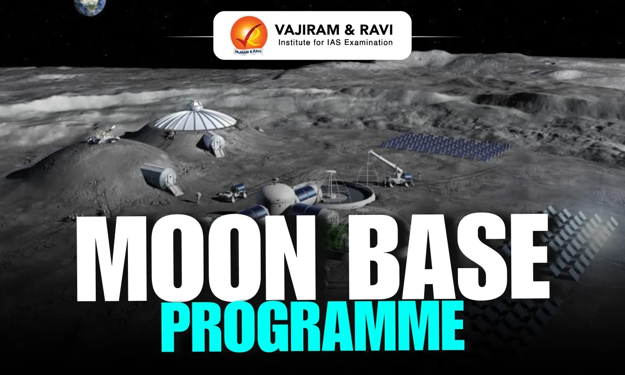
  • It is one of NASA’s most ambitious programmes, which aims to establish a sustained human presence near the lunar South Pole.
  • Moon Base is humanity’s first lunar outpost, a place where astronauts will live, work, and explore near the Moon’s South Pole, an area that was first accessed by India’s Chandrayaan-3 mission in August 2023
    • The South Pole of the Moon is important because of water ice in permanently shadowed regions, its scientific value, and potentially useful lunar resources. 
  • Through a series of crewed and uncrewed missions, NASA and its partners will build the infrastructure needed to support a sustained human presence on the Moon, unlock new scientific discoveries, and prepare for future exploration of Mars.  
  • The Moon Base will be built step by step using a phased approach.
  • Phase One (Now–2029): Gain Reliable Access, Experiment, and Learn
    • Robotic missions will explore the lunar South Pole, demonstrate new technologies, and gather the knowledge needed to guide future development. 
    • NASA will identify promising locations for future infrastructure, improve mission capabilities, and reduce risk before astronauts arrive. 
  • Phase Two (2029–2032): Build and Expand
    • Building on what is learned during Phase One, NASA will begin deploying the first infrastructure needed to support long-term operations on the Moon. 
    • Early power systems, cargo transportation, logistics, and communications capabilities will expand humanity’s footprint on the Moon and enable increasingly complex missions. 
  • Phase Three (2032 and Beyond): Live and Work on the Moon  
    • With the Moon Base’s foundational infrastructure in place, NASA will begin assembling a permanent lunar outpost where astronauts can live and work for extended periods.
    • Habitats, power systems, communications, transportation, and other critical capabilities will come together to support an enduring human presence near the Moon’s South Pole.

News: TP

Moon Base Programme FAQs

Q1: What is NASA’s Moon Base Programme?

Ans: It is a programme aimed at establishing a sustained human presence near the Moon’s South Pole.

Q2: Which space agency is leading the Moon Base Programme?

Ans: NASA

Q3: Where is the proposed Moon Base planned to be established?

Ans: Near the lunar South Pole.

Q4: How will the Moon Base be developed?

Ans: It will be developed step by step through a phased approach.

Kollidam River

Kollidam River

Kollidam River Latest News

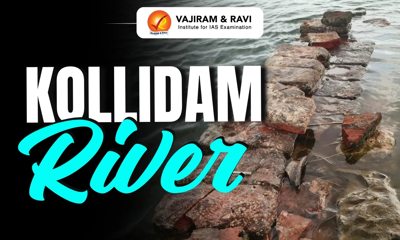
ASI archaeologists recently found remains of a possible Sangam-era irrigation structure in the Kollidam river near Lalgudi, Trichy.

About Kollidam River

  • It is a river in southeastern India flowing through the Tamil Nadu state.  
  • It is the northern distributary of the Kaveri River.  
  • It is also known as Kolidam and sometimes Coleroon in English. 
  • Course
    • Formed by the northern bifurcation of the Kaveri River just west of Srirangam, the Kollidam River flows in an easterly and then northeasterly direction for about 150 km.
    • It finally empties through several mouths into the Bay of Bengal, roughly equidistant between the Puducherry (north) and Karaikal (south) sectors of the Puducherry union territory on the coast. 
  • The Kollidam is the major northern stream of the Kaveri delta. 
  • The river was dammed in 1836 to help provide irrigation water for the delta, the most fertile and densely populated region of southern India, noted for its rice production.  
  • The town of Chidambaram lies on its banks.

News: TOI

Kollidam River FAQs

Q1: In which Indian state does the Kollidam River flow?

Ans: Tamil Nadu.

Q2: Which river is the Kollidam a northern distributary of?

Ans: The Kaveri River.

Q3: Where is the Kollidam River formed?

Ans: It is formed by the northern bifurcation of the Kaveri River just west of Srirangam.

Q4: Approximately how long is the course of the Kollidam River?

Ans: About 150 km.

Q5: Into which water body does the Kollidam River finally empty?

Ans: The Bay of Bengal.

Cascade Frog

Cascade Frog

Cascade Frog Latest News

Scientists have discovered three new species of cascade frogs from the biodiverse-rich forests of Northeast India. 

About Cascade Frog

  • These frogs belong to the genus Amolops.
  • Habitat: They are typically found around rocky waterfalls and fast-flowing forest streams.
  • The genus has around 100 species distributed across Asia.
  • Ecological Role: Cascade frogs are vital ecological anchors that connect aquatic and terrestrial food webs, control pest populations, and serve as sensitive indicators of clean water ecosystems.

Three New Cascade Frog Species

  • Ammachi’s Cascade Frog (Amolops ammachi)
    • It was discovered in the Jampui Hills of Tripura.
    • It honours the late Kerala social worker and philanthropist Padmini Varkey, affectionately known as ‘Ammachi’ (or mother).
    • It has a light brown body interspersed with beautiful olive-green reticulations.
  • Sendenyu Cascade Frog (Amolops sendenyu): It was found in Nagaland and named after Sendenyu Village; and
  • Beautiful Cascade Frog (Amolops bella): It was discovered in West Bengal and named for its striking green body marked with yellowish-green or reddish-brown mosaic patterns.

Cascade Frog FAQs

Q1: Cascade Frogs are commonly found in which habitat?

Ans: Fast-flowing streams and waterfalls

Q2: What is the ecological role of Cascade Frogs?

Ans: They are vital ecological anchors control pest populations, and serve as sensitive indicators of clean water ecosystems.

Black-Necked Crane

Black-Necked Crane

Black-Necked Crane Latest News

The Bombay Natural History Society (BNHS) has sterilised over 2,950 Free Ranging Dogs (FRD) to save Black-necked Cranes (Grus nigricollis) in Ladakh, whose chicks and nests were being attacked in alpine wetlands.

About Black-Necked Crane

  • It is classed as a medium-sized member of the crane family.
  • Other Names: It is locally known as “cha thung-thung” in Ladakh and “thungdung karma” in Arunachal Pradesh.
  • Appearance: It has a largely whitish-grey body contrasted by a jet-black head and upper neck, splashes of red around the eye, and long, elegant legs built for wading through alpine bogs.
  • Distribution: High altitude marshes and lakes of Tibetan Plateau (Tibet, Qinghai, Xinjiang, Gansu), Sichuan (China), and eastern Ladakh (India).
    • A small wintering population is also found in Sangti and Zimithang valleys of Arunachal Pradesh in India.
  • Diet: These are carnivores and herbivores. They feed on the tubers of sedges, plant roots, earthworms, insects and other invertebrates, frogs.
  • Breeding: The cranes breed at elevations between 2,600 and 4,900 metres, choosing gently sloping wetlands where they build simple nests of grasses and sedges.
    • The main breeding sites include the Changthang Cold Desert Wildlife Sanctuary, especially the wetlands of Hanle, Tso Kar, Nyoma, and nearby marshes.
  • Cultural Significance: They hold a special place in Ladakh’s Buddhist culture. They are regarded as sacred birds and symbols of peace, purity and good fortune.
  • Threats: Increasing human use of areas surrounding wetlands, expansion of linear infrastructure, growing tourism activities, habitat degradation, and the impacts of climate change.

Conservation Status of Black-Necked Crane

Source: DTE

Black-necked Crane FAQ's

Q1: What is the Scientific name of Black-necked Crane?

Ans: Grus nigricollis

Q2: What is the IUCN status of Black-necked Crane ?

Ans: Near Threatened

Liberia

Liberia

Liberia Latest News

Recently, the Union Women and Child Development Minister met a parliamentary delegation from Liberia and discussed India’s initiatives on women-led development, political representation and gender-responsive governance. 

About Liberia

  • Location: It is located along the coast of western Africa.
  • It is the only state in Africa which was never subjected to colonial rule and is Africa’s oldest republic.
  • Bordering Countries: It is bounded by Sierra Leone to the northwest, Guinea to the north, Côte d’Ivoire to the east.
  • Water Bodies: The Atlantic Ocean borders Liberia to the south-southwest.
  • Capital City: Monrovia

Geographical Features of Liberia

  • Climate: It has a tropical hot-humid climate.
  • Major Mountain Peaks: It has Cape Mount (about 1,000 feet in elevation) in the northwest, Cape Mesurado in Monrovia, and Cape Palmas in the southeast.
  • Highest Peak: Mount Wuteve.
  • Major Rivers: The Mano and Morro Rivers in the northwest and the Cavalla in the east and southeast are major rivers and form sections of Liberia’s boundaries.
  • Natural Resources: It is richly endowed with mineral resources such as diamond, iron ore, and gold, manganese, graphite, cyanite.

Source: DD India

Liberia FAQs

Q1: What is the Capital of Liberia?

Ans: Monrovia

Q2: Liberia lies on which ocean coast?

Ans: Atlantic Ocean

Sanchar Mitra Scheme

Sanchar Mitra Scheme

About Sanchar Mitra Scheme

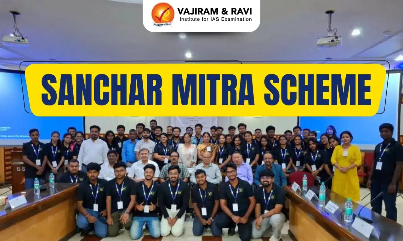
  • It envisions engaging the Yuva Shakti- India’s youth, as catalysts for digital empowerment and societal outreach.
  • It is aimed at harnessing the energy and potential of young students to spread awareness about safe digital behaviour.
  • Working
    • Under this scheme, student volunteers, named as Sanchar Mitra, will raise public awareness about mobile safety, telecom fraud prevention, and government digital initiatives. 
    • They will conduct outreach in communities, schools, and public spaces to educate citizens on responsible and secure use of telecom services.
    • It is open to students from those technical institutes that have active telecom, electronics, computers, cybersecurity, or similar programs and have agreed to participate in the scheme.
    • Sanchar Mitras will receive necessary training from experts and from the National Communications Academy-Technology (NCA-T). 
    • The Sanchar Mitras will receive various training on subjects like cybersecurity, emerging technologies in the telecom sector, telecom policies and regulations, etc. 
  • The scheme offers top performers
    • Access, on a best-effort basis, to research and development (R&D) projects and telecom start-ups;
    • Involvement in policy and standards work;
    • Participation in field surveys and DoT initiatives;
    • Exposure to national conferences and events. 
  • The scheme has been implemented across all states/UTs through the licensed service area (LSA) field offices of DoT.
  • Nodal Ministry: Department of Telecommunications (DoT), Ministry of Communications.

Source: PIB

Sanchar Mitra Scheme FAQs

Q1: Which ministry implements the Sanchar Mitra Scheme?

Ans: Ministry of Communications

Q2: What is the primary aim of the Sanchar Mitra Scheme?

Ans: Encouraging youth to spread awareness about safe digital behaviour.

Q3: Who are designated as “Sanchar Mitras” under the scheme?

Ans: Student volunteers

Q4: Students from which institutions can participate in the Sanchar Mitra Scheme?

Ans: Technical institutes with telecom, electronics, computers, cybersecurity or similar programmes.

Q5: Which organisation provides training support to Sanchar Mitras?

Ans: National Communications Academy-Technology (NCA-T)

South African Customs Union

South African Customs Union

Southern African Customs Union Latest News

India and the five-member Southern African Customs Union (SACU) recently signed the Terms of Reference (ToR) to start negotiations for a Preferential Trade Agreement (PTA), with an aim to  conclude the trade talks within a year.

About Southern African Customs Union 

  • It is an African regional economic organization. 
  • It is the world’s oldest customs union, which was established in 1910.
  • Member countries: South Africa, Namibia, Botswana, Lesotho, and Eswatini (formerly Swaziland).
  • The SACU Secretariat is located in Windhoek, Namibia. 
  • The five member states maintain a common external tariff, share customs revenues, and coordinate policies and decision-making on a wide range of trade issues. 
  • Like other customs unions, a key feature of SACU is the application of a single tariff regime − the Common External Tariff (CET). 
    • This means the member states form a single customs territory which provides for a free movement of goods where tariffs and other barriers are eliminated on all trade between them. 
    • The CET applies to goods imported from all territories that are not members of SACU.  
  • South Africa accounts for around 91 percent of the bloc's total economic output and is India's largest trading partner within the grouping. 
  • SACU countries are also part of the Southern African Development Community (SADC), together with Angola, the Democratic Republic of Congo, Malawi, Mozambique, Tanzania, Zambia, and Zimbabwe; as well as the island nations of Mauritius, Seychelles, Comoros, and Madagascar.

News: NIE

Southern African Customs Union FAQs

Q1: What is the Southern African Customs Union (SACU)?

Ans: SACU is an African regional economic organization.

Q2: When was the Southern African Customs Union established?

Ans: It is the world’s oldest customs union, which was established in 1910.

Q3: Which countries are members of Southern African Customs Union (SACU)?

Ans: South Africa, Namibia, Botswana, Lesotho, and Eswatini.

Q4: Where is the Secretariat of Southern African Customs Union (SACU) located?

Ans: Windhoek, Namibia.

Q5: What is a key feature of Southern African Customs Union (SACU) as a customs union?

Ans: The application of a single Common External Tariff (CET).

SAMRIDH Programme

SAMRIDH Programme

SAMRIDH Programme Latest News

Recently, the Union Minister of State for Electronics and Information Technology informed the Rajya Sabha about the SAMRIDHA Programme. 

About SAMRIDH Programme

  • The Startup Accelerator of MeitY for Product Innovation, Development, and Growth (SAMRIDH) is a flagship programme of the Ministry of Electronics & IT (MeitY).
  • Aim: It aims to support existing and upcoming Accelerators to select and accelerate potential IT-based startups to scale. 
    • It focuses on accelerating the startups by providing customer connect, investors connect and connect to international markets.
  • Target: The program supports 300 tech Start-Ups in 3-year duration with cohort size of 5-10 StartUps.
    • In the first round of cohort, 22 Accelerators spread across 12 states are supporting 175 startups, selected through a multilevel screening process.
  • Financial Assistance: It provides financial support of ₹2 lakh per startup to selected accelerators, along with matching funding to startups up to a maximum of ₹40 lakh.
  • Implementation: It is being implemented by MeitY Start-up Hub (MSH), Digital India Corporation (DIC).
  • Nodal Ministry: Ministry of Electronics & IT

Source: PIB


SAMRIDH Programme FAQs

Q1: Which ministry launched the SAMRIDH Programme?

Ans: Ministry of Electronics and IT

Q2: What is the main objective of SAMRIDH Programme?

Ans: Accelerate Indian software product startups

Enquire Now