Roll Cloud Latest News
A rare roll cloud appeared over Portugal’s coast recently, surprising beachgoers as strong winds hit during an ongoing extreme heatwave.
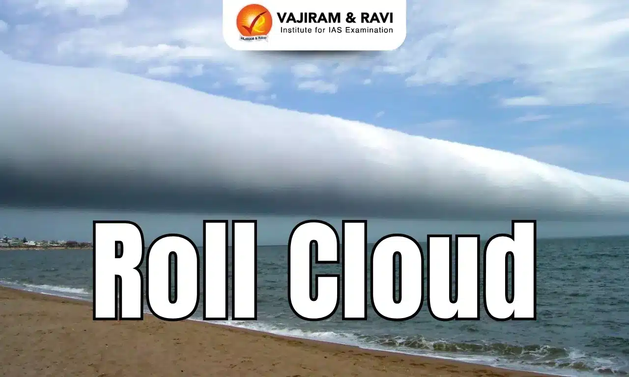
About Roll Cloud
- A roll cloud is a low, horizontal, tube-shaped, and relatively rare type of arcus cloud.
- Roll clouds usually appear to be "rolling" about a horizontal axis.
- They usually appear at an altitude of 2,000 to 7,000 meters, and continue to curl visibly.
- They are more often seen in areas with complex terrain and changeable weather—both in the mountains and on the coasts of the oceans. For example, in the Alps, around Japan, Scotland, and northern Australia.
- During severe weather, roll clouds can be confused with funnel clouds, as the roll cloud will show clear signs of rotation along the horizontal and vertical axes, like a tornado.
- Roll clouds are helpful to meteorologists because their appearance sometimes heralds bad weather—strong winds, thunderstorms, storms, or even tornadoes.
- A sharp, rapid roll of clouds can indicate a storm is about to intensify, while a smooth movement can mean calmer weather.
- Along the edge of a thunderstorm, they can serve as a precursor to more active and serious weather in the immediate future.
What is an Arcus Cloud?
- An arcus cloud is a low, horizontal cloud formation that typically forms along the leading edge of a thunderstorm outflow or cold front.
- There are two main types of arcus clouds: Shelf Cloud and Roll Cloud.
- Roll clouds and shelf clouds are found near the leading edge of thunderstorms and form when relatively cool air, from the storm’s downdraft, forges ahead into the warm, moist air that’s feeding the storm.
- The main difference between roll clouds and shelf clouds (both are called arcus clouds) is that a roll cloud is detached from the parent thunderstorm, whereas a shelf cloud is affixed to the base of a cumulonimbus cloud.
Source: IE
Roll Cloud FAQs
Q1: What distinguishes a roll cloud from a shelf cloud?
Ans: Roll clouds are detached from the parent thunderstorm.
Q2: What is the typical altitude range for roll clouds?
Ans: 2,000–7,000 meters
Q3: In which of the following regions are roll clouds more commonly observed?
Ans: Mountainous and coastal regions with variable weather.
Q4: What weather conditions can roll clouds indicate to meteorologists?
Ans: Approaching storms, strong winds, or potential tornadoes.
