Bering Strait Latest News
According to a recent study, mariners in the Bering Strait are following 2018 shipping guidelines, which suggest a quiet form of U.S.-Russia cooperation despite strained political relations.
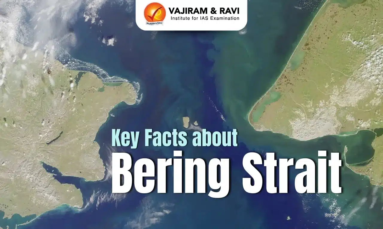
About Bering Strait
- It is the northernmost part of the Pacific Ocean, separating the continents of Asia and North America, particularly Russia and the United States.
- This important waterway is just south of the Arctic Circle.
- It connects the Bering Sea to the Chukchi Sea of the Arctic Ocean.
- At the strait’s narrowest point, Asia (Russia) and North America (the US) are just 85 km apart.
- The narrowest point is between Cape Prince of Wales in Alaska and Cape Dezhnev in Russia.
- The international boundary between the two countries passes through the Bering Sea and Strait.
- It is relatively shallow, with an average depth of 50 m.
- The Strait has numerous islands, including the Diomede Islands and St. Lawrence Islands.
- St. Lawrence Island is the US's sixth-largest Island.
- The two Diomede Islands are located in the middle of the strait.
- The Big Diomede Island belongs to Russia, while the Little Diomede Island is on the US side.
- The International Date Line runs between the two islands, leaving the American and Russian sides on different calendar days.
Source :MI
Bering Strait FAQs
Q1: The Bering Strait separates which two continents?
Ans: Asia and North America
Q2: The Bering Strait connects which two seas?
Ans: It connects the Bering Sea to the Chukchi Sea of the Arctic Ocean.
Q3: What is the approximate distance between Asia (Russia) and North America (USA) at the narrowest point of the Bering Strait?
Ans: 85 km
Q4: Which two capes mark the narrowest point of the Bering Strait?
Ans: Cape Prince of Wales in Alaska and Cape Dezhnev in Russia.
