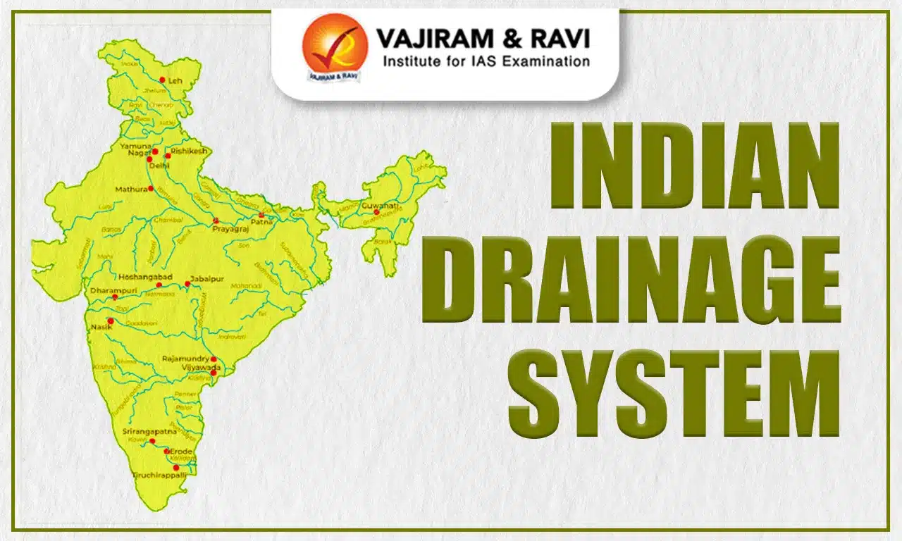
Indian Drainage System consists of a vast network of rivers and streams weaving across its varied landscapes. This system not only shapes the country’s physical geography but also sustains ecosystems and supplies vital resources for agriculture, industry, and daily life.
Indian Drainage System
The majority of rivers in India drain into the Bay of Bengal, while several others in the western region flow into the Arabian Sea. Certain areas, such as the northern Aravalli region, parts of Ladakh, and the arid zones of the Thar Desert, exhibit inland drainage where water does not reach the sea. Most of India’s major rivers originate from one of four main watersheds: the Himalayas and Karakoram Range, the Chotanagpur Plateau, the Vindhya and Satpura ranges, and the Western Ghats.
Indian Drainage System Categorisation
The Indian Drainage System can be classified into three main categories:
- Based on the origin of the rivers,
- Based on the type of drainage, and
- Based on the river’s orientation to the sea.
Each of these classifications is discussed in detail in the following sections.
Based on Origin of the Rivers
Based on their origin, India’s rivers can be divided into two main groups:
- Himalayan Rivers (Perennial): These rivers, including the Indus, Ganga, Brahmaputra, and their tributaries, flow throughout the year due to the melting of snow and rainfall in the mountains.
- Peninsular Rivers (Non-Perennial): Rivers such as the Mahanadi, Godavari, Krishna, Cauvery, Narmada, and Tapi, along with their tributaries, generally depend on seasonal rainfall and tend to dry up during the lean season.
Based on Type of Drainage
Indian Drainage System, or its network of rivers, can be broadly classified into four groups:
- Himalayan Rivers
- Deccan Rivers
- Coastal Rivers that flow directly into the sea
- Rivers of the Inland Drainage Basin
Based on River’s Orientation to Sea
Based on orientation to the sea, the Indian drainage system can be categorized as follows:
| Based on River’s Orientation to Sea | |
|
Bay Of Bengal Drainage |
Arabian Sea Drainage |
|
Rivers that drain into the Bay of Bengal. |
Rivers that drain into the Arabian Sea. |
|
East flowing rivers. |
West flowing rivers. |
|
Nearly 77 per cent of the drainage area of the country is oriented towards the Bay of Bengal. |
Nearly 23 per cent of the drainage area of the country is oriented towards the Arabian Sea. |
|
The Ganga, the Brahmaputra, the Mahanadi, the Godavari, the Krishna, the Cauvery, the Penneru, the Penneiyar, the Vaigai, etc. |
The Indus, the Narmada, the Tapi, the Sabarmati, the Mahi and a large number of swift-flowing western coast rivers descending from the Sahyadris. |
Difference between the Himalayan River System and the Peninsular River System
To better understand the Difference between the Himalayan River System and the Peninsular River System, the following table compares aspects such as origin, catchment area, valley types, drainage patterns, water flow, river stages, meandering behavior, and the formation of deltas and estuaries.
| Difference between the Himalayan River System and the Peninsular River System | ||
|
Feature |
Himalayan River System |
Peninsular River System |
|
Origin |
Originate from the high Himalayan ranges and are collectively known as Himalayan rivers. |
Begin in the hills of the Peninsular Plateau and are referred to as Peninsular rivers. |
|
Catchment Area |
Possess large basins and extensive catchment areas. |
Have relatively smaller basins and catchment areas. |
|
Valleys |
Flow through deep, V-shaped valleys or gorges. |
Travel through comparatively shallow valleys. |
|
Drainage Type |
Exhibit antecedent drainage patterns. |
Exhibit consequent drainage patterns. |
|
Water Flow |
Perennial, fed by both rainfall and glacier melt. |
Primarily seasonal, dependent on rainfall, with peak flow during the monsoon. |
|
Stage |
Considered youthful, flowing through the young fold mountains. |
Mature rivers, flowing across one of the world’s oldest plateaus. |
|
Meanders |
Form meanders and frequently change course upon entering the plains. |
Generally straighter courses with limited meandering due to hard rock and non-alluvial terrain. |
|
Deltas & Estuaries |
Form large deltas at their mouths; the Ganga-Brahmaputra delta is the largest in the world. |
Some rivers, like Narmada and Tapi, form estuaries; others, such as Mahanadi, Godavari, Krishna, and Cauvery, form deltas. |
River Regimes
The River Regimes refers to the pattern of its water flow over the course of a year. River flow can vary due to factors such as rainfall, snowmelt, geological features, and changes in the terrain. As a result, different rivers exhibit different flow patterns.
Himalayan rivers, for instance, are perennial because they are sustained by both rainfall and melting glaciers, giving them a glacial regime. In contrast, Peninsular rivers rely mainly on rainfall and are thus subject to seasonal fluctuations, known as a monsoonal regime.
Rivers with a monsoonal regime typically have low water levels from January to May, followed by a sharp rise during the monsoon months of June to September. For example, the Narmada River has minimal discharge for most of the year until August, when it peaks, then drops sharply again in October.
Utilization of River Water in India
River Water in India serves multiple vital purposes:
- Irrigation: Rivers receive about 45% of the country’s total precipitation. However, due to uneven terrain and flow patterns, not all of this water is usable, and only around 33% of the annual flow is actually available for irrigation.
- Hydroelectricity: Large rivers in mountainous regions offer significant hydroelectric potential. Peninsular rivers require water storage during the monsoon for power generation, whereas Himalayan rivers maintain substantial flow even in winter. Challenges like narrow valleys, high siltation, seismic activity, and vast alluvial plains complicate the construction of large storage projects.
- Waterways: India has an extensive network of navigable rivers, with the Ganga, Brahmaputra, and Mahanadi being the most significant for transport.
- Water Supply: River water supports agriculture and provides drinking water for cities, towns, and industrial use. However, water quantity and quality are declining due to pollution from sewage, industrial effluents, and excessive diversion.
Fishing: Inland fisheries, including rivers, canals, and reservoirs, contribute nearly half of the country’s total fish production. With improved water quality and management, freshwater fish production has considerable potential for growth.
Indian Drainage System FAQs
Q1: What is the Indian drainage system?
Ans: India’s drainage system consists of rivers, streams, and tributaries that drain rainfall and snowmelt into the seas, supporting agriculture, transport, and water resources.
Q2: What is India's largest drainage system?
Ans: The Ganga-Brahmaputra-Meghna river system is India’s largest drainage network, covering northern and eastern regions and supporting millions of people.
Q3: How many types of drainage systems are there in India?
Ans: India has four main types of drainage systems: Himalayan rivers, Peninsular rivers, inland drainage, and coastal drainage.
Q4: Does a drainage system work in India?
Ans: Yes, drainage systems manage flood control, irrigation, water supply, and river navigation, though monsoon floods sometimes overwhelm capacity.
Q5: What are the four types of drainage?
Ans: The four types are: Himalayan rivers, Peninsular rivers, inland drainage, and coastal drainage systems.
