Hot Desert Climate, Characteristics, Distribution Across World, Significance

Hot Desert Climate

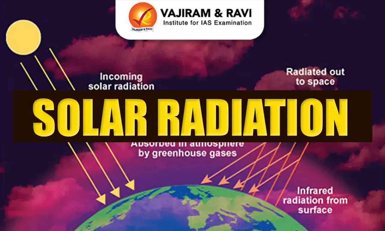
Hot Desert Climate is defined by intensely high daytime temperatures, very low humidity, and scant rainfall, often less than 250 mm per year. These regions fall under the arid climatic zones of the Köppen classification and are typically located around the subtropical high-pressure belts. A striking feature of hot deserts is the wide diurnal temperature variation, while days can be scorching, nights often turn quite cold due to rapid heat loss in the absence of cloud cover.

Despite their harsh environment, deserts sustain specialized flora and fauna adapted to conserve water and withstand extreme heat. Plants like cacti, xerophytes, and succulents, along with animals such as reptiles, camels, and rodents, exhibit unique survival mechanisms. Beyond their ecosystems, the Hot Desert influences the global climate patterns, acts as significant sources of dust storms that enrich soils in distant regions, and hold vital reserves of minerals and fossil fuels.
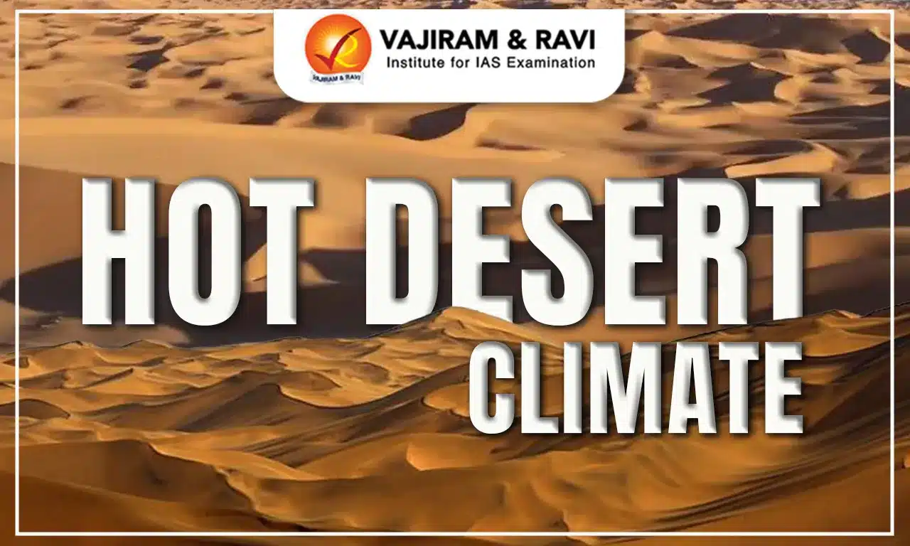
Hot Desert Climate

Hot Desert Climate are typically located between 15° and 30° latitude in both hemispheres, within the subtropical high-pressure zones. These regions are marked by extreme temperature contrasts, daytime temperatures often rise above 40°C, while nights turn unexpectedly cool due to rapid terrestrial heat loss under clear skies. Rainfall is scarce, generally less than 250 mm per year, and usually arrives in sudden, intense bursts rather than steady showers.

The aridity limits vegetation to drought-resistant plants such as cacti, succulents, and xerophytic shrubs. Faunal life, including camels, lizards, snakes, and scorpions, displays remarkable physiological and behavioral adaptations for conserving water and surviving the harsh environment.

Some of the most well-known hot deserts include the Sahara in Africa, the Arabian Desert in the Middle East, the Sonoran Desert in North America, and the Thar Desert in South Asia. Despite their stark landscapes, deserts contribute significantly to global systems by regulating heat balance, generating dust storms that enrich distant soils, and providing valuable reserves of petroleum, natural gas, and minerals. However, challenges like desertification, overgrazing, and climate change threaten their fragile ecological balance.

Hot Desert Climate Characteristics

Hot Desserts are unique natural environments shaped by extreme aridity and intense heat. Their distinct characteristics can be studied under the following heads:

  • Climate: Hot deserts experience scorching daytime temperatures, often above 40°C during summer. Nights, however, can be unexpectedly cold due to rapid heat loss under clear skies. Rainfall is scarce, usually less than 250 mm annually and occurs in irregular, intense bursts.
  • Vegetation: Plant life is sparse and dominated by drought-resistant species such as cacti, succulents, and thorny shrubs. Vegetation shows remarkable adaptations: some plants develop deep roots to tap groundwater, while others rely on shallow, widespread roots to quickly absorb rainfall.
  • Soil: Desert soils are typically sandy, rocky, and deficient in organic matter. They are often prone to wind erosion and may have high salt or mineral concentrations, making them unsuitable for dense vegetation.
  • Fauna: Animals of hot deserts display special survival strategies. Camels store fat for energy, reptiles and scorpions tolerate heat, and many species adopt nocturnal habits to escape daytime extremes. These adaptations help conserve water and energy.
  • Landscape: The desert terrain features vast sand dunes, rocky or gravel plains, and occasional plateaus. Oases, where underground water surfaces, create fertile pockets that sustain vegetation and human settlements.

Hot Desert Climate Distribution Across World

Hot Desert Climate are mainly located between 15° and 30° latitude in both hemispheres, influenced by subtropical high-pressure zones that suppress rainfall. Their distribution across continents is as follows:

Hot Desert Climate Distribution Across World

Continent

Hot Deserts

Key Features / Location

Africa

Sahara Desert

Largest hot desert; spans Algeria, Libya, Egypt, and other North African countries.

Kalahari Desert

Southern Africa; covers Botswana, Namibia, South Africa.

Namib Desert

Coastal desert in Namibia; known for tall dunes and unique biodiversity.

Asia

Arabian Desert

Covers Arabian Peninsula including Saudi Arabia, Oman, Yemen.

Thar Desert

Also called the Great Indian Desert; located in India and Pakistan.

Australia

Great Victoria Desert

Largest desert in Australia; located in the southwest.

Simpson Desert

Central Australia; known for red sand dunes.

Gibson Desert

Arid desert in central Western Australia.

North America

Sonoran Desert

Southwestern USA and northern Mexico.

Chihuahuan Desert

Spans northern Mexico and parts of Texas and New Mexico.

Mojave Desert

California; includes Death Valley, the hottest place on Earth.

South America

Atacama Desert

Northern Chile and Peru; driest desert in the world.

Hot Desert Climate Significance

Hot deserts, though often seen as barren and lifeless, contribute immensely to ecological balance, economic development, and scientific discovery. Their role goes beyond extreme climates, they regulate weather patterns, provide valuable resources, and support unique life forms. The table below highlights the major areas where Hot Desert Climate Significance:

Hot Desert Climate Significance

Aspect

Details

Examples

Climate Regulation

Deserts influence global wind and weather patterns, balancing Earth’s heat. Their quick heat absorption and release affect surrounding climates.

Biodiversity & Adaptation

Support unique ecosystems with drought-resistant plants and heat-adapted animals. Studying them reveals survival strategies.

Cacti, camels, scorpions.

Resource Reservoirs

Rich in minerals, oil, and gas, making them economically significant.

Sahara – phosphate; Arabian Desert – oil.

Solar Energy Potential

Receive maximum solar radiation, ideal for renewable energy projects.

Mojave Desert – large solar farms.

Scientific Exploration

Landscapes used for planetary geology studies and space technology testing.

Atacama Desert – Mars simulation site.

Cultural & Economic Significance

Shape traditions of indigenous communities and boost economies via tourism.

Camel safaris, desert festivals, treks.

Hot Desert Climate Challenges

Hot Desert Climate, though often seen as barren, are home to fragile ecosystems and communities that depend on scarce resources. Human activities and environmental changes have made these regions even more vulnerable. The key challenges include:

  • Desertification: Overgrazing, deforestation, and poor land-use practices turn semi-arid areas into desert landscapes.
    • Example: The Sahel in Africa is rapidly losing fertile land due to unsustainable practices.
  • Climate Change: Rising global temperatures intensify droughts, increase evaporation, and worsen water shortages.
    • Example: The Mojave Desert faces growing stress on its ecosystems due to higher temperatures.
  • Water Scarcity: Limited water supplies are further drained by agriculture, industry, and settlements.
    • Example: Groundwater over-extraction in the Arabian Desert has depleted aquifers.
  • Biodiversity Loss: Urbanization, agriculture, and mining threaten the survival of unique desert species.
    • Example: Mining in the Namib Desert disrupts habitats of endemic wildlife.
  • Soil Degradation: Delicate desert soils erode easily due to wind, grazing, and human activity.
    • Example: The Thar Desert suffers reduced agricultural productivity from soil erosion.
  • Invasive Species: Non-native plants and animals disrupt the balance of desert ecosystems.
    • Example: Invasive grasses in the Sonoran Desert displace native vegetation.
  • Human Encroachment: Expanding cities and infrastructure fragment desert habitats, making survival harder for wildlife.
    • Example: Las Vegas continues to push into the Mojave Desert.

Hot Desert Climate FAQs

Q1: What countries have a hot desert climate?

Ans: Countries like Saudi Arabia, Egypt, Sudan, Libya, Iran, Australia, Namibia, and parts of India have hot desert climates.

Q2: What is the type of climate in deserts?

Ans: Deserts have arid climate with very low rainfall, high evaporation, extreme temperatures, and scarce vegetation.

Q3: What is the weather like in a hot desert?

Ans: Hot deserts have scorching daytime heat, cool nights, minimal rainfall, strong winds, and very dry conditions.

Q4: What is the climate in the hot desert in India?

Ans: India’s Thar Desert has an arid climate with scorching summers, mild winters, low rainfall, and frequent dust storms.

Q5: What are the characteristics of the hot desert climate?

Ans: Hot deserts feature extreme heat, very low rainfall, arid air, sparse vegetation, sandy soils, and large diurnal temperature variations.

National Biodiversity Authority, Headquarter, Composition, Functions

National Biodiversity Authority

The National Biodiversity Authority (NBA) is a statutory body that plays a central role in safeguarding India’s rich and diverse biological heritage. Established under the Biological Diversity Act, 2002, it works to regulate the use of biological resources, ensure equitable benefit-sharing, and promote conservation at both national and local levels. Beyond regulation, the NBA fosters awareness, supports research, and strengthens community participation in biodiversity management. Studying the NBA is particularly important for understanding how India balances development with environmental sustainability.

National Biodiversity Authority 

The National Biodiversity Authority (NBA) is a statutory body established under the Biological Diversity Act, 2002. It was formally set up in 2003, with its headquarters located in Chennai, Tamil Nadu. The NBA performs facilitative, regulatory, and advisory functions for the Government of India, particularly on matters related to the conservation of biodiversity, sustainable use of biological resources, and the fair and equitable sharing of benefits derived from them.

To ensure effective implementation of the Act at different administrative levels, two additional entities were created alongside the NBA:

  • State Biodiversity Boards (SBBs): Functioning at the state level to regulate access to biological resources within their jurisdiction.
  • Biodiversity Management Committees (BMCs): Established at the local village or panchayat level to promote grassroots-level biodiversity conservation and documentation.

Together, these institutions form the backbone of India’s biodiversity governance structure, ensuring that conservation efforts are coordinated from the national to the local level.

National Biodiversity Authority Composition

The National Biodiversity Authority (NBA) is structured to bring together expertise from both the government and independent specialists. Its composition ensures a balance between policy-making authority and domain knowledge.

  • Chairperson: An eminent person with proven knowledge and experience in biodiversity conservation, sustainable use of biological resources, and equitable sharing of benefits.
  • 10 Ex-officio Members: Senior representatives from the Government of India, nominated to provide policy insights and ensure inter-ministerial coordination.
  • 5 Non-Official Members: Experts and professionals from diverse fields related to biodiversity management, nominated to contribute independent perspectives and specialized expertise.

National Biodiversity Authority Functions

The NBA plays a pivotal role in implementing India’s biodiversity laws and ensuring sustainable use of resources. Its major functions include:

  • Policy Advisory: Advises the Government of India on biodiversity conservation, sustainable use of its components, and equitable benefit-sharing from biological resources.
  • Regulation of Access: Frames guidelines and regulates access to biological resources, ensuring fair and equitable sharing of benefits.
  • Protection of Traditional Knowledge: Takes measures to oppose the grant of Intellectual Property Rights (IPRs) outside India on biological resources or traditional knowledge obtained illegally from the country.
    • Example: The NBA successfully opposed Monsanto’s patent claim on Indian melon varieties.
  • Biodiversity Heritage Sites: Advises State Governments in identifying areas of biodiversity importance to be declared as heritage sites and recommends their management strategies.

National Biodiversity Authority Effectiveness

The performance of the NBA has shown mixed outcomes across its key areas of jurisdiction.

  • Conservation of Biodiversity
      • Successes include an increase in the tiger population, which reflects effective conservation initiatives.
      • However, several species like the Indian Wild Ass, Blackbuck, and Indian Rhinoceros remain critically vulnerable.
      • Large-scale deforestation in many states continues to disrupt ecosystems, increasing threats to wildlife survival.
  • Sustainable Use of Bio-Resources
      • Positive steps have been taken to support tribal communities, allowing them to use minor forest products such as fruits, flowers, and honey for livelihoods.
      • Yet, challenges persist in the form of rampant poaching and illegal logging of species like red sanders.
      • Better monitoring technology and stricter enforcement of laws are needed to address these issues.
  • Access and Benefit Sharing (ABS)
    • ABS has faced obstacles due to conflicting interests. Businesses demand a stable commercial environment, while local communities fear livelihood disruptions.
    • External interventions often disturb traditional ways of living, making rehabilitation difficult for communities reliant on natural resources.
    • As a result, even approved projects struggle to move forward, creating roadblocks in benefit-sharing mechanisms.

National Biodiversity Authority Challenges

  • Resource Constraints: 
      • The NBA often struggles with limited financial and human resources.
      • This shortage reduces its ability to implement programs effectively, especially in remote and ecologically sensitive regions.
  • Coordination Issues
      • Biodiversity conservation requires coordination across states and among multiple stakeholders.
      • In the absence of strong mechanisms for collaboration, efforts become fragmented and less impactful.
  • Regulatory Challenges
    • Effective enforcement of the Biological Diversity Act (2002) remains difficult.
    • Addressing violations, monitoring compliance, and managing complex Access and Benefit Sharing (ABS) agreements demand stronger institutional capacity.

National Biodiversity Authority FAQs

Q1: Where is the National Biodiversity Authority situated?

Ans: It is headquartered in Chennai, Tamil Nadu, at the TICEL Bio Park, CSIR Road, Taramani. 

Q2: What is the role of the National Biodiversity Authority?

Ans: NBA regulates access to biological resources, advises on biodiversity conservation, sustainable use, and ensures fair, equitable benefit-sharing under the Biological Diversity Act, 2002.

Q3: Who is the chairperson of the National Biodiversity Authority in 2025?

Ans: As of 2025, Shri Virendra R Tiwari, IFS (Retd.), has been appointed Chairman of the NBA. 

Q4: Who is the present chairperson of NBA India?

Ans: The current Chairperson is Shri Virendra R Tiwari, IFS (Retd.), serving a three-year term starting 2025. 

Q5: Where is the headquarter of biodiversity?

Ans: For India’s biodiversity governance, the central hub is NBA’s headquarters in Chennai; globally, there’s no single “headquarter” for biodiversity. 

UPSC Daily Quiz 10 September 2025

UPSC Daily Quiz

The Daily UPSC Quiz by Vajiram & Ravi is a thoughtfully curated initiative designed to support UPSC aspirants in strengthening their current affairs knowledge and core conceptual understanding. Aligned with the UPSC Syllabus 2025, this daily quiz serves as a revision resource, helping candidates assess their preparation, revise key topics, and stay updated with relevant issues. Whether you are preparing for Prelims or sharpening your revision for Mains, consistent practice with these Daily UPSC Quiz can significantly enhance accuracy, speed, and confidence in solving exam-level questions.

[WpProQuiz 66]

UPSC Daily Quiz FAQs

Q1: What is the Daily UPSC Quiz?

Ans: The Daily UPSC Quiz is a set of practice questions based on current affairs, static subjects, and PYQs that help aspirants enhance retention and test conceptual clarity regularly.

Q2: How is the Daily Quiz useful for UPSC preparation?

Ans: Daily quizzes support learning, help in revision, improve time management, and boost accuracy for both UPSC Prelims and Mains through consistent practice.

Q3: Are the quiz questions based on the UPSC syllabus?

Ans: Yes, all questions are aligned with the UPSC Syllabus 2025, covering key areas like Polity, Economy, Environment, History, Geography, and Current Affairs.

Q4: Are solutions and explanations provided with the quiz?

Ans: Yes, each quiz includes detailed explanations and source references to enhance conceptual understanding and enable self-assessment.

Q5: Is the Daily UPSC Quiz suitable for both Prelims and Mains?

Ans: Primarily focused on Prelims (MCQ format), but it also indirectly helps in Mains by strengthening subject knowledge and factual clarity.

Different Types of Maps, Political, Physical, Topographic, Climatic Maps

Different Types of Maps

Maps allow us to understand, interpret, and navigate the Earth’s surface in a simplified yet meaningful way. Depending on their purpose, Different Types of Maps can depict political boundaries, physical landscapes, climatic conditions, or even socio-economic patterns.

Studying the Different Types of Maps in geography is important as it forms part of the General Studies Paper-I syllabus for both Prelims and Mains. Understanding Different Types of Maps such as reference maps, topographic maps, political maps, weather maps, zip code maps, and road maps enables aspirants to interpret spatial data effectively, a skill that is often tested in the exam.

In this article, we will explore the Different Types of Maps in geography, their features, and their uses in detail.

Maps

Maps are visual representations of the Earth’s surface or a particular region. They provide a scaled-down view of natural features like mountains, rivers, and oceans, as well as human-made structures such as roads, cities, and boundaries. By using symbols, colors, and labels, maps present complex information in a way that is easy to read and interpret. They not only help us understand spatial relationships between places but also allow us to measure distances and analyze patterns across regions.

Different Types of Maps

Maps in geography are not all the same. Each Type of Map serves a distinct purpose, whether it’s understanding political divisions, tracing physical features, tracking species, or forecasting weather. The table below highlights some of the most common map types along with their key functions.

Different Types of Maps
Map Type What it Shows Main Uses

Reference Maps

Natural & man-made landmarks, water bodies, political boundaries

Navigation, population analysis, market research

Political Maps

Boundaries of countries, states, territories, capitals

Administration, governance, understanding political divisions

Thematic Maps

Specific themes (climate, health, population density, etc.)

Highlighting spatial variations of one subject

Topographic Maps

Elevation, landforms, contour lines, water bodies, buildings

Civil engineering, planning, geography studies

Geological Maps

Rock types, strata, fault lines, folds

Geology research, resource exploration

Physical Maps

Natural features (mountains, rivers, soil, glaciers, land use)

Understanding physical landscape, environment studies

Digital Road/Street Maps

Roads, highways, traffic flow, speed limits, navigation data

GPS navigation, traffic planning, emergency management

Weather Maps

Temperature, pressure, humidity, wind speed, weather systems

Forecasting, storm warnings, monitoring weather

Time Zone Maps

Global time zones, IDL, GMT

Travel, scheduling across regions

Zip Code Maps

Postal/zip code divisions

Postal delivery, logistics, marketing campaigns

Species Distribution Maps

Range, habitat, and spread of species

Conservation, biodiversity monitoring, invasive species tracking

Election Result Maps

Voting patterns and results by region

Political analysis, trend studies

Earthquake Maps

Magnitude and location of earthquakes

Disaster management, seismic risk assessment

Plate Tectonic Maps

Boundaries and movement of tectonic plates, subduction zones, ridges

Geology, understanding earthquakes & volcanoes

Volcanic Hazard Maps

Zones at risk from volcanic eruptions (lava, ashfall, pyroclastic flows, lahars)

Land use planning, evacuation, risk mitigation

Different Types of Maps FAQs

Q1: What are the 7 types of maps?

Ans: Political, physical, topographic, thematic, climatic, economic, and road maps are considered the seven common types of maps.

Q2: What are the five maps?

Ans: Political, physical, topographic, climate, and thematic maps are widely categorized as the five main types.

Q3: What are the three types of maps class 6?

Ans: In Class 6, maps are generally divided into political, physical, and thematic maps.

Q4: What is an example of a type of map?

Ans: A physical map showing mountains, rivers, and plateaus is a clear example of a type of map.

Q5: What are the three main maps?

Ans: Political maps, physical maps, and thematic maps are considered the three main types.

Daily Editorial Analysis 10 September 2025

Daily Editorial Analysis

The Long March Ahead to Technological Independence

Context

  • On August 15, 2025, India celebrated its 79th Independence Day, commemorating the nation’s hard-won political freedom.
  • Yet, in today’s interconnected and digitised world, true independence extends beyond political autonomy.
  • It now encompasses technological sovereignty, the ability to control and trust the digital systems that shape nearly every aspect of national life and without it, India risks replacing one form of dependence with another.

The New Battleground of Geopolitics

  • The nature of global conflict has transformed and Modern wars are no longer fought primarily with bullets and bombs, but with software, drones, and cyberweapons.
  • The most insidious battleground today is cyberspace, where banks, transportation networks, and power grids rely heavily on information and communication technology.
  • A troubling reality emerges from this reliance: most of these critical systems are designed and controlled by a handful of foreign corporations, often concentrated in a single country.
  • This dependence constitutes a grave national vulnerability and If these companies were ever compelled by their governments, or motivated by malice, to cut off access to cloud services or artificial intelligence tools, the consequences for India could be catastrophic.
  • Such scenarios are not mere hypotheticals; recent disruptions of cloud services to a company illustrate the tangible risks of overreliance on external providers.

The Road to Technological Sovereignty for India

  • Building the Foundations of Autonomy

    • The solution lies in pursuing technological autonomy. Currently, India does not possess indigenous operating systems, databases, or foundational software infrastructure it can fully trust.
    • This dependence on external sources places the nation at risk. However, the path forward is neither impossible nor uncharted.
    • Open-source software offers a powerful framework for building secure, transparent, and reliable alternatives.
    • By developing customised versions of Linux and Android, India could create systems free of hidden vulnerabilities.
    • The challenge, however, is not just initial development but long-term maintenance and support.
    • For such software to thrive, it requires a robust user base and a community of dedicated professionals committed to constant updates and innovation.
    • This is not a task for a single institution. Rather, it is a collective mission for India’s vast pool of IT professionals.
    • If the country’s technology community can unite behind this cause, they can overcome dependency and shape a sovereign digital future.
  • The Harder Road: Hardware Sovereignty

    • While software sovereignty is challenging, achieving hardware independence poses an even greater test.
    • Semiconductor fabrication demands enormous investment, technical expertise, and enduring commitment.
    • Few nations possess fully self-reliant capabilities in this sector. India, therefore, must approach this journey strategically, by focusing on chip design, partnerships in manufacturing, and gradually building expertise in assembly and supply chain management.
    • Outsourcing fabrication in the short term is pragmatic, but it must be coupled with long-term investments to reduce reliance.
    • India’s political independence was won through non-violence; its technological independence can be pursued through collaboration and open-source innovation.
    • This quest is not about opposing others, but about ensuring self-reliance in critical systems.
  • A Social and Economic Movement

    • The open-source movement, once a vibrant socio-political force, has lost some of its momentum in recent years.
    • Although much of today’s software, including Android, Linux, and Hadoop, is open-source, the real control often rests with centralised cloud services and data centres abroad.
    • What India needs is a renewed social movement, one that rallies both professionals and ordinary citizens behind the goal of technological autonomy.
    • Private companies and individuals now share the concerns once confined to strategic sectors: the risk of dependency on external powers.
    • People already contribute financially to free and open-source software, whether directly or indirectly.
    • Redirecting these resources toward trusted, homegrown software is a small but crucial step.

The Way Forward

  • To turn this vision into reality, India must establish a mission-oriented program focused on implementation rather than research.
  • This mission would assemble strong engineering and project management teams to develop and maintain essential digital infrastructure.
  • Priority areas include both client-side software (databases, email clients, calendars) and server-side components (web servers, email servers, cloud systems).
  • Crucially, this mission must be designed as self-sustaining, supported by viable business models rather than perpetual reliance on government funding.
  • The government’s role should be that of an enabler, helping establish the initial framework while ensuring long-term independence from state or corporate control.

Conclusion

  • India stands at a pivotal moment and the risks of dependence on external technologies are clear, and the resources to chart a sovereign path are within reach.
  • What is required is collective will, a recognition that technological independence is not a luxury, but a necessity for national security, economic resilience, and genuine freedom.
  • The long march toward technological sovereignty will be neither quick nor easy, yet, as India’s history has shown, the pursuit of independence, political or technological, is always worth the struggle.

The Long March Ahead to Technological Independence FAQs

 Q1. Why does India need technological sovereignty in addition to political freedom?
Ans. India needs technological sovereignty because modern life and national security depend on digital systems that are currently controlled by foreign companies.

Q2. What role can open-source software play in India’s technological independence?
Ans. Open-source software allows India to build secure, transparent, and customisable systems free from external control or hidden vulnerabilities.

Q3. Why is hardware sovereignty considered more difficult than software sovereignty?
Ans. Hardware sovereignty is harder because semiconductor fabrication requires huge investments, advanced expertise, and long-term commitment.

Q4. What kind of mission does India need to achieve technological autonomy?
Ans. India needs a mission focused on implementation, with strong engineering teams and self-sustaining business models rather than dependence on government funding.

Q5. What is the immediate step India must take to reduce its dependence on external technologies?
Ans. The immediate step is to assemble teams to develop and maintain essential open-source software for both client-side and server-side systems.

Source: The Hindu


India-EFTA Trade and Economic Partnership Agreement (TEPA) - A Strategic Leap Forward

Context:

  • India and the European Free Trade Association (EFTA) — comprising Switzerland, Norway, Iceland, and Liechtenstein — have signed the Trade and Economic Partnership Agreement (TEPA).
  • This is India’s first comprehensive trade pact with developed European economies, marking a significant step in India’s global trade diplomacy.

Key Features of TEPA:

  • Investment and job creation:

    • EFTA pledge: In an unprecedented commitment, the pledge is to promote investment of about $100 billion over 15 years in India and facilitate up to 1 million direct jobs.
    • Positions India as an attractive destination for long-term investment.
  • Market access and tariff reductions:

    • EFTA countries have agreed to eliminate or reduce tariffs on 2% of tariff lines, representing 99.6% of India’s exports by value and to provide duty-free treatment for all non-agricultural products.
    • Boost to sectors: Textiles, gems and jewellery, organic chemicals, industrial goods.
    • Service sector gains: Commitments across 128 sub-sectors from Switzerland, 114 (Norway), 110 (Iceland), 107 (Liechtenstein).

Strategic and Technological Collaborations:

  • Alignment with India’s priorities:

    • EFTA strengths: Precision engineering, pharmaceuticals, health sciences, renewable energy, frontier technologies.
    • Opportunities for India:
      • With its skilled talent pool, India can not only absorb these technologies but also adapt, scale, and innovate them to meet the demands of its domestic market and beyond.
      • This will support Atmanirbhar Bharat and Make in India
    • Climate and energy transition:
      • India’s goals: Net Zero by 2070 and 500 GW renewable capacity by 2030.
      • TEPA opens doors for European green finance, technology partnerships, and capital for sustainability projects.
    • Nuclear energy and thorium advantage:
      • India has achieved 50% of its installed electricity capacity from non-fossil fuel sources (Total - 243 GW, including 116 GW of solar, 52 GW of wind, and nearly 50 GW of hydro power).
      • Though this is 5 years ahead of the target (under NDCs to the Paris Agreement), the challenge remains of ensuring a stable baseload power source to complement the renewables which work intermittently.
      • This is where nuclear energy presents a compelling solution.
      • As India has approximately 25% of the world's thorium reserves, there is the potential to develop thorium-based nuclear energy, which is safe, clean, and proliferation-resistant.
      • TEPA may help access EU Sustainable Finance Taxonomy funds for thorium pilot projects.
      • Collaboration with Norway’s thorium research ecosystem could accelerate India’s three-stage nuclear programme.

Economic and Diplomatic Significance:

  • Immediate benefits: Export promotion, services sector expansion, consumer choices.
  • Long-term benefits: Energy security, technology transfers, resilience in supply chains.
  • Strengthens: India’s position as a trusted global partner and services hub.
  • Symbolises: India’s confident, assertive economic diplomacy aligned with Viksit Bharat 2047 vision.

Conclusion:

  • TEPA is more than a trade deal. It is a strategic partnership framework combining trade, investment, technology, and sustainability.
  • By leveraging European capital and expertise with India’s demographic and resource strengths, TEPA sets a new benchmark for global cooperation.
  • It paves the way for an energy-secure, innovation-driven, and climate-resilient India, aligning domestic aspirations with global commitments.

India-EFTA Trade and Economic Partnership Agreement (TEPA) FAQs

Q1. What is the significance of the TEPA signed between India and the European Free Trade Association (EFTA)?

Ans. TEPA is India’s first comprehensive trade pact with developed European economies, ensuring $100 billion investment, 1 million jobs, and enhanced market access.

Q2. How does TEPA align with India’s vision of Atmanirbhar Bharat and Make in India?

Ans. TEPA fosters technology transfer, investment, and strategic collaborations, enabling India to scale domestic manufacturing and services while strengthening global competitiveness.

Q3. In what way can TEPA contribute to India’s climate commitments and Net Zero target by 2070?

Ans. TEPA facilitates access to European green finance, renewable energy technologies, and sustainability-linked capital, supporting India’s 500 GW renewable energy target by 2030.

Q4. Why is thorium considered a strategic advantage for India’s future energy security under TEPA?

Ans. With nearly 25% of global thorium reserves, India can leverage TEPA for collaborative research and green finance to advance safe, clean, and proliferation-resistant nuclear energy.

Q5. How does TEPA reflect India’s evolving approach to global economic diplomacy?

Ans. TEPA showcases India’s confident, equal-term negotiations with advanced economies, focusing on trade, technology, and sustainability, in line with its Viksit Bharat 2047 vision.

Source: IE

Daily Editorial Analysis 10 September 2025 FAQs

Q1: What is editorial analysis?

Ans: Editorial analysis is the critical examination and interpretation of newspaper editorials to extract key insights, arguments, and perspectives relevant to UPSC preparation.

Q2: What is an editorial analyst?

Ans: An editorial analyst is someone who studies and breaks down editorials to highlight their relevance, structure, and usefulness for competitive exams like the UPSC.

Q3: What is an editorial for UPSC?

Ans: For UPSC, an editorial refers to opinion-based articles in reputed newspapers that provide analysis on current affairs, governance, policy, and socio-economic issues.

Q4: What are the sources of UPSC Editorial Analysis?

Ans: Key sources include editorials from The Hindu and Indian Express.

Q5: Can Editorial Analysis help in Mains Answer Writing?

Ans: Yes, editorial analysis enhances content quality, analytical depth, and structure in Mains answer writing.

Compensatory Afforestation Fund Management and Planning Authority (CAMPA)

Compensatory Afforestation Fund Management and Planning Authority (CAMPA)

The Compensatory Afforestation Fund Management and Planning Authority (CAMPA) is an important part of India’s environmental policy framework, designed to strike a balance between development and forest conservation. It was created to ensure that when forest land is diverted for non-forest purposes, equivalent afforestation and ecological restoration are carried out. Over the years, CAMPA has played a key role in channeling funds towards sustainable development, biodiversity protection, and climate resilience.

Compensatory Afforestation Fund Management and Planning Authority (CAMPA)

The Compensatory Afforestation Fund Management and Planning Authority (CAMPA) functions as a dedicated mechanism to manage and utilise funds generated from compensatory afforestation. This process is designed to offset the ecological damage caused by deforestation due to industrial and developmental activities. CAMPA plays a vital role in ensuring that the diversion of forest land is balanced by afforestation, regeneration, and other conservation measures, thereby helping to maintain ecological equilibrium and safeguard biodiversity.

Compensatory Afforestation Fund Management and Planning Authority (CAMPA) Background

The destruction of forests results in the loss of crucial ecological services. However, due to developmental and industrial needs, forests are often “diverted for non-forest purposes.” Under the Forest (Conservation) Act of 1980, any diversion of forest land requires afforestation on non-forest land equivalent to the area being diverted.

Since afforestation is a long-term process, the ecological goods and services lost during this period must be compensated. To ensure this, the law mandates that the Net Present Value (NPV) of the diverted forest be recovered from the agency responsible for the diversion.

Thus, any user agency seeking to convert forest land must deposit funds for compensatory afforestation. The authority tasked with managing and utilizing these funds is the Compensatory Afforestation Fund Management and Planning Authority (CAMPA).

Compensatory Afforestation Fund Act, 2016

The Compensatory Afforestation Fund Management and Planning Authority (CAMPA) was initially set up under the Forest (Conservation) Act, 1980, to manage funds generated from compensatory afforestation. Over time, challenges in managing these funds necessitated a formal structure, leading to the enactment of the Compensatory Afforestation Fund Act, 2016, which streamlined the functioning of CAMPA.

Key provisions of the Act include:

  • Establishment of the National Compensatory Afforestation Fund (NCAF) under the Public Account of India and State Compensatory Afforestation Funds (SCAFs) under the Public Accounts of respective states.
  • Utilisation of funds for compensatory afforestation, additional/penal afforestation, Net Present Value (NPV) payments, catchment area treatment, and compliance with conditions under the Forest (Conservation) Act, 1980.
  • Statutory recognition of two authorities:
    • National Compensatory Afforestation Fund Management and Planning Authority (NCAFMPA) for managing NCAF.
    • State Compensatory Afforestation Fund Management and Planning Authority for SCAFs.
  • Sources of funds include payments for compensatory afforestation, NPV of forest land, and other project-specific contributions.
  • Provision for annual audit of accounts by the Comptroller and Auditor General (CAG) to ensure transparency and accountability.

Compensatory Afforestation Fund Management and Planning Authority Challenges

The Compensatory Afforestation Fund Act, 2016, while providing a formal mechanism for managing afforestation funds, also presents certain practical challenges:

  • Land Availability: The law mandates that afforestation should preferably occur on land adjacent to the diverted forest, but finding suitable non-forest land is often difficult, particularly in smaller or heavily forested states like Chhattisgarh.
  • Diversion of Funds: CAMPA funds are not limited to afforestation alone; they can also be used for other programmes under the Green India Mission, necessitating careful monitoring to ensure funds are used effectively.
  • Impact on Tribal Rights: The act grants the forest bureaucracy significant discretion over fund allocation, which may adversely affect the rights and participation of tribal communities and forest dwellers.

Compensatory Afforestation Fund Management and Planning Authority FAQs

Q1: What is the Compensatory Afforestation Fund Management and Planning Act?

Ans: The CAMPA Act, 2016, regulates collection, management, and utilization of funds for afforestation, compensating forest land diverted for non-forest purposes.

Q2: Is CAMPA a statutory body?

Ans: Yes, CAMPA (Compensatory Afforestation Fund Management and Planning Authority) is a statutory body established under the CAMPA Act, 2016.

Q3: What is the CAMPA fund used for?

Ans: The CAMPA fund finances afforestation, forest regeneration, biodiversity conservation, soil and water conservation, and eco-restoration projects.

Q4: Who manages the CAMPA Fund?

Ans: The CAMPA Fund is managed by the National CAMPA Authority at the central level, and State CAMPA Authorities at state levels.

Q5: Who is the head of CAMPA?

Ans: The National CAMPA Authority is headed by the Union Environment Minister, who oversees policy and fund allocation for afforestation projects.

Solar Radiation, Definition, Variability, Distribution

Solar Radiation

Solar Radiation is the energy released by the Sun in the form of electromagnetic waves, like shortwave radiation that includes visible light, ultraviolet and infrared that travel through space and reach the Earth, providing the primary source of heat and light that drives weather, climate and life processes on the Earth. In this article, we are going to cover solar radiation, its variability and distribution. 

Solar Radiation 

The sun radiates energy on the surface of Earth in the form of shortwave radiation. This incoming energy is known as insolation or incoming solar radiation. This energy is absorbed by the Earth and acts as a source of energy for all natural life processes. The shape of the Earth is round and due to this the rays of the sun strike the upper atmosphere at different angles. Due to this only a fraction of the total solar energy released by the Sun actually gets intercepted by the Earth. On average, at the top layer of the atmosphere, the Earth receives about 1.94 calories per square centimetre per minute which is known as the solar constant. 

Solar Radiation Variability of Insolation 

The amount of sunlight and its intensity is not always constant on the Earth surface, they fluctuate daily, seasonally and annually. The variation happens due to many reasons including the Earth’s rotation on its axis, tilt of its surface relative to the Sun’s rays and the length of daytime hours, clarity of atmosphere and the orientation of the landmasses. Along with this, an important factor is the angle of incidence of solar rays that are linked to latitude. At higher latitudes, the sun rays strike at a slant and cover a larger area and finally reduce the intensity of energy per unit surface. Vertical rays, however, concentrate energy over a smaller area. Along with this, slanting rays travel through a thicker layer of atmosphere helping with more absorption, scattering and diffusion, thereby reducing the net solar energy that reaches the ground. 

Solar Radiation Passage through the Atmosphere

The atmosphere is transparent to shortwave radiation that allows more of the solar energy to each Earth’s surface. However, there are certain radiations that don't pass through. Gases like the ozone and water vapour absorb a portion of near infrared radiation in the troposphere. Along with this, tiny suspended particles scatter visible light in different directions and this scattering creates natural optical phenomena that is when the sky appears blue due to shorter wavelengths scattered more properly, while the reddish hues that occur during sunrise and sunset are caused due to scattering of longer wavelengths when the sun is low on the horizon. 

Solar Radiation Distribution

Solar Energy distribution is uneven across the Earth’s surface. Tropical regions, located near the equator, receive about 320 Watt/m², while polar regions only receive about 70 Watt/m² due to the low solar angles. Subtropical deserts have high insolation since they have minimal cloud cover and equatorial regions get less energy than the tropics due to frequent cloudiness. Landmasses absorb more solar energy in comparison to oceans at the same latitude because water reflects and distributes heat unevenly. Seasonal variation is also seen during winter when middle and higher latitudes receive less solar energy than during summer months. 

Terrestrial Solar Radiation 

When shortwave solar energy is absorbed, the Earth’s surface gets warmed up and radiates energy back into the atmosphere in the form of longwave radiation. This emission is called terrestrial radiation. Unlike shortwave energy, longwave radiation is absorbed by greenhouse gases, particularly carbon dioxide and water vapour. This process warms up the lower atmosphere and hence is important in regulating the Earth’s climate. 

Heat Budget of Earth

Heat budget is the balance between the incoming solar energy absorbed and the outgoing terrestrial radiation emitted. If the amount of heat received and the heat lost is not balanced, Earth would heat up uncontrollably or cool drastically. The current balance makes sure that the planet remains within a livable temperature range. This process can be understood using an example- 

If the atmosphere is receiving 100% insolation, only 35 units are being reflected back into space and 27 units are absorbed by the clouds and 2 units are bouncing back by bright surfaces like snow and ice. All these units come together and form the Earth’s albedo. The remaining 65 units are absorbed with 14 absorbed within the atmosphere and 51 absorbed directly by the surface. 

This absorbed radiation is re-emitted by the Earth in the form of longwave radiation of which some energy gets directly escaped into space and some is absorbed by the atmosphere. Apart from this, the atmosphere itself emits radiation that is released into space. Thus, the total outgoing energy gets balanced with the original absorbed energy. This dynamic equilibrium between shortwave and longwave radiation is the Earth’s Heat Budget. 

Heat Balance

The Earth tries to create a stable climate by making sure that the incoming heat from the sun matches the outgoing terrestrial radiation. While some energy is lost through reflection and scattering, a big portion is absorbed and re-radiated maintaining equilibrium. It is due to this reason that the Earth is neither excessively hot nor freezing cold despite the constant energy exchanges. 

Temperature

When insolation interacts with the Earth’s surface and the atmosphere, it generates heat, which we perceive as temperature. While heat refers to the movement and energy of particles within matter, temperature is a numerical measure of how hot or cold something is, expressed in degrees (Celsius, Fahrenheit, or Kelvin).

Temperature Inversion

Under normal conditions, air temperature decreases with altitude in the troposphere. However, temperature inversion refers to a reversal of this trend, where a layer of cooler air lies beneath warmer air. This phenomenon is common in hilly or mountainous regions and often occurs at night due to air drainage.
During nighttime, the slopes cool quickly, and dense, cold air flows down into valleys, displacing warmer air upwards. This process not only creates inversion layers but also acts as a natural protective mechanism for crops, shielding them from frost damage.

Solar Radiation FAQs

Q1: What is the solar radiation?

Ans: Solar radiation is the energy emitted by the Sun in the form of electromagnetic waves, mainly visible light and heat, that reaches the Earth.

Q2: What are the three types of solar radiation?

Ans: The three types of solar radiation are ultraviolet (UV), visible light, and infrared (IR).

Q3: What is Earth’s Albedo?

Ans: Earth’s albedo is the fraction of incoming solar radiation reflected back into space by the Earth’s surface and atmosphere.

Q4: What is temperature inversion?

Ans: Temperature inversion is a weather phenomenon where the air temperature increases with altitude instead of decreasing, trapping pollutants near the ground.

Q5: What is heat balance?

Ans: Heat balance refers to the equilibrium between incoming solar radiation and outgoing terrestrial radiation, maintaining Earth’s average temperature.

Avalanche

Avalanche

Avalanche Latest News

Three Army personnel, including two Agniveers, lost their lives recently in a major avalanche at the Siachen base camp in Ladakh.

About Avalanche

  • An avalanche is a large amount of snow that quickly moves down a slope. 
  • An avalanche can be deadly because it will bury or sweep away anything in its path. 
  • Large amounts of sliding rocks, earth, or other materials may also be called avalanches. But these are often known as landslides.
  • Many different conditions make an avalanche possible. 
    • An avalanche is more likely to happen on a slope without trees or large rocks. These things help to keep snow in place. 
    • A weak layer of snow also makes an avalanche likely. 
  • Once the conditions are right, several things can start an avalanche.
    • Heavy snowfall, strong wind, and rising temperatures all can loosen snow on a slope. 
    • Falling rocks or ice also can cause snow to slide. 
    • Even the movement of a skier, a snowboarder, or a snowmobile can trigger an avalanche.
  • There are two main types of snow avalanches—sluffs and slabs. 
  • Sluff avalanches occur when the weak layer of a snowpack is on the top. 
    • A sluff is a small slide of dry, powdery snow that moves as a formless mass. 
    • Sluffs are much less dangerous than slab avalanches.
  • A slab avalanche occurs when the weak layer lies lower down in a snowpack. 
    • This layer is covered with other layers of compressed snow. 
    • When the avalanche is triggered, the weak layer breaks off, pulling all the layers on top of it down the slope. 
    • These layers tumble and fall in a giant block, or slab.
  • Avalanches vary in destructive power from harmless to large enough to destroy mature forests or flatten villages.
  • When an avalanche stops, the snow becomes solid like concrete, and people are unable to dig out. 
  • People caught in avalanches can die from suffocation, trauma, or hypothermia.
  • People in mountainous areas protect themselves from avalanches in several ways. 
    • Special fences help to hold snow in place. 
    • Barriers help to stop sliding snow or change its direction. 
    • Explosives help to clear snow from places where avalanches are likely to occur.

Source: IT

Avalanche FAQs

Q1: What is an avalanche?

Ans: An avalanche is a large amount of snow that quickly moves down a slope.

Q2: What are the two main types of snow avalanches?

Ans: Sluffs and slabs

Q3: What happens during a slab avalanche?

Ans: A weak lower snow layer breaks, pulling compressed layers above it.

Pallas’s Cat

Pallas’s Cat

Pallas’s Cat Latest News

A wildlife survey conducted in Arunachal Pradesh has brought out first-ever photographic evidence of the elusive Pallas’s cat in the state.     

About Pallas’s Cat

  • The Pallas’s cat (Otocolobus manul) is a small wild cat well camouflaged and adapted to the cold continental climate in its native range.
  • It was named Pallas’s cat after Peter Simon Pallas, who first described it in 1776 based on specimens collected near Lake Baikal, Russia.

Distribution of Pallas’s Cat

  • They are primarily found in Central Asia, with their range extending to western Iran, Mongolia, China, Russia (on the border of Mongolia and China), Kazakhstan, and Kyrgyzstan.
  • Habitat:  It inhabits rocky montane grasslands and shrublands, where the snow cover is below 15-20 cm and preys foremost on lagomorphs and rodents.

Features of Pallas’s Cat

  • It is a soft-furred animal about the size of a house cat and is pale silvery gray or light brown in colour.
  • The Pallas’s cat is distinguished by a broad head with high-set eyes and low-set ears.
  • The end of its tail is ringed and tipped with black, and some individuals have vague, dark markings on the body.
  • The fur of the underparts is about twice as long as that of the upper parts and possibly represents an adaptation to the cat’s habitual lying and crouching on cold ground.

Conservation Status of Pallas’s Cat

  • IUCN Red List: Least Concern
  • CITES: Appendix II

Source: TOI

Pallas’s Cat FAQs

Q1: Where is IUCN headquarters?

Ans: Gland, Switzerland.

Q2: What is the meaning of montane grasslands?

Ans: Montane (mountain) grasslands and shrublands occur at high altitudes, where temperatures are cooler than in lowland grasslands.

Iskander-K

Iskander-K

Iskander-K Latest News

Russia struck Ukraine's Cabinet building with an Iskander-K missile recently.

About Iskander-K

  • It is a Russian-made mobile short-range cruise missile launcher vehicle based on an 8x8 military truck chassis.
  • The design of the Iskander-K is very similar to the Iskander-M, which is a ballistic missile launcher vehicle. 
  • The Iskander-K, also referred to as SSC-8, entered service with the Russian Armed Forces in February 2017.
  • It is designed to perform tactical-operational strikes.

Iskander-K Features

  • For the Iskander-K, the vehicle can be fitted with two to six container launcher units.
  • The truck launcher can run at a maximum road speed of 70 km/h with a maximum cruising range of 1,000 km. 
  • The Iskander-K can launch two types of cruise missiles, including the 9M728 (SSC-X-7), also known as the R-500 and the 9M729 (SSC-X-8), a new long-range missile.
  • The 9M728 cruise missile has a maximum firing range of 500 km, while the 9M729 cruise missile is designed to destroy land targets and is able to fly at a low altitude to reduce the risks of detection and complicate countermeasures. 

Source: BI

Iskander-K FAQs

Q1: What is the Iskander-K?

Ans: A mobile short-range cruise missile launcher vehicle.

Q2: Which cruise missiles can the Iskander-K launch?

Ans: The Iskander-K can launch two types of cruise missiles, including the 9M728 (SSC-X-7), also known as the R-500 and the 9M729 (SSC-X-8), a new long-range missile.

Q3: What is the maximum firing range of the 9M728 (R-500) cruise missile?

Ans: 500 km

Swachh Vayu Survekshan (SVS) 2025

Swachh Vayu Survekshan 2025

Swachh Vayu Survekshan 2025 Latest News

Indore, India's cleanest city, topped the 'Swachh Vayu Survekshan 2025' for air pollution mitigation, despite a slight PM10 increase.

About Swachh Vayu Survekshan 2025

  • SVS is an annual survey conducted by the Ministry of Environment, Forest and Climate Change (MoEFCC) under the National Clean Air Programme (NCAP).
  • It is structured as a rigorous, multi-tiered evaluation mechanism, founded on comprehensive due diligence under the NCAP. 
  • The programme is conducted annually for 130 cities under NCAP to promote healthy competition among cities and encourage them to take expeditious actions to improve air quality.
  • The SVS assesses cities on eight key parameters, including road dust mitigation, solid waste management, vehicular and industrial emission control, C&D waste handling, and public awareness, as well as measurable improvements in particulate matter levels.

Highlights of Swachh Vayu Survekshan 2025

  • Indore topped the list of million-plus-population cities in the SVS 2025. Jabalpur and Agra/Surat followed.
  • It has put Navi Mumbai at 4th position, Kanpur at 5th, Bhopal at 6th, Allahabad at 7th, Chandigarh at 8th, Ahmedabad, Pune, and Nagpur at 10th, Varanasi and Raipur at 11th, Lucknow at 15th, Hyderabad at 22nd, Mumbai at 25th, Jaipur at 26th, Delhi at 32nd, Bengaluru at 36th, Kolkata at 38th, and Chennai at 41st in the list of million-plus-population cities.
  • Amravati secured first rank in the 3-10 lakh population category, followed by Jhansi and Moradabad (joint second rank) and Alwar (third rank).
  • In the third category of cities (population under 3 lakh), Dewas (MP) secured first rank, followed by Parwanoo (Himachal Pradesh) and Angul (Odisha).
  • PM10 levels went down in 103 out of the 130 cities under NCAP.
  • Mumbai registered the highest decline of 44% in PM10 level in 2024-25 compared to 2017-18. It was followed by Kolkata (37%), Hyderabad and Bengaluru (26% each), Delhi (15%), and Chennai (12%) among the six big metro cities.
  • Though a total of 22 out of the 130 cities have met the national ambient air quality standards (NAAQS) by reporting annual average PM10 concentrations of less than 60 micrograms per cubic metre (μg/m3), Chennai is the only big metro that met the acceptable limit, recording an annual average of 58 μg/m3.

Source: TOI

Swachh Vayu Survekshan 2025 FAQs

Q1: Swachh Vayu Survekshan (SVS) is conducted annually under which programme?

Ans: National Clean Air Programme (NCAP)

Q2: Which ministry conducts the Swachh Vayu Survekshan (SVS)?

Ans: Ministry of Environment, Forest and Climate Change

Q3: How many cities are covered under Swachh Vayu Survekshan (SVS) annually?

Ans: 130

Q4: What is the primary objective of Swachh Vayu Survekshan?

Ans: To encourage cities to improve air quality through competition.

Q5: Which city topped the list of million-plus-population cities in Swachh Vayu Survekshan (SVS) 2025?

Ans: Indore

Cross River Gorilla

Cross River Gorilla

Cross River Gorilla Latest News

Deep within the Nigeria-Cameroon border's misty mountains, the critically endangered Cross River gorilla struggles for survival, with fewer than 300 individuals remaining.

About Cross River Gorilla

  • It is a subspecies of the western gorilla. 
  • Scientific Name: Gorilla gorilla diehli
  • With fewer than 300 individuals estimated to exist in the wild, it is the most endangered of the gorilla subspecies.
  • They are the most endangered primate in Africa.
  • Cross River gorillas are scattered in at least 11 groups across the rugged, hilly terrain that straddles the Nigeria-Cameroon border on the African continent, known as the Cross-Sanaga-Bioko Coast Forest ecoregion.
  • Lowland, submontane, and montane forests situated on the upper drainage of the Cross River on either side of the border provide habitat.

Cross River Gorilla Features

  • These gorillas have brownish-grey or black fur. However, the face, hands, and feet have no fur at all. 
  • They have cone-shaped heads, above which rests a reddish crest. 
  • Adult males sport a silvery swath of hair down the center of their backs, a notable feature they share with all adult male gorillas, earning them the descriptive nickname “silverback.” 
  • These gorillas are very social and usually live in groups of 2 to 20. 
  • The groups are led by a dominant male. 
  • Apart from the dominant leader, there are 6-7 females and their children.
  • They are herbivores and usually feed on branches, nuts, leaves, and berries that they hunt for from different plants.

Cross River Gorilla Conservation Status

It is classified as ‘Critically Endangered’ under the IUCN Red List. 

Source: TOI

Cross River Gorilla FAQs

Q1: How many Cross River gorillas are left?

Ans: Fewer than 300 cross river gorillas remain in the wild making them the world's rarest great ape.

Q2: What countries do Cross River gorillas live in?

Ans: Cameroon and Nigeria

Q3: What is the IUCN Red List status of the Cross River Gorilla?

Ans: Critically Endangered

Employees’ State Insurance Corporation (ESIC) Initiatives

Employees’ State Insurance Corporation (ESIC) Initiatives

Employees’ State Insurance Corporation (ESIC) Initiatives

In a significant step towards strengthening the social security framework and simplifying compliance for industries, the Employees’ State Insurance Corporation (ESIC) recently launched two major initiatives — SPREE-2025 and the AMNESTY Scheme-2025.

About SPREE-2025

  • The SPREE-2025 (Scheme for Promoting Registration of Employers and Employees) will remain operational till 31st December 2025.
  • Under this scheme, industries and employees who are not yet associated with ESIC can register through the ESI Portal, Shram Suvidha Portal, and Company Affairs Portal without the demand of old dues. 
  • Employers registering under SPREE-2025 will be considered covered from the date of their registration or the date declared by them, and newly registered employees will start receiving ESI health and social security benefits from the date of registration itself.
  • The focus of this scheme is on voluntary compliance rather than punitive measures, as it seeks to reduce litigation, encourage formal registration, and foster a climate of mutual trust and cooperation between employers and employees.

AMNESTY Scheme-2025

  • It will be in effect from 1st October 2025 to 30th September 2026.
  • This one-time dispute resolution initiative has been designed to settle issues related to damages, interest, and coverage under the ESI Act. 
  • The scheme seeks to provide employers with an opportunity to resolve pending disputes and strengthen compliance, thereby reducing the number of lawsuits and ensuring the smooth delivery of social security benefits to employees.
  • Under the scheme, the regional directors have been empowered to withdraw cases where contributions and interest have been paid, and also to withdraw cases filed against insured persons over five years ago where no notices were issued.
  • For the first time, disputes along with cases involving damages and interest regarding coverage are included.

Source: PIB

Employees’ State Insurance Corporation (ESIC) Initiatives FAQs

Q1: The SPREE-2025 scheme will remain operational till which date?

Ans: 31st December 2025

Q2: SPREE-2025 is a scheme under which organisation?

Ans: Employees’ State Insurance Corporation (ESIC)

Q3: What is unique about Amnesty Scheme-2025 compared to earlier schemes?

Ans: It allows disputes on coverage, damages, and interest to be included.

Q4: Under SPREE-2025, when will newly registered employees start receiving ESI health and social security benefits?

Ans: From the date of registration itself.

Exercise ZAPAD 2025

Exercise ZAPAD

Exercise ZAPAD Latest News

An Indian Armed Forces contingent departed for the Mulino Training Ground, Nizhniy, Russia, to participate in the exercise ZAPAD 2025.

About Exercise ZAPAD

  • It is a multilateral joint military exercise.
  • Participating forces from India: The Indian contingent consists of 65 personnel, including 57 from the Army, seven from the Air Force and one from the Navy. 
  • Aim: This exercise is aimed at enhancing military cooperation, improving interoperability, and providing a platform for participating armies to exchange tactics, techniques and procedures in the domains of conventional warfare and counter-terrorism operations.
  • Focus area: It will focus on joint company level operations in open and plain terrain, wherein troops will undertake missions ranging from joint planning, tactical drills, and special arms skills.
  • It will offer a valuable opportunity to hone joint operational capabilities, integrate emerging technologies, and operate in a multinational combat environment.
  • Significance: It will further strengthen defence cooperation and foster camaraderie between India and Russia, thereby reinforcing the spirit of collaboration and mutual trust.

Source: PIB

Exercise ZAPAD FAQs

Q1: Where exercise ZAPAD 2025 is being held?

Ans: Russia

Q2: Where is the main headquarters of the Indian Army?

Ans: New Delhi

Greenhouse Effect, Definition, Causes, Sources, Protocols

Greenhouse Effect

Greenhouse Effect is an impact of atmospheric gases that absorb the heat radiated from the Earth’s surface and thereby causing greenhouse effect. This process is intensified by human activities and has become a big cause of global warming and climate change. In this article, we are going to cover the types, sources, effects and mitigation strategies of Greenhouse Gases. 

Greenhouse Effect

The solar radiation enters Earth in the form of shortwaves and easily passes through without much absorption. The Earth’s surface after absorbing part of this radiation warms up and re-emits energy in the form of long wave infrared radiation. A portion of this outgoing heat is trapped by gases such as carbon dioxide, methane, ozone, nitrous oxide, chlorofluorocarbons and water vapour, causing a rise in atmospheric temperature. This heat-trapping process is called the greenhouse effect. Without naturally occurring greenhouse gases, Earth would be very cold and unable to sustain life, as no heat would be retained. However, huge emissions, caused due to human activity, intensify the greenhouse effect leading to abnormal global warming and adverse consequences. 

Greenhouse Effect Causes

The greenhouse Effect is caused due to the accumulation of gases like carbon dioxide(CO2), methane, nitrous oxide and water vapour in the atmosphere. 

These gases come together to form a blanket layer in the sky that blocks the way for the solar heat to escape in space. This trapping of solar heat leads to warming of the planet. Human induced activities like burning fossil fuels like coal, oil, natural gas, and practices like deforestation, rapid urbanisation and energy intensive industrial processes have contributed to the greenhouse effect. While natural phenomena like volcanic activity and variations in solar radiation contribute, anthropogenic factors remaining the dominant force behind the greenhouse effect. 

Greenhouse Gases 

Greenhouse gases are gases present in the atmosphere that absorb and hold infrared radiation emitted from the surface of Earth, creating a heating effect. These include both naturally occurring and human-made gases such as water vapour, carbon dioxide, methane, nitrous oxide, and fluorinated gases. 

Water Vapour

Water Vapour is the most abundant greenhouse gas present in the atmosphere that reflects back the heat to the surface of Earth, amplifying the heat. Water vapour’s concentration is determined by temperature because warmer air holds more moisture and intensifies global warming. 

Carbon Dioxide 

Carbon Dioxide is a greenhouse gas that is transparent for incoming solar radiation but absorbs the outgoing terrestrial infrared radiation. Some of this absorbed energy is re-radiated back towards the Earth and raises surface temperature. As Carbon dioxide is denser than air, its concentration is greater near the surface of Earth and its high presence is due to fossil fuel combustion, deforestation and industrial activities making it a significant contributor to global warming today. 

Methane (CH₄)

Methane is the second most important greenhouse gas after carbon dioxide, but has a greater heat-trapping capacity per molecule. It is produced naturally by decomposing organic matter and anthropogenically through livestock, rice cultivation, and landfills.

Sources of Methane include:

  • Decomposition of animal waste and plant material.
  • Livestock rearing, where methane is released during digestion.
  • Paddy fields, which become oxygen-deprived and generate methane through anaerobic decomposition.
  • Wetlands, permafrost melting, and decaying vegetation.
  • Industrial activities like coal mining, oil drilling, and gas pipeline leaks.
  • Historically, methane was formed when ancient plant material partially decomposed and was buried underground, later transforming under geological pressure. Its emission today is closely tied to agriculture, fossil fuel extraction, and climate-induced thawing of permafrost regions.

Nitrous Oxide (N₂O)

Nitrous oxide is a greenhouse gas that has a global warming potential about 300 times that of carbon dioxide over a 100-year span. It is primarily linked to agriculture and soil management.

Sources of N₂O include:

  • Excessive use of nitrogen-based fertilisers, leading to denitrification by soil bacteria.
  • Animal manure management and sewage treatment.
  • Combustion of fossil fuels and certain industrial processes like nitric acid production.
  • Natural emissions from soil bacteria and thunderstorms.
  • Recent research shows atmospheric N₂O levels have been rising steadily at around 0.25% per year. Though small compared to CO₂, its impact on global warming is disproportionately large.

Control Measures: Efficient fertilizer use, adoption of cleaner energy, catalytic converters in vehicles, and sustainable industrial practices can reduce nitrous oxide emissions.

Fluorinated Gases

Fluorinated gases are synthetic, industrially produced gases that have very high global warming potential and long atmospheric lifetimes. They are far more harmful than CO₂, even in small quantities.

Types include:

  • Hydrofluorocarbons (HFCs): Used as substitutes for CFCs in refrigeration and air-conditioning.
  • Perfluorocarbons (PFCs): By-products of aluminium smelting and semiconductor production.
  • Sulphur Hexafluoride (SF₆): Used in the electronics industry and as a tracer gas.
  • Nitrogen Trifluoride (NF₃): Emitted during production of solar panels and flat displays, with a global warming potential 17,200 times greater than CO₂.

Black Carbon

Black carbon, though not a gas but a particulate matter, plays a big role in atmospheric warming. Produced from incomplete combustion of fossil fuels and biomass, it strongly absorbs sunlight and warms the atmosphere. When deposited on snow and ice, it reduces their reflectivity (albedo), causing accelerated melting of glaciers and polar ice caps. Although short-lived (stays in the atmosphere for weeks), its impact is severe but also quickly reversible if emissions are reduced.

Sources of black carbon include diesel engines, cookstoves, open biomass burning, industrial emissions, and wildfires. The black carbon impacts regional disruption of rainfall, glacial melting, and significant warming of the lower atmosphere.

Brown Carbon

Brown carbon has complex organic aerosols that appear yellowish or brownish in the atmosphere. These release from biomass burning, fossil fuel combustion, agricultural residue burning, and industrial emissions. They absorb solar radiation at ultraviolet and visible wavelengths, contributing to atmospheric heating, while simultaneously scattering some light, creating mixed effects on climate. 

Greenhouse Gases Effects

The excessive presence of greenhouse gases is causing large-scale environmental and socio-economic challenges.

  • Rising Sea Levels: increase in ice melt leads to coastal flooding and submergence of islands.
  • Extreme Weather: Hurricanes, floods, droughts, and heatwaves have become more frequent and intense.
  • Ocean Acidification: CO₂ dissolves in seawater, lowering pH and endangering coral reefs and marine ecosystems.
  • Biodiversity Loss: Climate change is causing mass extinctions and disrupting ecosystems.
  • Agricultural Challenges: Crop failures, lower yields, and food insecurity are intensifying.
  • Health Impacts: Spread of vector-borne diseases, respiratory illnesses, and heat-related disorders are on the rise.

Global Efforts to Mitigate GHG Emissions

International and national initiatives are introduced to counter the threats posed by greenhouse gases. These global efforts include:

  • The Paris Agreement: A landmark treaty aimed at limiting global warming to well below 2°C, with efforts to cap it at 1.5°C.
  • Renewable Energy: Transition to solar, wind, hydro, and geothermal sources to cut fossil fuel dependence.
  • Carbon Pricing: Mechanisms like emissions trading and carbon taxes to incentivize low-carbon technologies.
  • Energy Efficiency: Adoption of sustainable practices across industries and households.
  • Carbon Capture Projects: Investment in technologies to remove or store carbon emissions.

Greenhouse Effect and Global Warming

The greenhouse effect is important for sustaining life on Earth. However, human-induced intensification has resulted in global warming, which refers to the long-term rise in Earth’s average temperatures. This warming drives climate change, ice melt, extreme weather, and sea-level rise.

The Greenhouse Gas Protocol (GHG Protocol)

The GHG Protocol, developed by the World Resources Institute (WRI) and the World Business Council for Sustainable Development (WBCSD), provides a standardised framework to measure and manage emissions.

It classifies emissions into three scopes:

  • Scope 1: Direct emissions from sources owned or controlled by an organisation.
  • Scope 2: Indirect emissions from purchased energy like electricity and heating.
  • Scope 3: Other indirect emissions across the value chain, such as transport, waste, and product use.

Greenhouse Effect FAQs

Q1: What is the greenhouse effect?

Ans: The greenhouse effect is the process by which greenhouse gases trap the Earth’s heat, keeping the planet warm and habitable.

Q2: What are the 5 main causes of the greenhouse effect?

Ans: Burning fossil fuels, deforestation, industrial activities, agriculture, and urbanisation.

Q3: What are the four major greenhouse gases?

Ans: Carbon dioxide (CO₂), methane (CH₄), nitrous oxide (N₂O), and fluorinated gases.

Q4: Which agricultural crops produce methane?

Ans: Rice (paddy cultivation) is the primary crop that produces methane.

Q5: What is the impact of the greenhouse effect?

Ans: It leads to global warming, sea-level rise, extreme weather, biodiversity loss, and health risks.

Bhil Tribe

Bhil Tribe

Bhil Tribe Latest News

A translated collection of folk tales of the Bhil tribe in Madhya Pradesh will be made available on the Ministry of Tribal Affairs’ Adi Vaani website and the app.

About Bhil Tribe

  • Bhils are considered as one of the oldest tribes in India and identified as one of the Dravidian racial tribes of Western India and belong to the Australoid group of tribes.
  • They are the most widely distributed tribal groups in India. 
  • The name ‘Bhil’ is derived from the word villu or billu, which according to the Dravidian language is known as Bow. 
  • Occupation: Nearly all of the Bhil engage in agriculture, some using the slash-and-burn (jhum) method but most employing the plow.
  • Language: They speak Bhili (blend of Gujarati and Marathi), which is an Indo Aryan language.

Distribution of Bhil Tribe

  • They are mainly divided into two main groups: the central and eastern or Rajput Bhils.
  • The central Bhils are found in the mountain regions in the Indian states of Madhya Pradesh, Maharashtra, Gujarat and Rajasthan. 
  • Bhils are also found in the north eastern parts of Tripura.

Beliefs and Customs of Bhil Tribe

  • Almost all Bhils practice ethnic religions that have been highly influenced by Hinduism. 
  • Most of them worship local deities like Khandoba, Kanhoba, Bahiroba, and Sitalmata. Some worship the Tiger God called ‘vaghdev’.
  • Main festivals: The Baneshwar fair is the main festival celebrated among the Bhils. This fair is held during the period of Shivratri and is dedicated to Baneshwar Mahadev also known as Lord Shiva.

Source: TH

Bhil Tribe FAQs

Q1: What is the main festival of the Bhil tribe?

Ans: The Baneshwar fair

Q2: Which is the famous dance of Bhils?

Ans: Ghoomar

Decoding the Harappan Script: Culture Ministry’s Global Conference

Harappan Script

Harappan Script Latest News

  • The Union Ministry of Culture will host a conference in New Delhi from September 11 to 13, bringing together archaeologists, scientists, and experts from diverse fields to present findings on the undeciphered Harappan script, a mystery since its discovery in the 1920s. 
  • The event is being organised by the Indira Gandhi National Centre for the Arts (IGNCA), an autonomous body under the Culture Ministry.

The Enigma of the Indus Valley Script

  • Since its discovery in the 1920s by Sir John Marshall’s team, the script of the Indus Valley Civilisation (IVC) has remained undeciphered. 
  • The civilisation, flourishing between 2600–1900 BCE, covered nearly 800,000 sq. km across present-day Pakistan and north-west India, making it the world’s largest urban culture of its time, with advanced trade, taxation, and drainage systems.

Nature of the Inscriptions

  • Indus inscriptions appear on seal stones, terracotta tablets, and occasionally on metal, often combining pictograms with animal or human motifs. 
  • Scholars continue to debate the total number of signs in the script. 
  • Estimates vary widely: archaeologist S.R. Rao suggested 62 signs in 1982, Finnish Indologist Asko Parpola proposed 425 signs in 1994, while Bryan K. Wells estimated 676 signs as recently as 2016.

Debates on Linguistic Roots

  • The script’s linguistic base remains unresolved. 
  • Sir Alexander Cunningham, who first reported a Harappan seal, linked the script to Brahmi — the ancestor of over 200 South and Southeast Asian scripts. 
  • Other scholars supported this Brahmi connection. 
  • However, Parpola rejects this, arguing instead that Brahmi evolved from the Aramaic script used in the Persian Empire, distancing it from Harappan origins.
  • The lack of consensus on both the number of symbols and the language underlying the script underscores why the Indus script remains one of history’s greatest undeciphered puzzles.

Debates on the Harappan Script at Upcoming Conference

  • The papers to be presented at the Culture Ministry’s conference on the Harappan script reveal widely differing conclusions.
  • This underscores the continuing mystery of the undeciphered language of the Indus Valley Civilisation.

Competing Theories on the Script

  • Sanskrit and Vedic Linkages: Some researchers claim the script is based on Sanskrit or even contains Rig Vedic mantras. They argue that Indus seals had primarily religious significance, even identifying references to Puranas — though historians note these texts were composed much later.
  • Dravidian Roots: Few experts assert that 90% of the script has been deciphered as Gondi, a Proto-Dravidian language.
  • Santali Connection: Many experts link the script to the Santali language, inspired by Indologist Asko Parpola’s research.

Scholarly Challenges

  • Historians stress that deciphering the script requires rigorous interdisciplinary methods. 
  • They note the absence of bilingual inscriptions, the vast geographical spread of the civilisation, and its longevity make it unlikely that a single language underpinned the script.
  • The diversity of claims — from Sanskrit and Dravidian to Santali and Gondi — illustrates both the fascination and the difficulty of unlocking the Harappan script. 
  • Experts agree that no credible breakthrough has yet been achieved, and the task requires more systematic, contextual, and comparative study.

The Politics of Deciphering the Harappan Script

  • The search for decoding the Harappan script is not just an academic pursuit but one heavily shaped by political and cultural narratives in India.
  • Tamil Nadu CM M.K. Stalin has offered a $1 million award for anyone who can credibly decipher the script. 
  • A Dravidian-origin conclusion would allow the political party in Tamil Nadu to claim that the subcontinent’s oldest civilisation has southern roots rather than being exclusively northern in origin.
  • On the other hand, various groups view the Harappan script as a means to counter the Aryan migration theory. 
  • They argue that Harappans were Vedic people, pointing to the Ghaggar-Hakra (linked to the Saraswati River of the Rig Veda) as central evidence. 
  • If proven, the script’s language would be Sanskrit, strengthening the Vedic-Harappan continuity argument.

Source: IE | IE

Harappan Script FAQs

Q1: What is the Harappan script?

Ans: The Harappan script, a collection of pictograms and symbols from the Indus Valley Civilisation, remains one of the world’s greatest undeciphered languages.

Q2: Why is the Harappan script difficult to decipher?

Ans: The absence of bilingual inscriptions, vast geographical spread, and long civilisation timeline make decoding the script highly challenging.

Q3: What are the main theories about the Harappan script?

Ans: Theories link it to Sanskrit, Dravidian languages like Gondi, and tribal languages like Santali, though no consensus exists.

Q4: Why is the Harappan script politicised?

Ans: Political narratives connect decipherment with identity—Dravidian roots support southern claims, while Vedic continuity strengthens northern perspectives.

Q5: What is the goal of the upcoming conference

Ans: The Ministry of Culture’s conference seeks to present findings and foster dialogue, though experts admit no credible breakthrough has yet been made.

Nepal’s Gen Z Protests: Social Media Ban, Unrest, and Political Fallout

Nepal Gen Z protests

Nepal Gen Z protests Latest News

  • Unprecedented protests erupted across Nepal on September 8, 2025, after the government banned major social media platforms. 
  • What began as peaceful demonstrations by thousands of youth soon turned violent, with at least 19 dead and over 400 injured. 
  • Protesters stormed Parliament and targeted politicians’ homes, prompting curfews in Kathmandu and other cities. 
  • As the Gen Z-led agitation intensified for a second day, Prime Minister K.P. Sharma Oli resigned, his secretariat confirming the decision amidst mounting pressure.

Protesters on Nepal’s Streets and the Reasons Behind Their Anger

  • The protesters are primarily Generation Z youth — those born between 1996 and 2012. 
    • With the age group of 16-25 years, Gen Z youths accounted for 20.8 per cent of total population and 90 per cent of its 30 million people using the internet.
  • Teens and young adults, frustrated with politics and governance, have taken to the streets in large numbers.

Corruption and Nepotism

  • Gen Z has expressed deep anger at Nepal’s entrenched corruption and the impunity enjoyed by politicians since the republic’s formation in 2008. 
  • The extravagant lifestyles of politicians’ children, mocked as “Nepo Babies” and “Nepo Kids,” became a flashpoint of resentment online.

Immediate Trigger: Social Media Ban

  • The government’s decision to ban 26 major social media platforms, including Facebook, WhatsApp, Instagram, X, and YouTube, cut off Gen Z’s primary platform for expression and solidarity. 
    • Authorities accused these platforms of failing to register with Nepali regulators and of being misused for hate speech, misinformation and fraud. 
    • TikTok was the only major platform to comply and remains accessible.
  • This aggravated their frustration.

Protests and Violence

  • The discontent culminated in mass protests on Monday. Police and security forces opened fire, killing 19 and injuring hundreds. 
  • The unrest represented the most forceful youth uprising in years.
  • While the protesters had no detailed charter, they demanded lifting of the social media ban, which was fulfilled. 
  • More broadly, they sought an end to corruption, social inequality, and lack of job opportunities.

India’s Concerns Over Nepal’s Crisis

  • India is closely watching Nepal’s turmoil with concern, mindful of its sensitive political alignments in the country. 
  • Having once lost goodwill with the monarchy and Nepali Congress by backing Maoists, New Delhi now faces a delicate balancing act. 
  • Recently, PM Modi chaired a Cabinet Committee on Security meeting to assess the situation, stressing that the violence was “heart-rending” and reaffirming that Nepal’s stability, peace, and prosperity remain of utmost importance to India.

Analysis: Nepal’s Crisis Beyond Oli’s Resignation

  • The recent violence in Kathmandu, where protesters torched Parliament, ministerial homes, and media offices, reflects deep structural failures in Nepal’s democratic experiment. 
  • PM Oli’s resignation has not stemmed the unrest, which now questions the country’s political future.

Systemic Revolt: From Social Media Ban to Nationwide Rage

  • Protests began against the government’s ban on social media but quickly transformed into a broader indictment of corruption, nepotism, and inequality. 
  • Security forces’ killing of 19 youth on September 8 ignited nationwide outrage, galvanising Gen Z against decades of political dysfunction, unemployment, and institutional decay. 
  • Unlike past democratic movements, these protests lack leadership or clear objectives, instead expressing nihilistic anger against all state institutions.

Dangerous Precedents in Nepal’s Democracy

  • Despite two people’s movements, a new constitution, and republican institutions, Nepal’s governance remains dominated by elite power-sharing and patronage networks
  • This disillusionment has created space for anti-system forces, including pro-monarchy and Hindutva groups. 
  • The amorphous Gen Z protests, without clear democratic alternatives, risk being co-opted by such forces.

Regional Parallels and Outsider Appeal

  • Nepal’s turmoil mirrors unrest in South Asia, from Bangladesh’s student-led uprisings to Sri Lanka’s Aragalaya
  • The popularity of outsider figures like jailed Rabi Lamichhane and Kathmandu Mayor Balendra Shah shows youth distrust of mainstream politics. 
  • However, Shah’s call for Parliament’s dissolution raises fears of anti-institutional rhetoric undermining democratic renewal.

The Road Ahead: Reform or Ruin

  • The Gen Z protests have exposed Nepal’s political bankruptcy and systemic failures
  • Yet, their drift toward violence and institutional destruction threatens democracy itself. 
  • For meaningful change, Nepal’s leaders must channel this energy into building credible alternatives, policy frameworks, and constructive institutions. 
    • Without this, the movement risks destabilising an already fragile state without delivering sustainable solutions.

Source: IE | TH | BBC

Nepal Gen Z protests FAQs

Q1: Who are the main protesters in Nepal’s crisis?

Ans: The protests are led by Generation Z youth, aged 16–25, frustrated by corruption, nepotism, inequality, and lack of opportunities.

Q2: What triggered the Nepal protests?

Ans: The immediate trigger was the government’s ban on 26 social media platforms, cutting off Gen Z’s main avenue for expression and solidarity.

Q3: What happened during the protests?

Ans: At least 19 protesters were killed, hundreds injured, and Parliament and politicians’ homes attacked, leading to PM Oli’s resignation.

Q4: How has India responded to Nepal’s unrest?

Ans: India expressed concern, with PM Modi stressing Nepal’s peace and stability as vital, while carefully balancing its political alignments.

Q5: What risks do these protests pose to Nepal’s democracy?

Ans: The movement’s violent and leaderless nature risks destabilising Nepal further, creating space for anti-system forces and threatening democratic renewal.

Adaptive Learning in Andhra Pradesh Shows Significant Gains

Adaptive Learning

Adaptive Learning Latest News

  • The Andhra Pradesh Personalised Adaptive Learning (PAL) programme is in the news after a Nobel laureate-led study found it significantly boosted students’ math learning outcomes.

Introduction

  • Education reforms in India have increasingly focused on leveraging technology to bridge learning gaps. 
  • One of the promising interventions in this space is Personalised Adaptive Learning (PAL), a digital model that tailors educational content to individual students’ needs. 
  • Andhra Pradesh has been at the forefront of implementing PAL, and a recent evaluation led by Nobel laureate Michael Kremer has revealed significant learning gains, especially in mathematics.

Personalised Adaptive Learning

  • Personalised Adaptive Learning refers to an educational approach where software dynamically adjusts content and difficulty levels according to the learner’s performance
  • This creates a customized pathway for each student, ensuring that those who lag receive additional support, while advanced learners are challenged further.
  • Key features of PAL include:
    • Gamification of concepts to enhance engagement.
    • Continuous assessment that adapts in real-time.
    • Use of digital devices such as tablets and laptops.
    • Focus on skill mastery rather than rote memorisation.
  • The Andhra Pradesh government, in collaboration with ConveGenius AI, introduced PAL in select schools to address the issue of low foundational numeracy and to improve overall math proficiency among government school students.

The Andhra Pradesh Experiment

  • The state government began implementing PAL in 2018, scaling it gradually to 500 schools. 
  • To scientifically measure its effectiveness, a Randomised Control Trial (RCT) was conducted across 120 government schools between 2023 and 2025.
    • Treatment group: 30 schools received PAL-equipped labs with tablets.
    • Control group: 30 schools without PAL for comparison.
    • Sample size: Around 6,800 students across Grades 6 to 9.
    • Intervention period: 17 months, with students spending an average of 35.3 hours on the software.
  • Each participating school had dedicated PAL labs with 30 tablets, and students engaged in two math sessions per week, each lasting 40 minutes.

Key Findings from the Study

  • According to the study, the PAL intervention yielded striking results:
    • Learning Gains: Students achieved the equivalent of 1.9 additional years of schooling compared to peers without PAL.
    • Faster Progress: Students using PAL learned at almost double the rate of those in the control group.
    • Impact by Grade: Gains were higher in younger grades (6 and 7) since students had greater access to devices.
    • Gender Gap: Girls benefited more than boys, largely due to higher usage hours.
    • Cost-effectiveness: Annual per-student implementation cost was estimated at $20-25, making it a scalable and affordable model.
  • Importantly, the evaluation was conducted independently and included external math assessments, ensuring the results were unbiased.

Broader Implications for India

  • The Andhra Pradesh model is being hailed as a proof of concept for technology-driven learning interventions in India. 
  • With nearly 45,000 government schools in the state, scaling PAL across all institutions remains a logistical challenge but holds significant promise.
  • Nationally, PAL can address:
    • The learning crisis highlighted by ASER reports, which repeatedly show low math and reading levels among Indian students.
    • The growing demand for EdTech solutions that complement traditional teaching.
    • The need for cost-effective scalable interventions to improve public education quality.

Future Outlook

  • The Andhra Pradesh government has announced plans to expand PAL to 1,224 schools, including PM-SHRI and residential schools. 
  • If successful, the intervention could serve as a national model for digital learning reforms.
  • Experts suggest that combining PAL with teacher training and infrastructure investment can transform India’s education system, equipping students with the critical skills needed for the 21st century.

Source: TH

Adaptive Leaning FAQs

Q1: What is Personalised Adaptive Learning (PAL)?

Ans: PAL is a digital learning model that tailors educational content to each student’s individual learning level through adaptive software.

Q2: How was PAL implemented in Andhra Pradesh?

Ans: The state introduced PAL in 500 schools, with a Randomised Control Trial in 60 schools to measure its impact.

Q3: What were the key outcomes of the study?

Ans: Students using PAL achieved 1.9 years of additional learning in math over two academic years.

Q4: Who conducted the evaluation of the PAL model?

Ans: Nobel laureate Michael Kremer and his team conducted the study through a Randomised Control Trial.

Q5: What is the cost of implementing PAL per student annually?

Ans: The estimated cost is $20–25 per student, including hardware, software, and support.

Innovations for Defence Excellence

Innovations for Defence Excellence

Innovations for Defence Excellence Latest News

Recently, the Innovations for Defence Excellence - Defence Innovation Organisation has inked an MoU with EdCIL (India) Limited to foster the development of dual-use cutting-edge technologies , driven by the new ASPIRE (Accelerating Strategic Progress in Research and Education) program. 

About Innovations for Defence Excellence

  • It is the flagship initiative launched in 2018 by the Ministry of Defence, Govt of India
  • Objective: The objective of the scheme is to cultivate an innovation ecosystem in the Defence and Aerospace sector by collaborating with startups, innovators, MSMEs, incubators, and academia.
  • Funding: It will be funded and managed by a ‘Defence Innovation Organization (DIO)’
  • Defence Innovation Organization has been formed as a ‘not for profit’ company as per the Companies Act 2013 for this purpose, by the two founder members. Defence Public Sector Undertakings (DPSUs) Hindustan Aeronautics Limited (HAL) and Bharat Electronics Limited (BEL).
  • iDEX functions as the executive arm of DIO, carrying out all the required activities while DIO  provides high level policy guidance to iDEX.
  • It offers grants and support for R&D with significant potential for future adoption in Indian defence and aerospace
  • It is currently engaged with over 650 start-ups and MSMEs.

Source: PIB

Innovations for Defence Excellence FAQs

Q1: When was iDEX launched?

Ans: April 2018

Q2: What is the innovation for Defence excellence iDEX initiative?

Ans: It is the operational framework of the Defence Innovation Organization (DIO), a special purpose vehicle under the aegis of the Department of Defence Production, Ministry of Defence.

Universal Postal Union (UPU)

Universal Postal Union

Universal Postal Congress Latest News

The 28th Universal Postal Congress, the supreme decision-making body of the Universal Postal Union (UPU) , opened recently.

About Universal Postal Congress

  • It is a United Nations specialized agency and the postal sector’s primary forum for international cooperation.
  • It was established by the Treaty of Bern of 1874. It is the second oldest international organization worldwide.
  • Headquarters: Bern, Switzerland.

Functions of Universal Postal Congress

  • It coordinates postal policies among member nations in addition to the worldwide postal system. 
  • It sets the rules for international mail exchanges and makes recommendations to stimulate growth in mail, parcel and financial services volumes and improve the quality of service for customers.

Governance Structure

  • The Congress: It is the supreme authority of the UPU and meets every four years.
  • The Council of Administration: It ensures the continuity of the UPU’s work between Congresses, supervises its activities and studies regulatory, administrative, legislative and legal issues.
  • The Postal Operations Council: It is the technical and operational mind of the UPU and consists of 48 member countries elected during Congress.
  • The International Bureau: Fulfilling a secretariat function, the International Bureau provides logistical and technical support to the UPU’s bodies.

Member Countries of Universal Postal Congress

  • Any member country of the United Nations may become a member of the UPU.
  • Any non-member country of the United Nations may become a UPU member, provided that its request is approved by at least two-thirds of the member countries of the UPU.
  • Member countries: At present it consists of 192 member countries.


Source: News on Air

Universal Postal Congress FAQs

Q1: Where the Universal Postal Congress 2025 is held?

Ans: Dubai, United Arab Emirates

Q2: When did India become a member of the Universal Postal Union?

Ans: July 1, 1876

Enquire Now