Bharathapuzha River, Origin, Geographical Features, Projects

Bharathapuzha River

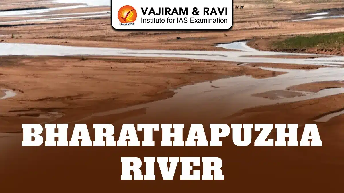
Bharathapuzha River is also known as Nila River, Ponnani River, Perar RIver and Kuttippuram River. It is the second longest river flowing through Kerala, with a total length of about 209 km. It is an important interstate river of Kerala and Tamil Nadu and flows through the Palakkad Gap, the widest break in the Western Ghats. The river supports agriculture, culture and daily life across Palakkad and Malappuram districts and parts of Thrissur, Coimbatore and Tiruppur. Its basin is spread over 6,186 sq km, making it the largest river basin in Kerala.

Bharathapuzha River Geographical Features

Bharathapuzha River originates from the Anamalai Hills in Tamil Nadu and flows westward through the Palakkad Gap before draining into the Arabian Sea at Ponnani.

  • Origin and Course: The river begins as small streams near Thirumoorthy Hills in the Anamalai range, flows northward initially, then turns west across Palakkad and Malappuram, finally meeting the Arabian Sea at the Ponnani estuary.
  • Length and Basin Area: With a length of 209 km, Bharathapuzha has a drainage basin of 6,186 sq km, of which around 4,400 sq km lies in Kerala and 1,786 sq km in Tamil Nadu.
  • Palakkad Gap Influence: The Palakkad Gap allows dry continental winds to enter Kerala, making the river basin comparatively drier, which directly reduces water availability despite the large basin size.
  • Tributaries: Important tributaries include Kannadipuzha, Kalpathipuzha, Gayathripuzha and Thuthapuzha, with Thuthapuzha significantly increasing river width and flow after joining near Pallippuram.
  • Rainfall and Climate Influence: The basin receives 2,000-2,800 mm rainfall in hilly areas and up to 3,000 mm near the coast, but high temperatures and rain shadow effects limit year round flow.

Bharathapuzha River Projects

Bharathapuzha River is one of the most heavily regulated rivers in Kerala, with multiple dams and irrigation projects built after independence.

  • Reservoirs: There are 11 reservoirs across the river system, including Malampuzha, Walayar, Mangalam, Pothundi, Meenkara, Chulliyar, Thirumoorthy, Aliyar, Upper Aliyar, Chitturpuzha regulator and Kanjirapuzha dam.
  • Malampuzha Dam: Malampuzha is the largest reservoir in the basin and plays a critical role in irrigating Palakkad district, supporting paddy cultivation in one of Kerala’s main food producing regions.
  • Irrigation Coverage: Existing irrigation projects support about 773 sq km of agricultural land, mainly for paddy, coconut and vegetable farming across Palakkad and Malappuram districts.
  • Ongoing Developments: Two additional irrigation projects under construction are expected to increase the irrigated area by around 542 sq km, strengthening water security in drought prone regions.
  • Thrithala Regulator-cum-Bridge: This project has a shutter height of 5 meters, improves drinking water storage, reduces travel distance between Thrissur and Kozhikode by 11 km and has revived summer fish populations.

Bharathapuzha River Threats

Bharathapuzha River faces severe environmental stress due to human activities, climatic changes and unsustainable resource use as highlighted below:

  • Reduced Summer Flow: Due to extensive dam construction and dry catchment areas, many stretches of the river almost dry up during summer months, affecting drinking water and agriculture.
  • Sand Mining Impact: Large scale sand mining over the past three decades removed ancient sand beds, destabilized riverbanks, lowered groundwater levels and altered the natural flow pattern of the river.
  • Vegetation Overgrowth: Loss of sand has allowed grasses and bushes to grow within the river channel, obstructing flow and increasing the risk of course alteration during monsoon floods.
  • Water Pollution: Untreated waste from hospitals, households and urban settlements has reduced water quality, making many stretches unsuitable for drinking and domestic use.
  • Climate Variability: Studies show declining annual rainfall and rising temperatures in the basin, further reducing water availability and intensifying seasonal drought conditions.

Bharathapuzha River Conservation Measures

Several conservation efforts and proposed measures aim to restore ecological balance and long term sustainability of the Bharathapuzha River:

  • Regulated Sand Mining: Experts recommend strict regulation instead of total bans, ensuring limited, monitored extraction and allocating a portion of sand mining revenue for river restoration activities.
  • Waste Management Controls: Enforcing strict waste treatment rules for hospitals, hotels and households is essential to prevent direct discharge of pollutants into the river system.
  • Riverbank Afforestation: Planting banyan, jackfruit, teak and mango trees along riverbanks can improve groundwater recharge, reduce erosion and enhance summer base flow.
  • Mangrove Development: Mangroves near estuarine stretches act as natural barriers against erosion, support fish breeding and stabilize riverbanks near the Ponnani mouth.
  • Community Initiatives: Groups like Bharathapuzha Samrakshana Samithi and Friends of Bharathapuzha, led by E. Sreedharan, work to raise awareness, promote conservation and protect the river from further degradation.

Bharathapuzha River FAQs

Q1: What is Bharathapuzha River also known as?

Ans: Bharathapuzha is also known as Nila, Ponnani River, Perar and Kuttippuram River in different regions and historical records.

Q2: What is the origin of the Bharathapuzha River?

Ans: It originates from the Anamalai Hills near Thirumoorthy in Tamil Nadu and flows westward into the Arabian Sea at Ponnani.

Q3: Why is Bharathapuzha River important to Kerala?

Ans: It is Kerala’s second longest river and supports irrigation, drinking water needs, agriculture, culture and livelihoods across multiple districts.

Q4: Which is the largest dam on Bharathapuzha River?

Ans: Malampuzha Dam is the largest reservoir built across the Bharathapuzha river system and is mainly used for irrigation.

Q5: What is the biggest threat to Bharathapuzha River?

Ans: Uncontrolled sand mining, reduced rainfall, pollution and heavy damming have severely reduced its water flow and ecological health.

Residual Mountains, Formation, Characteristics, Examples in India

Residual Mountains

Residual mountains are ancient landforms formed by the continuous erosion of old mountain ranges or plateaus over millions of years. They are created when weathering and denudation remove softer rocks, leaving behind hard and resistant rock structures. These mountains usually have rounded peaks, lower heights, and appear as isolated hills or small ranges. Examples include the Aravalli Range in India and the Ural Mountains, Scottish Highlands, and Scandinavian Highlands in the world.

Residual Mountains Formation

Residual Mountains also known as Circum-erosional or Relict mountains are formed through the long-term process of erosion and denudation, where external natural forces gradually wear down ancient mountain ranges or plateaus. Over time, softer rocks are removed, leaving behind hard and resistant rock structures as residual mountains.

  • Origin from Ancient Mountain Ranges or Plateaus: Residual mountains were originally part of large fold mountains or elevated plateau regions formed by tectonic forces millions of years ago.
  • Weathering of Rocks: Physical, chemical, and biological weathering processes break down rocks into smaller particles, weakening the mountain structure.
  • Erosion by External Agents: Natural agents such as rivers, wind, glaciers, and rainfall remove weathered rock materials layer by layer, reducing the mountain’s height.
  • Denudation Process: Continuous removal of surface material through erosion, transportation, and deposition gradually reshapes mountains into smaller remnants.
  • River Dissection of Plateaus: Rivers cut deep valleys and separate plateau regions into hills and ridges, which later appear as residual mountains.
  • Survival of Hard Rocks: Hard and erosion-resistant rocks like granite and quartzite remain intact after softer rocks are removed, forming the core structure of residual mountains.
  • Gradual Reduction in Height and Size: Over long geological periods, erosion lowers the elevation and changes the rugged mountain terrain into smoother, rounded landforms.

Residual Mountains Characteristics

Residual mountains are ancient landforms formed after long periods of erosion and denudation that wear down older mountain ranges or plateaus. The key characteristics of the residual mountains are:

  • Ancient Geological Formation: Residual mountains are among the oldest mountain landforms on Earth. They represent the remaining parts of once massive mountain ranges that have been reduced in height due to continuous erosion over millions of years.
  • Rounded Peaks and Gentle Slopes: Due to prolonged weathering and erosion, residual mountains generally have smooth, rounded summits and less rugged terrain compared to young fold mountains like the Himalayas.
  • Lower Elevation: These mountains usually have moderate or low heights because erosion gradually removes upper rock layers, reducing their overall size and elevation.
  • Composed of Hard and Resistant Rocks: Residual mountains mainly consist of strong rocks such as granite, quartzite, and basalt, which resist erosion and remain standing after softer rocks are removed.
  • Isolated or Fragmented Appearance: Many residual mountains appear as scattered hills or small mountain ranges surrounded by plains or plateaus, giving them a distinct landscape presence.
  • Thin Soil Cover and Sparse Vegetation: Continuous erosion removes fertile topsoil, leaving rocky surfaces where vegetation is often limited.
  • Evidence of Long-Term Erosion Processes: Residual mountains serve as geological records showing the impact of weathering, river erosion, wind action, and glacial activity over long time periods.

Residual Mountains in India

India contains several prominent residual mountain ranges that provide evidence of ancient geological activity and erosion.

  1. Aravalli Range

The Aravalli Range is one of the oldest mountain systems in the world, stretching from Gujarat to Delhi. It represents the eroded remains of ancient fold mountains and contains important mineral deposits such as copper and zinc.

  1. Parasnath Hills (Jharkhand)

Parasnath Hill is the highest peak in Jharkhand and is considered a residual mountain formed through long-term erosion. It is also a significant religious site for Jain pilgrims.

  1. Nallamala Hills (Andhra Pradesh and Telangana)

These hills are part of the Eastern Ghats and are formed through plateau dissection by river erosion. They consist mainly of ancient sedimentary rocks.

  1. Mahendragiri Hills (Odisha)

Mahendragiri is a residual mountain within the Eastern Ghats and is known for its geological and religious importance.

  1. Javadi, Veliconda, and Palkonda Hills

These hill ranges in southern India are remnants of ancient plateau regions dissected by rivers and erosion processes.

Residual Mountains in the World

Residual Mountains are found across different continents, showcasing the universal impact of erosion on Earth’s surface.

  1. Ural Mountains (Russia)

The Ural Mountains are among the oldest mountain ranges and form a natural boundary between Europe and Asia. They are heavily eroded remnants of ancient fold mountains.

  1. Highlands of Scotland

The Scottish Highlands represent a classic example of residual mountains formed through long-term glacial and river erosion.

  1. Scandinavian Highlands

Located in Northern Europe, these highlands are remnants of ancient geological structures shaped by glaciation and erosion.

  1. Sierras de Europa (Spain)

This mountain range is formed from the erosion of older mountain systems and contains limestone formations shaped by weathering.

  1. Mesas and Buttes (United States)

Mesas and buttes are flat-topped elevated landforms created when plateau surfaces are eroded by rivers and wind, leaving isolated residual hills.

UPSC CSE PYQs

Question: Which of the following mountains is considered a residual mountain? [2018]

  1. A) Andes
  2. B) Ural Mountains
  3. C) Himalayas
  4. D) Alps

Answer: (B)

Residual Mountains FAQs

Q1: What are Residual Mountains?

Ans: Residual mountains are old landforms formed by the erosion and denudation of ancient mountain ranges or plateaus, leaving behind resistant rock structures.

Q2: Why are Residual Mountains called Relict Mountains?

Ans: They are called relict mountains because they are the remaining parts or remnants of previously existing high mountain systems.

Q3: How are Residual Mountains formed?

Ans: Residual mountains are formed when external forces like wind, rivers, glaciers, and rainfall gradually erode softer rock layers and leave behind harder rocks.

Q4: Name some examples of Residual Mountains in India.

Ans: Major examples include the Aravalli Range, Parasnath Hills, Nallamala Hills, Mahendragiri Hills, and Javadi Hills.

Q5: Which are the major Residual Mountains in the world?

Ans: Examples include the Ural Mountains in Russia, Scottish Highlands, Scandinavian Highlands, and Sierras de Europa in Spain.

Tamraparni River, Origin, Drainage, Features, History, Biodiversity

Tamraparni River

The Tamraparni River is also known as Thamirabarani River or Porunai River. It is a rare perennial river of southern India flowing entirely within Tamil Nadu. It originates from the Agastyarkoodam peak of the Pothigai hills in the Western Ghats at about 1,725 metres. The river travels nearly 128 kilometres before draining into the Gulf of Mannar. It flows initially northward and later turns eastward, passing through Tirunelveli and Thoothukudi districts. It is fed by both southwest and northeast monsoons. It sustains agriculture, biodiversity, settlements and cultural traditions, making it ecologically, historically and economically vital.

Tamraparni River Geographical Features

The Tamraparni River displays unique geographical characteristics influenced by the Western Ghats, monsoonal rainfall and an extensive tributary network:

    • Origin and Elevation: The river rises at Agastyarkoodam peak in the Pothigai hills at around 1,725 metres above sea level, ensuring continuous flow throughout the year due to heavy monsoonal rainfall in the Western Ghats region.
    • Length and Course Direction: From source to sea, the river covers about 128 kilometres, making it the shortest perennial river in Tamil Nadu, initially flowing northwards and later turning eastwards across plains.
    • Tributary System: Major tributaries include Servalar, Manimuthar, Gadananathi, Pachaiyar, Chittar, Ramanathi and Koraiyar, all originating from forested Western Ghats regions and strengthening perennial discharge.
    • Waterfalls and Reservoirs: The river forms Paanatheertham waterfalls of about 40 metres near Karaiyar reservoir and Kalyanatheertham and Agasthiar falls near Papanasam, highlighting sharp elevation drops.
    • Drainage Basin: Along with its tributaries, the river drains an area of nearly 4,400 square kilometres, with most catchment zones lying within the Western Ghats, making it flood prone during intense northeast monsoon rainfall.
    • Flood Characteristics: Major floods occurred in 1992, 2015 and December 2023, when discharge peaked around 4.5 lakh cubic feet per second, severely affecting Tirunelveli, Palayamkottai, Eral and Athur regions.

Tamraparni River Historical Background

The Tamraparni River has deep historical, literary and cultural significance, reflected in ancient texts, trade links and long standing human settlements as discussed below:

  • Ancient Names: Historically known as Tan Porunai, Tamira Porunai and Tamraparni, the name is derived from “Thamiram” meaning copper-red and “parani” meaning leaf, symbolising red foliage.
  • Sangam Literature: The river is celebrated in Sangam Era Tamil works like Purananuru, indicating its importance in early Tamil society, agriculture, trade routes and ritual practices.
  • Epics and Puranas: Sanskrit texts such as the Mahabharata, Ramayana and various Puranas describe Tamraparni as a sacred river where sages performed penance seeking spiritual liberation.
  • Pandyan Kingdom: During the Early Pandyan period, the river basin supported pearl fisheries, conch harvesting, agriculture and maritime trade linking southern India with Sri Lanka.
  • Sri Lankan Connection: The name Tamraparni influenced ancient names of Sri Lanka such as Tambapanni and Taprobane, reflecting migration, trade and cultural exchange across the Palk Strait.
  • Archaeological Evidence: A 2021 report by Beta Analytic Testing Laboratory suggested continuous human civilisation along the riverbanks for nearly 3,200 years, indicating early river based settlements.

Read about: Mechi River

Tamraparni River Projects

Several irrigation, hydropower and ecological restoration projects have shaped the Tamraparni River’s role in regional development and environmental management as highlighted below:

  • Papanasam Hydroelectric Project: The Papanasam lower reservoir supports hydroelectric generation, utilising steep gradients near the Western Ghats while regulating downstream water flow for irrigation.
  • Major Dams and Anicuts: Key structures include Karaiyar Dam, Manimuthar Dam, Gadananathi Dam and Ramanathi Dam, supporting irrigation across thousands of hectares in Tirunelveli district.
  • Irrigation Network: Seven major ancient anicuts like Kannadian, Ariyanayagipuram, Marudur and Suthamalli divert river water through channels irrigating over 20,000 hectares of wet and dry lands.
  • British Era Engineering: The Srivaikundam Anicut, completed in 1869, remains one of the most important hydraulic structures, distributing water through North and South Main Channels.
  • TamiraSES Project: The Tirunelveli district administration and ATREE launched the TamiraSES project to restore social-ecological systems from headwaters to estuary using hyper-local conservation strategies.
  • Water Management Challenges: Despite projects, issues like illegal sand mining, industrial effluent discharge, sewage inflow and encroachments threaten water quality and long term sustainability.

Tamraparni River Biodiversity

The Tamraparni River supports exceptional biodiversity due to perennial flow, forested catchments and connection with the Gulf of Mannar ecosystem. The major flora and fauna found in the River Ecosystem has been mentioned here:

  • Aquatic Biodiversity Richness: The river is considered among the most fish rich rivers globally, with estimates of nearly 669 fish species supported by year round freshwater availability.
  • Snakehead Fish Diversity: More than 17 species of native snakehead fishes, including Channa marulius, Channa striata and Channa diplogramma, dominate the river as top level predators.
  • Catfish and Invasive Species: Around 13 catfish species occur, while invasive African catfish, first recorded in 2009, pose ecological risks to native fish populations.
  • Eels and Carp Species: Nearly 90 eel species including Indian mottled eel (Anguilla bengalensis) and carp species like silver, grass and common carp form significant biomass.
  • Terrestrial and Riparian Fauna: The river basin supports Nilgiri marten, slender loris, lion tailed macaque, great hornbill, Sri Lankan Atlas moth and endemic amphibians.
  • Ecological Link to Gulf of Mannar: The river’s estuary near Punnaikayal nourishes mangroves, coastal fisheries and coral associated marine life, strengthening regional ecological connectivity.

Tamraparni River FAQs

Q1: Why is the Tamraparni River unique in Tamil Nadu?

Ans: It is the only perennial river in Tamil Nadu, flowing throughout the year due to Western Ghats catchment and dual monsoons.

Q2: Where does the Tamraparni River originate?

Ans: It originates from the Agastyarkoodam peak of the Pothigai hills in the Western Ghats at about 1,725 metres elevation.

Q3: Which districts does the Tamraparni River flow through?

Ans: The river flows through Tirunelveli and Thoothukudi districts before draining into the Gulf of Mannar.

Q4: Which sea does the Tamraparni River drain into?

Ans: The river drains into the Gulf of Mannar, part of the Bay of Bengal, near Punnaikayal in Thoothukudi district.

Q5: Why is the Tamraparni River ecologically important?

Ans: It supports rich biodiversity with hundreds of fish species, forest wildlife and sustains coastal ecosystems of the Gulf of Mannar.

Mechi River, Origin, Geographical Features, Kosi-Mechi River Link Project

Mechi River

The Mechi River is a trans-boundary perennial river flowing through Nepal and India that forms an important part of the eastern Himalayan river system. It originates in the Mahabharat Range of Nepal and travels southwards. It briefly marks the India-Nepal international boundary before entering Bihar and finally joining the Mahananda River in Kishanganj district. As a tributary of the Mahananda, the Mechi plays a critical role in regional hydrology, agriculture and flood dynamics. It lies within the larger Mahananda River System, which drains high rainfall sub-Himalayan regions and frequently experiences monsoon induced flooding.

Read about: Kushiyara River

Mechi River Geographical Features

The Mechi River originates in the Mahabharat Lekh of Nepal and flows through varied terrain before merging with the Mahananda River in Bihar.

  • Source and Origin: The Mechi rises in the Mahabharat Range, an inner Himalayan belt in Nepal, making it a perennial river sustained by monsoon rainfall and hill catchments throughout the year.
  • Course and Flow Path: After originating, it flows through eastern Nepal and the Darjeeling district of West Bengal before joining the Mahananda River in the Kishanganj district of Bihar, India.
  • Trans-boundary Nature: The river flows through both Nepal and India, requiring bilateral coordination for embankments, flood control and water management, especially in border areas.
  • River System: Mechi is a tributary of the Mahananda River, which ultimately drains into the Ganga, connecting it to the larger Ganga-Brahmaputra-Meghna basin.
  • Catchment Area: The Mahananda river system, including Mechi, covers about 8,088 square kilometres in Nepal and 11,520 square kilometres in India, reflecting its extensive hydrological influence.
  • Interfluve Characteristics: The Mechi-Mahananda interfluve represents a transition zone between hills and plains, showing sharp elevation changes and diverse landforms.
  • Braided Channel Nature: Rivers emerging from the hills, including the Mechi, often develop braided channels due to heavy sediment load and variable discharge during monsoon months.
  • Alluvial Fan Formation: The Mechi contributes to well developed alluvial fans in the plains, depositing fertile sediments that support agriculture but also increase flood vulnerability.
  • Flood Prone Behaviour: During peak monsoon, high rainfall in sub-Himalayan regions causes the Mechi and Mahananda to swell, leading to waterlogging and inundation in low lying areas.
  • Embankment Infrastructure: Embankments exist along about 14 kilometres of the left bank in West Bengal, though they require remodelling to reduce flood risks in Naxalbari and nearby areas.
  • Border Sensitivity: Since the river marks an international boundary, embankment alignment must maintain equal top levels on both sides, as agreed by the Nepal-India Joint Standing Technical Committee.
  • Role in Local Livelihoods: Communities along the Mechi depend on its waters for irrigation and farming, but frequent flooding and erosion often damage crops and settlements.

Read about: Potomac River

Kosi-Mechi River Link Project

The Kosi-Mechi River Link Project aims to transfer surplus water from the Kosi River to the Mechi for irrigation and regional water management.

Background

  • The project is part of India’s National Perspective Plan for interlinking rivers, which was formulated in 1980 to enable inter basin water transfer.
  • It proposes linking the Kosi River, known as the “Sorrow of Bihar,” with the Mechi.
  • The project is overseen by the National Water Development Agency under the Union Ministry of Jal Shakti.

Objectives

  • The project aims to provide annual irrigation to about 4.74 lakh hectares, including nearly 2.99 lakh hectares in Bihar.
  • It is designed to support irrigation for about 2.15 lakh hectares in the Mahananda basin during the Kharif season.
  • The project plans to supply around 24 million cubic metres of water annually for domestic and industrial use.
  • Upon completion, an extra 5,247 cubic feet per second of water is expected to be released from the Kosi barrage.
  • Expected irrigation benefits will reach Araria, Purnea, Kishanganj and Katihar districts of Bihar.
  • Authorities state the project will also contribute to flood moderation, though experts consider the impact limited.
  • The project reflects ongoing efforts to manage eastern India’s complex water challenges through inter basin river linking.

Implementation

  • On 28 March 2025, the Cabinet Committee on Economic Affairs approved the Kosi-Mechi Intra-State Link Project under PMKSY-AIBP.
  • The plan includes a barrage across the Kosi near Chatra village, located 10-12 kilometres below the proposed Kosi High Dam.
  • The plan involves remodelling the Eastern Kosi Main Canal from 0 to 41.30 kilometres and extending it up to the Mechi at 117.50 kilometres.
  • Water will be transferred through the Kosi-Mechi link canal, with the Kankai River forming part of the broader interlinking structure.
  • The project is scheduled for completion by March 2029.
  • The total estimated cost is ₹6,282.32 crore, with a central share of ₹3,652.56 crore.

Criticism

  • Although promoted as a multi purpose project, it lacks a strong flood mitigation component for Bihar’s chronically flood affected districts.
  • Flood affected communities in Bihar have protested, arguing that irrigation benefits do not address annual flooding, erosion and displacement.
  • This release is minimal compared to the Kosi barrage capacity of nearly 9,00,000 cusecs, raising questions about flood control effectiveness.
  • Recurrent floods between embankments destroy homes and crops and locals fear the project will not significantly reduce these losses.

Mechi River FAQs

Q1: What is the Origin of the Mechi River?

Ans: The Mechi River originates in the Mahabharat Range of Nepal within the inner Himalayan region.

Q2: In which district does the Mechi River join the Mahananda River?

Ans: The Mechi River joins the Mahananda River in Kishanganj district of Bihar, India.

Q3: Why is the Kosi-Mechi Link criticised by flood affected communities?

Ans: Critics argue its low additional discharge capacity cannot significantly reduce recurring floods and erosion in Bihar.

Q4: Why is the Mechi River prone to flooding?

Ans: High monsoon rainfall, heavy sediment load, braided channels, and low-lying plains increase flooding risk along the Mechi.

Q5: What is the purpose of the Kosi-Mechi River Link Project?

Ans: The project aims to improve irrigation, water supply, and limited flood moderation by transferring water from the Kosi River.

Enquire Now