Aluminium Phosphide

Aluminium Phosphide

Aluminium Phosphide Latest News

Recently, doctors at the PGIMER achieved a global breakthrough in treating aluminium phosphide (Celphos) poisoning with intravenous lipid emulsion therapy.

About Aluminium Phosphide 

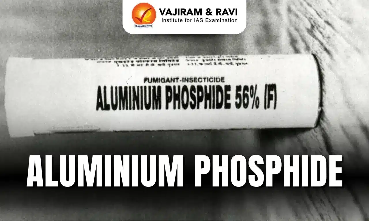
  • Aluminium phosphide is commonly known as Celphos.

Characteristics of Aluminium Phosphide 

  • It is a yellow or dark grey crystalline solid that has a garlic-like odour. 
  • It is a cheap, effective and commonly used pesticide.
  • It liberates lethal phosphine gas when it comes in contact either with atmospheric moisture or with hydrochloric acid in the stomach.
    • Phosphine gas, which is highly flammable, and very toxic in nature
    • The mechanism of toxicity includes cellular hypoxia due to the effect on mitochondria, inhibition of cytochrome C oxidase and formation of highly reactive hydroxyl radicals. 
  • Impact on Human Health: Aluminium phosphide poisoning continues to be a serious public-health challenge, particularly in agricultural states such as Punjab, Haryana and Uttar Pradesh.

Uses of Aluminium Phosphide 

  • Aluminum Phosphide (ALP) is a highly toxic fumigant which is used commonly as an indoor pesticide in agriculture based industry for storage of grains.
  • It is often dispersed in pellets; the pellets react with moisture which produces toxic phosphine gas. 
  • Aluminium phosphide is also used to make semi-conductor materials such as light-emitting diodes.

Source: IE

Aluminium Phosphide FAQs

Q1: What is Aluminium Phosphide used for?

Ans: Fumigant pesticide

Q2: What is the toxicity of Aluminium Phosphide attributed to?

Ans: Release of phosphine gas

World Wetlands Day

World Wetlands Day 2026

World Wetlands Day Latest News

World Wetlands Day 2026 theme explores the long-standing connections between the habitats and cultural practices, traditions and knowledge systems of communities.

About World Wetlands Day

  • It is celebrated every year on 2 February. 
  • It was first celebrated in 1997 and has been a United Nations International Day since 2022.
    • It marks the anniversary of the Ramsar Convention, signed in Ramsar, Iran, on 2 February 1971.
    • The agreement is also known as the Convention on Wetlands of International Importance. 
    • It is one of the oldest modern international environmental agreements and the only one focused entirely on a single ecosystem: wetlands.
    • There are 172 Contracting Parties to the convention and over 2500 listed Ramsar wetlands worldwide.  
    • Each year, the Convention Secretariat leads the World Wetlands Day campaign, with participation from governments, conservation organisations, businesses, NGOs, media, youth groups, and communities worldwide.
  • World Wetlands Day 2026 Theme: The global theme for 2026, ‘Wetlands and Traditional Knowledge: Celebrating Cultural Heritage’, highlights the role of indigenous and local communities in conserving and managing wetlands.

New Ramsar Sites in India

Patna Bird Sanctuary in Etah, Uttar Pradesh, and Chhari-Dhand in Kutch, Gujarat, have been officially designated as Wetlands of International Importance under the Ramsar Convention, bringing the total number of Ramsar sites in India to 98.

Source: N18

[youtube url="https://www.youtube.com/watch?v=SSE0fdf60s4" width="560" height="315"]

World Wetlands Day FAQs

Q1: When is World Wetlands Day celebrated every year?

Ans: World Wetlands Day is celebrated every year on 2 February.

Q2: In which year was World Wetlands Day first celebrated?

Ans: World Wetlands Day was first celebrated in 1997.

Q3: What historical event does World Wetlands Day commemorate?

Ans: It marks the anniversary of the signing of the Ramsar Convention on 2 February 1971.

Q4: What is the Ramsar Convention also known as?

Ans: It is also known as the Convention on Wetlands of International Importance.

Q5: What is the theme of World Wetlands Day 2026?

Ans: The theme of World Wetlands Day 2026 is “Wetlands and Traditional Knowledge: Celebrating Cultural Heritage”.

Bhairav Battalions

Bhairav Battalions

Bhairav Battalions Latest News

For the first time, the Indian Army’s newly raised Bhairav Battalion will march down Kartavya Path and salute the Supreme Commander during the Republic Day parade.

About Bhairav Battalions

  • They are a new class of compact, high-tech combat units of the Indian Army.
  • Each battalion comprises approximately 250 soldiers, drawing personnel from infantry, artillery, air defence, signals, and other combat support arms.
  • They are specially equipped for swift, surprise, and high-impact operations in diverse combat environments.
  • Unlike Para Special Forces, which handle strategic missions deep inside enemy territory, Bhairav Battalions are positioned closer to the border.
  • Their job is to handle tactical, fast-breaking situations, the kind that require immediate response rather than detailed planning.
  • In the Army’s own words, Bhairav units are built to “fight tonight”, meaning they must be ready to move at short notice, often without waiting for larger formations.
  • The Bhairav units will act as a bridge between Special Forces and regular infantry, aimed at freeing up Special Forces for more critical assignments.
  • The battalions are being placed under corps and division-level formations, especially in sectors considered sensitive, Rajasthan, Jammu, Ladakh, and the Northeast.
  • Their structure allows them to be deployed for multi-domain tasks, a mix of ground action, drone operations, and electronic support.
  • With nearly 15 battalions already raised and plans for up to 25, the Bhairav formation is becoming a permanent part of India’s defence structure.

Source: IS

Bhairav Battalions FAQs

Q1: What are Bhairav Battalions?

Ans: They are a new class of compact, high-tech combat units of the Indian Army.

Q2: How many soldiers are there in a Bhairav Battalion?

Ans: Each battalion comprises approximately 250 soldiers, drawing personnel from infantry, artillery, air defence, signals, and other combat support arms.

Q3: What type of operations are Bhairav Battalions designed for?

Ans: Swift, surprise, and high-impact operations.

Q4: How are Bhairav Battalions different from Para Special Forces?

Ans: They handle tactical, immediate-response situations rather than deep strategic missions.

Q5: In which regions are Bhairav Battalions primarily deployed?

Ans: Rajasthan, Jammu, Ladakh, and the Northeast.

Devnimori Relics of Lord Buddha

Devnimori Relics

Devnimori Relics of Lord Buddha Latest News

India is set to undertake a profound gesture of spiritual outreach and cultural diplomacy through the exposition of the sacred Devnimori Relics of Lord Buddha in Sri Lanka. 

About Devnimori Relics of Lord Buddha

  • The Devnimori Relics originate from the Devnimori archaeological site, located near Shamlaji in the Aravalli district of Gujarat.
  • It was first explored in 1957 by eminent archaeologist Prof. S. N. Chowdhry,

Major Findings of Excavations

  • The excavations revealed important Buddhist structures and relics that stand testimony to the flourishing of Buddhism in western India.
    • Relic casket: The relic casket found within Devnimori Stupa at a height of 24 feet from the base, made out of green schist.
      • It is inscribed in Brahmi Script and Sanskrit language, it reads. “dashabala sharira nilay” - the abode of the Buddha’s bodily relic.
      • It holds a copper box having organic matter with holy ashes, with silk cloth and beads.
    • Copper box: The copper box had a flat top and base with a slipon lid fitting onto a rim ledge, and contained silk cloth, a gold coated silver-copper bottle, organic material with holy ashes, and black clay used as covering.
      • The small amphora-like gold coated bottle had a sagger base, cylindrical body, and a narrow neck with a screw-type lid.
    • Desiccator: The desiccator now houses the Holy Relics. It is sealed in an air-tight glass to prevent further deterioration of the object inside.

Source: PIB

Devnimori Relics of Lord Buddha FAQs

Q1: Where is the Devnimori archaeological site located?

Ans: Gujarat, India

Q2: What is inscribed on the relic casket?

Ans: Dashabala Sharira Nilaya

Fuego Volcano

Fuego Volcano

Fuego Volcano Latest News

Guatemala's Volcan de Fuego, one of Central America's most persistently active volcanoes, produced a striking explosive eruption recently.

About Fuego Volcano

  • Volcan de Fuego, which translates to “Volcano of Fire” in Spanish, is an active volcano located in Guatemala.
  • It is a relatively young basaltic stratovolcano. 
  • It is one of three large stratovolcanoes overlooking Guatemala’s former capital, Antigua.
  • Nestled between the neighboring volcanoes of Acatenango and Agua, it rises dramatically to an altitude of 3,763 meters (12,346 feet) above sea level.
  • It forms part of the Central American Volcanic Arc, a chain of volcanoes stretching from Guatemala to Panama. 
  • Guatemala lies on the Pacific “Ring of Fire and experiences frequent seismic and volcanic activity.
  • Fuego has erupted more than 60 times since 1524, making it Central America’s historically most active volcano.
  • A deadly eruption in 2018 claimed 194 lives and left 234 people missing.
  • Since then Volcan Fuego has continued to be active, but to a lesser extent, with small eruptions several times a day.
  • Typical activity is characterized by ashfall, pyroclastic flows, lava flows, and lahars.

What is a Stratovolcano?

  • It is a tall, steep, and cone-shaped type of volcano.
  • Unlike flat shield volcanoes, they have higher peaks.
  • They are typically found above subduction zones, and they are often part of large volcanically active regions, such as the Ring of Fire that frames much of the Pacific Ocean.
  • Strato Volcanoes comprise the largest percentage (~60%) of the Earth’s individual volcanoes, and most are characterized by eruptions of andesite and dacite, lavas that are cooler and more viscous than basalt.
  • These more viscous lavas allow gas pressures to build up to high levels. Therefore, these volcanoes often suffer explosive eruptions. 
  • They are usually about half-half lava and pyroclastic material, and the layering of these products gives them their other common name of composite volcanoes.
  • At the peak, stratovolcanoes usually have a small crater. The crater may be filled with water or ice, or it may contain a volcanic dome during a period of relative inactivity.

Source: IT

Fuego Volcano FAQs

Q1: Where is Fuego Volcano located?

Ans: It is located in Guatemala.

Q2: What type of volcano is Fuego Volcano?

Ans: It is a relatively young basaltic stratovolcano.

Q3: Fuego Volcano overlooks which historic city of Guatemala?

Ans: It overlooks Guatemala’s former capital, Antigua.

Q4: Which two volcanoes are located adjacent to Fuego Volcano?

Ans: It is located between the volcanoes of Acatenango and Agua.

NeophyteID App

NeophyteID App

NeophyteID App Latest News

Recently, the Kerala chief minister launched the NeophyteID application.

About NeophyteID App

  • It is an AI-powered mobile application designed to help users identify invasive plant species across Kerala.
  • It is developed by researchers at the Malabar Botanical Garden and Institute for Plant Sciences (MBGIPS),
  • It is aimed as a citizen-friendly app which enables local communities, students and ecologists to collectively monitor, report and manage the spread of invasive plants threatening native flora and ecosystems.

Key Features of NeophyteID App

  • Technology Used: It is powered by the YOLOv11 machine learning model.
  • The app leverages image recognition and geospatial tracking to accurately detect and map invasive (neophyte) plant species directly from your camera or gallery.
  • Each identification contributes to a real-time distribution map, supporting research, conservation, and community-based biodiversity management. 
  • Languages: It is accessible in English and Malayalam.

Source: TOI

NeophyteID App FAQs

Q1: What is the primary purpose of the NeophyteID App?

Ans: To identify and map invasive plant species

Q2: Which institution developed the NeophyteID App?

Ans: Malabar Botanical Garden and Institute for Plant Sciences (MBGIPS)

Pennaiyar River

Pennaiyar River

Pennaiyar River Latest News

The Supreme Court recently directed the Centre to constitute a tribunal to adjudicate the dispute between Tamil Nadu and Karnataka over the sharing of Pennaiyar River water.

About Pennaiyar River

  • The Pennaiyar River is a major river in southern India flowing through Tamil Nadu and Karnataka.
  • It is also known as the South Pennar River, Dakshina Pinakini in Kannada, and Thenpennai, Ponnaiyar, or Pennaiyar in Tamil. 
  • Course:
    • It originates in the Nandi Hills in the Chikkaballapura district of Karnataka
    • It then flows southward for 80 km through Karnataka to northwestern Tamil Nadu, where it turns and flows southeastward to enter the Bay of Bengal at Cuddalore. 
  • It is the second longest river in Tamil Nadu, stretching 497 km in length. 
  • It is also the second largest interstate east-flowing river basin, situated between the Pennar and Cauvery basins.
  • The Basin is bounded on the northwest and south by various ranges of the Eastern Ghats, like the Velikonda Range, the Nagari hills, the Javadu hills, the Shevaroy hills, the Chitteri hills, and the Kalrayan hills, and in the east by the Bay of Bengal.
  • Major tributaries are the Chinnar, Markanda, Vaniar, and Pamban.
  • Heavy rains at the river’s source cause sudden, but short-lived, floods. 
  • The river is extensively dammed for irrigation, especially in Tamil Nadu.
  • There are also reservoirs at Krishnagiri and Sathanur. 

Pennaiyar River Dispute

  • It is a water-sharing dispute between the Indian states of Tamil Nadu and Karnataka. 
  • Tamil Nadu claims that Karnataka’s construction of check dams and diversion structures would reduce the water flow into their state, affecting their irrigation and drinking water needs.

Source: TH

Pennaiyar River FAQs

Q1: Through which Indian States does the Pennaiyar River flow?

Ans: The Pennaiyar River flows through Karnataka and Tamil Nadu.

Q2: Where does the Pennaiyar River originate?

Ans: The Pennaiyar River originates in the Nandi Hills in the Chikkaballapura district of Karnataka.

Q3: Where does the Pennaiyar River drain into the sea?

Ans: It drains into the Bay of Bengal at Cuddalore.

Q4: What are the major tributaries of the Pennaiyar River?

Ans: The major tributaries are the Chinnar, Markanda, Vaniar, and Pamban.

Rafah Border Crossing

Rafah Border Crossing

Rafah Border Crossing Latest News

Recently, Israel reopened Gaza’s Rafah border crossing with Egypt.

About Rafah Border Crossing

  • It's the southernmost post of exit from Gaza and borders Egypt's Sinai peninsula.
  • It is controlled by Egypt.
  • There are only two other border crossings from and into the Gaza Strip –
    • Erez: A crossing into Israel in northern Gaza, which is for people.
    • Kerem Shalom: A solely commercial goods junction with Israel in southern Gaza

Key Facts about Sinai Peninsula

  • It is a triangle-shaped peninsula located in northeastern Egypt.
  • It serves as a land bridge connecting Asia and Africa.
  • Boundaries
    • North: It is bordered to the north by the Mediterranean Sea and to the east by Israel and the Gaza Strip. 
    • West: To the west of the Sinai Peninsula is the Suez Canal, across which lies the African part of Egypt. 
    • It is bordered to the southwest by the Gulf of Suez and to the immediate south by the Red Sea. 
    • The Gulf of Aqaba borders the Sinai in the southeast.

Source: IE

Rafah Border Crossing FAQs

Q1: What is the primary purpose of Rafah Border Crossing?

Ans: To allow Palestinians to travel in and out of Gaza

Q2: What is the current status of Rafah Border Crossing?

Ans: It is open for limited traffic

Enquire Now