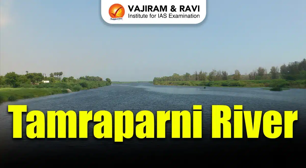
The Tamraparni River is also known as Thamirabarani River or Porunai River. It is a rare perennial river of southern India flowing entirely within Tamil Nadu. It originates from the Agastyarkoodam peak of the Pothigai hills in the Western Ghats at about 1,725 metres. The river travels nearly 128 kilometres before draining into the Gulf of Mannar. It flows initially northward and later turns eastward, passing through Tirunelveli and Thoothukudi districts. It is fed by both southwest and northeast monsoons. It sustains agriculture, biodiversity, settlements and cultural traditions, making it ecologically, historically and economically vital.
Tamraparni River Geographical Features
The Tamraparni River displays unique geographical characteristics influenced by the Western Ghats, monsoonal rainfall and an extensive tributary network:
-
- Origin and Elevation: The river rises at Agastyarkoodam peak in the Pothigai hills at around 1,725 metres above sea level, ensuring continuous flow throughout the year due to heavy monsoonal rainfall in the Western Ghats region.
- Length and Course Direction: From source to sea, the river covers about 128 kilometres, making it the shortest perennial river in Tamil Nadu, initially flowing northwards and later turning eastwards across plains.
- Tributary System: Major tributaries include Servalar, Manimuthar, Gadananathi, Pachaiyar, Chittar, Ramanathi and Koraiyar, all originating from forested Western Ghats regions and strengthening perennial discharge.
- Waterfalls and Reservoirs: The river forms Paanatheertham waterfalls of about 40 metres near Karaiyar reservoir and Kalyanatheertham and Agasthiar falls near Papanasam, highlighting sharp elevation drops.
- Drainage Basin: Along with its tributaries, the river drains an area of nearly 4,400 square kilometres, with most catchment zones lying within the Western Ghats, making it flood prone during intense northeast monsoon rainfall.
- Flood Characteristics: Major floods occurred in 1992, 2015 and December 2023, when discharge peaked around 4.5 lakh cubic feet per second, severely affecting Tirunelveli, Palayamkottai, Eral and Athur regions.
Tamraparni River Historical Background
The Tamraparni River has deep historical, literary and cultural significance, reflected in ancient texts, trade links and long standing human settlements as discussed below:
- Ancient Names: Historically known as Tan Porunai, Tamira Porunai and Tamraparni, the name is derived from “Thamiram” meaning copper-red and “parani” meaning leaf, symbolising red foliage.
- Sangam Literature: The river is celebrated in Sangam Era Tamil works like Purananuru, indicating its importance in early Tamil society, agriculture, trade routes and ritual practices.
- Epics and Puranas: Sanskrit texts such as the Mahabharata, Ramayana and various Puranas describe Tamraparni as a sacred river where sages performed penance seeking spiritual liberation.
- Pandyan Kingdom: During the Early Pandyan period, the river basin supported pearl fisheries, conch harvesting, agriculture and maritime trade linking southern India with Sri Lanka.
- Sri Lankan Connection: The name Tamraparni influenced ancient names of Sri Lanka such as Tambapanni and Taprobane, reflecting migration, trade and cultural exchange across the Palk Strait.
- Archaeological Evidence: A 2021 report by Beta Analytic Testing Laboratory suggested continuous human civilisation along the riverbanks for nearly 3,200 years, indicating early river based settlements.
Read about: Mechi River
Tamraparni River Projects
Several irrigation, hydropower and ecological restoration projects have shaped the Tamraparni River’s role in regional development and environmental management as highlighted below:
- Papanasam Hydroelectric Project: The Papanasam lower reservoir supports hydroelectric generation, utilising steep gradients near the Western Ghats while regulating downstream water flow for irrigation.
- Major Dams and Anicuts: Key structures include Karaiyar Dam, Manimuthar Dam, Gadananathi Dam and Ramanathi Dam, supporting irrigation across thousands of hectares in Tirunelveli district.
- Irrigation Network: Seven major ancient anicuts like Kannadian, Ariyanayagipuram, Marudur and Suthamalli divert river water through channels irrigating over 20,000 hectares of wet and dry lands.
- British Era Engineering: The Srivaikundam Anicut, completed in 1869, remains one of the most important hydraulic structures, distributing water through North and South Main Channels.
- TamiraSES Project: The Tirunelveli district administration and ATREE launched the TamiraSES project to restore social-ecological systems from headwaters to estuary using hyper-local conservation strategies.
- Water Management Challenges: Despite projects, issues like illegal sand mining, industrial effluent discharge, sewage inflow and encroachments threaten water quality and long term sustainability.
Tamraparni River Biodiversity
The Tamraparni River supports exceptional biodiversity due to perennial flow, forested catchments and connection with the Gulf of Mannar ecosystem. The major flora and fauna found in the River Ecosystem has been mentioned here:
- Aquatic Biodiversity Richness: The river is considered among the most fish rich rivers globally, with estimates of nearly 669 fish species supported by year round freshwater availability.
- Snakehead Fish Diversity: More than 17 species of native snakehead fishes, including Channa marulius, Channa striata and Channa diplogramma, dominate the river as top level predators.
- Catfish and Invasive Species: Around 13 catfish species occur, while invasive African catfish, first recorded in 2009, pose ecological risks to native fish populations.
- Eels and Carp Species: Nearly 90 eel species including Indian mottled eel (Anguilla bengalensis) and carp species like silver, grass and common carp form significant biomass.
- Terrestrial and Riparian Fauna: The river basin supports Nilgiri marten, slender loris, lion tailed macaque, great hornbill, Sri Lankan Atlas moth and endemic amphibians.
- Ecological Link to Gulf of Mannar: The river’s estuary near Punnaikayal nourishes mangroves, coastal fisheries and coral associated marine life, strengthening regional ecological connectivity.
Tamraparni River FAQs
Q1: Why is the Tamraparni River unique in Tamil Nadu?
Ans: It is the only perennial river in Tamil Nadu, flowing throughout the year due to Western Ghats catchment and dual monsoons.
Q2: Where does the Tamraparni River originate?
Ans: It originates from the Agastyarkoodam peak of the Pothigai hills in the Western Ghats at about 1,725 metres elevation.
Q3: Which districts does the Tamraparni River flow through?
Ans: The river flows through Tirunelveli and Thoothukudi districts before draining into the Gulf of Mannar.
Q4: Which sea does the Tamraparni River drain into?
Ans: The river drains into the Gulf of Mannar, part of the Bay of Bengal, near Punnaikayal in Thoothukudi district.
Q5: Why is the Tamraparni River ecologically important?
Ans: It supports rich biodiversity with hundreds of fish species, forest wildlife and sustains coastal ecosystems of the Gulf of Mannar.
