The Tigris River is one of the most historically important rivers of Western Asia and a central pillar of the ancient Fertile Crescent. It sustained early agriculture, urban growth and political power in Mesopotamia. Along with the Euphrates, it shaped the rise of Sumerian, Assyrian and later Islamic civilizations by providing water, transport routes and fertile alluvial land. Even today, the Tigris remains vital for drinking water, irrigation, hydropower and cultural identity across multiple urban states.
Tigris River
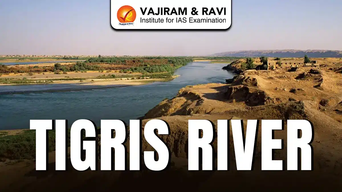
The Tigris River is the eastern river of Mesopotamia and is about 1,750 kilometers long, making it the second largest river in Western Asia. It rises near Lake Hazar in the Taurus Mountains of southeastern Türkiye (earlier Turkey). It flows southeast through Türkiye and Iraq while briefly touching Syria. The river passes through cities like Mosul, Tikrit, Samarra, Baghdad, and eventually joins the Euphrates near al-Qurnah to form the Shatt al-Arab, which drains into the Persian Gulf.
Also Read: Phalgu River
Tigris River Features
The Tigris River displays unique geographical, historical and cultural characteristics that distinguish it from other major river systems of the region. The key features of this river are highlighted below:
- Etymology: The name Tigris comes from Sumerian “Idigna,” meaning “swift river,” later adopted into Akkadian as Idiqlat and Old Persian as Tigrā, reflecting its faster flow compared to the Euphrates.
- Origin: The river originates from the Taurus Mountains of Türkiye.
- Course and Countries: The river flows around 400 kilometers in Türkiye. It briefly marks the Syria-Türkiye border and then crosses Iraq where more than half of its length lies.
- Tributaries: Important tributaries include the Greater Zab, Lesser Zab, Diyala, Al-Adhaim and Karkheh rivers, which significantly increase its discharge and support agriculture in northern and central Iraq.
- Ancient Civilizations: The Tigris supported Assyrian cities such as Nineveh and Ctesiphon, enabling irrigation-based farming, administrative systems and monumental architecture, including reliefs of rulers like Tiglath-Pileser carved along its banks.
- Cultural Role: The river holds spiritual importance for communities like the Mandaeans, who require naturally flowing water for baptism rituals, linking the river directly to living religious traditions.
- Urban Importance: Baghdad, the capital of Iraq, is developed on the banks of the Tigris. Ancient Canal Systems around 2900 BCE carried its water to cities like Lagash for large scale irrigation.
- Water Management and Dams: The river is heavily dammed, including the Mosul Dam, Iraq’s largest, built for flood control, irrigation and power generation, but also raising safety and maintenance concerns.
- Challenges: Climate change, upstream dam construction, pollution and political tensions have reduced water flow, threatening ecosystems, agriculture and cities, prompting regional cooperation efforts like the Geneva Consensus on river data sharing.
Also Read: Bharathapuzha River
Tigris River FAQs
Q1: Which countries does the Tigris River flow through?
Ans: The Tigris flows through Türkiye and Iraq and briefly forms part of the Syria-Türkiye border before entering Iraq.
Q2: Where does the Tigris River originate?
Ans: It originates near Lake Hazar in the Taurus Mountains of southeastern Türkiye (Turkey).
Q3: Which major cities are located on the banks of the Tigris River?
Ans: Important cities include Mosul, Tikrit, Samarra and Baghdad are located at the bank of Tigris River.
Q4: What are the major tributaries of Tigris River?
Ans: Key tributaries are the Greater Zab, Lesser Zab, Diyala, Al-Adhaim and Karkheh rivers.
Q5: What is the historical significance of the Tigris River?
Ans: It supported ancient Mesopotamian civilizations by providing water for agriculture, transport and early urban development.
