Pearl River, Location, Tributaries, Drainage Pattern, Importance

Pearl River

Pearl River, known in China as Zhu Jiang, is one of the major river systems of East Asia and the third longest river system of China, after the Yangtze and the Yellow River. The name "Pearl River" comes from the pearl-colored shells that lie within the Pearl's riverbed as it flows through the city of Guangzhou.

Pearl River Location and Extent

  • The Pearl River basin is located in southern China.
  • The river system flows mainly through the provinces of Yunnan, Guizhou, Guangxi, and Guangdong.
  • The river finally drains into the South China Sea near Guangzhou, Hong Kong, and Macau.

Pearl River Tributaries and River System

  • The Pearl River is not a single river but a river system formed by the confluence of three major rivers. These three major tributaries are: Xi Jiang (West River) - the longest and most important tributary, Bei Jiang (North River), Dong Jiang (East River). 
  • The Xi Jiang, the main tributary, originates in the Yunnan Plateau.
  • The river system flows generally from west to east, descending from highlands to low-lying coastal plains.
  • After flowing through Guangdong province, the river forms a large delta before entering the South China Sea.

Read about: Tigris River
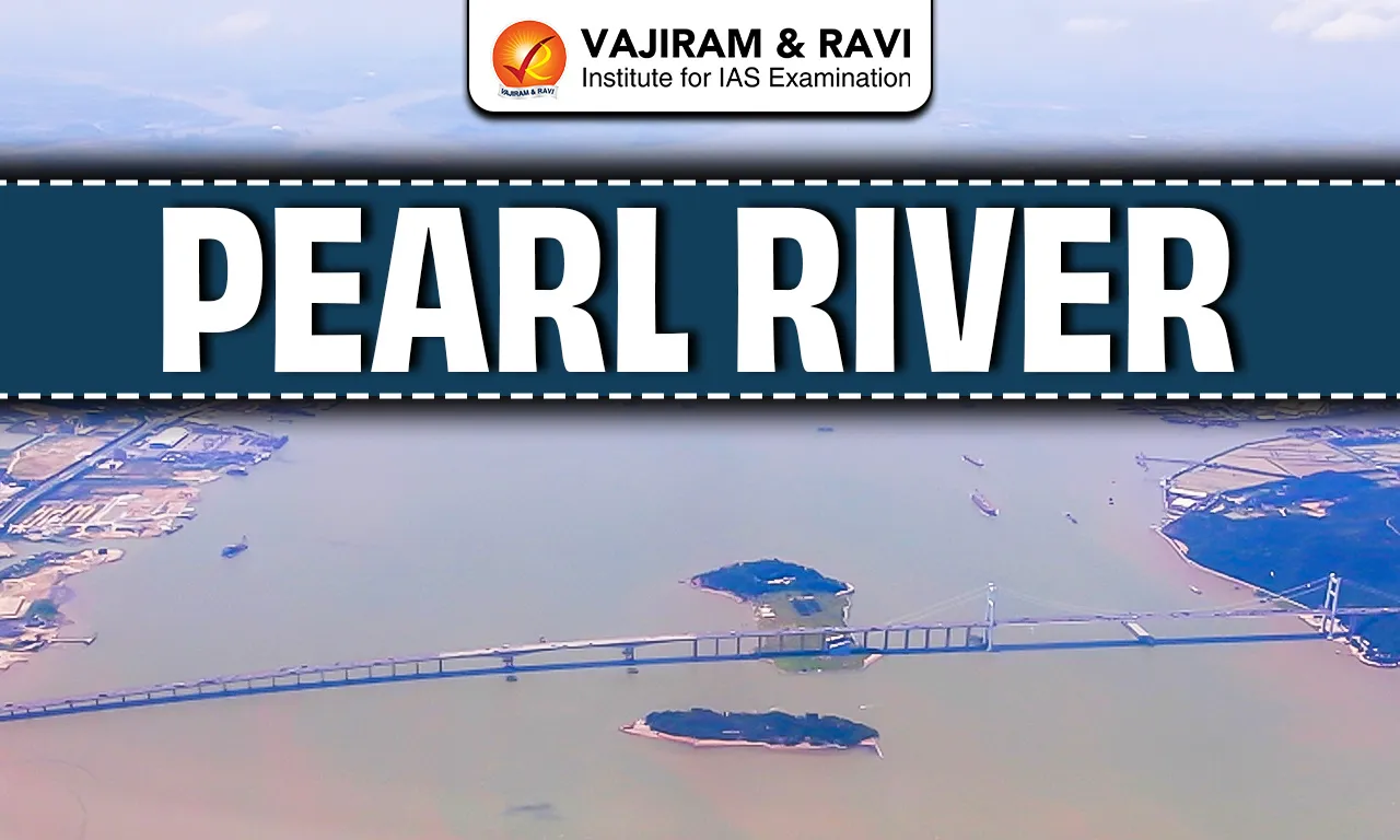
Pearl River Delta

  • The Pearl River Delta is one of the largest and most economically dynamic deltas in the world.
  • Major cities located in the delta include Guangzhou, Shenzhen, Zhuhai, Hong Kong, and Macau.
  • The delta is characterised by dense population, extensive urbanisation, and advanced industrial activity. It plays a crucial role in China’s export-oriented growth and global trade.

Pearl River Drainage Pattern

  • The Pearl River exhibits a dendritic drainage pattern.
  • Near the delta, the river divides into numerous distributaries, forming a complex estuarine system.

Climate Influence

  • The Pearl River basin lies in a subtropical monsoon climate region.
  • The river receives heavy rainfall during the East Asian summer monsoon.
  • High discharge during monsoon months supports agriculture but also increases flood risk in the delta region.

Pearl River Ecological Significance

  • The Pearl River basin supports wetlands, estuaries, and mangrove ecosystems, especially near its mouth.
  • These ecosystems provide habitats for diverse aquatic and bird species. 
  • For Example, Mai Po Marshes (Hong Kong) - a Ramsar site that supports migratory birds like the Black-faced Spoonbill and Great Egret.

Pearl River Economic Importance

  • The Pearl River is vital for irrigation, inland navigation, hydropower generation, and industrial water supply.
  • The river system supports some of China’s most productive agricultural and industrial regions.
  • Ports in the Pearl River Delta, such as the Port of Guangzhou and the Port of Shenzhen, support international trade and connectivity.

Pearl River FAQs

Q1: The Pearl River drains into which sea?

Ans: Pearl River drains into the South China Sea.

Q2: Which three rivers form the Pearl River system?

Ans: Xi Jiang (West), Bei Jiang (North), Dong Jiang (East) form the Pearl River system.

Q3: Which is the longest and most important tributary of the Pearl River system?

Ans: Xi Jiang (West River) is the longest and most important tributary of the Pearl River system.

Q4: The Pearl River basin lies mainly in which part of China?

Ans: Pearl River basin lies mainly in Southern China.

Q5: Which major cities are located in the Pearl River Delta?

Ans: Guangzhou, Shenzhen, Hong Kong, and Macau.

Karakoram Range, Location, Physiography, Drainage, Ecology

Karakoram Range

The Karakoram Range, also known as Krishnagiri, is the northernmost Trans-Himalayan range in India. The name Karakoram is derived from a Turkic term meaning “Black Rock” or “Black Mountain.”

The range is geopolitically significant as the borders of India, Pakistan, China, Afghanistan, and Tajikistan converge in this region.

Karakoram Range Location and Extent

  • The Karakoram range is a mountain range in Asia located primarily in the Kashmir region.
  • It lies to the north of the Great Himalayan Range and extends across Ladakh in India, Gilgit-Baltistan in Pakistan, and Xinjiang in China.
  • It is a part of the Trans-Himalayan mountain system. 
  • It is bounded by Pamir Plateau in the northwest, Kunlun Mountains in the north, Himalayan Range in the south.
  • The range runs in a north-west to south-east direction and acts as a natural barrier between the Indian subcontinent and Central Asia.

Karakoram Range Geology

  • The Karakoram range was formed during the Cenozoic era.
  • It is a young fold mountain range. It formed due to the collision of the Indian Plate with the Eurasian Plate.
  • Due to active tectonics, the region is highly prone to earthquakes and landslides.
  • The region is structurally complex and consists mainly of igneous and metamorphic rocks, such as granite and gneiss.
  • Major geological features include the Karakoram Fault and the Indus-Tsangpo Suture Zone, which indicate intense tectonic activity.

Karakoram Range Relief and Physiography

  • The Karakoram Range is known for its extremely rugged and steep terrain.
  • The Karakoram Range contains some of the highest peaks on Earth including K2 (Mount Godwin-Austen), at 8,611 metres, which is the second highest peak in the world.
  • The Karakoram Range is marked by deep, narrow, and glaciated valleys formed by tectonic uplift and intense glacial erosion. Important valleys include the Nubra Valley in Ladakh, Hunza Valley in Gilgit-Baltistan, Shigar Valley, Shimshal Valley. 
  • The Karakoram Range contains several high-altitude passes such as the Karakoram Pass, Khunjerab Pass, and Saser La, which have historically served as trade and strategic routes between South Asia, Central Asia, and China.

Karakoram Range Glaciers

  • The Karakoram Range is one of the most heavily glaciated regions outside the polar areas.
  • Major glaciers include the Siachen Glacier, Baltoro Glacier, Biafo Glacier, and Hispar Glacier.
  • The region exhibits the Karakoram Anomaly, where many glaciers are stable or advancing despite global warming trends. This anomaly is attributed to high-altitude snowfall, lower summer temperatures, and the dominance of western disturbances.

Karakoram Range Drainage

  • The rivers of the Karakoram Range are mainly glacier-fed. 
  • The Karakoram Range acts as a water divide, with rivers on its southern side draining into the Indus basin and those on the northern side draining into the Yarkand - Tarim basin.
  • Rivers such as the Indus, Shyok, Nubra, and Hunza originate from or are fed by Karakoram glaciers.

Karakoram Range Climate 

  • Karakoram Range experiences a cold desert climate with extremely low annual precipitation.
  • The Indian monsoon has very little influence on the region, and most precipitation occurs in the form of winter snowfall due to western disturbances.
  • The region experiences long, severe winters and short, cool summers, along with large diurnal temperature variations.

Karakoram Range Ecology and Biodiversity

  • Due to harsh climatic conditions, vegetation in the Karakoram is sparse and mainly consists of alpine grasses and cold desert shrubs.
  • Despite extreme conditions, the region supports rare wildlife such as the snow leopard, Himalayan ibex, and blue sheep.

Karakoram Range FAQs

Q1: The Karakoram Range belongs to which mountain system?

Ans: It is part of the Trans-Himalayan mountain system, lying north of the Greater Himalayas.

Q2: Which is the highest peak of the Karakoram Range?

Ans: K2 (Mount Godwin-Austen) at 8,611 m, the second-highest peak in the world.

Q3: Siachen Glacier is a part of which mountain range.

Ans: The Siachen Glacier is a part of Karakoram Range.

Q4: The Karakoram Range forms a watershed between which two river basins?

Ans: Between the Indus Basin (south) and the Yarkand–Tarim Basin (north).

Q5: What is the “Karakoram Anomaly”?

Ans: A phenomenon where many Karakoram glaciers are stable or advancing, unlike most Himalayan glaciers which are retreating.

Dhauladhar Range, Location, Geology, Physiography

Dhauladhar Range

The Dhauladhar Range is a prominent mountain range in the Lesser Himalayas located in the state of Himachal Pradesh. The name Dhauladhar comes from Sanskrit, where “Dhawala” means white and “Dhar” means ridge, referring to its snow-covered peaks.

Dhauladhar Range Location and Extent

  • The Dhauladhar Range lies primarily in the state of Himachal Pradesh, with a small extension into Jammu and Kashmir.
  • It runs in an east-west direction, parallel to the main Himalayan axis.
  • The range rises abruptly from the plains of the Kangra Valley, creating a sharp physiographic contrast.

Read about: Mountain Ranges in India

Dhauladhar Range Geology 

  • The Dhauladhar Range was formed as a result of the ongoing collision between the Indian Plate and the Eurasian Plate.
  • It is composed mainly of sedimentary and metamorphic rocks, such as slate, schist, and limestone.
  • The region lies close to major Himalayan fault systems and is therefore seismically active.

Dhauladhar Range Physiography

  • The Dhauladhar Range is characterised by steep slopes, sharp ridges, and narrow valleys.
  • It rises suddenly from low elevations of about 1,000 metres in the Kangra Valley to peaks exceeding 5,000 metres.
  • This steep gradient makes the range prone to landslides and erosion.
  • The highest peak of the Dhauladhar Range is Hanuman Tibba, with a height of about 5,639 metres.
  • The Indrahar Pass is the most important mountain pass across the Dhauladhar Range. The pass historically connected the Kangra Valley with Chamba and Lahaul regions.
  • Lam Dal lake (glacial lake) is situated in this range. Other notable examples include Kundal Lake, Kareri Lake, Nag Dal Lake, Khajjiar Lake, Chanderkoop Lake (Moon Lake)

Read about: Aravalli Range

Dhauladhar Range Climate

  • The Dhauladhar Range experiences a temperate to alpine climate.
  • The southern slopes receive heavy rainfall from the southwest monsoon, making them among the wettest parts of Himachal Pradesh.
  • The northern slopes lie in the rain-shadow area and are comparatively drier.
  • Winters are cold with substantial snowfall at higher elevations.

Dhauladhar Range Drainage and River Systems

  • The Dhauladhar Range acts as an important water divide in Himachal Pradesh.
  • Rivers originating or influenced by the range include the Beas River and tributaries of the Ravi River.
  • The range forms a natural watershed between the Beas and Ravi river systems.

Ecology and Biodiversity

  • The lower slopes of the Dhauladhar Range support sub-tropical and temperate forests, including sal, pine, oak, and deodar.
  • Higher elevations are characterised by alpine meadows and shrubs.
  • The range supports rich biodiversity, including species such as the Himalayan black bear, goral, and snow leopard in the upper reaches.

Dhauladhar Range Hill Stations

The Dhauladhar Range is associated with several famous hill stations in Himachal Pradesh, mainly located in the Kangra region. Important hill stations are Dharamshala, McLeod Ganj, Palampur, Dalhousie.

Dhauladhar Range FAQs

Q1: Where is the Dhauladhar Range located?

Ans: Mainly in Himachal Pradesh, with a small part in Jammu & Kashmir, running east-west above the Kangra Valley.

Q2: Dhauladhar Range is part of which Himalayas?

Ans: Dhauladhar Range is part of the Middle or Lesser Himalayas.

Q3: What is the highest peak of the Dhauladhar Range?

Ans: Hanuman Tibba (5,639 metres) is the highest peak of the Dhauladhar Range.

Q4: Which hill stations are located in the Dhauladhar Range?

Ans: Dharamshala, McLeod Ganj, Palampur, Dalhousie are some of the famous hill stations located in the Dhauladhar Range.

Q5: What is the climate of the Dhauladhar Range?

Ans: Temperate to alpine, with heavy rainfall on southern slopes and snowy winters at higher elevations.

Enquire Now