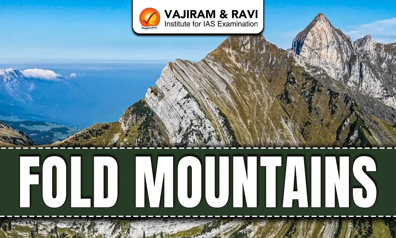
Mountains are large natural elevations of the Earth’s surface formed through different geological processes over millions of years. Based on their origin, mountains are mainly classified into Fold Mountains, block mountains, volcanic mountains and residual mountains. Among them, Fold Mountains are the most extensive and significant mountain systems on Earth. They are created due to compressional forces inside the Earth that bend and fold rock layers at convergent plate boundaries. The Himalayas, Andes and Alps are classic examples of Fold Mountains formed by large scale tectonic collisions.
Fold Mountains
Fold Mountains are long, narrow mountain ranges formed when sedimentary rock layers in the Earth’s crust are compressed, crumpled and folded due to tectonic plate convergence. These mountains mainly develop along continental margins where plates collide or one plate subducts beneath another. The folding creates upward arches called Anticlines and downward troughs called Synclines. In intense compression zones, rocks may form complex structures like nappes and recumbent folds. Most of the world’s highest and geologically youngest mountain ranges belong to this category.
Fold Mountains Formation Process
Fold Mountains develop due to intense compressional forces at convergent plate boundaries over geological time. The process of formation has been listed below in schematic steps:
- Plate Convergence: Fold Mountains originate where two lithospheric plates move toward each other at convergent boundaries. In oceanic continental convergence, denser oceanic crust subducts below lighter continental crust, while continental continental collision produces massive compression, as seen in the Himalayas formed by Indian and Eurasian plate interaction.
- Sediment Accumulation: Before collision, thick layers of marine sediments accumulate in geosynclinal basins such as the ancient Tethys Sea. These sediments later become sedimentary rocks like limestone and sandstone, which are highly foldable under compressional stress.
- Compressional Stress: When plates collide, horizontal pressure builds up and shortens the crust. Rock layers bend instead of breaking, especially where weak layers like salt act as decollement zones, allowing smooth folding similar to cloth pushed across a surface.
- Folding Structures: Compression creates anticlines as upward folds and synclines as downward folds. In stronger compression, asymmetric, overturned and recumbent folds form. Severely displaced rock sheets are known as nappes, commonly seen in the Alps.
- Crustal Thickening: The continental crust thickens significantly beneath Fold Mountains. Due to isostasy, the lighter continental crust floats over denser mantle material, leading to upward uplift balanced by deep crustal roots extending downward.
- Thrust Fault Development: Continued compression generates reverse and thrust faults where older rocks override younger layers. Major thrust systems such as the Main Central Thrust in the Himalayas illustrate this mechanism.
- Uplift and Orogeny: The overall mountain building event is called orogeny. Examples include the Alpine orogeny around 65 million years ago and the Himalayan orogeny about 50 million years ago. These processes uplift extensive mountain belts.
Also Read: Ural Mountains
Fold Mountains Types
Fold Mountains are classified based on their age of origin and the nature of folding structures.
Types of Fold Mountains based on Age:
- Very Old Fold Mountains: These mountains formed more than 500 million years ago during early geological periods. They are highly eroded and appear rounded and low in height. The Laurentian and Algoma ranges of Canada represent this ancient category.
- Old Fold Mountains: Formed before the Tertiary period which began 66 million years ago, these mountains developed during Caledonian and Hercynian orogenies. Examples include the Appalachians in North America, the Ural Mountains in Russia and the Aravalli range in India.
- Young or Alpine Fold Mountains: These mountains formed during the Tertiary period from 66 million years ago onward. They are rugged, high and tectonically active. Major examples include the Himalayas, Andes, Alps and Rockies, with peaks often exceeding 4,000 meters.
Also Read: Mount Manaslu
Types of Fold Mountains based on Nature of Fold:
- Simply Folded Mountains: These consist of open and symmetrical anticlines and synclines arranged in wave like patterns. The Jura Mountains and Ridge and Valley Appalachians display such simple folding structures formed due to moderate compression.
- Complex Folded Mountains: These mountains show intense compression resulting in tight folds, nappes and overturned structures. The Alps and parts of the Zagros Mountains exhibit complex folding caused by powerful continental collision forces.
Fold Mountains Features
Fold Mountains display distinct physical and geological characteristics shaped by tectonic compression and uplift as highlighted below:
- Great Length Compared to Width: Fold Mountains are long and narrow ranges. The Andes stretch about 7,000 km along South America, while their maximum width is around 430 km, showing the typical elongated structure.
- High Elevation: Many Fold Mountains contain the highest peaks on Earth. The Himalayas include Mount Everest at 8,848 meters, formed by continental collision and ongoing uplift of nearly 5 to 10 mm annually.
- Arc Shape Structure: Fold Mountains often appear in arc shapes with one side concave and the other convex. This curvature reflects the direction and intensity of compressional tectonic forces.
- Presence of Sedimentary Rocks: Fossil bearing sedimentary rocks are common in Fold Mountains, proving their marine origin. Marine fossils found at high Himalayan elevations confirm uplift of former seabed sediments.
- Active Seismic Zones: Most Fold Mountains lie along active plate boundaries and experience frequent earthquakes. The Himalayan region remains seismically active due to continued Indian plate movement toward Eurasia.
- Granite Intrusions: Large scale magma intrusions occur due to high heat and pressure beneath these mountains. Crystallized granite bodies are visible in many fold mountain belts.
- Associated Volcanism: In oceanic continental convergence zones like the Andes, volcanic activity accompanies folding because subducting plates generate magma. The Himalayas are an exception with limited volcanism.
Also Read: Mount Logan
Fold Mountains Distribution
Fold Mountains are mainly located along convergent plate margins and former plate boundaries worldwide:
- India and Nepal: The Himalayas extend across northern India and Nepal, formed by the collision of the Indian and Eurasian plates about 50 million years ago and include some of the world’s highest peaks above 8,000 meters.
- China and Tibet: The Tibetan Plateau and Trans Himalayan ranges developed due to continued continental collision, creating thickened crust and high elevation mountain systems associated with the Himalayan orogeny.
- France, Switzerland, Italy and Austria: The Alps stretch across these European countries, formed during the Alpine orogeny around 65 million years ago due to African and Eurasian plate convergence.
- Spain and France: The Pyrenees Mountains lie between Spain and France and were formed by compressional forces related to plate convergence during the same Alpine mountain building phase.
- Morocco, Algeria and Tunisia: The Atlas Mountains in North Africa formed due to tectonic compression along the African plate margin and represent part of the Alpine Himalayan mountain belt.
- Iran and Iraq: The Zagros Mountains in Iran and parts of Iraq are a simply folded belt created by the collision of the Arabian and Eurasian plates above a basal decollement in evaporite layers.
- United States (Eastern Region): The Appalachian Mountains in the eastern United States formed during the Paleozoic era about 300 million years ago and represent old, highly eroded fold mountains.
- United States and Canada (Western Region): The Rocky Mountains extend from Canada into the United States and formed mainly during the Laramide orogeny between 70 and 40 million years ago.
- Chile, Peru and Argentina: The Andes Mountains run along the western edge of South America and were formed by subduction of the Nazca plate beneath the South American plate, stretching about 7,000 km.
- Ghana: The Akwapim Togo ranges in Ghana represent fold mountain development linked to past tectonic compressional forces in West Africa.
Fold Mountains Significance
Fold Mountains play a crucial role in shaping climate, ecology, water resources and economic activities.
- Climate Regulation: The Himalayas block cold winds from Central Asia, keeping northern India warmer. They also cause heavy orographic rainfall by forcing monsoon winds to rise and cool.
- Water Resources: Snow and glaciers in Fold Mountains feed major rivers like the Ganga, Indus and Amazon, supporting billions of people and vast agricultural regions.
- Mineral Wealth: Fold Mountains contain valuable minerals such as copper and gold in the Andes, zinc and lead in the Rockies and limestone in the Alps. Chile produces nearly 30% of global copper.
- Hydroelectric Power: Steep gradients and glacier fed rivers provide strong potential for hydroelectric projects, offering cleaner energy alternatives compared to fossil fuels.
- Biodiversity Zones: Elevation variation creates diverse habitats from tropical forests to alpine tundra. Species like the snow leopard and Andean condor inhabit these mountainous ecosystems.
- Tourism and Economy: Ranges like the Alps and Himalayas attract millions of tourists annually for trekking, skiing and pilgrimage, contributing significantly to local economies.
Fold Mountains Challenges
Fold Mountains face serious natural and human induced environmental challenges.
- Earthquake Risk: Active tectonic boundaries cause frequent earthquakes. The 2015 Nepal earthquake highlighted the vulnerability of Himalayan fold mountain regions.
- Landslides and Soil Instability: Steep slopes and soft sedimentary rocks increase landslide risk, especially during heavy rainfall and seismic activity.
- Volcanic Hazards: In subduction zones like the Andes, volcanic eruptions pose threats to nearby populations and infrastructure.
- Deforestation: Logging, mining and infrastructure development destabilize slopes, increase erosion and disturb fragile mountain ecosystems.
- Climate Change Impact: Rapid glacial melting in high Fold Mountains threatens long term water availability and increases risks of glacial lake outburst floods.
- Human Pressure: Urbanization, tourism expansion and unplanned construction in valleys increase disaster vulnerability and ecological imbalance.
Fold Mountains FAQs
Q1: What are Fold Mountains?
Ans: Fold Mountains are long and high mountain ranges formed when rock layers bend due to compressional forces at convergent plate boundaries.
Q2: How are Fold Mountains formed?
Ans: They form when two tectonic plates collide, causing sedimentary rock layers to fold into anticlines and synclines under intense pressure.
Q3: Name some examples of Fold Mountains.
Ans: Major examples include the Himalayas, Andes, Alps, Rockies, Appalachians and the Atlas Mountains.
Q4: Where are Fold Mountains mainly located?
Ans: They are mostly found along convergent plate boundaries, especially near continental margins and subduction zones.
Q5: What is the difference between anticline and syncline in Fold Mountains?
Ans: An anticline is an upward arch shaped fold formed by compression, while a syncline is a downward trough shaped fold. Both of the structures are fundamental features of folded sedimentary rock layers of Fold Mountains.