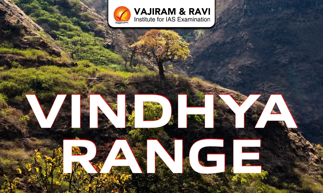
The Vindhya Range, also called Vindhyachal, is a discontinuous chain of hills, ridges and plateau escarpments located in west-central India. It runs almost parallel to the Narmada River and stretches for about 1,200 km from Gujarat in the west to Bihar in the east. The range forms the southern edge of the Central Indian Highlands and acts as a natural divide between northern India and the Deccan Plateau. Although its average height is only 300 to 650 metres, it holds major geographical, geological and historical importance.
Vindhya Range
The Vindhya Range is not a single continuous fold mountain system but a group of separated hill ranges and plateau edges. In ancient times, the term “Vindhyas” was used broadly and sometimes included the present Satpura Range. Today, it mainly refers to the escarpment north of the Narmada River in Madhya Pradesh and its eastern extensions. The highest peak is Sad-bhawna Shikhar near Singrampur in Madhya Pradesh. In the 2nd century CE, Greek geographer Ptolemy called it “Vindius.”
Also Read: Mountain Ranges in India
Vindhya Range Features
The Vindhya Range shows clear physical, geological and cultural characteristics across central India.
- Location: The range runs from eastern Gujarat near Jobat to Sasaram in Bihar for about 1,200 km.
- Extent: It passes mainly through Madhya Pradesh and extends into Uttar Pradesh and Bihar, forming a major central Indian highland belt.
- Natural Boundary: It separates the Indo-Gangetic Plains from the Deccan Plateau.
- Discontinuous Nature: The Vindhyas are not formed by folding. They consist of separate ridges, highlands and plateau edges..
- Highest Peak: The highest point is Sad-bhawna Shikhar, also known as Kalumar Peak, at 752 metres above sea level. It lies in the Panna or Bhander hills of Madhya Pradesh.
- Average Height: The general elevation ranges between 300 and 650 metres. The height rarely crosses 700 metres along most of the stretch, making it lower than the Satpura Range.
- Western Division: In the west, the range connects with the Aravalli system near Champaner in Gujarat. From there, it gradually rises in height eastward toward Madhya Pradesh.
- Eastern Division: East of the Malwa Plateau, the range splits into branches. One branch forms the Bhander Plateau and Kaimur Range north of the Son River and extends into Bihar.
- Southern Division: A southern branch runs between the upper Son and Narmada rivers and meets the Satpura Range in the Maikal Hills near Amarkantak. Earlier texts sometimes included these hills within the Vindhyas.
- Vindhyan Plateau: The Vindhyan tableland lies to the north of the central range. The Rewa and Panna plateaus are commonly grouped as the Vindhya Plateau, known for flat-topped hills.
- Flat-top Structure: Because of horizontal sandstone layers, many hills appear flat and plateau like. This sandstone was used in constructing monuments such as the Sanchi Stupa and Khajuraho temples.
- Rock Composition: The region is made of horizontally layered sedimentary rocks called the Vindhyan Supergroup. It is one of the thickest sedimentary sequences in the world and dates back over 1.6 billion years.
- Northern Rivers: The northern slopes give rise to tributaries of the Ganga-Yamuna system. Important rivers include Chambal, Betwa, Ken, Dhasan, Sunar, Kali Sindh, Parbati and Tamsa.
- Southern Rivers: The southern slopes are drained by the Narmada and Son rivers. The Narmada flows westward to the Arabian Sea, while the Son joins the Ganga in Bihar.
- Watershed Role: The range acts as a major watershed dividing north flowing Ganga tributaries from south flowing river systems, making it an important hydrological boundary.
- Climate: The region has a tropical monsoon climate with seasonal rainfall followed by long dry periods. Summers are hot and dry and rainfall mainly occurs during the southwest monsoon.
- Vegetation: Forests are mostly tropical dry deciduous. Common trees include teak, sal and bamboo, which shed leaves during dry seasons to conserve water.
- Human Settlement: Tribal groups such as Gond, Bhil, Baiga and Korku have lived here for centuries. Major towns in the region include Rewa, Satna and Mirzapur.
- Historical Boundary: Ancient texts describe the Vindhyas as the southern boundary of Aryavarta. Even today, it is seen as a traditional divide between north and south India.
- Fossils: The Vindhyan basin contains some of the earliest known multicellular fossils of eukaryotes dating back 1.6 to 1.7 billion years. Fossils from the Cambrian period about 550 million years old have also been found.
Also Read: Karakoram Range
Vindhya Range Biodiversity
The Vindhya Range region supports rich dry deciduous forest biodiversity across central India.
- Forest Ecosystem: The dominant forest type is tropical dry deciduous. Trees such as teak, sal and bamboo adapt to seasonal rainfall and prolonged dry periods.
- Large Carnivores: The region supports Bengal tiger, Indian leopard and sloth bear, especially in dense forested and plateau regions.
- Herbivores: Spotted deer, blackbuck, chinkara and wild buffalo are commonly found in grasslands and open forest patches.
- Small Mammals: Species such as Indian wild dog (dhole), Indian grey mongoose, Indian pangolin and Indian porcupine are part of the ecosystem.
- Reptiles and Amphibians: Indian rock python, king cobra, common krait and Indian bullfrog inhabit rocky hills and seasonal streams.
- Bird Species: Indian peafowl, Indian roller, crested serpent eagle and Indian eagle owl are common. River valleys act as migration routes for birds.
- Ecological Pressure: Deforestation and human expansion have reduced forest cover in some areas, creating conservation challenges for wildlife.
Also Read: Dhauladhar Range
Vindhya Range FAQs
Q1: Where is the Vindhya Range located?
Ans: The Vindhya Range is located in central India. It stretches across states like Madhya Pradesh, Uttar Pradesh, Bihar and Gujarat, forming a natural boundary between North India and South India.
Q2: What is the highest peak of the Vindhya Range?
Ans: The highest peak of the Vindhya Range is Kalumar Peak, with an elevation of about 752 meters (2,467 feet), located in Madhya Pradesh.
Q3: Which major rivers originate or flow through the Vindhya Range?
Ans: Important rivers associated with the Vindhya Range include the Narmada, Son, Chambal, Betwa and Ken. These rivers flow into the Arabian Sea and Bay of Bengal basins.
Q4: What type of mountains are the Vindhya Range?
Ans: The Vindhya Range is mainly a series of plateaus, escarpments and hills formed from ancient sedimentary rocks.
Q5: How is the Vindhya Range different from the Satpura Range?
Ans: The Vindhya Range lies north of the Narmada River, while the Satpura Range lies south of it. The Narmada flows in a rift valley between these two ranges.