Cyclone Midhili, Formation, Classification, Naming, Impact

Cyclone Midhili

A Cyclone is a large rotating weather system formed around a low pressure area, characterized by inward spiraling winds. In the Northern Hemisphere, winds rotate counterclockwise and such systems usually develop between 5° and 30° latitude over warm ocean waters above 26°C. Cyclone Midhili was one such tropical cyclone that formed over the southeastern Bay of Bengal on 14 November 2023 which intensified into a Severe Cyclonic Storm.

Cyclone Midhili Formation

Cyclone Midhili originated as a low pressure area over the southeastern Bay of Bengal in 2023 and intensified steadily under favourable oceanic conditions. The system strengthened into a cyclonic storm on 17 November and further intensified before making landfall near Khepupara in Patuakhali District of Bangladesh. After landfall, it weakened rapidly and dissipated over Tripura on 18 November, leaving significant human and economic losses.

Cyclone Midhili Features

Cyclone Midhili developed in November 2023 and severely impacted Bangladesh and Northeast India with heavy rain and strong winds.

  • Naming: The name “Midhili” was provided by the Maldives under the North Indian Ocean naming system. It became the fifth named storm of the 2023 season. 
  • Classification: It was classified as a Severe Cyclonic Storm by the Indian Meteorological Department on 17 November 2023.
  • Formation: It formed near the Andaman and Nicobar Islands in November 2023 over warm sea surface temperatures of 28-29°C. 
  • Path: The system initially moved west northwest, later turned north northeast and accelerated toward coastal Bangladesh.
  • Wind Speed and Intensity: At peak intensity, maximum sustained winds reached about 102 kmph near Patuakhali. Forecast winds ranged between 62 and 88 kmph at major ports, while squally winds of up to 85 kmph were predicted near landfall.
  • Landfall and Dissipation: The cyclone made landfall near Khepupara coast. It weakened quickly into a depression and dissipated over Tripura, India, on 18 November.
  • Impact: Several Impacts of the cyclone were:
    • Region like Bhola, Chandpur and Barisal recorded rainfall above 200mm in 24 hours. 
    • Flooding damaged 243,294 hectares of crops, affecting 163,449 farmers and causing losses of 3.87 billion.
    • Ten deaths were confirmed in Bangladesh, with 25 fishermen missing. 
    • Around 1,243 houses were damaged or destroyed.

Cyclone Midhili FAQs

Q1: What is Cyclone Midhili?

Ans: Cyclone Midhili formed as a low pressure area over the southeastern Bay of Bengal on 14 November 2023 and intensified into a cyclonic storm on 17 November 2023.

Q2: How much rainfall was recorded during Cyclone Midhili?

Ans: Bhola recorded the highest 24 hour rainfall of 249 mm, followed by Chandpur with 232 mm and Barisal with 221 mm.

Q3: What was the economic impact of Cyclone Midhili?

Ans: The cyclone damaged 243,294 hectares of crops, affected 163,449 farmers, caused losses of about 3.87 billion in agriculture and around 12 billion loss to the brickfield industry.

Q4: How did Cyclone Midhili form?

Ans: Cyclone Midhili developed from a low pressure area over the southeastern Bay of Bengal. Warm sea surface temperatures of 28 to 29°C, strong poleward outflow, high moisture and low wind shear initially supported intensification into a cyclonic storm.

Q5: What type of cyclone was Cyclone Midhili?

Ans: Cyclone Midhili was a tropical cyclone over the North Indian Ocean basin. It was classified as a Severe Cyclonic Storm by the Indian Meteorological Department.

Hokkaido Islands, Location, Geography, Climate Change, Features

Hokkaido Islands

Hokkaido Islands are Japan’s northernmost and second largest island, covering 83,423.84 km² and ranking 21st globally by area. It lies north of Honshu, separated by the Tsugaru Strait and close to Russia across the La Pérouse Strait. The island is bordered by the Sea of Japan to the west, the Sea of Okhotsk to the north and the Pacific Ocean to the east and south. Sapporo City is located on the Ishikari River and serves as the administrative headquarters. Hokkaido forms a key part of the Japanese Archipelago.

Also Read: Lakshadweep Islands

Hokkaido Islands Features

The major highlighting features of the Hokkaido Islands have been listed below:

  • Position in Japanese Archipelago: Hokkaido is the northernmost of Japan’s five main islands within the 14,125 Islands of the Japanese Archipelago. 
  • Location: It lies near Russia’s Sakhalin Oblast and forms the northern arc of Japan’s island chain stretching over 3,000 km.
  • Surrounding Water Bodies: The island is bordered by the Sea of Japan in the west, the Sea of Okhotsk in the north and the Pacific Ocean in the east and south. Key straits include Tsugaru Strait, La Pérouse Strait and Nemuro Strait.
  • Area and Relief: With 83,423.84 km² area, it is Japan’s second largest island. The interior is mountainous with volcanic plateaux. Major plains include Ishikari 3,800 km², Tokachi 3,600 km², Kushiro 2,510 km² and Sarobetsu 200 km².
  • Rivers: The Ishikari River flows through Sapporo city of Hokkaido. 
  • Wetlands: Kushiro Wetland is Japan’s largest wetland and a Ramsar site since 1980. Other wetlands include Lake Utonai and Lake Akkeshi.
  • Climate: Hokkaido has a sub arctic climate with 8°C annual average temperature and 1,150 mm rainfall. January averages -9°C in Asahikawa; August averages 21°C. Snowfall reaches 11 metres in western mountains.
  • Recent Climate Change: In April 2024, Sapporo recorded 26°C, its earliest summer day. Japan’s temperature has risen 1.28°C per century since 1898. Sea ice in the Sea of Okhotsk has reduced thickness by 30% in 30 years.
  • Biodiversity: The island has three lineages of Ussuri brown bear, Asia’s largest population outside Russia. Species include Steller’s sea eagle, Yezo sika deer, Ezo red fox and Sakhalin fir.
  • Geological Activity: Major earthquakes include 7.7 magnitude in 1993, 8.3 in 2003, 6.6 in 2018 and 6.1 in 2021.
  • Volcano: Active volcanoes include Mount Usu, Mount Tokachi and Mount Meakan.

Also Read: Indian Islands

Hokkaido Islands FAQs

Q1: Where are the Hokkaido Islands located?

Ans: Hokkaido is the northernmost main island of Japan, located near Russia’s Sakhalin. It is separated from Honshu by the Tsugaru Strait and bordered by the Sea of Japan, Sea of Okhotsk and the Pacific Ocean.

Q2: What is the total area of the Hokkaido Islands?

Ans: Hokkaido covers 83,423.84 square kilometres, making it the second largest island of Japan and ranking 21st largest island in the world by area.

Q3: What type of climate does the Hokkaido Islands have?

Ans: Hokkaido has a sub arctic climate with an average annual temperature of 8°C and annual precipitation of about 1,150 mm. Winters are snowy and temperatures in January can fall to -9°C in central areas.

Q4: Why is the Hokkaido Islands important for biodiversity?

Ans: Hokkaido hosts three distinct lineages of Ussuri brown bears and has Asia’s largest brown bear population outside Russia. It also supports species like Steller’s sea eagle and Yezo sika deer.

Q5: What recent climate change trend has been observed in the Hokkaido Islands?

Ans: In April 2024, Sapporo recorded 26°C, its earliest summer day. Sea ice in the Sea of Okhotsk has lost about 30% thickness over the past 30 years.

Highest Mountain Peak in the World, Top 10 List, Height, Range

Highest Mountain Peak in the World

The Highest Mountain Peak in the World is the tallest natural point on Earth measured above sea level. It is formed due to the movement and collision of tectonic plates over millions of years. Such high peaks influence climate patterns, support glaciers and give rise to major rivers. They are important in the study of physical geography and environmental processes.

Highest Mountain Peak in the World

Around the world, more than one hundred mountain peaks rise above 7,200 metres above sea level. Most of these extremely high mountains are concentrated in Asia, particularly along the zone where the Indian Plate is pushing against the Eurasian Plate. This tectonic collision has created some of the tallest and youngest fold mountains on Earth, making the region highly significant in physical geography.

List of Highest Mountain Peaks in the World

The highest mountain peaks in the world are briefly discussed below in order of their height above sea level. These peaks are mainly located in Asia and are significant for their geographical features, formation processes and global importance.

List of Highest Mountain Peaks in the World
S No. Mountain Metres Feet Range Location

1.

Mount Everest

8,848

29,029

Himalayas

Nepal/China(Tibet)

2.

K2

8,611

28,251

Karakoram

India

3.

Kangchenjunga

8,586

28,169

Himalayas

Nepal/India

4.

Lhotse

8,516

27,940

Himalayas

Nepal/China -Climbers ascend Lhotse Face in climbing Everest

5.

Makalu

8,485

27,838

Himalayas

Nepal/China

6.

Cho Oyu

8,201

26,906

Himalayas

Nepal/China-Considered “easiest” eight-thousander

7.

Dhaulagiri

8,167

26,795

Himalayas

Nepal – Presumed world’s highest from 1808-1838

8.

Manaslu

8,163

26,781

Himalayas

Nepal

9.

Nanga Parbat

8,126

26,660

Himalayas

India

10.

Annapurna I

8,091

26,545

Himalayas

Nepal – First eight-thousander to be climbed (1950)

11.

Gasherbrum I (Hidden peak; K5)

8,080

26,509

Karakoram

India (currently under the illegal occupation of Pakistan)

12.

Broad Peak

8,051

26,414

Karakoram

India (currently under the illegal occupation of Pakistan)

13.

Gasherbrum II (K4)

8,035

26,362

Karakoram

India (currently under the illegal occupation of Pakistan)/China Border

14.

Shishapangma

8,027

26,335

Himalayas

China

Top 10 Highest Mountain Peaks in the World

  1. Mount Everest
  • Mount Everest is the tallest mountain in the world with a height of 8,848.86 metres above sea level.
  • It has the highest topographic prominence, which means it rises higher than any other peak on Earth. There is no taller mountain nearby.
  • It is situated in the Himalayas on the border of Nepal and China (Tibet). It lies within Sagarmatha National Park and Qomolangma National Nature Preserve.
  • The mountain was accurately measured in 1856 during the Great Trigonometrical Survey of India and was officially named in 1865 after Sir George Everest.
  • It is called Sagarmatha in Nepal and Chomolungma in Tibet, reflecting its cultural importance in both regions.

    2. K2
  • K2 is the second-highest mountain in the world, with a height of 8,611 metres above sea level. It is also called Mount Godwin Austen.
  • It is popularly known as “The Savage Mountain”.
  • It is situated in the Karakoram Range along the border between India and China. Karakoram is known for its rugged and high-altitude terrain.
  • K2 has a prominence of about 4,020 metres, which means it rises sharply above the surrounding landscape. 
  • The mountain is famous for its extremely steep slopes and harsh weather conditions. Due to its difficult climbing routes, it is considered one of the toughest and most dangerous peaks in the world.
  • Compared to Mount Everest, K2 has a higher death rate among climbers and fewer mountaineers have successfully reached its summit.

    3. Kangchenjunga
  • Kangchenjunga is the third-highest mountain in the world, with a height of 8,586 metres above sea level.
  • It is located in the Himalayas on the border between Nepal and the Indian state of Sikkim.
  • It is known for its remote location, heavy snowfall, and difficult climbing conditions, making it one of the more dangerous high peaks.
  • The first successful ascent was made in 1955 by a British team. It is one of the 14 “eight-thousanders,” meaning peaks in the world that are higher than 8,000 metres.

    4. Lhotse
  • Lhotse is the fourth-highest mountain in the world, with a height of 8,516 metres above sea level.
  • It is situated in the Himalayas on the Nepal-China (Tibet) border.
  • Lhotse lies very close (around 2.66 km) to Mount Everest.
  • It has two main summits-Lhotse Main and Lhotse Middle.
  • The first successful ascent was made in 1956 by a Swiss team, and it is often climbed along with Mount Everest.

    5. Makalu
  • Makalu is the fifth-highest mountain in the world, with a height of 8,485 metres above sea level.
  • It is located on the border of Nepal and Tibet in the Mahalangur range of the Himalayas.
  • The mountain is famous for its sharp ridges and pyramid-like shape, which makes climbing very difficult and risky.
  • The surrounding region is rich in biodiversity and is home to endangered animals like the red panda and snow leopard.
  • Local communities such as the Sherpa, Rai and Limbu live in this area and consider the mountain spiritually important.

    6. Cho Oyu
  • Cho Oyu is the sixth-highest mountain in the world, with a height of 8,201 metres above sea level.
  • It lies in the Himalayas on the border of Nepal and China and falls under the Khumbu region of Nepal.
  • It was first successfully climbed in 1954 by a Swiss expedition team.
  • Among the fourteen peaks above 8,000 metres, Cho Oyu is considered comparatively less difficult to climb, though it still requires high-altitude experience.

    7. Dhaulagiri
  • Dhaulagiri is the seventh-highest mountain in the world, rising to 8,167 metres above sea level.
  • It is situated in Nepal.
  • It was first successfully climbed in 1960 by a Swiss expedition.
  • Dhaulagiri is regarded as one of the more difficult peaks among the fourteen mountains above 8,000 metres due to its steep slopes and harsh weather conditions.

    8. Manaslu
  • Manaslu is the eighth-highest mountain in the world, with a height of 8,163 metres above sea level.
  • It is located in Nepal in the Himalayas and lies within the Manaslu Conservation Area.
  • It was first climbed successfully in 1956 by a Japanese expedition team.
  • Manaslu is one of the fourteen peaks above 8,000 metres and is considered challenging due to difficult weather and terrain conditions.

    9. Nanga Parbat
  • Nanga Parbat is the ninth-highest mountain in the world, with a height of 8,126 metres above sea level.
  • It is located in the western Himalayas in the Gilgit-Baltistan region of Kashmir, near a sharp bend of the Indus River. It is considered the westernmost major peak of the Himalayan range.
  • Nanga Parbat is famous for its steep faces, technical climbing routes and frequent avalanches, making it one of the more dangerous peaks above 8,000 metres.
  • The first successful ascent was made in 1953 by an Austrian expedition team.

    10. Annapurna I
  • Annapurna I is the tenth-highest mountain in the world, rising to 8,091 metres above sea level.
  • It is situated in Nepal in the Himalayas and lies within the Annapurna Conservation Area.
  • Annapurna was first successfully climbed in 1950 by a French expedition, becoming one of the earliest 8,000-metre peaks to be summited.
  • It is regarded as one of the most dangerous “eight-thousanders” because of its steep slopes and high risk of avalanches.

Highest Mountain Peak in the World FAQs

Q1: What is the highest mountain peak in the world?

Ans: Mount Everest is the highest mountain peak in the world, with a height of 8,848.86 metres above sea level.

Q2: Where are most of the world’s highest mountain peaks located?

Ans: Most peaks above 8,000 metres are located in Asia formed due to the collision of the Indian and Eurasian Plates.

Q3: Which mountain is known as “The Savage Mountain”?

Ans: K2 is popularly known as “The Savage Mountain” because of its extremely difficult and dangerous climbing conditions.

Q4: What are “Eight-thousanders”?

Ans: Eight-thousanders are the 14 mountain peaks in the world that rise above 8,000 metres above sea level.

Q5: Which mountain is considered the most dangerous among the top peaks?

Ans: Annapurna I is considered one of the most dangerous eight-thousanders due to its steep slopes and high avalanche risk.

Lakshadweep Islands, History, Geography, Features, Flora & Fauna

Lakshadweep Islands

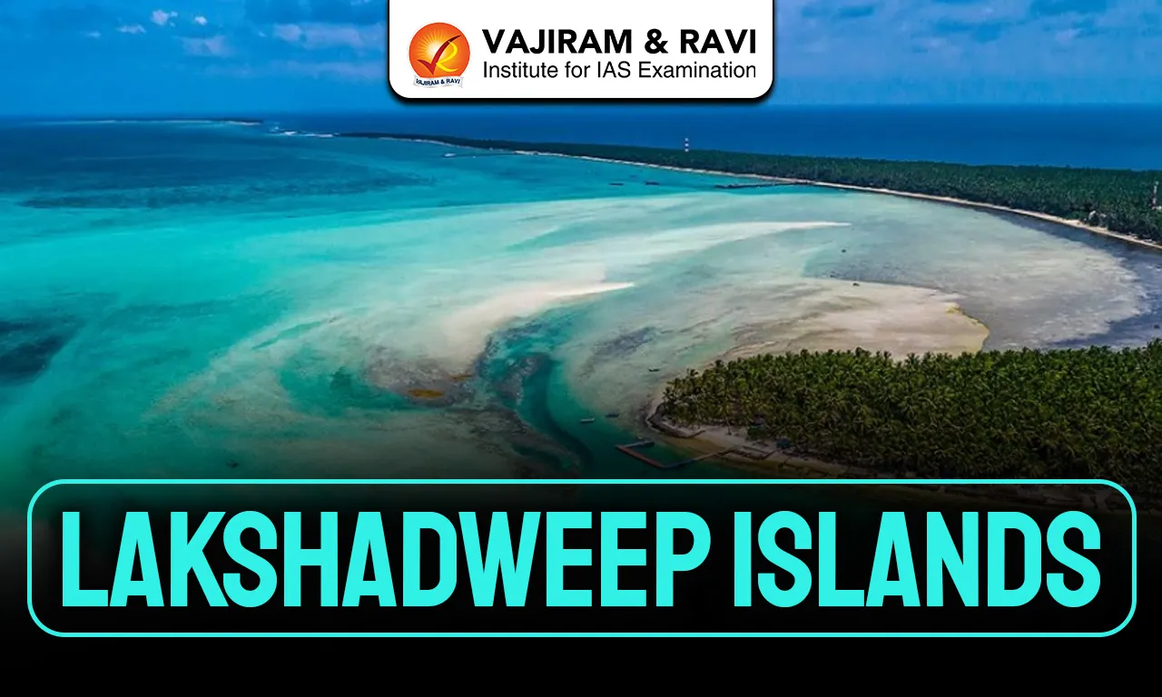
Lakshadweep is a Union Territory of India and the country’s smallest administrative unit by land area. It covers about 32.62 square kilometres of the area. It is an archipelago of 36 coral islands located 220-440 km off the Malabar Coast between the Arabian Sea and the Laccadive Sea. Only ten islands are inhabited in this group of Islands. The islands have a 132 km coastline, 20,000 km² territorial waters, vast lagoon area and a huge Exclusive Economic Zone.

Lakshadweep Islands Historical Evolution

Human presence in Lakshadweep dates back to ancient times with strong maritime links. The historical evolution of the archipelago has been listed below:

  • Archaeological findings from Kalpeni confirm habitation from at least 1500 BCE, while Buddhist Jataka tales and Tamil Sangam literature like Patiṟṟuppattu mention the islands between 3rd century BCE and 3rd century CE, linking them to early South Indian civilizations.
  • The Periplus of the Erythraean Sea in the 1st century CE refers to islands off Damirica as turtle shell sources. Ptolemy in the 2nd century CE listed islands such as Kanathara (Kavaratti) and Argidion (Agatti), indicating established trade routes.
  • During the Sangam period, the Cheras ruled the islands. Later control passed to the Pallavas in the 7th century CE, Kadambas in the 10th century, and the Cholas under Rajendra Chola I around 1018-19 CE.
  • Local tradition attributes the arrival of Islam to Ubaidullah in 661 CE, and early Islamic graves found in Agatti date to the 8th century Hijri period, showing early Muslim influence.
  • The Portuguese briefly controlled the islands in the late 15th century for coir trade but were expelled in 1545. The Arakkal rulers of Kannur later governed them, followed by annexation by Tipu Sultan in 1787 and eventual British control in 1799.
  • After 1947, the islands joined India and were formed into a separate Union Territory in 1956. 
  • On 1 November 1973, the Laccadive, Minicoy and Amindivi Islands were officially renamed Lakshadweep.

Also Read: Indian Islands

Lakshadweep Islands Geographical Features

The key highlighting geographical features of the Lakshadweep Island has been listed below:

  • Island Structure: The archipelago includes 12 atolls, three reefs and five submerged banks. These coral formations are part of the Chagos-Lakshadweep Ridge, an exposed undersea mountain chain.
  • Subgroup Division: The territory is divided into the Amindivi Islands in the north, Laccadive Islands in the central region separated by the 11th parallel north, and Minicoy south of the 9° Channel.
  • Important Channels: The Nine Degree Channel separates Minicoy Island from the main Lakshadweep group, while the Eight Degree Channel lies between Minicoy and the Maldives, making these channels strategically important sea routes in the Arabian Sea.
  • Topography and Soil: The islands are flat and rarely exceed five meters above sea level. Soil is sandy and derived from coral debris, making agriculture limited and increasing vulnerability to sea-level rise.
  • Lagoon and Marine Area: Though land area is small, the lagoon area covers 4,200 km², supporting fisheries and tourism. The Exclusive Economic Zone of 400,000 km² provides significant marine resource potential.
  • Climate: The region experiences a tropical monsoon climate with temperatures ranging between 20°C and 32°C. 
  • Precipitation: Annual rainfall averages 1,602.9 mm, mainly during June to September.
  • Coastal Changes: Reports in 2017 noted erosion of Parali I island in Bangaram atoll and partial erosion of nearby islands, showing environmental sensitivity of coral ecosystems.

Also Read: Cayman Islands

Lakshadweep Islands Features

Major features and specialities of the Lakshadweep Islands has been highlighted below:

  • Capital: Kavaratti serves as the capital of the Union Territory. 
  • Administration: The territory is governed by an Administrator and falls under the jurisdiction of the Kerala High Court. It elects one Member of Parliament to the Lok Sabha.
  • Population: As per the 2011 Census, population stands at 64,473 with 51.3% males and 48.7% females. 
  • Literacy: Literacy rate is 92.28%, one of the highest among Indian territories.
  • Religion and Society: Islam is followed by 96.58% of residents, predominantly Sunni. Hindus form 2.77% and Christians 0.49%. The society reflects matrilineal traditions influenced by Kerala’s social structure.
  • Languages: English is the official language. Jeseri, a Malayalam dialect, is widely spoken in most islands, while Mahl, a Dhivehi dialect, is spoken in Minicoy.
  • Economy and Agriculture: Coconut is the primary crop with production reaching 553 lakh nuts annually from about 2,689 hectares. Lakshadweep records high productivity of about 20,500 nuts per hectare and high oil content.
  • Fisheries Sector: Fishing is the backbone of the economy, with annual production around 21,016 tonnes. Tuna varieties like skipjack and yellowfin dominate commercial fishing, supported by lagoon resources.
  • Industries: Coir production is the main industry with seven coir factories, five demonstration centers and seven curling units producing fiber, yarn and mats in the public sector.
  • Tourism Development: Tourism began in 1974 at Bangaram. In 2018, 10,435 domestic and 1,313 foreign tourists visited. Activities include scuba diving and snorkelling, with entry regulated by permits.
  • Infrastructure and Connectivity: There are 228 km of paved roads and no railways. Agatti Airport has a 1.2 km runway. Seven ships connect Kochi to islands. Undersea fiber optic connectivity was inaugurated in 2024.
  • Strategic Importance: The Indian Navy operates INS Dweeprakshak, commissioned in 2012, highlighting the islands’ importance near major sea lanes linking India with West Asia.

Lakshadweep Islands Biodiversity

Lakshadweep is part of the Maldives-Lakshadweep-Chagos tropical moist forest ecoregion.

  • Marine Diversity: Over 600 species of marine fishes, 78 coral species, 82 seaweed species, 52 crab species and two lobster species have been recorded, making it one of India’s four major coral reef regions.
  • Flora: Nearly 400 flowering plant species exist, including coconut palms and coastal shrubs like Pemphis acidula and Cordia subcordata, along with sea grasses such as Thalassia hemprichii.
  • Avifauna: About 101 bird species are found, including brown noddy and sooty tern. Pitti Island is a declared bird sanctuary and important nesting ground for pelagic birds and sea turtles.
  • Marine Mammals and Reptiles: The surrounding waters host whales, dolphins, sharks, manta rays and turtles, highlighting rich pelagic biodiversity within the vast Exclusive Economic Zone.
  • Ecological Vulnerability: Being low-lying coral atolls, the islands are highly sensitive to sea-level rise, erosion and climate variability, making environmental conservation essential for sustainable development.

Lakshadweep Islands FAQs

Q1: Where are the Lakshadweep Islands located?

Ans: Lakshadweep is located 220-440 km off the Malabar Coast of India in the Arabian Sea, between 8° and 12° North latitude.

Q2: How many islands are there in Lakshadweep?

Ans: Lakshadweep consists of 36 islands, including 12 atolls, three reefs and five submerged banks, out of which ten islands are inhabited.

Q3: What is the capital of Lakshadweep?

Ans: Kavaratti is the capital of Lakshadweep and serves as the administrative headquarters of this Union Territory.

Q4: What is the main occupation of people in Lakshadweep?

Ans: Fishing and coconut cultivation are the main occupations, with tuna fishing and coir production playing a major economic role.

Q5: Which language is widely spoken in Lakshadweep?

Ans: Jeseri, a dialect of Malayalam, is widely spoken, while Mahl (a Dhivehi dialect) is mainly used in Minicoy Island.

Enquire Now