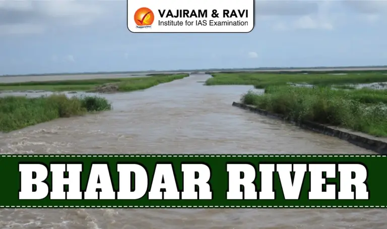
The Bhadar River is one of the major seasonal rivers of the Saurashtra peninsula in Gujarat, western India. It originates in the Rajkot district at an elevation of 261 metres above mean sea level and flows for about 198 kilometres before emptying into the Arabian Sea near Porbandar district. It is a vital seasonal river system of western India, combining geomorphological importance, irrigation utility, reservoir infrastructure and environmental governance dimensions within Gujarat’s Saurashtra region.
Bhadar River Features
The Bhadar River shows seasonal flow, major tributary network, reservoir regulation and environmental importance in Saurashtra region. The key features of the river has been listed below:
- Origin: The river rises near Vaddi or Aniali village, about 26 km northwest of Jasdan in Rajkot district, at 261 metres elevation. The source lies close to the Hingolgadh hill region in central Saurashtra, marking the beginning of its southward journey.
- Course: Initially flowing south towards Jasdan, the river turns south-west near Jetpur and finally flows west to meet the Arabian Sea at Naviobandar near Porbandar. Its total length is approximately 198 km across hilly and plain terrain.
- Drainage Area: The basin covers 7,094 sq km, of which around 706 sq km is hilly and the remaining area consists of plains. It drains nearly one-seventh of Saurashtra, making it one of the peninsula’s principal river systems.
- Tributaries: The river has nine major tributaries longer than 25 km. Right bank tributaries include Gandali, Chapparwadi, Phopal, Utawali, Moj and Venu. Left bank tributaries are Vasavadi, Surwa and Galolio, with a more extensive right bank drainage system.
- Rainfall: The basin receives an average annual rainfall of about 625 mm.
- Climate: Winter temperatures range between 4°C and 15°C, while May records peak summer temperatures between 40°C and 45°C, reflecting semi arid climatic conditions.
- Hydrological Nature: The Bhadar is primarily monsoon fed. Most discharge occurs during intense southwest monsoon rainfall. Flow reduces sharply after September, showing typical seasonal characteristics of western Indian peninsular rivers.
- Reservoirs: Two major reservoirs regulate the river. Bhadar I has a storage capacity of 238 million cubic metres, while downstream Bhadar II holds about 49 million cubic metres. In total, 12 reservoirs and weirs exist within the catchment.
- Bhadar Dam: Located in Rajkot district, Bhadar Dam is the second largest in Saurashtra after Shetrunji Dam. Constructed in 1965, it plays a crucial role in irrigation, regional water supply and seasonal flood moderation.
- Vegetation: The river basin supports semi arid vegetation with dry deciduous species such as teak (Tectona grandis) and tendu (Diospyros melanoxylon), along with riparian growth near reservoirs and seasonal wetlands during monsoon months.
- Flora: Aquatic and wetland plants found in the basin include Hydrilla verticillata, Vallisneria spiralis, lotus (Nymphaea spp.), water hyacinth (Ipomoea aquatica) and halophytic species like Suaeda nudiflora near estuarine stretches.
- Fauna: The river and its reservoirs support fish species such as Labeo rohita (rohu), Labeo calbasu (calbasu), Wallago attu, Channa spp. (murrel) and Cyprinus carpio (common carp), along with seasonal wetland bird species.
- Flood Events: In 2015, intense short duration rainfall triggered flash floods, damaging 29 floodgates of Bhadar Dam. The Dam Safety Organisation of the Central Water Commission recommended replacement to strengthen flood management capacity.
- Flash Flood: Flash floods in this basin occur within six hours of heavy rainfall. Sudden water surges, blocked drainage channels and encroachments worsen flooding impacts in downstream plains and reservoir areas.
- Monitoring Infrastructure: There is one key gauge discharge and sediment monitoring station near Ganod in the plains of Rajkot district, close to the river’s mouth, used for discharge and sediment load assessment.
- Environmental Oversight: The National Green Tribunal, established under the NGT Act 2010, directed the Gujarat Pollution Control Board to submit action reports on pollution abatement near Ahmedabad stretch.
- Administrative Coordinates: The basin is entirely located within Gujarat and spans districts such as Rajkot and Porbandar. Its geographical positioning enhances its importance in western coastal drainage and Arabian Sea outflow systems.
- Regional Importance: As a major river of Kathiawar peninsula, the Bhadar supports irrigation, agriculture and rural settlements across semi arid Saurashtra, where dependable surface water resources are limited.
Also Read: Tigris River


![]() Last updated on March, 2026
Last updated on March, 2026
→ UPSC Final Result 2025 is now out.
→ UPSC has released UPSC Toppers List 2025 with the Civil Services final result on its official website.
→ Anuj Agnihotri secured AIR 1 in the UPSC Civil Services Examination 2025.
→ UPSC Marksheet 2025 is now out.
→ UPSC Notification 2026 & UPSC IFoS Notification 2026 is now out on the official website at upsconline.nic.in.
→ UPSC Calendar 2026 has been released.
→ Check out the latest UPSC Syllabus 2026 here.
→ UPSC Prelims 2026 will be conducted on 24th May, 2026 & UPSC Mains 2026 will be conducted on 21st August 2026.
→ The UPSC Selection Process is of 3 stages-Prelims, Mains and Interview.
→ Prepare effectively with Vajiram & Ravi’s UPSC Prelims Test Series 2026 featuring full-length mock tests, detailed solutions, and performance analysis.
→ Enroll in Vajiram & Ravi’s UPSC Mains Test Series 2026 for structured answer writing practice, expert evaluation, and exam-oriented feedback.
→ Join Vajiram & Ravi’s Best UPSC Mentorship Program for personalized guidance, strategy planning, and one-to-one support from experienced mentors.
→ Shakti Dubey secures AIR 1 in UPSC CSE Exam 2024.
→ Also check Best UPSC Coaching in India
Bhadar River FAQs
Q1. Where does the Bhadar River originate?+
Q2. What is the catchment area of the Bhadar River basin?+
Q3. Which major dams are built on the Bhadar River?+
Q4. Into which sea does the Bhadar River drain?+
Q5. How many major tributaries does the Bhadar River have?+
Tags: bhadar river geography