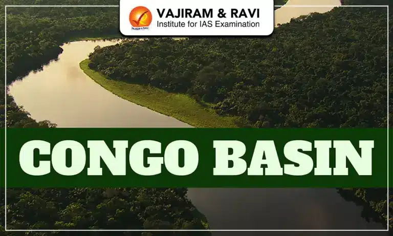
The Congo Basin is one of the largest and most ecologically important regions on Earth. It holds the second largest tropical rainforest after the Amazon. It is spread across Central Africa and plays a crucial role in global climate regulation, hydrological cycles, biodiversity protection, and carbon storage. The basin supports millions of people and contains unique forest ecosystems, extensive river systems, and globally significant peatlands. It remains a priority conservation region due to accelerating deforestation, mining pressure, climate change, and ecological degradation.
Congo Basin
The Congo Basin covers nearly 4 million km², making it the second-largest river basin. It is drained by the Congo River, the world’s second-largest river by discharge at 41,000 m³/s and the deepest river globally, exceeding 220 m in depth. Six countries contain most of the basin: Democratic Republic of Congo (DRC), Republic of Congo, Central African Republic, Cameroon, Gabon, and Equatorial Guinea, with portions extending into Angola, Zambia, and Tanzania. The forest area spans roughly 3 million km².
Congo Basin Location
The Congo Basin lies in Central Africa and straddles the equator. Its approximate coordinates range between latitudes 10°N to 10°S and longitudes 12°E to 34°E. The basin is primarily located in the Democratic Republic of Congo, which alone contains more than 60% of the Basin’s forest. It is bordered by countries including the Republic of Congo to the west, Central African Republic to the north, Angola and Zambia to the south, and Uganda, Rwanda, Burundi, and Tanzania to the east. The basin drains into the Atlantic Ocean’s Gulf of Guinea at Banana in the DRC. It is situated on the African continent’s central plateau and is surrounded by highlands such as the East African Rift to the east and the Batéké Plateau to the west.


Congo Basin Geography
The Congo Basin is composed of ancient cratons, Mesozoic-Cenozoic sediments, humid climate, and major seasonal rainfall systems.
- Formed as a large depression in the Congo Craton with rocks dating to the Phanerozoic era.
- It is one of the 3 hotspots of Deep Convection (thunderstorm) in the tropics.
- It has the highest lightning strike frequency on the Earth.
- Annual rainfall averages 1500-2000 mm, experiences two rainfall peaks: March-May and September-November.
- Average temperatures range 20-30°C, moderated by dense forests and humidity.
Congo Basin Physical Features
The Congo Basin is marked by dense rainforest belts, vast wetlands, extensive river networks, and uplifted surrounding highlands.
- Dominated by the Congo River, the world’s 2nd largest by discharge.
- Congo Rainforest (Ituri Rainforest) is the second largest rainforest of the world.
- Includes Central Congolian lowland forests, deep swamps, wetlands, and peatlands.
- Encircled by uplifts: Mayumbe, Bie, Adamlia, Nile-Congo and East African Swells.
- Contains meandering rivers such as Lualaba, Ubangi, Uele, and Chambeshi.
- Large low-relief plains support seasonal flooding and rich alluvial soils.
- Lakes include Lake Tanganyika (second deepest lake).
- Natural Resources include Gold, Diamond, Timber, etc. contribute to economic activities
Congo Basin Biodiversity
The Congo Basin is one of the world’s most biologically diverse rainforest regions with globally threatened species. It includes nearly 400 mammal species, 1,000 species of birds, and 700 species of fish, etc.
- Over 10,000 plant species, including African teak, hardwoods.
- Home to African forest elephant, bonobo, chimpanzee, bongo, okapi, pygmy hippo.
- Hosts globally endangered western lowland gorilla; UNEP warned risk of extinction by 2025.
- Apex predator: Congo leopard, larger than savannah types due to limited competition.
- Holds 8% of global forest-based carbon, crucial for climate mitigation.
- Eight sites listed as UNESCO World Heritage, five in danger.
Congo Basin Natural Vegetation
The Congo Basin covers dense evergreen rainforest, swamp forests, and savanna transitions shaped by high rainfall and humidity.
- Evergreen humid rainforest dominates 3 million sq km.
- Southern edges transition into savanna woodlands and mosaic forests.
- Peatlands in the Cuvette Centrale (145,500 sq km) contain 30 billion tonnes of carbon.
- Trees include Gilbertiodendron, Julbernardia, and African teak species.
- Vegetation supports millions of people’s livelihoods through timber, NTFPs, and agriculture.
- Seasonal rainfall drives rich undergrowth and liana development.
Congo Basin Challenges
The Congo Basin is facing several challenges such as accelerating human pressures, climate change stress, and deforestation threats.
- Deforestation increased 5% in 2021, doubling in DRC between 2015–2019.
- Logging concessions cover 44-66 million hectares (Global Forest Atlas).
- 143,500 miles of roads built inside concessions by 2018 enabled forest access.
- Climate change causing rainfall variability, hydrological stress, economic impacts.
- Poaching threatens elephants, gorillas, okapis, bonobos.
- Peatland degradation risks releasing carbon equal to 20 years of US fossil emissions.
Congo Basin Conservation Measures
Multiple national, global, and scientific initiatives aim to protect forests, peatlands, and biodiversity.
- Establishment of major national parks like Virunga, Salonga, etc.
- A 2002 logging moratorium in DRC tied to World Bank funding.
- Forest code mandates 25 year rotational logging cycles for sustainability.
- Community agreements require companies to invest in local development packages.
- Projects like L’Île Mbiye (Kisangani) support peatland and forest ecosystem conservation.
- NGOs like OCEAN link communities with Greenpeace for anti-logging campaigns.
Congo Basin Peatlands
Largest tropical peatland complex on Earth, storing enormous carbon reserves vital for climate stability.
- Cuvette Centrale peatlands cover 145,500 sq km (2017 UK scientists).
- Store 30 billion tonnes of carbon, equal to 20 years of U.S. fossil fuel emissions.
- Peat depth averages 6 meters, formed over 10,000+ years of waterlogged conditions.
- Destruction could release massive CO₂, accelerating global climate tipping points.
- Peatlands regulate Congo Basin hydrology by slowing floods and supporting swamps.
- Classified as one of the major carbon-dense ecosystems, crucial for climate agreements.
![]() Last updated on March, 2026
Last updated on March, 2026
→ UPSC Final Result 2025 is now out.
→ UPSC has released UPSC Toppers List 2025 with the Civil Services final result on its official website.
→ Anuj Agnihotri secured AIR 1 in the UPSC Civil Services Examination 2025.
→ UPSC Marksheet 2025 is now out.
→ UPSC Notification 2026 & UPSC IFoS Notification 2026 is now out on the official website at upsconline.nic.in.
→ UPSC Calendar 2026 has been released.
→ Check out the latest UPSC Syllabus 2026 here.
→ UPSC Prelims 2026 will be conducted on 24th May, 2026 & UPSC Mains 2026 will be conducted on 21st August 2026.
→ The UPSC Selection Process is of 3 stages-Prelims, Mains and Interview.
→ Prepare effectively with Vajiram & Ravi’s UPSC Prelims Test Series 2026 featuring full-length mock tests, detailed solutions, and performance analysis.
→ Enroll in Vajiram & Ravi’s UPSC Mains Test Series 2026 for structured answer writing practice, expert evaluation, and exam-oriented feedback.
→ Join Vajiram & Ravi’s Best UPSC Mentorship Program for personalized guidance, strategy planning, and one-to-one support from experienced mentors.
→ Shakti Dubey secures AIR 1 in UPSC CSE Exam 2024.
→ Also check Best UPSC Coaching in India
Congo Basin FAQs
Q1. What is the Congo Basin and why is it important?+
Q2. Where is the Congo Basin located?+
Q3. What are the major physical and geographical features of the Congo Basin?+
Q4. Why is the Congo Basin known for high biodiversity?+
Q5. What are the major environmental challenges facing the Congo Basin?+
Tags: congo basin