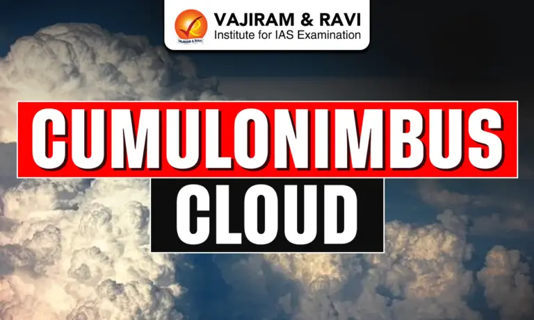
Cumulonimbus Cloud is a dense and towering vertical cloud formed by strong convection in the lower troposphere. It develops when warm, moisture laden air rises rapidly and expands upward across atmospheric layers. These clouds are the largest in the troposphere and are associated with severe weather phenomena such as thunderstorms, lightning, hail and intense rainfall. They may occur as isolated cells, clusters or along squall lines, often evolving from cumulus congestus clouds.
Cumulonimbus Cloud Features
Cumulonimbus Clouds are vertically developed, highly dynamic systems with distinct structural and physical features extending across atmospheric layers.
- Vertical extent: These clouds extend from low altitudes around 200-4000 m to heights of 12,000 m, with extreme cases reaching 20,000-21,000 m, sometimes penetrating near or beyond the tropopause.
- Anvil shaped top: Well developed Cumulonimbus Clouds exhibit a flat, anvil shaped top formed due to wind shear or temperature inversion near the equilibrium level in the upper troposphere.
- Internal composition: Lower regions contain water droplets, while upper colder regions consist of ice crystals such as snow, graupel and hail, contributing to precipitation and electrical activity.
- Size: Even the smallest Cumulonimbus Cloud is significantly larger than surrounding clouds, with bases ranging from tens of metres to several kilometres across.
- Weather Associated: Produces intense weather phenomena including torrential rainfall, thunderstorms, lightning, hailstorms, strong winds, downbursts, microbursts and occasionally tornadoes and thundersnow under extreme atmospheric conditions.
- Life Cycle: Follows three stages: Developing (cumulus congestus formation), Mature (strong updrafts, downdrafts, precipitation, lightning) and Dissipating (dominance of downdrafts leading to weakening), which typically lasts for around 30 minutes.
- Electrical activity: Interaction between ice particles causes charge separation, leading to lightning formation and thunder, making these clouds the primary source of thunderstorms.
- Dynamic structure: Presence of strong updrafts and downdrafts makes them highly unstable, capable of rapid growth, transformation into supercells and severe atmospheric disturbances.
- Incus feature: Seen in mature clouds with flat anvil tops formed by strong winds and temperature inversion, indicating widespread storm development.
- Overshooting top: Dome like structure rising above the anvil due to strong updrafts, signalling extremely intense storm conditions and severe weather potential.
- Accessory formations: Features like arcus clouds, mammatus, tuba, pileus and flanking lines provide visual indicators of storm intensity, turbulence and possible tornado formation.
Cumulonimbus Cloud Types
Cumulonimbus Clouds are classified into different species and special types based on structural appearance and formation conditions.
- Cumulonimbus calvus: Characterised by a rounded, dome shaped top with minimal fibrous structure, representing an early stage that may further develop into a more mature cloud form.
- Cumulonimbus capillatus: Identified by a fibrous, cirrus like upper portion due to ice crystal formation, often accompanied by a distinct anvil shaped top indicating maturity.
- Pyrocumulonimbus: A special type formed due to intense heat from wildfires or volcanic eruptions rather than atmospheric heating, capable of rapid vertical growth and lightning generation.
Also Check: Cloud Seeding


Factors Affecting Cumulonimbus Cloud Formation
Cumulonimbus Clouds require specific atmospheric conditions that promote strong vertical convection and sustained cloud growth.
- High moisture content: Presence of abundant moisture in the lower troposphere provides sufficient water vapour for condensation, cloud formation and development of heavy precipitation systems.
- Atmospheric instability: A highly unstable air mass, where warm air lies beneath cooler air, enhances buoyancy and allows rapid vertical ascent of air parcels.
- Strong surface heating: Intense solar heating increases temperature near the surface, initiating convection currents that lift warm, moist air upward into the atmosphere.
- Lifting mechanisms: Triggers such as frontal uplift, orographic barriers or convergence zones force air to rise, initiating cloud formation and vertical development.
- Wind patterns and shear: Moderate wind shear supports organized cloud growth and helps in formation of features like anvil tops and severe storm structures such as supercells.
Cumulonimbus Cloud Formation Process
Cumulonimbus Clouds form through rapid convection involving moisture, instability and lifting mechanisms that drive vertical cloud development.
- Initial uplift: Warm, moist air rises due to surface heating or frontal uplift, creating instability and initiating vertical air movement in the lower troposphere.
- Condensation process: As rising air cools, water vapour condenses into droplets, forming cumulus clouds that continue growing vertically with sustained buoyancy.
- Vertical growth stage: Continuous ascent leads to development into cumulus congestus, eventually forming cumulonimbus with strong updrafts extending through atmospheric layers.
- Ice formation stage: At higher altitudes, droplets freeze into ice crystals like graupel and hail, intensifying precipitation and enabling charge separation within the cloud.
- Mature stage: Cloud reaches maximum development with simultaneous updrafts and downdrafts, producing heavy rainfall, lightning and severe weather phenomena.
- Dissipation stage: Downdrafts dominate, cutting off warm air supply, leading to weakening of the cloud; most storms last around 30 minutes, though larger systems persist longer.
Also Check: Cloud Burst
Cumulonimbus Cloud Occurrence
Cumulonimbus Clouds occur globally but are most frequent in regions with high moisture, temperature and atmospheric instability.
- Tropical regions: Most common in tropical areas due to abundant heat and moisture, supporting strong convection and frequent thunderstorm activity throughout the year.
- Temperate regions: Occur mainly during warm seasons when atmospheric instability and humidity are high, leading to seasonal thunderstorms and convective storms.
- Squall line formation: Often develop in linear arrangements known as squall lines, producing widespread storms and propagating over long distances through outflow boundaries.
- Multicellular systems: Outflow from one storm can trigger new cells nearby, forming multicellular thunderstorms that may last for hours or even extend over multiple days.
- Arid region events: In dry areas, Cumulonimbus Clouds generate dust storms known as Haboobs through strong downdrafts and gust fronts.
- Winter occurrence: In rare cases, they produce thundersnow during intense winter storms, combining heavy snowfall with lightning and strong winds, reducing visibility significantly.
![]() Last updated on March, 2026
Last updated on March, 2026
→ UPSC Final Result 2025 is now out.
→ UPSC has released UPSC Toppers List 2025 with the Civil Services final result on its official website.
→ Anuj Agnihotri secured AIR 1 in the UPSC Civil Services Examination 2025.
→ UPSC Marksheet 2025 is now out.
→ UPSC Notification 2026 & UPSC IFoS Notification 2026 is now out on the official website at upsconline.nic.in.
→ UPSC Calendar 2026 has been released.
→ Check out the latest UPSC Syllabus 2026 here.
→ UPSC Prelims 2026 will be conducted on 24th May, 2026 & UPSC Mains 2026 will be conducted on 21st August 2026.
→ The UPSC Selection Process is of 3 stages-Prelims, Mains and Interview.
→ Prepare effectively with Vajiram & Ravi’s UPSC Prelims Test Series 2026 featuring full-length mock tests, detailed solutions, and performance analysis.
→ Enroll in Vajiram & Ravi’s UPSC Mains Test Series 2026 for structured answer writing practice, expert evaluation, and exam-oriented feedback.
→ Join Vajiram & Ravi’s Best UPSC Mentorship Program for personalized guidance, strategy planning, and one-to-one support from experienced mentors.
→ Shakti Dubey secures AIR 1 in UPSC CSE Exam 2024.
→ Also check Best UPSC Coaching in India
Cumulonimbus Cloud FAQs
Q1. What is a Cumulonimbus Cloud?+
Q2. At what height do Cumulonimbus Clouds form?+
Q3. What weather is associated with Cumulonimbus Clouds?+
Q4. How long does a Cumulonimbus Cloud last?+
Q5. Where are Cumulonimbus Clouds most commonly found?+
Tags: cumulonimbus cloud geography geography notes