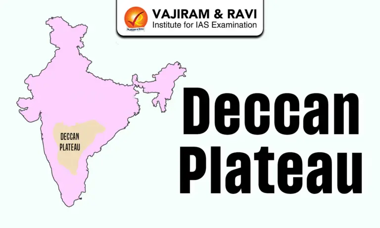
The Deccan Plateau is a large highland area in southern India. It is known for its flat and rocky land and warm climate. The plateau is important for farming and natural resources and plays a key role in the geography of India.
About Deccan Plateau
- The Deccan Plateau is a very large plateau located in western and southern India. It covers most of the southern part of the country and also spreads into central India. It is one of the largest plateaus in the world, covering about 5 lakh square kilometres. The word “Deccan” comes from the Sanskrit word Dakshina, which means “south.”
- Location and Boundaries
- The plateau has a roughly triangular shape.
- In the north, it is bordered by the Vindhya and Satpura ranges.
- In the west, it is bounded by the Western Ghats.
- In the east, it extends towards the Eastern Ghats and the Bay of Bengal.
- To the west lies the Arabian Sea.
- Relief and Physical Features
- The Deccan Plateau has an average height of about 600 metres above sea level. The land is mostly flat but gently slopes from west to east, which is why most rivers flow in that direction.
- It also includes several smaller plateaus formed due to river erosion. Some important hills in this region include the Nilgiri, Anaimalai, and Cardamom Hills.
- The highest point is Doddabetta Peak.
- Formation of the Deccan Plateau
- The plateau was formed millions of years ago due to volcanic activity.
- Around 65 million years ago, the Indian Plate moved and collided with the Eurasian Plate
- This caused cracks in the Earth’s surface, allowing lava to flow out
- Repeated lava flows created layers of basalt rock, forming the Deccan Traps.
- Over time, erosion shaped the present landscape, including hills, valleys, and rivers
- Climate
- The climate of the Deccan Plateau varies from place to place.
- Lower regions are generally hot and tropical
- Higher regions have a milder, more pleasant climate
- Rainfall depends on monsoon winds and is not the same everywhere
- Rivers and Drainage
- Many important rivers flow across the plateau.
- Major east-flowing rivers include the Godavari, Krishna, and Kaveri, which flow into the Bay of Bengal
- Some short rivers flow west into the Arabian Sea
- These rivers are important for irrigation, water supply, and hydroelectric power.
- Soil and Agriculture
- Different types of soil are found here:
- Black soil is very good for growing cotton
- Red and laterite soils are suitable for millets, pulses, and oilseeds
- River valleys have fertile soil for crops like rice and sugarcane
- Agriculture is the main occupation of people living here. Major crops include cotton, rice, wheat, millets, sugarcane, and pulses. Farming is supported by both rainfall and irrigation.
- Mineral Resources
- The Deccan Plateau is rich in minerals. Important minerals found here include:
- Iron ore
- Coal
- Manganese
- Bauxite
- Limestone
- These resources play a major role in industries and economic development.
- Flora and Fauna
- The plateau has different types of forests such as dry deciduous and moist deciduous forests. The Western Ghats region is especially rich in biodiversity.
- Animals like tigers, elephants, leopards, and deer are found here.
- People and Culture
- The Deccan Plateau is home to many different communities, languages, and religions.
- Most people follow Hinduism, but there are also Muslims, Christians, Sikhs, and Jains
- Many languages are spoken, including Hindi, Marathi, Telugu, Tamil, and Kannada
- Tribal groups like Gonds, Bhils, and Santhals also live in this region
- The region has a rich cultural heritage with famous historical sites and temples.
- Economic Importance
- The Deccan Plateau is very important for India’s economy.
- Agriculture and livestock rearing are major occupations
- It produces important crops like cotton and sugarcane
- Mineral resources support industries like mining and manufacturing
- Rivers provide water and electricity through dams
Sub-Plateaus of the Deccan Plateau
The Deccan Plateau is not a single flat region. It is made up of several smaller plateaus. These were formed over time due to river erosion, which cut and shaped the land into different parts. The three main sub-plateaus are:
- Maharashtra Plateau
- The Maharashtra Plateau forms the northern part of the Deccan Plateau and lies mainly in the state of Maharashtra.
- This region is mostly made up of basalt rocks, formed from ancient volcanic lava flows known as the Deccan Traps
- The land looks like a rolling plain because of long-term weathering
- The lava layers have created a step-like (trap) landscape, which is a unique feature of this region
- Rivers like the Godavari, Bhima, and Krishna flow through this plateau, forming broad and shallow valleys
- The entire region is covered with black cotton soil (regur), which is very fertile and ideal for growing cotton.
- Karnataka Plateau (Mysore Plateau)
- The Karnataka Plateau lies south of the Maharashtra Plateau and forms the southern part of the Deccan Plateau.
- It has an average height of about 600–900 metres above sea level
- The land looks like a rolling plateau with gentle slopes
- Many rivers such as the Krishna, Kaveri, Tungabhadra, and Sharavati flow through this region
- These rivers, especially those rising from the Western Ghats, have deeply cut the land, dividing it into two parts:
- Malnad
- “Malnad” means hill country in Kannada
- It has high hills, deep valleys, and dense forests
- This region receives heavy rainfall and is rich in biodiversity
- Maidan (or Maidan region)
- This is a plain area with low granite hills
- It has less rainfall compared to Malnad
- It is suitable for agriculture and human settlement
- The highest point here is Mulangiri Peak in the Baba Budan Hills
- Towards the south, the plateau merges with the Nilgiri Hills
- Telangana Plateau
- The Telangana Plateau lies in the state of Telangana and forms another important part of the Deccan region.
- It is mainly made up of very old rocks (Archaean gneisses)
- The average height is about 500-600 metres.
- The southern part is slightly higher than the northern part
- It is drained by major rivers like: Godavari, Krishna and Penneru
- The plateau is divided into two main physical regions:
- Ghats: These are upland or hilly areas with uneven terrain
- Peneplains: These are broad, flat, and slightly undulating plains formed after long periods of erosion. They represent the final stage of land leveling.


![]() Last updated on March, 2026
Last updated on March, 2026
→ UPSC Final Result 2025 is now out.
→ UPSC has released UPSC Toppers List 2025 with the Civil Services final result on its official website.
→ Anuj Agnihotri secured AIR 1 in the UPSC Civil Services Examination 2025.
→ UPSC Marksheet 2025 is now out.
→ UPSC Notification 2026 & UPSC IFoS Notification 2026 is now out on the official website at upsconline.nic.in.
→ UPSC Calendar 2026 has been released.
→ Check out the latest UPSC Syllabus 2026 here.
→ UPSC Prelims 2026 will be conducted on 24th May, 2026 & UPSC Mains 2026 will be conducted on 21st August 2026.
→ The UPSC Selection Process is of 3 stages-Prelims, Mains and Interview.
→ Prepare effectively with Vajiram & Ravi’s UPSC Prelims Test Series 2026 featuring full-length mock tests, detailed solutions, and performance analysis.
→ Enroll in Vajiram & Ravi’s UPSC Mains Test Series 2026 for structured answer writing practice, expert evaluation, and exam-oriented feedback.
→ Join Vajiram & Ravi’s Best UPSC Mentorship Program for personalized guidance, strategy planning, and one-to-one support from experienced mentors.
→ Shakti Dubey secures AIR 1 in UPSC CSE Exam 2024.
→ Also check Best UPSC Coaching in India
Deccan Plateau FAQs
Q1. What is the Deccan Plateau?+
Q2. Where is the Deccan Plateau located?+
Q3. How was the Deccan Plateau formed?+
Q4. What are the main rivers of the Deccan Plateau?+
Q5. What type of soil is found in the Deccan Plateau?+
Tags: deccan plateau geography geography notes