Himalayan Rainfall and Climate Change Latest News
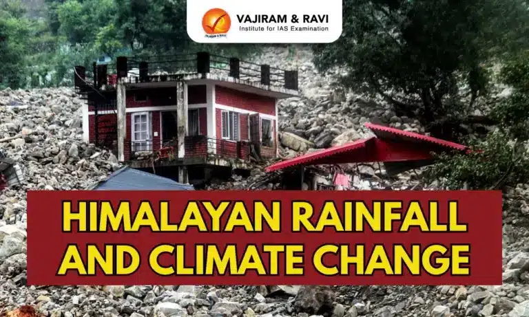
- Dehradun and several districts of Uttarakhand have seen very heavy rainfall in recent days, triggering landslides, swollen rivers, and at least 15 deaths.
- Over the past month, both Uttarakhand and Himachal Pradesh have witnessed repeated incidents of cloudbursts, flash floods, mudslides, and damaged communication networks.
- While such events are typical of the monsoon, their growing frequency and intensity in recent years have raised serious concerns about safety and resilience in the Himalayan region.
Why Hilly Regions Receive More Rainfall
- This monsoon, the northwestern region has seen unusually high rainfall, with 34% surplus in August and over 67% above normal in early September.
- Consecutive low-pressure systems from the Bay of Bengal moved farther north, intensifying rains.
- In hilly areas like the western Himalayas, geography amplifies the impact: rising air forms massive, steep clouds that release heavy local precipitation.
- Such rainfall levels, manageable in coastal states like Goa or Kerala, trigger disasters in mountains.
- For example, Udhampur in J&K recorded 630 mm in 24 hours — equal to Rajkot’s annual rainfall — while Leh received 59 mm in two days, a record since 1973.


Why Hilly Regions Face Greater Disaster Risks
- In plains, heavy rainfall usually drains into rivers or local water bodies, but in mountains it often triggers landslides, mudslides, and flash floods as water rushes downhill carrying mud, soil, and debris.
- This has recently occurred in Mandi, Kullu, Dharali, Tharali, and Jammu.
- When major rivers get choked, overflowing water and debris can inundate settlements, destroying roads and bridges.
- However, not every cloudburst results in disaster — the impact depends on local factors, such as slope stability and whether debris falls into river channels.
Climate Change and Himalayan Rainfall Extremes
- Recent years show a southward shift of western disturbances — wind systems from the Mediterranean that bring rain and snow to northern India.
- Their increasing interaction with southwest monsoon currents, driven by global warming, has complicated rainfall patterns over the Himalayas.
- This shift is linked to more frequent extreme rainfall events and longer dry spells.
- Additionally, Arctic Sea ice melting may further influence these changing monsoon dynamics, raising concerns about heightened climate risks in hilly regions.
Why the Himalayas Are Prone to Cloudbursts
- The Himalayas, positioned where moist tropical monsoon winds meet mid-latitude westerlies, experience strong uplift and instability that often trigger cloudbursts.
- Warm, moisture-rich air forced up the slopes cools quickly, condenses, and produces intense, localised downpours.
- Climate change is worsening this vulnerability: rapid Arctic warming weakens the jet stream, causing westerly troughs to interact more with monsoon currents, while warmer air carries more moisture, intensifying rainfall.
- A slower, wavering jet stream makes storms linger, leading to prolonged heavy rain and devastating floods — trends already seen globally, including in Germany (2021), Pakistan (2010), and West Asia (2024).
Observational Tools and Their Limitations in Forecasting Cloudbursts
- Cloudburst forecasting relies on Doppler Weather Radars (DWRs), satellites, rain gauges, GPS-based moisture monitoring, and high-resolution numerical weather prediction (NWP) models.
- While DWRs provide detailed cloud and rainfall structures, their coverage is limited in Himalayan terrain.
- Rain gauges and automatic weather stations offer accurate point data but lack spatial density.
- Satellites like INSAT-3D/3DR, GPM, and Himawari capture convective growth and rainfall but struggle with coarse resolution and biases in rugged topography.
- NWP models simulate convection and storm dynamics but require very fine resolution (<1 km), precise initial conditions, and explicit process representation, making sudden bursts hard to predict.
- To improve accuracy, denser observation networks, advanced models with better cloudburst representation, and AI/ML integration for data assimilation are essential.
![]() Last updated on March, 2026
Last updated on March, 2026
→ UPSC Final Result 2025 is now out.
→ UPSC has released UPSC Toppers List 2025 with the Civil Services final result on its official website.
→ Anuj Agnihotri secured AIR 1 in the UPSC Civil Services Examination 2025.
→ UPSC Marksheet 2025 is now out.
→ UPSC Notification 2026 & UPSC IFoS Notification 2026 is now out on the official website at upsconline.nic.in.
→ UPSC Calendar 2026 has been released.
→ Check out the latest UPSC Syllabus 2026 here.
→ UPSC Prelims 2026 will be conducted on 24th May, 2026 & UPSC Mains 2026 will be conducted on 21st August 2026.
→ The UPSC Selection Process is of 3 stages-Prelims, Mains and Interview.
→ Prepare effectively with Vajiram & Ravi’s UPSC Prelims Test Series 2026 featuring full-length mock tests, detailed solutions, and performance analysis.
→ Enroll in Vajiram & Ravi’s UPSC Mains Test Series 2026 for structured answer writing practice, expert evaluation, and exam-oriented feedback.
→ Join Vajiram & Ravi’s Best UPSC Mentorship Program for personalized guidance, strategy planning, and one-to-one support from experienced mentors.
→ Shakti Dubey secures AIR 1 in UPSC CSE Exam 2024.
→ Also check Best UPSC Coaching in India
Himalayan Rainfall and Climate Change FAQs
Q1. Why do hilly regions like the Himalayas receive more rainfall?+
Q2. Why are hilly regions more disaster-prone during heavy rains?+
Q3. What role does climate change play in Himalayan rains?+
Q4. Why are the Himalayas prone to cloudbursts?+
Q5. What are the limitations of current forecasting tools for cloudbursts?+
Tags: Himalayan rainfall and climate change mains articles upsc current affairs upsc mains current affairs