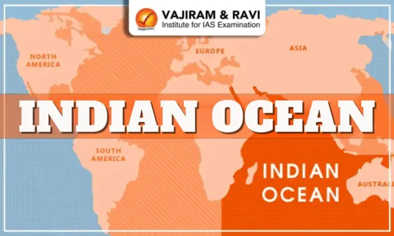
The Indian Ocean, covering nearly 70.56 million sq km, is the world’s third-largest ocean and one of the most strategically significant maritime regions today. Its semi-enclosed nature, monsoon-driven currents, rich biodiversity, and dense network of global trade routes make it crucial not just for India but for Asia, Africa, and world powers. For UPSC aspirants, the Indian Ocean integrates Geography, Environment, Economy, Disaster Management, and International Relations, making it a multi-dimensional topic frequently asked in Prelims and Mains.
Indian Ocean Introduction
The Indian Ocean holds immense climatic and geopolitical importance due to its central location between Africa, Asia, Australia, and Antarctica. It forms a vital link between the energy-rich Middle East and the manufacturing hubs of East Asia. Over the decades, this ocean has emerged as the epicentre of global trade, strategic competition, and environmental vulnerability.
- Total area: ~70.56 million sq km (20% of world ocean)
- Surrounded by 36 littoral and 14 landlocked countries
- Unique for monsoon reversal of currents
- Crucial for global shipping, food security, and energy supplies
Indian Ocean Location, Extent
The Indian Ocean extends from the east coast of Africa to western Australia and merges with the Southern Ocean in the south. Unlike the Pacific and Atlantic, it is landlocked to the north, giving it a semi-closed character. This geography makes the Indian Ocean sensitive to geopolitical developments, resource competition, and climatic events.
- Lies roughly between 20°E to 147°E longitude.
- Extends from the equator towards 60°S latitude.
- Warmest ocean among major oceans due to enclosed nature.
- Accounts for nearly 20% of Earth’s water surface.
The Indian Ocean spans a vast area of around 70.56 million sq km, making it slightly smaller than the Atlantic and Pacific but larger than the Arctic and Southern Oceans. It is characterized by deep basins, ridges, and significant monsoon-driven current systems. Its average depth is approximately 3,900 meters, with the Java Trench (7,258 m) as its deepest point.


Indian Ocean Boundaries
he Indian Ocean is surrounded by diverse landmasses that shape its climatic systems, ocean currents, and maritime routes. The northern boundary is almost completely enclosed by Asia, while the eastern and western boundaries are open and connected to major straits. The southern boundary merges with the Southern Ocean, forming a continuous circumpolar water mass.
Northern Boundary
- Bounded by Asia, including India, Pakistan, Bangladesh, Sri Lanka, and Indonesia.
- Contains semi-enclosed seas such as the Arabian Sea and Bay of Bengal.
- Highly influenced by the Indian Monsoon System.
Western Boundary
- Bordered by Africa, including Somalia, Kenya, Tanzania, Mozambique, and South Africa.
- Features key choke points like Bab-el-Mandeb and the Mozambique Channel.
Eastern Boundary
- Includes Australia, Indonesia, and the Timor Sea region.
- Acts as a transition zone between the Pacific and Indian Oceans.
- Major straits such as Malacca, Sunda, and Lombok lie here.
Southern Boundary
- Opens into the Southern Ocean (Antarctic Ocean) around 60°S latitude.
- Characterized by powerful circumpolar currents and cold water masses.
Indian Ocean Map
The Indian Ocean spans the region between Africa, Asia, Australia, and the Southern Ocean, covering an area of about 70.56 million sq. km. It includes major seas such as the Arabian Sea, Bay of Bengal, Andaman Sea, and important islands like Sri Lanka, Maldives, Seychelles, and Mauritius. The map also highlights strategic sea lanes, chokepoints like Malacca Strait and Hormuz, and resource-rich zones, emphasizing the ocean’s geopolitical and economic importance.
Bordering Countries of the Indian Ocean
The Indian Ocean is bordered by 36 countries, along with numerous island nations, territories, and dependencies. These countries influence the politics, economics, and maritime security of the region. Many of them are part of regional groupings like IORA, BIMSTEC, and SAARC, making the region geopolitically active.
| List of Bordering Countries of the Indian Ocean | |
| Region | Countries |
|
South Asia |
India, Pakistan, Sri Lanka, Bangladesh, Maldives |
|
West Asia / Middle East |
Iran, Oman, Yemen, UAE, Saudi Arabia |
|
East Africa (Horn of Africa) |
Somalia, Djibouti, Eritrea |
|
East African Coast |
Kenya, Tanzania, Mozambique, South Africa |
|
Island Nations (Western & Central IO) |
Madagascar, Mauritius, Seychelles, Comoros |
|
Southeast Asia |
Indonesia, Thailand, Malaysia |
|
Australia Region |
Australia, Timor-Leste |
|
Additional Littoral States |
Myanmar (Indo-Pacific region), Bahrain and Qatar (via Persian Gulf opening), Kuwait (connected waters) |
Geographical Features of the Indian Ocean
The Indian Ocean is characterized by deep basins, mid-oceanic ridges, trenches, plateaus, and monsoon-driven current systems that make it unique among the world’s oceans. Its semi-enclosed nature and warm waters create distinct climatic, tectonic, and ecological patterns.
- Contains major deep basins such as the Arabian Basin, Somali Basin, Central Indian Basin, and Wharton Basin, reaching depths of 4,000-6,000 meters.
- Features a prominent Mid-Indian Ridge System, including the Central, Southwest, and Southeast Indian Ridges, forming a T-shaped tectonic structure.
- Home to the Java/Sunda Trench, the deepest point in the Indian Ocean at approximately 7,258 meters.
- Includes large submarine plateaus like the Kerguelen Plateau, Ninety East Ridge, and Chagos-Laccadive Ridge, formed mainly by volcanic hotspots.
- Hosts diverse island groups such as Madagascar, Maldives, Seychelles, Mauritius, Comoros, and Andaman & Nicobar Islands.
- Bordered by marginal seas including the Arabian Sea, Bay of Bengal, Red Sea, and Andaman Sea, each influencing monsoon and regional climate.
- Characterized by varied continental shelves, broad along India’s west coast and narrow off the East African coastline.
- Displays strong monsoon-driven current reversals, especially the Somali Current, which reverses direction between SW and NE monsoon seasons.
- Exhibits significant tectonic activity due to divergent and convergent plate boundaries, leading to earthquakes and tsunamis, such as the 2004 Indian Ocean tsunami.
- Shows distinct temperature patterns, being the warmest ocean, with higher salinity in the Arabian Sea and lower salinity in the Bay of Bengal due to high river discharge.
Indian Ocean and UNCLOS
The Indian Ocean is governed by the principles of the United Nations Convention on the Law of the Sea (UNCLOS), which provides the legal framework for maritime rights, navigation, resource utilization, and dispute resolution. UNCLOS plays a crucial role in defining the maritime boundaries of Indian Ocean littoral states, including Exclusive Economic Zones (EEZs), continental shelves, and territorial waters.
| Indian Ocean and UNCLOS | ||||
| Maritime Zone | UNCLOS Definition | Extent (from Baseline) | India’s Rights | Examples/Notes (India) |
|
Internal Waters |
Waters landward of the baseline |
Landward side of baseline |
Full sovereignty, same as land territory |
Ports: Mumbai, Kochi, Chennai |
|
Territorial Sea |
Belt of coastal waters under full sovereignty |
Up to 12 nautical miles |
Complete sovereignty; foreign ships have innocent passage |
India enforces security & customs laws; used for patrols |
|
Contiguous Zone |
Additional zone beyond territorial sea |
12-24 nautical miles |
Rights to prevent & punish infringements of customs, immigration, sanitation laws |
Indian Coast Guard actively monitors this zone |
|
Exclusive Economic Zone (EEZ) |
Zone for exclusive resource rights |
Up to 200 nautical miles |
Exclusive rights to explore/exploit living & non-living resources |
India’s EEZ = 2.37 million sq. km (one of the largest in world) |
|
Continental Shelf |
Seabed/subsoil extending to margin of continental slope |
200-350 nautical miles |
Exclusive rights over seabed minerals like hydrocarbons |
India claims extended shelf in the Arabian Sea & Bay of Bengal |
|
High Seas (Beyond National Jurisdiction) |
Open ocean beyond EEZ |
Beyond 200 nautical miles |
Freedom of navigation, fishing (regulated), overflight |
India participates in global fisheries management |
|
Archipelagic Waters |
Applies to archipelago states |
Not applicable to India |
– |
India is not an archipelagic state |
|
International Seabed Area (The “Area”) |
Seabed beyond continental shelves |
Beyond national jurisdiction |
Common heritage of mankind; regulated by ISA |
India has a pioneer investor status for deep-sea mining (Polymetallic nodules in Central Indian Ocean Basin) |
Indian Ocean Importance
The Indian Ocean is vital for global trade, energy security, climate regulation, and strategic power competition, making it one of the most significant oceans in the 21st century. Its sea lanes, resources, and geopolitical leverage shape the economic and security interests of India and the world.
- Facilitates nearly 80% of global maritime oil trade and connects major economies across Asia, Africa, and Europe.
- Hosts critical Sea Lanes of Communication (SLOCs) that carry two-thirds of the world’s oil shipments and one-third of global bulk cargo.
- Contains vital choke points like the Strait of Malacca, Strait of Hormuz, and Bab-el-Mandeb, essential for global energy and trade flows.
- Rich in hydrocarbons, especially in the Persian Gulf, Arabian Sea, and Bay of Bengal, supporting global energy supply chains.
- Supports a diverse blue economy, including fisheries, tourism, mineral resources, and maritime industries.
- Plays a crucial role in monsoon formation and climate regulation, influencing weather patterns across South and Southeast Asia.
- Acts as a key arena for geopolitical rivalry, especially between India, China, the US, and regional powers.
- Enhances India’s strategic depth, allowing it to project power through the Andaman & Nicobar Command and a growing naval presence.
- Serves as a hub for disaster response and humanitarian operations, especially in regions affected by cyclones and tsunamis.
Major Challenges Faced in Indian Ocean Region
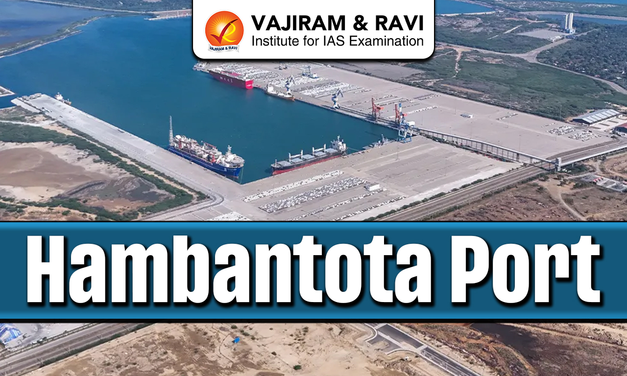
- China’s presence in the region continues to expand, with major port investments like the Kyaukpyu deep-sea port in Myanmar (over USD 1.3 billion), increasing strategic pressure on India.
- In 2024, Sri Lanka imposed a one-year suspension on all foreign research vessels after repeated controversies involving Chinese survey ships operating in the Indian Ocean.
- India’s Defence Ministry (2025) reaffirmed that 95% of India’s trade by volume and 68% by value passes through the Indian Ocean, highlighting increasing security vulnerabilities.
- Maritime piracy and armed robbery incidents in the Indian Ocean touched 227 cases in 2024, reflecting a 17% rise from 2023, especially near the Gulf of Aden and East Africa.
- Hybrid maritime threats, missile attacks, drone strikes, and water-borne improvised explosive devices rose sharply, with over 270 incidents reported in 2024, mostly linked to regional conflicts.
- The ongoing Red Sea and West Asian crises triggered spillover: 128 out of 175 maritime violence incidents in 2024 were associated with retaliatory drone and missile attacks affecting Indian Ocean shipping lines.
- The Indian Navy significantly expanded its operational role: 30+ warships, 5,000 personnel, and 900+ hours of aerial surveillance were deployed in 2024-25 for anti-piracy and security operations.
- Narcotics trafficking through the Arabian Sea surged, with seizures amounting to nearly 5,000 kg of drugs (including heroine and methamphetamine) by Indian naval forces in late 2024.
- Illegal, unreported, and unregulated (IUU) fishing remains a key challenge, with 78 distinct IUU incidents recorded in January 2025 alone, affecting India’s coastal states and maritime ecology.
- Competition among major powers: India, China, the US, France, and Australia—has intensified, with India conducting its largest-ever combined naval exercises with African littoral states in early 2025.
- Climate events such as cyclones have become more frequent and intense in the Bay of Bengal and Arabian Sea; Cyclone Mocha (2023) and Cyclone Tej (2024) highlighted the vulnerability of coastal populations.
- Rising sea levels and warming ocean temperatures threaten Indian Ocean coral reefs, fisheries, and shipping routes, contributing to ecosystem degradation and livelihood losses for coastal communities.
Steps Taken to Strengthen Indian Ocean Region
- India has expanded Mission-Based Deployments to ensure continuous naval presence across key IOR chokepoints like the Gulf of Aden, Malacca Strait, and Mozambique Channel.
- Over 30 Indian Navy warships and long-range maritime aircraft (P-8I, MQ-9B drones) are regularly deployed to secure sea lanes and monitor threats.
- The commissioning of INS Vikrant and strengthening of the Andaman & Nicobar Command enhanced India’s maritime power projection.
- India operates the Information Fusion Centre-IOR (IFC-IOR), sharing real-time maritime data with 50+ partner nations.
- Coastal radar systems have been provided to Maldives, Mauritius, Seychelles, Sri Lanka, and Myanmar to expand joint maritime surveillance.
- India has signed white-shipping agreements to track non-military vessels and detect piracy, trafficking, and illegal fishing.
- Diplomatic initiatives under SAGAR strengthen India’s role as the primary security provider in the Indian Ocean.
- India actively participates in IORA, IONS, and other maritime forums to coordinate disaster relief, security, and economic projects.
- India provides patrol vessels, aircraft, training, and hydrography support to countries like Sri Lanka, Maldives, Mauritius, Mozambique, and Seychelles.
- Regular naval exercises such as SLINEX, VARUNA, EKUVERIN, AUSINDEX, and TRILATERAL exercises with Sri Lanka-Maldives improve interoperability.
India’s Deep Ocean Mission
Deep Ocean Mission (DOM), aims to explore and utilise polymetallic nodules, cobalt crusts, and hydrothermal minerals in the Central Indian Ocean Basin. It strengthens India’s blue economy, maritime resource security, and technological capabilities in deep-sea exploration.
- India has 75,000 sq. km allocated in the Central Indian Ocean Basin for polymetallic nodule exploration.
- Estimated resources include manganese, nickel, copper, cobalt, and rare earth minerals.
- Development of MATSYA 6000, a 6,000 m depth-rated manned submersible, for deep-sea missions.
- Indigenous Crawler-based mining technology is being tested for seabed nodule collection.
- Mission contributes to India’s energy transition and strategic autonomy in critical minerals for technology and renewable sectors.
![]() Last updated on March, 2026
Last updated on March, 2026
→ UPSC Final Result 2025 is now out.
→ UPSC has released UPSC Toppers List 2025 with the Civil Services final result on its official website.
→ Anuj Agnihotri secured AIR 1 in the UPSC Civil Services Examination 2025.
→ UPSC Marksheet 2025 is now out.
→ UPSC Notification 2026 & UPSC IFoS Notification 2026 is now out on the official website at upsconline.nic.in.
→ UPSC Calendar 2026 has been released.
→ Check out the latest UPSC Syllabus 2026 here.
→ UPSC Prelims 2026 will be conducted on 24th May, 2026 & UPSC Mains 2026 will be conducted on 21st August 2026.
→ The UPSC Selection Process is of 3 stages-Prelims, Mains and Interview.
→ Prepare effectively with Vajiram & Ravi’s UPSC Prelims Test Series 2026 featuring full-length mock tests, detailed solutions, and performance analysis.
→ Enroll in Vajiram & Ravi’s UPSC Mains Test Series 2026 for structured answer writing practice, expert evaluation, and exam-oriented feedback.
→ Join Vajiram & Ravi’s Best UPSC Mentorship Program for personalized guidance, strategy planning, and one-to-one support from experienced mentors.
→ Shakti Dubey secures AIR 1 in UPSC CSE Exam 2024.
→ Also check Best UPSC Coaching in India
Indian Ocean FAQs
Q1. What is the Indian Ocean?+
Q2. Which countries border the Indian Ocean?+
Q3. What are the major seas and gulfs in the Indian Ocean?+
Q4. What are the key maritime zones under UNCLOS in the Indian Ocean?+
Q5. Why is the Indian Ocean strategically important?+
Tags: indian ocean