The Indo-Gangetic Plain, spanning India, Bangladesh, and Nepal, faces recurrent floods due to heavy monsoon rains, glacial melt, deforestation, and urbanization. These floods damage lives, agriculture, and infrastructure. Effective management demands an integrated approach combining sustainable land use, afforestation, advanced forecasting technologies, and active community participation. Building resilience through coordinated planning and environmental conservation is essential to reduce flood impacts and safeguard livelihoods in this densely populated region.
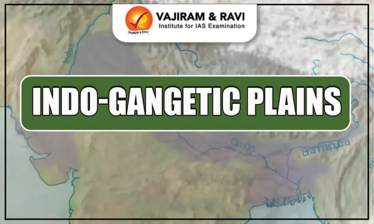
Indo-Gangetic Plains
The Indo-Gangetic Plains, or Indo-Gangetic-Brahmaputra Plains, are vast aggradational plains formed by alluvial deposits from the Indus, Ganga, Brahmaputra, and their tributaries. The Northern Plains of India are one of the five physiographic divisions of India and represent its youngest landform. Spanning a massive area, they hold the title of the world’s largest alluvial plain, supporting dense populations, fertile agriculture, and a rich cultural history shaped by these mighty river systems.
Indo-Gangetic Plains Features
The Indo-Gangetic Plains has some unique geographical, climatic, and socio-economic characteristics. The table below includes the Indo-Gangetic Plains Features for better understanding:
| Indo-Gangetic Plains Features | |
|
North-South Extension |
They extend from the south of the Himalayas upto the edge of the Peninsular Plateau. |
|
East-West Extension |
They extend from the mouth of the Indus in the west to the mouth of the Ganga in the east. |
|
Boundaries |
They are bounded by the Shiwalik range to the north, the Desert to the west, the Peninsular Plateau to the south, and the Puruvachal Hills to the east. |
|
Length |
The total length of this tract is 3200 km, of which around 2400 km lies in India and the rest lies in Bangladesh. |
|
Width |
The average width of the Great Northern Plains is 150-300 km. They are widest in the west where their width goes up to 500 km, and narrow down towards the east where their width shrinks down to 60-100 km. |
|
Area |
They occupy an area of around 7.8 lakh sq. km, making it the largest alluvial plain in the world. |
|
States Covered |
The Great Northern Plains of India spread over the states – Punjab, Haryana, Delhi, Uttar Pradesh, Bihar, parts of Jharkhand and West Bengal, and Assam. |
|
Extreme Horizontality |
Extreme horizontality is an important feature of this plain. With an average elevation of around 200 m and the highest elevation of about 291 m above the mean sea level, its average gradient range is just 15-20 cm. |
|
Soil Cover |
The rivers coming from the northern mountain carry a huge load of sediments which get deposited over these plains. Thus, these plains have a rich and fertile soil cover. |


Indo-Gangetic Plains Formation
The Indo-Gangetic Plains were formed by the deposition of sediments from the Indus, Ganga, and Brahmaputra river systems, which filled a vast depression between the Peninsular Plateau and the Himalayas. During the Tertiary Period, the collision of the Indo-Australian and Eurasian plates created the Himalayas and a large syncline to the south. Over time, rivers from the Himalayas deposited immense alluvial material into this depression, giving rise to the Northern Plains of India.
Indo-Gangetic Plains Regional Division
Regionally, the Indo-Gangetic Plains are divided into four major sections:
- Rajasthan Plain – Occupies the arid western part, largely desert with some fertile tracts along river channels.
- Punjab-Haryana Plain – Known for extensive alluvial deposits and intensive agriculture, supported by canal irrigation.
- Ganga Plain – The largest and most fertile stretch, spanning several states from Uttarakhand to West Bengal.
- Brahmaputra Plain – A flood-prone yet highly fertile region in Assam, shaped by the Brahmaputra River and its tributaries.
Rajasthan Plain
Forming the western edge of the Indo-Gangetic Plains, this region includes the Thar or Great Indian Desert, extending across western Rajasthan and into Pakistan. It has two main parts:
Marusthali
The true desert area in the east covers much of the Marwar plain. While it appears as an aggradational plain, geologically it belongs to the Peninsular Plateau, evident from scattered outcrops of gneiss, schist, and granite. Its eastern side is rocky; the west is dominated by shifting sand dunes called Dhrian.
Rajasthan Bagar
A semi-arid tract between the Thar desert and the Aravalli Range. Seasonal streams from the Aravallis create fertile patches called Rohi. The Luni River, flowing southwest into the Rann of Kutch, is the main watercourse. North of the Luni lies the sandy plain called Thali. The region also has saline lakes such as Sambhar, Didwana, and Khatu.
Punjab-Haryana Plain
Located east and northeast of the Rajasthan Plain, this region stretches about 640 km from northwest to southeast, with an average width of 300 km. It slopes gently southwest, so rivers follow the same direction. The soil is mainly silty and porous.
Key subdivisions and features:
- Bet – Floodplain areas near riverbanks formed by new alluvium.
- Bhabar Plain – Foothill zone with boulders, gravel, sand, and clay that cannot retain water.
- Punjab Plain – Formed by the alluvium of the Satluj, Beas, Ravi, Chenab, and Jhelum; hence called the Land of Five Rivers. Divided into five Doabs:
- Bist-Jalandhar Doab – Between Beas and Satluj
- Bari Doab – Between Beas and Ravi
- Rachna Doab – Between Ravi and Chenab
- Chaj Doab – Between Chenab and Jhelum
- Sind Sagar Doab – Between Jhelum-Chenab and the Indus
Other notable features:
- Bet Lands – Khadar-rich fertile floodplains replenished annually.
- Dhayas – Broad Khadar floodplains bordered by bluffs.
- Chos – Eroded tracts in the north near the Shiwalik Hills caused by seasonal streams.
Ganga Plain
The largest unit of the Indo-Gangetic Plains, covering about 3.75 lakh sq. km, formed by the alluvium of the Ganga and its Himalayan and Peninsular tributaries. It stretches from Delhi to Kolkata across Uttar Pradesh, Bihar, and West Bengal, sloping east and southeast.
Upper Ganga Plain
- Location: Westernmost part, bounded by the Shiwaliks (north), Peninsular boundary (south), Yamuna River (west). Eastern limit unclear.
- Gradient: ~25 cm/km; sluggish rivers.
- Features: River bluffs, meanders, oxbow lakes, levees, abandoned channels, sandy bhurs.
- Major Units: Ganga-Yamuna Doab, Rohilkhand Plains, Avadh Plains.
Middle Ganga Plain
- Location: East of the Upper Ganga Plain; covers eastern Uttar Pradesh and Bihar.
- Boundaries: Himalayas (north), Peninsular edge (south).
- Features: Levees, bluffs, oxbow lakes, marshes, tals, ravines; highly flood-prone due to shifting river courses—Kosi, the “Sorrow of Bihar,” is most notorious.
- Major Units: Ganga-Ghaghara Doab, Ghaghara-Gandak Doab, Gandak-Kosi Doab (Mithila Plain).
Lower Ganga Plain
- Location: Eastern Bihar, West Bengal, most of Bangladesh.
- Boundaries: Darjeeling Himalaya (north), Bay of Bengal (south), Chotanagpur Highlands (west), Bangladesh (east).
- Features: Dominated by deltaic landforms. The Ganga-Brahmaputra Delta, the world’s largest is rich in mangroves and home to the Royal Bengal Tiger.
Brahmaputra Plain
- Location & Names: Northeastern India; also called Brahmaputra Valley or Assam Valley.
- Boundaries: Eastern Himalayas of Arunachal Pradesh (north), Patkai Bum & Naga Hills (east), Garo-Khasi-Jaintia & Mikir Hills (south), Indo-Bangladesh border and lower Ganga Plain (west).
- Formation: An aggradational plain formed by the depositional work of the Brahmaputra and its tributaries.
- Riverine Features: Alluvial fans, sandbars, meanders, oxbow lakes formed as northern tributaries enter the valley abruptly.
- Notable Facts: Majuli Island, the world’s largest riverine island, lies here. The valley is also famous for its tea plantations.
Indo-Gangetic Plains Geomorphology
The table of the distinctive geomorphological features of the Indo-Gangetic Plains is shared below:
| Indo-Gangetic Plains Geomorphology | ||||
| Feature | Location & Extent | Composition | Key Characteristics | Fertility / Use |
|
Bhabar |
8–16 km belt along Shiwalik foothills (Indus to Tista) |
Unassorted gravel and pebbles |
Streams disappear underground due to porous sediments |
Poor for cultivation |
|
Tarai |
South of Bhabar; 15-30 km wide |
Finer alluvium |
Marshy, waterlogged; streams re-emerge |
Fertile; much converted to farmland |
|
Khadar |
Along river floodplains |
New alluvium |
Renewed annually; no calcareous deposits |
Very fertile; intensively cultivated |
|
Bhangar |
Terraces above floodplains |
Older alluvium with kankar |
Not renewed frequently; higher than Khadar |
Less fertile |
|
Reh / Kallar |
Dry tracts of UP and Haryana |
Saline/alkaline efflorescence |
Generally barren |
Unfit for cultivation |
|
Bhur |
Elevated sandy ridges along Ganga |
Wind-blown sand |
Formed in hot, dry months |
Limited agricultural use |
Indo-Gangetic Plains Significance
- Although the Northern Plains of India cover less than one-third of India’s total area, they support over 40% of the country’s population.
- Fertile alluvial soils, flat terrain, slow-moving perennial rivers, and a favorable climate enable intensive agriculture, earning the northern plains the title of Granary of India.
- The flat relief supports a dense network of roads and railways, promoting rapid urbanization and industrial growth.
- The banks of rivers like the Ganga and Yamuna host numerous pilgrimage sites, adding deep cultural and spiritual significance to the region.
![]() Last updated on March, 2026
Last updated on March, 2026
→ UPSC Final Result 2025 is now out.
→ UPSC has released UPSC Toppers List 2025 with the Civil Services final result on its official website.
→ Anuj Agnihotri secured AIR 1 in the UPSC Civil Services Examination 2025.
→ UPSC Marksheet 2025 is now out.
→ UPSC Notification 2026 & UPSC IFoS Notification 2026 is now out on the official website at upsconline.nic.in.
→ UPSC Calendar 2026 has been released.
→ Check out the latest UPSC Syllabus 2026 here.
→ UPSC Prelims 2026 will be conducted on 24th May, 2026 & UPSC Mains 2026 will be conducted on 21st August 2026.
→ The UPSC Selection Process is of 3 stages-Prelims, Mains and Interview.
→ Prepare effectively with Vajiram & Ravi’s UPSC Prelims Test Series 2026 featuring full-length mock tests, detailed solutions, and performance analysis.
→ Enroll in Vajiram & Ravi’s UPSC Mains Test Series 2026 for structured answer writing practice, expert evaluation, and exam-oriented feedback.
→ Join Vajiram & Ravi’s Best UPSC Mentorship Program for personalized guidance, strategy planning, and one-to-one support from experienced mentors.
→ Shakti Dubey secures AIR 1 in UPSC CSE Exam 2024.
→ Also check Best UPSC Coaching in India
Indo-Gangetic Plains FAQs
Q1. What are the Indo-Gangetic Plains?+
Q2. Where are the Indo-Gangetic Plains located?+
Q3. How were the Indo-Gangetic Plains formed?+
Q4. Why are the Indo-Gangetic Plains important?+
Q5. What type of soil is found in the Indo-Gangetic Plains?+
Tags: indo-gangetic plains