NISAR Satellite Latest News
- The Indian Space Research Organisation (ISRO) is planning to launch the NISAR satellite from Sriharikota onboard a GSLV Mk-II rocket.
Introduction
- India and the United States are set to launch their most ambitious joint space mission to date, the NASA-ISRO Synthetic Aperture Radar (NISAR) satellite.
- Scheduled for lift-off on July 30 from Sriharikota onboard a GSLV Mk-II, the Rs. 12,000-crore mission has been over a decade in the making and is being considered as one of the world’s most advanced Earth observation missions.
- NISAR will provide real-time, high-resolution radar data on land deformation, biomass, disaster impact, crop patterns, and climate-related changes, not just for India but globally.
- It combines NASA’s strength in long-range radar systems with ISRO’s spaceflight engineering and S-band radar technology.


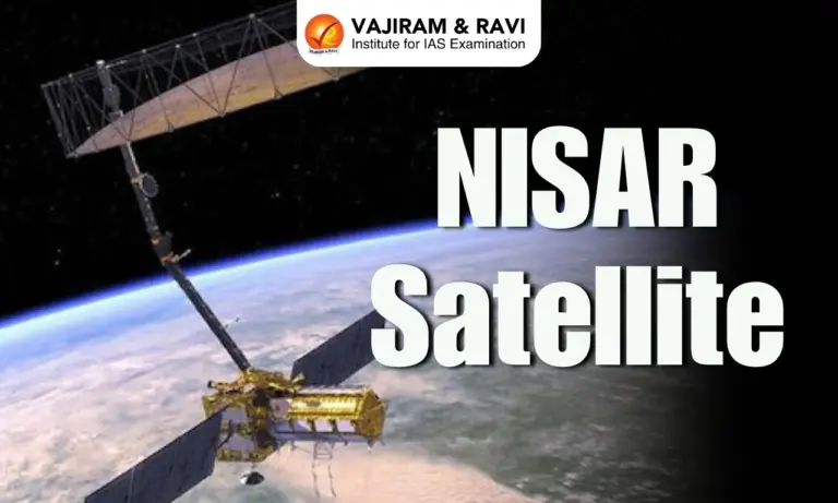
About NISAR Satellite
- First Dual-Band Radar Satellite for Earth Observation
- NISAR is the world’s first Earth-observing satellite with dual-frequency synthetic aperture radar (SAR).
- L-band radar (1.257 GHz) from NASA can penetrate dense forests and soil layers to detect ground deformation and subsurface movement.
- S-band radar (3.2 GHz) from ISRO is optimised for surface-level changes like crop growth, biomass estimates, and water levels.
- This dual-frequency advantage allows for all-weather, day-and-night imaging, even through clouds, smoke, or vegetation cover.
- Wide Swath and High Resolution
- NISAR’s radar swath width is 240 km, allowing it to scan large areas in one go.
- It offers a spatial resolution of 3-10 metres and vertical displacement mapping accuracy down to centimetres, enabling early detection of phenomena like land subsidence in cities.
- Every spot on Earth will be revisited once every 12 days, providing consistent monitoring.
Scientific and Societal Applications
- NISAR is designed to support research and operations across six broad themes:
- Solid Earth Processes – Tracking earthquakes, landslides, and land deformation.
- Ecosystems – Monitoring forests, woody biomass, and biodiversity.
- Ice and Snow Dynamics – Measuring glacial movements and polar ice thickness.
- Coastal and Ocean Monitoring – Tracking shoreline erosion, oil spills, and storm surges.
- Disaster Response – Providing near-real-time damage maps after floods, quakes, or cyclones.
- Agriculture and Infrastructure – Supporting food security and monitoring subsidence near dams, roads, and reservoirs.
- During natural disasters, NISAR can provide damage proxy maps within five hours, crucial for emergency relief planning and response.
India-Specific Enhancements
- While NISAR will operate globally at the L-band, ISRO will routinely operate the S-band radar over Indian territory, enabling:
- Enhanced biomass and soil moisture mapping
- Improved agricultural forecasting
- Ionospheric noise correction for high-precision imagery
- All of this aligns with India’s national needs in agriculture, disaster management, forestry, and rural development.
Technical Design and Deployment
- Once launched, NISAR will be placed in a sun-synchronous polar orbit at an altitude of 747 km.
- It features a massive 12-metre mesh radar antenna and a 9-metre boom to support deployment and scanning.
- To overcome size constraints in space, the SAR system mimics a large antenna by collecting radar pulses over time and combining them through complex processing, hence the term “synthetic aperture.”
- Its advanced SweepSAR mode allows electronic steering of radar beams, providing consistent swath coverage without compromising resolution.
Data Access and Ground Infrastructure
- NISAR’s open-data policy ensures that data is freely available to all users, typically within a few hours of acquisition.
- NASA’s Near Earth Network (in Alaska, Norway, and Chile) will handle most global data downlinks (up to 3 TB/day).
- ISRO’s Ground Stations in Shadnagar and Antarctica will manage India’s data needs.
- India’s National Remote Sensing Centre (NRSC) will process and distribute NISAR products for domestic use.
India-U.S. Contributions
- The mission exemplifies balanced international collaboration:
- ISRO contributed the spacecraft bus, the entire S-band radar system, Ka-band telemetry systems, and launch support via GSLV Mk-II.
- NASA provided the L-band radar, radar structure, antenna, onboard avionics, and high-capacity data systems.
- The satellite was integrated and tested in Bengaluru, symbolising “Made-in-India” ownership of a global science instrument.
Source : TH
![]() Last updated on March, 2026
Last updated on March, 2026
→ UPSC Final Result 2025 is now out.
→ UPSC has released UPSC Toppers List 2025 with the Civil Services final result on its official website.
→ Anuj Agnihotri secured AIR 1 in the UPSC Civil Services Examination 2025.
→ UPSC Marksheet 2025 is now out.
→ UPSC Notification 2026 & UPSC IFoS Notification 2026 is now out on the official website at upsconline.nic.in.
→ UPSC Calendar 2026 has been released.
→ Check out the latest UPSC Syllabus 2026 here.
→ UPSC Prelims 2026 will be conducted on 24th May, 2026 & UPSC Mains 2026 will be conducted on 21st August 2026.
→ The UPSC Selection Process is of 3 stages-Prelims, Mains and Interview.
→ Prepare effectively with Vajiram & Ravi’s UPSC Prelims Test Series 2026 featuring full-length mock tests, detailed solutions, and performance analysis.
→ Enroll in Vajiram & Ravi’s UPSC Mains Test Series 2026 for structured answer writing practice, expert evaluation, and exam-oriented feedback.
→ Join Vajiram & Ravi’s Best UPSC Mentorship Program for personalized guidance, strategy planning, and one-to-one support from experienced mentors.
→ Shakti Dubey secures AIR 1 in UPSC CSE Exam 2024.
→ Also check Best UPSC Coaching in India
NISAR Satellite FAQs
Q1. What is the NISAR satellite?+
Q2. What makes NISAR unique?+
Q3. What are the main applications of NISAR data?+
Q4. How will NISAR benefit India specifically?+
Q5. When and where will NISAR be launched?+
Tags: mains articles nisar satellite upsc current affairs upsc mains current affairs