Pale-Capped Pigeon

Pale-Capped Pigeon

Pale-Capped Pigeon Latest News

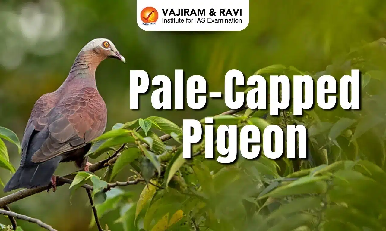
In a significant sighting for birdwatchers and conservationists alike, the elusive Pale-capped Pigeon was recently photographed in Dehing Patkai National Park in Assam.

About Pale-Capped Pigeon

  • The pale-capped pigeon, also known as the purple wood pigeon, is a large, dark purplish-maroon bird that is found in parts of the Indian Subcontinent and Southeast Asia.
  • Scientific Name: Columba punicea
  • Distribution: It is very locally distributed across its broad range, which encompasses parts of northern and northeastern India, Bangladesh, Myanmar, Thailand, Laos, Cambodia,  and Vietnam. 

Pale-Capped Pigeon Habitat

  • It largely inhabits forest habitats, chiefly, primary or secondary evergreen forests, and bamboo and agricultural fields in close proximity to forests.
  • Its range extends from the lowlands up to 1,600 m.

Pale-Capped Pigeon Features

  • It is mainly brown above and chestnut below with a sheen of green or amethyst. 
  • Males have a whitish-grey-cap while females have a brownish-grey-cap and less gloss on the feathers.
  • They are frugivores, foraging in small groups in the canopy of trees but sometimes descending to the ground for seeds and fallen fruit.

Pale-Capped Pigeon Conservation Status

It is classified as 'Vulnerable' under the IUCN Red List.

Key Facts about Dehing Patkai National Park

  • It is located in the Dibrugarh and Tinsukia districts of Assam.
  • It is situated at the foothills of the Patkai Hill Ranges, on the banks of the River Dehing (a tributary of Brahmaputra), and adjacent to the Namdapha Wildlife Sanctuary.
  • Also known as the ‘Amazon of the East’, it harbours the longest stretch of tropical lowland rainforests in India. 
  • It covers an area of 231.65 sq.km. 
  • The climate of the region is mostly tropical, with an annual rainfall of more than 4,000 mm.
  • There are more than a dozen different ethnic groups living in the area, including the indigenous Assamese communities, particularly Tai Phake, Khamyang, Khampti, Singpho, Nocte, Ahom, Kaibarta, Moran, and Motok, Burmese, and non-indigenous Nepali people.
  • Vegetation: The park is a deciduous rainforest with semi-evergreen and lush green flora.
  • Flora: It is dominated by species like Hollong, Nahor, Mekai, Paroli, Simul, various orchids, ferns, cane, and bamboo.
  • Fauna: The rich biodiversity includes diverse species such as slow loris, pig-tailed macaque, stump-tailed macaque, capped langur, Indian leopard, Asian elephant, royal Bengal tiger, gaur, Himalayan black bear, clouded leopard, barking deer, Chinese pangolin, etc.

Source: NEN

Pale-Capped Pigeon FAQs

Q1: What is the scientific name of the pale-capped pigeon?

Ans: Columba punicea

Q2: What is the IUCN Red List status of the pale-capped pigeon?

Ans: Vulnerable

Q3: What distinguishing feature separates male and female pale-capped pigeons?

Ans: Males have a whitish-grey cap, females have a brownish-grey cap.

Q4: Up to what elevation is the pale-capped pigeon typically found?

Ans: 1,600 m

Lyriothemis Abrahami

Lyriothemis Abrahami

Lyriothemis Abrahami Latest News

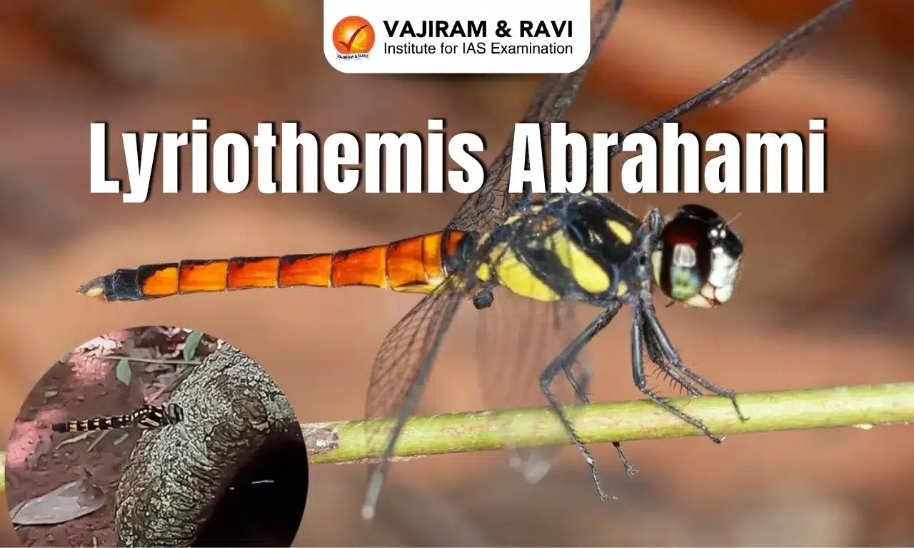
Recently, a new species of dragonfly, Lyriothemis abrahami, which was previously misidentified as Lyriothemis flava due to superficial similarities, has been officially documented.

About Lyriothemis Abrahami 

  • It is a new species of dragonfly discovered in Kerala.
  • Habitat: It breeds in small water pools in tree holes.
  • Features of Lyriothemis abrahami : It exhibits strong dimorphism, with males featuring uniquely shaped hamules and females displaying jet black bodies with yellow triangular spots.
  • Distribution: Its distribution spanned from lowland rainforests to mid-elevation evergreen and deciduous forests between 50 m and 1,100 m above sea level.
  • The finding increased Kerala’s odonate species count to 191, including 78 endemic species,

Ecological Significance Dragonfly

  • The dragonfly is an indicator of forest health, stressing habitat conservation’s broader ecological benefits.
  • Dragonflies are among the apex predators of the insect world and are considered to be responsible for regulating the numbers of many other insect species.
  • They are crucial insect predators that help regulate mosquito and pest populations in urban areas.

Source: TH

Lyriothemis abrahami FAQs

Q1: What is an indicator species?

Ans: Indicator species can signal a change in the biological condition of a particular ecosystem, and thus may be used as a proxy to diagnose the health of an ecosystem.

Q2: What is Dimorphism?

Ans: It is a condition of existence in two different characteristics in males and females of the same species.

Slovenia

Slovenia

Slovenia Latest News

Recently, Slovenia approved a law to allow assisted dying, joining an increasing number of countries giving terminally-ill adults the right to end their lives if they face unbearable suffering.

About Slovenia

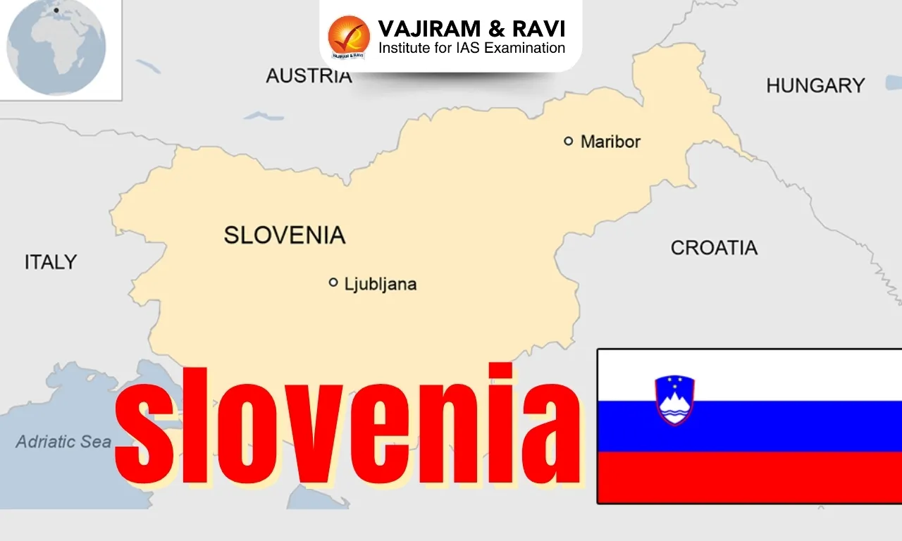
  • It occupies the Central and South Eastern Europe region.
  • Bordering countries: It is bordered by 4 countries: Austria in the north; Hungary in the northeast; Italy in the west; and Croatia in the southeast. Slovenia also shares a small coastline along the Adriatic Sea in the southwest.
  • Slovenia has a highly elevated terrain with over 40% of the country being mountainous.
  • It is made up of portions of four major European geographic landscapes—the European Alps, the karstic Dinaric Alps, the Pannonian and Danubian lowlands and hills, and the Mediterranean coast.
  • Climate:  Mediterranean climate on the coast, continental climate with mild to hot summers and cold winters in the plateaus and valleys to the east.
  • Highest point: Mount Triglav
  • Natural Resources: Lignite, lead, zinc, building stone, hydropower, forests
  • Economy: Slovenia has a developed market economy based primarily on services and trade. Its main industries include the manufacture of automotive parts, pharmaceuticals, and electrical appliances.
  • River: Major rivers include the Drava and Sava.
  • Capital City: Ljubljana

Source: Reuters

Slovenia FAQs

Q1: Is Slovenia uses euro currency?

Ans: Slovenia joined the European Union in 2004 and, on 1 January 2007, became the first of the new EU countries to adopt the euro.

Q2: What kind of country is Slovenia?

Ans: Parliamentary democratic republic

Invictus Programme

Invictus Programme

Invictus Programme Latest News

Recently, the European Space Agency (ESA) and UK-based Frazer-Nash have kicked off the INVICTUS research programme.

About Invictus Programme

  • It is a research programme with the goal of developing hypersonic technologies applicable to future reusable vehicles capable of horizontal launch.
  • Funding: It is funded through ESA’s General Support Technology Programme (GSTP) and Technology Development Element (TDE)
  • It is a fully reusable experimental aerospace vehicle capable of flying at Mach 5 (five times the speed of sound).
  • The vehicle will demonstrate key technologies for sustained hypersonic flight in the atmosphere and will be upgradable, allowing for the exchange of materials, software and propulsion systems between flight test campaigns.
  • INVICTUS builds on previous technology developments managed by ESA and will offer industry, agencies and academia an opportunity to test future hypersonic technologies in a relevant environment.
  • Significance: The INVICTUS programme will prove the suitability of a hydrogen-fuelled precooled air-breathing propulsion system for horizontal take-off and hypersonic flight.

Source: ESA

Invictus Programme FAQs

Q1: What is hypersonic tech?

Ans: Hypersonic weapons travel faster than five times the speed of sound — Mach 5 — covering vast distances in minutes.

Q2: What are the three types of propulsion?

Ans: There are many types of propulsion systems, each with unique features and uses. These include internal combustion engines, gas turbine engines, electric propulsion systems, and rocket propulsion systems.

Tuvalu Island

Tuvalu

Tuvalu Latest News

More than 5,000 people have applied for a first-of-its-kind migration visa that offers residents of Tuvalu an escape from the worst effects of climate change.

About Tuvalu

  • Tuvalu, formerly known as the Ellice Islands, is an island country located midway between Hawaii and Australia in the west-central Pacific Ocean.
  • Its neighbours include Kiribati, to the north, and Fiji, to the south. 
  • It comprises nine islands (four reef islands and five coral atolls) scattered in a chain lying approximately northwest to southeast over a distance of some 420 miles (676 km).
  • All islands are low-lying, with no point on Tuvalu being higher than 4.5 m above sea level. Thus, the islands are threatened by any future sea level rise. 
  • There are no rivers. Tuvalu’s climate is hot and rainy.
  • With the exception of tiny Vatican City, Tuvalu has the fewest inhabitants of any other independent nation.
  • Capital: Funafuti
  • Languages: Most people speak a language called Tuvaluan. English is also common.
  • Economy:
    • Most people are subsistence farmers and are aided by remittances from relatives working overseas.
    • A small quantity of copra is produced for export, the sale of stamps accounts for modest earnings, and fees are collected from foreign fishing fleets.
  • Political Overview:
    • Tuvalu became independent from the United Kingdom in October 1978
    • It operates as a parliamentary democracy under a constitutional monarchy.
    • It is part of the Commonwealth Realm, with King Charles III recognized as King of Tuvalu. He is represented by a Governor-General, who is appointed upon the advice of the Prime Minister.
    • There are no political parties: the prime minister is chosen by and from the legislature.

Source: LS

Tuvalu FAQs

Q1: Where is Tuvalu located?

Ans: It is an island country located midway between Hawaii and Australia in the west-central Pacific Ocean.

Q2: What is the capital of Tuvalu?

Ans: Funafuti

Q3: What geographical characteristic makes Tuvalu particularly vulnerable to climate change?

Ans: Its low-lying islands.

Q4: How many islands make up Tuvalu?

Ans: 9

Q5: What is the main occupation of most people in Tuvalu?

Ans: Subsistence farming

King Rajendra Chola I

King Rajendra Chola I

King Rajendra Chola I Latest News

The Prime Minister is expected to participate in a function in Tamil Nadu being organised to commemorate the 1000th anniversary (millenary) of the conquest of the Gangetic plains by King Rajendra Chola I.

About King Rajendra Chola I

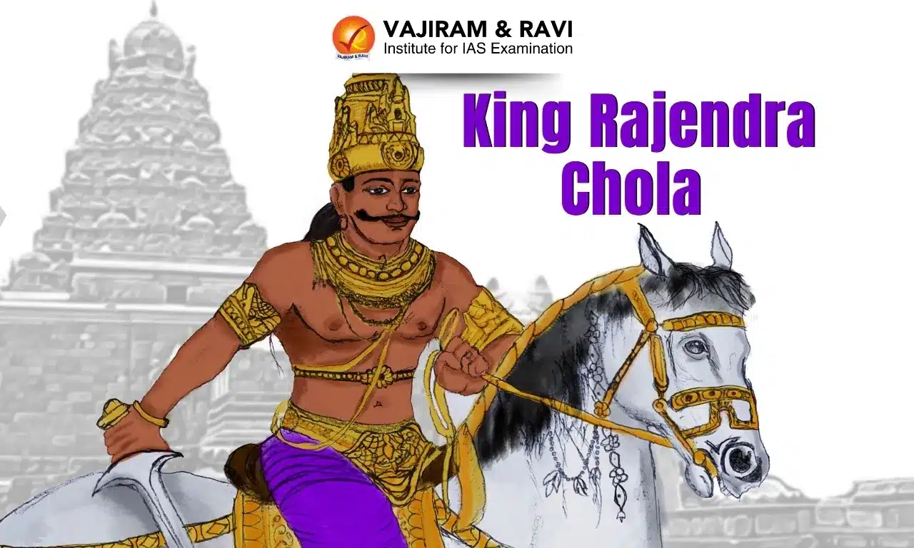
  • Rajendra Chola I, often described as Rajendra the Great, was a Chola emperor who ruled between 1014 and 1044 CE. 
  • Rajendra succeeded his father, Rajaraja I, in 1014 CE.
  • He was also known as Gangaikonda Cholan, meaning "Bringer of the Ganges River". Another title was Kadaram Kondan, which means "Conqueror of Kedah".
  • Military Campaigns:
    • During his reign, he extended the influences of the already vast Chola empire to the banks of the river Ganges in the north and across the ocean. 
    • He commanded the largest blue water navy in Indian history.
    • Rajendra’s territories extended to coastal Burma, the Andaman and Nicobar Islands, Lakshadweep, and the Maldives, conquering the kings of Srivijaya (Sumatra, Java, and Malaya in South East Asia) and the Pegu Islands with his fleet of ships.
    • He defeated Mahipala, the Pala king of Bengal and Bihar. 
    • Tamil Chola armies exacted tribute from Thailand and the Khmer kingdom of Cambodia. 
    • Rajendra stood as the first Indian king to take his armies overseas.
  • In order to commemorate his victory to the Ganges and over the northern kings, Rajendra Chola I assumed the title of ‘Gangaikondachola’ and had a temple dedicated to Lord Shiva built, which he named ‘Gangaikondacholeshwaram Mahadev’. 
  • He also founded the city of ‘Gangaikondacholapuram’ and shifted his capital there from Thanjavur. 
  • It was a major center for trade for many centuries. 
  • The Chola Empire under him became one of the wealthiest empires of the time, developing connections with Song China in the east and the Arabs in the west.
  • A hallmark of the Chola dynasty under his rule was the promotion of local self-governance, setting a unique example in administrative excellence. 
  • Religion: Rajendra followed Shaivism (a branch of Hinduism). However, he also welcomed Buddhism and built many stupas (Buddhist shrines) in South-East Asia and South India.
  • Rajendra Chola I was followed by his son Rajadhiraja I.

Source: TH

King Rajendra Chola I FAQs

Q1: Rajendra Chola I ruled during which period?

Ans: 1014–1044 CE

Q2: Who was the father of Rajendra Chola I?

Ans: Rajaraja I

Q3: What was the name of the capital city founded by Rajendra Chola I?

Ans: Gangaikondacholapuram

Q4: What religion did Rajendra Chola I follow?

Ans: Shaivism

Chikungunya

Chikungunya

Chikungunya Lates News

The Ministry of Health in China recently initiated an emergency campaign to safeguard those at risk of Chikungunya fever illness.

About Chikungunya

  • It is a mosquito-borne viral disease caused by the chikungunya virus (CHIKV). 
  • It causes fever and severe joint pain. 
  • The word comes from the African Makonde language and means "bent over in pain."
  • It was first described during an outbreak in southern Tanzania in 1952 and has now been reported in more than 110 countries in Asia, Africa, the Americas, and Europe.

Chikungunya Transmission

  • It is transmitted to humans by the bites of infected female mosquitoes, most commonly Aedes aegypti and Aedes albopictus mosquitoes. 
  • These two species can also transmit other viruses, including dengue and Zika viruses.
  • An infected person cannot spread the infection directly to other persons (i.e., it is not a contagious disease).

Chikungunya Symptoms

  • The symptoms of chikungunya are similar to those of dengue and Zika, making chikungunya easy to misdiagnose.
  • The most common symptom is an abrupt onset of fever, often accompanied by joint pain. 
  • Other symptoms include muscle pain, headache, nausea, fatigue, and rash. 
  • Severe joint pain usually lasts a few days but can persist for months or even years. 
  • Serious complications are uncommon, but atypical severe cases can cause long-term symptoms and even death, especially in older people and in children under one year old.

Chikungunya Treatment

  • There is no vaccine or antiviral drug treatment for chikungunya.
  • Treatment is focused on relieving the symptoms.

Source: INDIA

Chikungunya FAQs

Q1: What is Chikungunya?

Ans: It is a viral disease caused by the chikungunya virus (CHIKV).

Q2: How is chikungunya transmitted?

Ans: It is transmitted to humans by the bites of infected female mosquitoes.

Q3: Why is chikungunya often difficult to diagnose accurately?

Ans: Symptoms overlap with dengue and Zika.

Who Are Bedouins?

Who Are Bedouins?

Bedouins Latest News

Over 300 people have been killed in a week of violent clashes between Syria's Druze minority and Sunni Bedouin tribes in and around the southern city of Sweida.

About Bedouins

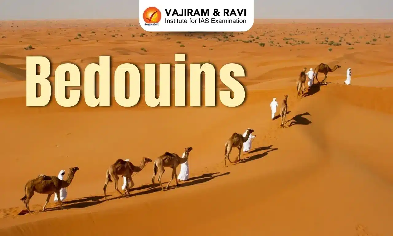
  • The Bedouins are traditionally nomadic, Arabic-speaking tribes who have inhabited the deserts of the Middle East and North Africa for centuries.
  • The word Bedouin derives from the Arabic badawi, meaning "desert dweller".
  • These communities historically survived by herding livestock, primarily camels, sheep, and goats, while navigating seasonal migrations across vast arid landscapes.
  • These tribes have traditionally been classified according to the animal species that are the basis of their livelihood. 
  • In Syria, Bedouins have primarily lived in the expansive Al-Badia desert, which covers much of the country's south and east, including provinces like Sweida, Homs, and Deir ez-Zor.
  • Society: Bedouin society is tribal and patriarchal, typically composed of extended families that are patrilineal, endogamous, and polygynous.
  • The head of the family, as well as of each successively larger social unit making up the tribal structure, is called sheikh; the sheikh is assisted by an informal tribal council of male elders.

Source: NDTV

Bedouins FAQs

Q1: What are Bedouins known for?

Ans: Traditionally, they made a living by herding goats, sheep and camels, hunting, escorting caravans and working as mercenaries.

Q2: Which religion are Bedouins?

Ans: Sunni Muslims

Kamchatka Peninsula

Kamchatka Peninsula

Kamchatka Peninsula Latest News

Recently, as many as five earthquakes struck near the coast of the Kamchatka peninsula region in the far east of Russia.

About Kamchatka Peninsula

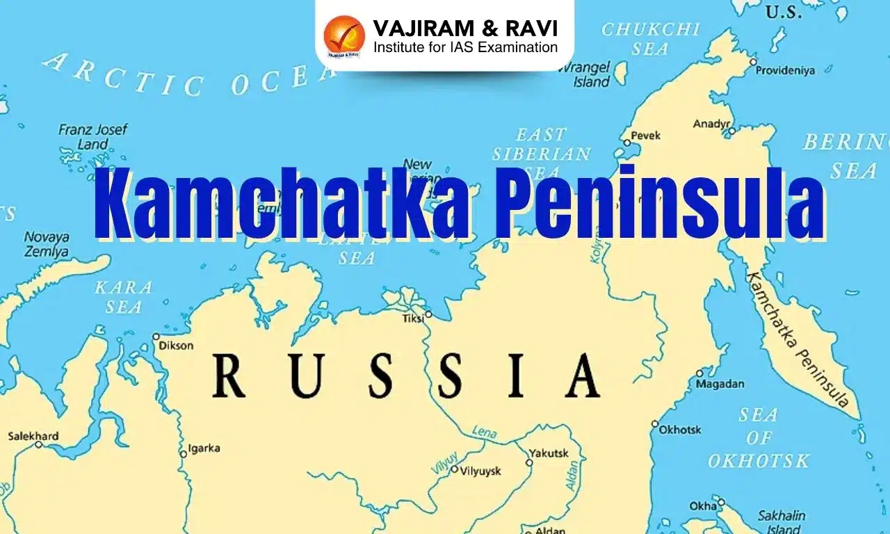
  • Location: It lies in far eastern Russia, between the Sea of Okhotsk on the west and the Pacific Ocean and Bering Sea on the east.
  • It is one of the world’s most concentrated areas of geothermal activity
  • It is part of the Kamchatka Krai. Kamchatka, also known as a land of fire and ice, sits on the Pacific Ring of Fire and is home to over 150 volcanoes, including 29 active volcanoes.
  • It is about 1,200 km long north-south and about 480 km across at its widest.
  • Area: Approximately 370,000 square km.
  • About the size of New Zealand, it is one of the largest peninsulas in the world.
  • Population: About 300,000 people live on the peninsula. The population density is one of the lowest in the world, at less than a person per square kilometre. 
  • Climate: Severe, with prolonged, cold, and snowy winters and wet, cool summers.
  • Highest Point: The Klyuchevskaya Sopka in the Eastern Range is the highest point on the Kamchatka Peninsula. 
  • Regional Capital: Petropavlovsk-Kamchatsky.
  • The Kuril island chain runs from the southern tip of the peninsula to a short distance from Japan’s northern Hokkaido Island.

Source: LM

Kamchatka Peninsula FAQs

Q1: What is Kamchatka famous for?

Ans: It is known as the Land of Ice and Fire, Kamchatka is one of the wildest regions of the world. It is home to brown bears, active volcanoes.

Q2: Where is Kamchatka located?

Ans: Eastern Russia

Shettihalli Wildlife Sanctuary

Shettihalli Wildlife Sanctuary

Shettihalli Wildlife Sanctuary Latest News

The Karnataka government has violated Wildlife (Protection) Act as well as Supreme Court orders in clearing a proposal to reduce the extent of Shettihalli Wildlife Sanctuary,, while the National Board of Wildlife (NBWL) has failed to ensure that denotification of 300 sq km of sanctuary is compensated.

About Shettihalli Wildlife Sanctuary

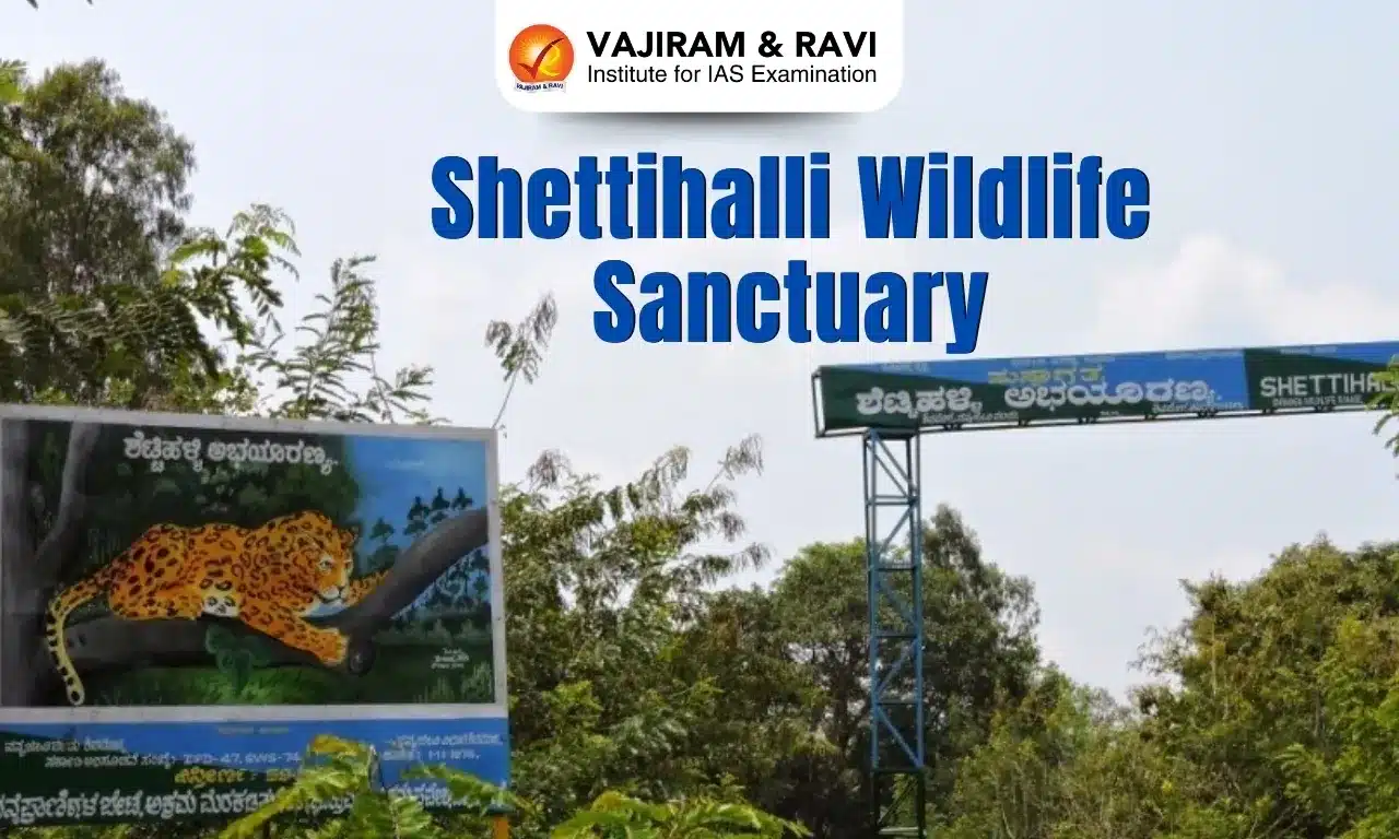
  • It is located in the Shimoga District of Karnataka.
  • It was declared a wildlife sanctuary on 23rd November 1974.
  • It spans an area of 395.6 square kilometres.
  • Inside the sanctuary is located the Tunga Anicut Dam, which shelters otters and water birds. 
  • Mandagadde Natural Bird Sanctuary, present on a small island in the River Tunga, is also a part of this sanctuary.
  • There are a large number of human settlements inside Shettihalli Sanctuary, mainly consisting of families that were displaced by the construction of the Sharavathi Dam in the 1960s.
  • Vegetation: The vegetation in the region mainly consists of dry deciduous, moist deciduous, and semi-evergreen types. 
  • Flora: Major tree species include silver oak, teak, Indian Thorny Bamboo, Calcutta Bamboo, Asan, Tectona Grandis, Sweet Indrajao, Amla, etc.
  • Fauna:
    • It houses mammals like Tiger, Leopard, Wild Dog, Jackal, Gaur, Elephant, Sloth Bear Sambar, Spotted Deer, Wild Pig, Common Langur, Bonnet Macaque, etc.
    • Birds include Hornbills, Kingfishers, Bulbuls, Parakeets, Doves, Pigeons, Babblers, Flycatchers, Munias, Swallows, Woodpeckers, Peafowl, Jungle fowl and Partridges.

Source: DH

Shettihalli Wildlife Sanctuary FAQs

Q1: Shettihalli Wildlife Sanctuary is located in which state?

Ans: Karnataka

Q2: Which dam is located inside Shettihalli Sanctuary?

Ans: Tunga Anicut Dam

Q3: What is the total area covered by Shettihalli Wildlife Sanctuary?

Ans: 395.6 sq. km

Enquire Now