Nauru

Nauru

Nauru Latest News

A remote Pacific nation, Nauru selling passports to fund climate action has approved just six applicants since early this year.
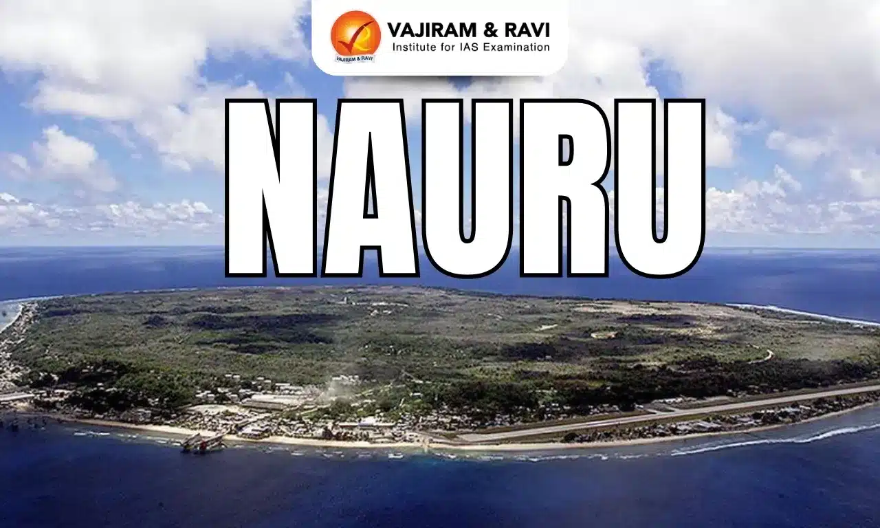
About Nauru

  • Location: Nauru is an island nation and a microstate in Oceania, located in the southwestern Pacific Ocean. 
  • The island is about 1,300 km northeast of the Solomon Islands; its closest neighbour is the island of Banaba, in Kiribati, some 300 km to the east. 
  • Topography: Nauru is a raised, fossilized coral atoll and is one of the three great phosphate rock islands in the Pacific Ocean. 
  • The island is dominated by a central phosphate plateau which is surrounded by coral cliffs. 
  • Phosphate mining has ravaged the interior of the island, leaving about four-fifths of it uninhabitable and uncultivable.
  • It has no official capital city. Located on the southern coast of the island country is the district of Yaren – the de facto capital of Nauru.
  • Language: Their native language is Nauruan, but English is widely spoken as it is used for government and commercial purposes.
  • Political structure: Its constitution, adopted upon gaining independence in 1968, established it as a republic with a Westminster-style parliamentary system of government.

Source: TH

Nauru FAQs

Q1: Is Nauru a sovereign nation?

Ans: Nauru is one of the world's smallest independent states.

Q2: Is Nauru a UN member state?

Ans: The Republic of Nauru was admitted as the 187th member state of the United Nations in September 1999.

CATCH Grant Program

CATCH Grant Program

CATCH Grant Program Latest News

Recently, IndiaAI Independent Business Division (IBD), in collaboration with the National Cancer Grid (NCG), has announced the launch of the Cancer AI & Technology Challenge (CATCH) Grant Program.

About CATCH Grant Program

  • It seeks to support the development and deployment of innovative Artificial Intelligence (AI) solutions to strengthen cancer screening, diagnostics, treatment support, and healthcare operations across India.
  • Grants: This Program will provide up to ₹50 lakh per project to selected teams comprising technology innovators and clinical institutions. The grants will be co-funded by IndiaAI and NCG.
  • The initiative is designed to catalyse piloted deployment of AI solutions within the NCG hospital network, with the potential for future scale-up based on demonstrated clinical impact and operational readiness.
  • Successful pilot projects may also be eligible for an additional scale-up grant of up to ₹1 crore, facilitated by IndiaAI, for wider deployment across the NCG network or through national implementation pathways.
  • The Challenge will focus on high-impact categories including AI-enabled screening, diagnostics, clinical decision support, patient engagement, operational efficiency, research, and data curation.
  • A total of up to 10 proposals will be selected for piloting under this round, based on technical maturity, feasibility, and alignment with healthcare delivery needs.

Who is Eligible for the CATCH Grant Program?

  • Applicants may include startups, health technology companies, academic institutions, and public or private hospitals.
  • Joint applications from Clinical Leads (hospitals or clinicians) and Technical Leads (technology developers) are encouraged.
  • The program will emphasize responsible AI development, clinical validation, and readiness for deployment in Indian healthcare contexts.

Key Facts about IndiaAI

  • It is an Independent Business Division under the Digital India Corporation (DIC) of the Ministry of Electronics and IT (MeitY),
  • It is the implementation agency of the IndiaAI Mission, which aims to democratize AI's benefits across all strata of society, bolster India’s global leadership in AI, foster technological self-reliance, and ensure ethical and responsible use of AI.

Source: PIB

CATCH Grant Program FAQs

Q1: What is the national cancer grid?

Ans: It is a network of major cancer centres, research institutes, patient groups and charitable institutions across India with the mandate of establishing uniform standards of patient care.

Q2: What is Cancer?

Ans: It is a disease in which some of the body’s cells grow uncontrollably and spread to other parts of the body.

Bharat Forecast System

Bharat Forecasting System (BFS)

Bharat Forecast System Latest News

Recently, the union Minister of State (Independent Charge) for Science and Technology, Earth Sciences informed the Rajya Sabha about the Bharat Forecast System.

About Bharat Forecast System

  • It is an indigenously built advanced weather forecasting system.
  • It is based on the newly implemented Triangular Cubic Octahedral (TCo) dynamical grid that enables the model to operate at 6 km horizontal resolution, surpassing its predecessor (GFS T1534 ~ 12km) and typical global operational models having horizontal resolution of 9–14 km.
  • Supercomputing facilities Arka (IITM-Pune) and Arunika (NCMRWF-Noida), enabled the model to be used for real-time weather prediction.
  • The BharatFS was developed with the objective of generating forecasts at the cluster of panchayats level and improving the prediction of extremes.
  •  In research mode, it has demonstrated significant improvement in the rainfall forecast over the core monsoon region and 30% better accuracy for the extreme rainfall forecast compared to the previous operational model.   
  • With the increase in horizontal resolution, the BharatFS is capable of generating distinct forecasts every 6 km.
  • It has demonstrated significant improvement in the skill of predicting the core monsoon region rainfall, with a 30% improvement in the accuracy for the forecasting of extreme rainfall events.
  • The BharatFS was developed by a team of scientists from Indian institutions like IITM-Pune, with support from the NCMRWF-Noida and the India Meteorological Department (IMD).
  • The development and launch of BharatFS has enabled India to upgrade its meteorological services and support neighboring countries, reinforcing regional leadership and self-reliance.
  • Significance: This allows the capturing of local weather features, thus enabling the forecasts to cater to a cluster of panchayats/villages.
  • Localized forecasts help farmers with crop planning, irrigation, and harvesting. Additionally, water authorities can better manage reservoirs during monsoons, reducing flood risk and improving yield resilience.

Source: PIB

Bharat Forecast System FAQs

Q1: What is the Bharat forecasting system in India?

Ans: It is the newly implemented Triangular Cubic Octahedral (TCo) dynamical grid that enables the model to operate at 6 km horizontal resolution.

Q2: Which institution developed the Bharat Forecasting System?

Ans: Indian Institute of Tropical Meteorology (IITM), Pune.

MERITE Scheme

MERITE Scheme

MERITE Scheme Latest News

Recently, the Union Cabinet has approved the proposal for implementation of the ‘Multidisciplinary Education and Research Improvement in Technical Education’ (MERITE) Scheme.

About MERITE Scheme

  • It is a ‘Central Sector Scheme’ which will be implemented in government engineering institutions and Polytechnics in all States/ UTs.
  • This scheme has been formulated in collaboration with the World Bank.
  • Objective: To improve the quality, equity and governance in technical education covering all States/UTs by implementing interventions aligned with the National Educational Policy-2020 (NEP-2020).
  • Funding: Total financial implication of Rs.4200 crore for a period from 2025-26 to 2029-30. Out of Rs.4200 crore, there will be an external assistance of Rs.2100 crore from World Bank as loan.
  • It will have the facility of funds transfer from the Central Government to participating entities through a Central Nodal Agency.
  • Eminent educational institutions like the IITs and IIMs and regulatory bodies in the higher education sector such as the AICTE, NBA etc. will also play a significant role in the scheme implementation. 
  • The initiative emphasizes enhancing students' skills to improve their employability through a comprehensive, multi-faceted approach.
  • Key interventions include offering internship opportunities, updating curricula to align with industry requirements, organizing faculty development programs, and setting up research hubs.
  • Additionally, support will be provided to incubation and innovation centers, skill and maker labs, and language workshops.

Benefits of MERITE Scheme

  • An estimated 275 Government/ Government-aided technical institutions are expected to be selected and supported under the scheme.
  • This will include selected National Institutes of Technology (NITs), State Engineering Institutions, Polytechnics and Affiliating Technical Universities (ATUs).
  • Apart from this, the State/ UT departments handling the technical education sector will also be supported through the MERITE scheme.

Source: PIB

MERITE Scheme FAQs

Q1: What are Central sector schemes (CSS)?

Ans: These are schemes that are fully funded and implemented by the central government of a country, without any financial contribution from the state or local governments.

Q2: What are the foundational pillars of National Educational Policy 2020?

Ans: Access, Equity, Quality, Affordability and Accountability

Dardanelles Strait

Dardanelles Strait

Dardanelles Strait Latest News

Turkey recently closed the Dardanelles strait to shipping traffic due to forest fires in the area.

About Dardanelles Strait

  • It is a narrow strait in northwestern Turkey, connecting the Aegean Sea and the Sea of Marmara.
  • It also separates the continent of Europe from the westernmost tip of Asia Minor. 
  • The strait is named for the ancient city of Dardanus. In ancient times it was called the Hellespont, meaning “Helle’s sea,” in memory of Helle, a mythical princess.
  • It is one of the narrowest straits used for international navigation. The Dardanelles has a length of 61 km and a width ranging from 1.2 to 6.5 km.
  • Another strait, called the Bosporus, connects the Sea of Marmara with the Black Sea. 
  • Together the Bosporus and the Dardanelles provide the only sea connection between the lands lying on the Black Sea and the rest of the world. 
  • The Gallipoli Peninsula lies along the western side of the Dardanelles Strait.
  • Major ports along its shores include Gallipoli, Eceabat, and Çanakkale, all in Turkey.

Source: MSN

Dardanelles Strait FAQs

Q1: The Dardanelles Strait connects which two water bodies?

Ans: Aegean Sea and Sea of Marmara

Q2: The Dardanelles Strait separates which two landmasses?

Ans: Europe and the westernmost tip of Asia Minor.

Q3: What is the approximate length of the Dardanelles Strait?

Ans: 61 km

Q4: Which strait connects the Sea of Marmara to the Black Sea?

Ans: Bosphorus Strait

Lepcha Tribe

Lepcha Tribe

Lepcha Tribe Latest News

Sikkim recently celebrated Tendong Lho Rum Faat, the traditional nature-worshipping festival of the primitive Lepcha tribe.

About Lepcha Tribe

  • They are an indigenous people of eastern Nepal, western Bhutan, Sikkim state, and the Darjeeling district of West Bengal.
  • They are classified as a Scheduled Tribe in the state of Sikkim.
  • The Lepchas call themselves ‘Rongs’ or ‘Rongkups’. 
  • They occupy the southern and eastern slopes of Mt. Kanchenjunga (world’s third highest mountain). 
  • The region Lepchas inhabit varies in elevation from 230 m (750 ft) in the Sikkim basin to the summit of Kanchenjunga at 8,586 m (28,168 ft) above sea level.
  • They are thought to be the earliest inhabitants of Sikkim but have adopted many elements of the culture of the Bhutia people, who entered Sikkim from Tibet in the 14th century and afterward. 
  • While some intermarriage has occurred between the two groups, they tend to stay apart and to speak their own languages, which are dialects of Tibetan. 
  • They speak the language of Lepcha, which has its own script based on Sanskrit.
  • They are a vanishing tribe with a dwindling population. Lepcha has an estimated population of around 42,909 individuals at the time of the Indian Census 2011.
  • Livelihood: Traditionally hunters and gatherers, the Lepchā now also engage in farming and cattle breeding.
  • Religion and Beliefs
    • Originally, Lepchas were nature worshipers and had belief in witch-craftship and spirits. But in due course they embarrassed Buddhism. 
    • The community would traditionally have worshiped Mt. Kanchenjunga, which they regard as their guardian deity.
  • They have regular festivals involving singing and dancing, as well as archery contests.

Source: EM

Lepcha Tribe FAQ's

Q1: The Lepcha tribe is classified as a Scheduled Tribe in which Indian state?

Ans: Sikkim

Q2: Which mountain is regarded as the guardian deity of the Lepcha tribe?

Ans: Mount Kanchenjunga

Q3: In which district of West Bengal do Lepchas mainly live?

Ans: Darjeeling

Khorramshahr-5

Khorramshahr-5

Khorramshahr-5 Latest News

Iran may have developed or prepared for testing its first intercontinental ballistic missile (ICBM), called Khorramshahr-5, according to recent reports.

About Khorramshahr-5

  • It is an intercontinental ballistic missile (ICBM) developed by Iran.
  • It is said to have an operational range of 12,000 kilometers.
  • The missile's speed has been reported to be Mach 16 (approximately 20,000 km/h), typical of ICBMs in mid- or terminal flight.
  • It can reportedly carry a heavy warhead weighing approximately two tons.

What is an Intercontinental Ballistic Missile (ICBM)?

  • An ICBM is a powerful long-range missile designed mainly to carry and deliver nuclear weapons. 
  • Range: ICBMs can travel over 5,500 kilometers, with some capable of reaching up to 16,000 kilometers.
  • Speed: They can fly at speeds faster than 20,000 kilometers per hour, making them hard to intercept.
  • Payload: ICBMs are usually equipped with nuclear warheads but could theoretically carry other weapons, like chemical or biological ones, though this is rare.
  • Deployment: These missiles can be launched from underground silos, mobile land launchers, or submarines at sea.
  • Countries with Operational ICBMs:
    • The countries that have operational ICBMs include Russia, the United States, China, France, India, the United Kingdom, Israel, and North Korea.
    • India’s Agni V is a solid-fueled ICBM.

Source: N18

Khorramshahr-5 FAQs

Q1: Khorramshahr-5 is classified as which type of missile?

Ans: Intercontinental ballistic missile (ICBM)

Q2: Which country developed the Khorramshahr-5 missile?

Ans: Iran

Q3: What is the reported operational range of the Khorramshahr-5 missile?

Ans: 12,000 km

Steel Import Monitoring System 2.0 Portal

Steel Import Monitoring System 2.0 Portal

Steel Import Monitoring System 2.0 Portal Latest News

Recently, the Government of India has revised the advance registration period to apply for registration on the Steel Import Monitoring System (SIMS) 2.0 portal for import of all steel products, except some items.

About Steel Import Monitoring System 2.0 Portal

  • SIMS 2.0 Portal was launched by the Union Ministry of Steels, Government of India.
  • SIMS was introduced in 2019, and has played a crucial role in providing detailed steel import data to the domestic industry.

Features of SIMS 2.0 Portal

  • It provides advanced information about steel imports to both the government as well as relevant stakeholders.
  • It features API integration with multiple government portals, enhancing quality control and streamlining processes for improved efficiency and effectiveness.
  • The portal boasts a robust data entry system, ensuring consistent and authentic data, which promotes transparency and accountability.
  • Integration of various databases enables stakeholders to locate areas of risk and, thereby, permit better risk management.
  • Based on industry feedback, the Ministry has revamped the portal to develop a more effective SIMS 2.0, a significant step forward in monitoring steel imports and promoting the growth of the domestic steel industry.
  • Significance: Availability of such detailed data not only provides input for policy making but also signals areas for production and growth to the domestic steel industry

Source: PIB

Steel Import Monitoring System 2.0 Portal FAQs

Q1: Who launched the steel import Monitoring System 2.0 portal?

Ans: Ministry of Steel

Q2: What is a steel import monitoring system?

Ans: It is a government initiative designed to monitor and regulate the import of steel products into India.

Barak River

Barak River

Barak River Latest News

Communities along the Barak River say their nets have been empty following the June floods in a region once teeming with Hilsa, Rohu, and Catla.

About Barak River

  • It is the second largest river in Northeast India after the Brahmaputra. 
  • It runs through Manipur, Nagaland, Mizoram, and Assam in India, and Bangladesh.
  • Course:
    • Origin: It rises from the Manipur hills, south of Mao in the Senapati district of Manipur, at an elevation of 2,331 m.
    • It flows then along the Nagaland-Manipur border through hilly terrains and enters Assam.
    • Just before flowing into the neighboring country of Bangladesh, the Barak splits into the Surma River and the Kusiyara River. 
    • These two rivers meet to form the Meghna River, which flows southward, joins the Padma River, and finally drains into the Bay of Bengal. 
  • Length: Barak has a length of about 900 km. It spans 524 km in India, with a significant part along the Indo-Bangladesh border. 
  • The Barak River basin, formed by the Barak and its tributaries, drains India, Bangladesh, and Myanmar.
  • The major part of the basin is covered with forest, accounting for 72.58% of the total area, and only 1.92% of the basin is covered by water bodies.
  • The basin is bounded by the Barail Range in the north, the Naga and Lushai Hills in the east, and Bangladesh in the south and west.
  • Tributaries: The key tributaries of the Barak River are Jiri, Chiri, Modhura, Jatinga, Harang, Kalain, Gumra, Dhaleswari, Singla, Longai, Sonai, and Katakhal.
  • The composite Ganga–Brahmaputra–Meghna basin covers nearly one-third of the land area of India.

Source: DTE

Barak River FAQs

Q1: Where is the origin of Barak River?

Ans: It rises from the Manipur hills, south of Mao in the Senapati district of Manipur.

Q2: What is the total length of the Barak River?

Ans: 900 km

Q3: The Barak River basin is bounded to the north by which range?

Ans: Barail Range

Shri Banke Bihari Temple

Shri Banke Bihari Temple

Shri Banke Bihari Temple Latest News

The Supreme Court recently expressed displeasure over the orders passed by Allahabad High Court in a PIL over the historic Banke Bihari Temple in Vrindavan and questioned the use of “intemperate language” against the Uttar Pradesh government.

About Shri Banke Bihari Temple

  • It is a Hindu temple dedicated to Lord Krishna in the holy city of Vrindavan in the Mathura District of Uttar Pradesh.
  • ‘Banke’ means bent, and ‘Bihari’ refers to Vihari, or enjoyer.
  • In this temple, the principal deity stands in the ‘tribhanga’ posture, which is tilted at three angles. Hence, Lord Krishna, who is bent at three places, got the name “Banke”.
  • It was established by Swami Haridas, a guru of the famous singer Tansen.
  • The present temple complex housing ‘Banke Bihari’ was constructed in 1864 and is a unique example of Indian craftsmanship. 
  • Architecture of the temple is influenced by the Rajasthani style, with arches and pillars adding to its magnificence.
  • In this temple, from the walls to the ceiling, the pictures of the deities have been painted through oil paintings. 
  • One unique feature of the Banke Bihari temple is that there are no bells or conchs on the premises.
  • In the freedom struggle, this temple was the main center of revolutionary activities; from here, the revolutionary newspaper “Bundelkhand Kesari” was published secretly.

Source: HT

Shri Banke Bihari Temple FAQs

Q1: Shri Banke Bihari Temple is located in which state?

Ans: It is located in the holy city of Vrindavan in the Mathura District of Uttar Pradesh.

Q2: Who established Shri Banke Bihari Temple?

Ans: It was established by Swami Haridas, a guru of the famous singer Tansen.

Enquire Now