Papua New Guinea

Papua New Guinea

Papua New Guinea Latest News

Recently, as part of the 50th Independence Day celebrations of Papua New Guinea, the Indian Navy Band participated in the grand Military Tattoo at Port Moresby. 

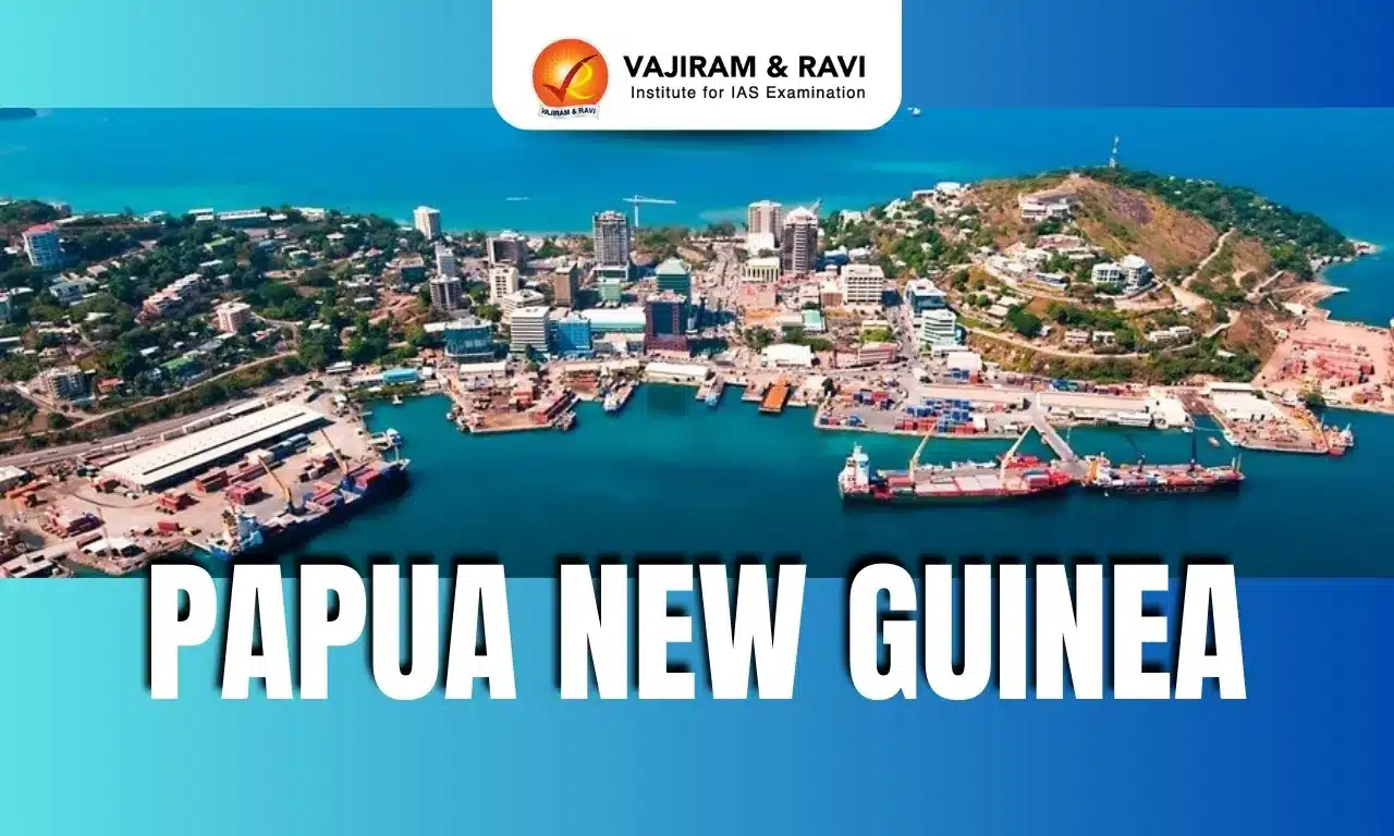
About Papua New Guinea

  • It is an island nation in Oceania located in southwestern Pacific Ocean. 
  • Its neighbors are: Indonesia to the west; Australia to the south and Solomon Islands to the south-east.
  • It is bounded by the Pacific Ocean, Bismarck Sea, Solomon Sea, Coral Sea, Torres Strait and Gulf of Papua.
  • Capital City: Port Moresby

Geographical Features of Papua New Guinea

  • It has several volcanoes and is prone to earthquakes and tsunamis.
  • Much of the island nation is mountainous and covered in tropical rainforests. 
  • Highest Point: The highest point of Papua New Guinea is Mount Wilhelm – at an elevation of 14,793 ft (4,509 m).
  • Rivers: Sepik River and Fly River
  • Volcano: Rabaul Caldera is its most active volcano.
  • Papua New Guinea’s rainforests are rich in biodiversity, housing rare species such as birds of paradise, tree kangaroos, and the Queen Alexandra’s birdwing butterfly.

Government Structure of Papua New Guinea

  • The country is a constitutional monarchy and a member of the Commonwealth.
  • The British monarch, represented by a governor-general, is head of state, and the Prime Minister is head of government.

Source: PIB


Papua New Guinea FAQs

Q1: What is the capital city of Papua New Guinea?

Ans: Port Moresby

Q2: Which mountain range runs along the central part of Papua New Guinea?

Ans: Owen Stanley Range

Yedshi Ramling Ghat Wildlife Sanctuary

Yedshi Ramling Ghat Wildlife Sanctuary

Yedshi Ramling Ghat Wildlife Sanctuary Latest News

A young male tiger recently travelled 450 km from Vidarbha to make his home in Yedshi Ramling Ghat Wildlife Sanctuary, a modest jungle in Maharashtra's that had not seen a big cat settling in decades.

About Yedshi Ramling Ghat Wildlife Sanctuary

  • It is located in the Osmanabad District of Maharashtra.
  • Established on May 23, 1997, the sanctuary spans approximately 22.38 sq.km.
  • The sanctuary lies in the Balaghat mountain range of the Sahyadri hills.
  • A significant attraction within the sanctuary is the ancient Ramling Temple dedicated to Lord Shiva.  
  • Nearby, there’s a waterfall and a cave associated with local legends involving figures from the Ramayana, such as Ravana and Jatayu. 
  • Vegetation: The sanctuary features South Deccan Plateau dry deciduous forests and thorny scrublands.
  • Flora
    • Common tree species include teak (Tectona grandis), sandalwood (Santalum album), neem (Azadirachta indica), and various Acacia species. 
    • Shrubs like Lantana camara and Carissa carandas are also prevalent.
  • Fauna: Wildlife in the sanctuary includes leopards, sloth bears, blackbucks, jackals, wolves, foxes, monitor lizards, porcupines, barking deer, and hares. 

Source: PTI

Yedshi Ramling Ghat Wildlife Sanctuary FAQs

Q1: Yedshi Ramling Ghat Wildlife Sanctuary is located in which Indian state?

Ans: Maharashtra

Q2: The Yedshi Ramling Ghat Wildlife Sanctuary lies in which mountain range?

Ans: Balaghat Range of Sahyadri hills

Q3: Which ancient temple is located within the Yedshi Ramling Ghat Wildlife Sanctuary?

Ans: Ramling Temple dedicated to Lord Shiva.

Missile Technology Control Regime (MTCR)

Missile Technology Control Regime

Missile Technology Control Regime Latest News

U.S. President Donald Trump is expected to unilaterally reinterpret the Missile Technology Control Regime (MTCR) agreement it signed in 1987 to sell sophisticated "Reaper" style and other advanced military drones abroad, according to U.S. officials.

About Missile Technology Control Regime

  • It is an intergovernmental organization whose members implement voluntary export controls on missiles capable of delivering nuclear, chemical, or biological weapons, as well as related technology.
  • Formation:
    • It was founded in 1987 by Canada, France, Germany, Italy, Japan, the United Kingdom, and the United States to control the spread of nuclear-capable missiles and the technology used in their production. 
    • In 1993, the group broadened its focus to include chemical and biological weapons-capable missiles.
  • Member States: 
    • There are currently 35 countries that are members (Partners) of the MTCR.
    • India became the 35th member of the MTCR on 27 June 2016.
  • Member states of the regime agree to impose export controls on missiles, defined as rocket systems and unmanned aerial vehicle systems (UAVs), as well as a wide variety of technical components and software related to missile production. 
  • The equipment, software and technology covered by the agreement are broken down into Category I and Category II items. 
    • Category I items are strictly controlled under the organization’s guidelines; these items are missiles capable of delivering a warhead weighing 500 kilograms or more to ranges exceeding 300 kilometers, as well as their major subsystems like engines and re-entry vehicles. 
    • Member countries have more discretion regarding the transfer of Category II items, which are considered less sensitive, such as propulsion and launch components, and missile systems with a range of at least 300 kilometers, no matter the payload.

Consequences for Violating MTCR Guidelines

  • MTCR guidelines are an informal standard set by a selected group of countries rather than an international treaty adopted by its members. 
  • The agreement has no legally binding provisions or regime-wide compliance procedures. 
  • If disagreements occur, member states can consult bilaterally to clarify the issue, or bring their concerns up at the MTCR’s annual policy-level Plenary Meeting.
  • While the agreement outlines no legal repercussions for breaking the adopted standards of the MTCR, the United States government has passed legislation allowing for the introduction of sanctions against any nations that export items restricted by the MTCR agreement.

Why Join the MTCR?

  • Joining the MTCR provides member countries with international legitimacy and signals support for the nonproliferation of missiles.
  • Adoption of the treaty may also assist in legitimizing existing long-range ballistic missile capabilities in the eyes of other MTCR members by showcasing responsible handling of existing missile technology.

Source: REUT

Missile Technology Control Regime FAQs

Q1: The Missile Technology Control Regime (MTCR) was founded in which year?

Ans: It was founded in 1987 by Canada, France, Germany, Italy, Japan, the United Kingdom, and the United States.

Q2: Is India a member of Missile Technology Control Regime?

Ans: India became the 35th member of the MTCR on 27 June 2016.

Q3: Are Missile Technology Control Regime (MTCR) guidelines legally binding on member states?

Ans: No, MTCR agreement has no legally binding provisions or regime-wide compliance procedures.

WHO Model Lists of Essential Medicines

WHO Model Lists of Essential Medicines

WHO Model Lists of Essential Medicines Latest News

Recently, the World Health Organization (WHO) released updated editions of its Model Lists of Essential Medicines (EML), adding new treatments for various types of cancer, diabetes, and obesity associated with comorbidities

About WHO Model Lists of Essential Medicines

  • It acts like a register of minimum medicine needs for every health-care system. 
  • It is updated every two years by the Expert Committee on Selection and Use of Essential Medicines.
  • History of the Essential Medicines List
    • The first country in the world to compose its EML was Tanzania in 1970.
    • Then in 1975, the World Health Assembly requested WHO to assist member states in selecting and procuring essential medicines, assuring good quality at reasonable cost.
    • Subsequently, the first WHO model list of essential medicines was published in the year 1977 which contained 186 medicines.
    •  WHO selects essential medicines based on public health relevance, evidence of benefits and harms, and with consideration of costs, affordability and other relevant factors.
    • Globally, over 150 countries have national essential medicines lists based on the WHO Model List.

What are Essential Medicines?

  • As per the World Health Organisation (WHO), Essential Medicines are those that satisfy the priority health care needs of the population.
  • The list is made with consideration to disease prevalence, efficacy, safety and comparative cost-effectiveness of the medicines.
  • Such medicines are intended to be available in adequate amounts, in appropriate dosage forms and strengths with assured quality. They should be available in such a way that an individual or community can afford.

Source: WHO

WHO Model Lists of Essential Medicines FAQs

Q1: How many members are in WHO?

Ans: 194 Member States

Q2: What is the purpose of the World Health Organization?

Ans: WHO works worldwide to promote health, keep the world safe, and serve the vulnerable.

Pavagadh Kalika Mata Temple

Pavagadh Kalika Mata Temple

Pavagadh Kalika Mata Temple Latest News

Six persons were killed on Saturday after the cable wire of a ropeway meant for material transport at the Kalika Mata temple snapped, causing the cable car to crash to the ground in the Pavagadh area of Gujarat’s Panchmahal district.

About Pavagadh Kalika Mata Temple

  • It is a Hindu temple complex and pilgrim centre at the summit of Pavagadh Hill in Panchmahal District, Gujarat.
  • The presiding deity is Maa Kali (Kalika Mata), a form of Goddess Durga/Shakti.
  • It is one of the 51 Shakti Peethas in India.
  • It lies at an elevation of 762 meters above sea level. It is located on a cliff surrounded by dense forest cover. 
  • The temple is believed to be over 1,000 years old, with its origins tracing back to the 10th–11th centuries. Mahakali’s idol was installed here in the 12th century.
  • It saw patronage and renovations under the Solanki Rajput dynasty, who ruled large parts of Gujarat.
  • During the reign of Sultan Mahmud Begada, Pavagadh and Champaner became key religious and cultural centers.
  • Today, the temple is a part of the Champaner-Pavagadh Archaeological Park, which was declared a UNESCO World Heritage Site in 2004.

Pavagadh Kalika Mata Temple Architecture

  • Built with stone, the temple structure reflects medieval Hindu temple architecture with intricate carvings, domes, and an inner sanctum (garbhagriha).
  • The sanctum houses the black stone idol of Mahakali—the upper part visible to devotees, while the lower part remains underground, symbolizing mystery and divine grounding.
  • The temple has been refurbished in recent years, with improved ropeway connectivity and facilities while maintaining its sacred ambiance.

Source: IE

Pavagadh Kalika Mata Temple FAQs

Q1: The Pavagadh Kalika Mata Temple is located in which state?

Ans: Gujarat

Q2: The origins of the Pavagadh Kalika Mata Temple trace back to which period?

Ans: 10th–11th centuries

Q3: Which dynasty patronized and renovated the Pavagadh Kalika Mata Temple?

Ans: It saw patronage and renovations under the Solanki Rajput dynasty, who ruled large parts of Gujarat.

Q4: The Pavagadh Kalika Mata Temple is part of which UNESCO World Heritage Site?

Ans: Champaner-Pavagadh Archaeological Park

Himalayan Brown Bear

Himalayan Brown Bear

Himalayan Brown Bear Latest News

A rare sighting of a Himalayan brown bear, reportedly with its family, in the Nelong and Jadung Valleys has sparked excitement within Gangotri National Park, Uttarakhand.

About Himalayan Brown Bear

  • It is the largest mammal found in the high-altitude regions of the Himalayas. 
  • It is one of the most ancient brown bear lineages. 
  • Scientific Name: Ursus arctos isabellinus
  • It is also known as the “Himalayan Red Bear” and the “Isabelline Bear”. It is known as Denmo in the Ladakhi language.
  • It is believed by some that the bear’s ability to walk upright probably gave rise to the legend of the Yeti or “Abominable Snowman.” 

Himalayan Brown Bear Distribution

  • They are found in northwestern and central Himalayas, including Pakistan, India, Nepal, the Tibetan Autonomous Region of China, and Bhutan. 
  • They are found above the timberline, between 3,000 and 5,500 meters (9,800 and 18,000 feet) above sea level.
  • In India, this species exists in small isolated populations in the fragmented alpine and subalpine habitats of Jammu and Kashmir, Himachal Pradesh, and Uttarakhand. 

Himalayan Brown Bear Features

  • Males are larger than females, with an average length of 1.9 m and weight of 135 kg, in comparison to the female averages of 1.6 m and 70 kg. 
  • It has thick fur which is most often sandy or reddish-brown in colour. 
  • Food: Omnivorous, eating grasses, roots, bulbs and other plants, insects, and small mammals such as marmots, pikas, and voles. 
  • They hibernate in dens during the winter. 
  • They are solitary and only interact with each other to mate or fight over mates. The only exception to this is a mother and her cubs.
  • Life span: 20 to 30 years in the wild.

Himalayan Brown Bear Conservation Status

  • IUCN Red List: Critically Endangered
  • Wildlife (Protection) Act of 1972: Schedule I
  • CITES – Appendix I

Source: NIE

Himalayan Brown Bear FAQs

Q1: What is the scientific name of the Himalayan Brown Bear?

Ans: Ursus arctos isabellinus

Q2: In which altitude range is the Himalayan Brown Bear typically found?

Ans: 3,000 to 5,500 meters

Q3: What is the IUCN status of the Himalayan brown bear?

Ans: Critically Endangered

Q4: What type of diet does the Himalayan Brown Bear follow?

Ans: Omnivorous

Q5: What is the average lifespan of a Himalayan Brown Bear in the wild?

Ans: 20–30 years

Red Sea

Red Sea

Red Sea Latest News

Recent undersea cable cuts in the Red Sea disrupted internet access in parts of Asia and the Middle East.

About Red Sea

  • It is a semi-enclosed inlet of the Indian Ocean between Africa and Asia.
  • It is connected to the Arabian Sea and the Indian Ocean to the south through the Gulf of Aden and the narrow strait of Bab el Mandeb.
  • The northern portion of the Red Sea is bifurcated by the Sinai Peninsula into the Gulf of Aqaba and the Gulf of Suez, where it is connected to the Mediterranean Sea via the famous Suez Canal.
  •  It is known for its hot and salty waters and is a crucial maritime route between Europe and Asia.
  • The Red Sea's unique color changes are due to algae blooms. Geologically, it lies in a fault depression between the Arabian and North African tectonic plates.
  • Bordering Countries: Egypt, Saudi Arabia, Yemen, Sudan, Eritrea and Djibouti.
  • Five major types of mineral resources are found in the Red Sea region: petroleum deposits, evaporite deposits, sulfur, phosphates, and the heavy-metal deposits.
  • Islands: Tiran Island, which is located near the mouth of the Gulf of Aqaba, and Shadwan Island, which is located at the entrance of the Gulf of Suez.

Source: DD News

Red Sea FAQs

Q1: What is the primary reason for the Red Sea's distinct coloration?

Ans: It contains a cyanobacteria called Trichodesmium erythraeum, which turns the normally blue-green water a reddish-brown.

Q2: Which major shipping canal connects the Red Sea to the Mediterranean Sea?

Ans: Suez Canal

Notifiable Diseases

Notifiable Diseases

Notifiable Disease Latest News

An eminent New York-based oncologist welcomes a recent parliamentary committee recommendation to declare cancer a notifiable disease in India.

About Notifiable Disease

  • A notifiable disease is any disease that is required by law to be reported to government authorities. 
  • Effective notification allows the authorities to monitor the disease and provides early warning of possible outbreaks.
  • A notifiable disease is one for which regular and timely information regarding individual cases is considered necessary for the prevention and control of the disease.
  • Criteria for Declaring a Disease as Notifiable may be:
    • It is of interest to national or international regulations or control programs.
    • Its national/ State/District incidence.
    • Its severity (potential for rapid mortality).
    • Its communicability/Its potential to cause outbreaks.
    • Significant risk of international spread.
    • The socio-economic costs of its cases.
    • Its preventability.
    • Evidence that its pattern is changing.
  • In other words, diseases which are considered to be serious menaces to public health are included in the list of notifiable diseases.
  • Hence the list of notifiable diseases vary from
    • Country to country 
    • Within the same country
      • Between the States 
      • Between urban and rural areas
  • Responsibility
    • Medical practitioners and diagnostic labs are required to notify the local health department of cases of notified diseases. 
    • In India, the state government is responsible for determining which diseases must be reported to the medical officer in their area and to notify the diseases. 
    • The government and regional authorities maintain a list of notifiable diseases in India, which is subject to change as new diseases are added or existing ones are removed.
  • Examples: Cholera, tuberculosis, AIDS, dengue, hepatitis, leprosy, meningitis, plague, and measles.
  • WHO’s International Health Regulations (1969): Mandates countries to report diseases for global surveillance and advisory purposes.

Source: DEVD

Notifiable Disease FAQs

Q1: What is a notifiable disease?

Ans: A disease that must legally be reported to government authorities.

Q2: Why is notification of diseases important?

Ans: It allows authorities to monitor diseases and provides early outbreak warnings.

Q3: In India, who is primarily responsible for determining which diseases must be notified?

Ans: State Governments

International Earth Sciences Olympiad

International Earth Sciences Olympiad

International Earth Sciences Olympiad Latest News

Recently, the union Minister of State (Independent Charge) for Science & Technology felicitated the student winners comprising the Indian team at the 18th "International Earth Science Olympiad" (IESO-2025) held at Jining, China.

About International Earth Sciences Olympiad

  • It was established in 2003 by the International Geoscience Education Organization (IGEO).
  • It aims to generate awareness of earth sciences through teamwork, collaboration, exchanging ideas, and competition.
  • It is an annual competition for secondary school students (Class IX–XII) worldwide.
  • India has been participating since 2007 and hosted the 10th edition at Mysore in 2013.

Government of India’s Initiatives

  • To encourage the participation of Indian students (of grades 9 to 12) the Ministry of Earth Sciences (MoES) supports the Indian National Earth Science Olympiad (INESO) held in various schools across India.
  • The INESO is a national-level prelude to the IESO, which is facilitated annually by the Geological Society of India in collaboration with MoES and select educational bodies in the country.
  • Topics for assessment: Geology, Meteorology, Oceanography, and Environmental sciences.
  • Top-performing participants from INESO get to represent India at the IESO, which also receives support from the MoES.
  • The MoES supports the INESO and IESO as part of the REACHOUT scheme under the PRITHVI (PRITHvi Vigyan) scheme.

Source: PIB

International Earth Sciences Olympiad FAQs

Q1: What is the International Olympiad in Earth Science?

Ans: It is an educational event for secondary school students globally, organised by the International Geoscience Education Organisation (IGEO).

Q2: Where is the Earth Science Olympiad 2025 organised?

Ans: Jining, Peoples Republic of China

Ratle Hydroelectric Project

Ratle Hydroelectric Project

Ratle Hydroelectric Project Latest News

Five persons were injured when a landslide struck the vital Rattle hydroelectric project in Kishtwar recently.

About Ratle Hydroelectric Project

  • It is a hydroelectric power plant under construction in Kishtwar District, Jammu and Kashmir.
  • It is an 850 MW run-of-river scheme located on the Chenab River.
  • The project is being developed by Ratle Hydroelectric Power Corporation (RHPCL), which was formed as a joint venture (JV) between Jammu & Kashmir State Power Development Corporation (JKSPDC) and India’s state-owned National Hydroelectric Power Corporation (NHPC).
  • NHPC and JKSPDC hold 51% and 49% equity ownership in RHPCL, respectively.
  • The project includes a 133-meter-tall and 194.8-meter-long concrete gravity dam, a diversion dam, and an underground powerhouse on the right bank of the river.
  • The underground powerhouse measuring 168 m x 24.5 m x 49 m will house four 205 MW Francis turbine-generating units and a 30 MW auxiliary turbine-generating unit.
  • The project is expected to generate 3,137 GWh of electricity.
  • Pakistan has frequently alleged that the project violates the Indus Waters Treaty of 1960.

Source: TRIB

Ratle Hydroelectric Project FAQs

Q1: Where is the Ratle Hydroelectric Project located?

Ans: It is located in Kishtwar District, Jammu and Kashmir.

Q2: What is the total installed capacity of the Ratle Hydroelectric Project?

Ans: 850 MW

Q3: On which river is the Ratle Hydroelectric Project being constructed?

Ans: Chenab River

Enquire Now