Kenya

Kenya

Kenya Latest News

The Indian Navy’s First Training Squadron (1TS), comprising INS Tir, INS Sujata, INS Shardul, and ICGS Sarathi, made a port call at Mombasa, Kenya, recently.

Recent Development

  • The deployment is part of a long-range training mission in the South West Indian Ocean Region, with earlier visits to Seychelles, Mauritius, La Réunion, and Mozambique.
  • The visit involves joint training, Maritime Partnership Exercise (MPX), Passage Exercise (PASSEX), professional exchanges, yoga sessions, cultural performances, and community outreach.
  • The initiative aligns with the vision of MAHASAGAR – Mutual and Holistic Advancement for Security and Growth Across Regions, reflecting India’s commitment to maritime security and regional cooperation.

Political and Geographical Features of Kenya

  • Location: Eastern Africa, bordering Somalia (NE), Ethiopia (N), South Sudan (NW), Uganda (W), Tanzania (S), and the Indian Ocean (E).
  • Political Significance: Nairobi hosts UNEP (United Nations Environment Programme) and UN-HABITAT headquarters.
  • Geographical Features:
    • Almost bisected by the Equator.
    • Major lakes: Lake Victoria (shared with Uganda & Tanzania), Lake Turkana.
    • Rivers: Athi/Galana, Tana, Mara.
    • Mountain Ranges: Aberdare, Mau Escarpment.
    • Highest Peak: Mount Kenya (second highest in Africa after Kilimanjaro).

Source: PIB

Kenya FAQs

Q1: Why is Kenya strategically important for India?

Ans: Because of its Indian Ocean coastline, trade hub role, and location in the South West Indian Ocean Region, vital for maritime security.

Q2: Which UN organizations are headquartered in Nairobi, Kenya?

Ans: UNEP (United Nations Environment Programme) and UN-HABITAT (United Nations Human Settlements Programme).

Q3: What is the highest point in Kenya?

Ans: Mount Kenya, the second highest peak in Africa.

Q4: Which major lakes does Kenya share with neighboring countries?

Ans: Lake Victoria (shared with Tanzania and Uganda) and Lake Turkana.

Santorini and Kolumbo Volcanoes

Santorini and Kolumbo Volcanoes

Santorini and Kolumbo Volcanoes Latest News

Recently, an earthquake swarm of over 1,200 quakes around Santorini revealed that Santorini and the submerged Kolumbo volcano share an underground magma reservoir.

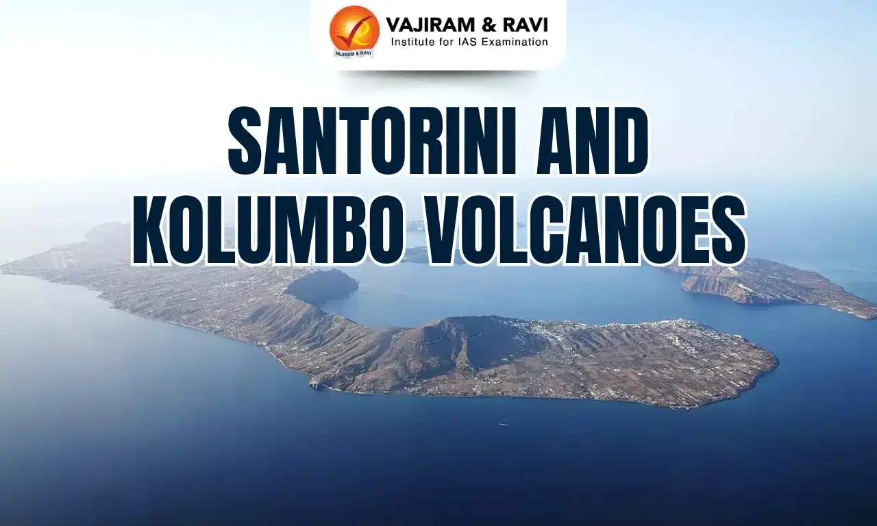
About Santorini Volcano

  • Located in the southern Aegean Sea, about 200 km southeast of mainland Greece.
  • It is the largest island of a small archipelago, forming the remnant of a volcanic caldera.
  • Part of the South Aegean Volcanic Arc, and the southernmost member of the Cyclades group.
  • Famous for the Minoan (Thera) eruption (~1600 BCE), one of the largest eruptions in recorded history, which contributed to the collapse of the Minoan civilisation and may have triggered a volcanic winter.

About Kolumbo Volcano

  • A submarine volcano located about 7 km northeast of Santorini.
  • Last major eruption: 1650 AD, which caused tsunamis and toxic gas emissions, leading to destruction on Santorini and nearby islands.
  • It forms part of the Christiana-Santorini-Kolumbo (CSK) volcanic field.

Recent Findings

  • This is the first scientific evidence of a magmatic connection between the two volcanoes, complicating eruption prediction and risk assessment.
  • Both volcanoes lie in the Hellenic Volcanic Arc, one of the most active volcanic zones in Europe, making them critical for global geological studies and disaster management planning.
  • Seismic & GPS data (2024–2025): Showed swelling of Santorini due to magma accumulation.
  • Earthquake migration (Jan 2025): Quakes shifted from Santorini toward Kolumbo, while both volcanoes simultaneously deflated, indicating a shared magma source.
  • Significance: Proves that interconnected volcanic systems exist and may behave in coordination (similar to volcanoes in Hawaii, Iceland, and Kamchatka).
  • Calls for real-time, high-resolution monitoring to improve eruption forecasting and minimise risks.

Source: SCN

Santorini and Kolumbo Volcanoes FAQs

Q1: Where are Santorini and Kolumbo volcanoes located?

Ans: They are part of the Hellenic Volcanic Arc in the southern Aegean Sea, about 200 km from mainland Greece.

Q2: What was the historical significance of the Santorini eruption?

Ans: The Minoan eruption (~1600 BCE) devastated the Minoan civilisation, causing earthquakes, tsunamis, and possibly climatic impacts.

Q3: When did Kolumbo last erupt?

Ans: In 1650 AD, a volcanic eruption produced tsunamis and toxic gas emissions that killed people and livestock on nearby islands.

Gaia Telescope 3D Map

Gaia Telescope 3D Map

Gaia Telescope 3D Map Latest News

Recently, a new 3D map created using data from the Gaia Telescope shows stellar nurseries (star-forming regions) within 4,000 light-years of the Sun in all directions.

Latest Development

  • This is the most detailed chart of glowing hydrogen gas clouds, helping scientists understand how stars form and the dynamics of turbulent interstellar gas.
  • The study integrates Gaia dust maps with the radiation impact of 87 massive O-type stars, which emit intense ultraviolet light capable of ionising hydrogen gas.
  • The resulting simulation shows glowing hydrogen clouds, aligning closely with older hydrogen emission maps, but with much higher precision.

About the GAIA Mission

  • Full name: Originally Global Astrometric Interferometer for Astrophysics (GAIA), simplified to Gaia.
  • Launch Year: 2013, by the European Space Agency (ESA).
  • Objective: To create the most precise 3D map of the Milky Way Galaxy through astrometry (measurement of star positions, distances, and movements).
  • Position: Located at Lagrange Point 2 (L2), about 1.5 million km from Earth, providing a stable and unobstructed cosmic view.

Structure and Instruments

  • Twin Telescopes: Capture light from two directions simultaneously.
  • Digital camera: Contains nearly 1 billion pixels, making it the largest camera ever flown in space.
  • Three Main Instruments:
    • Astrometer – Measures precise positions of celestial objects.
    • Photometer – Determines the brightness and temperature of stars.
    • Spectrometer – Identifies chemical composition and radial motion of stars.

Source: SCN

Gaia Telescope 3D Map FAQs

Q1: What is the Gaia Telescope?

Ans: The Gaia Telescope is a space observatory by ESA, designed to create the most precise 3D map of the Milky Way.

Q2: When was Gaia launched?

Ans: It was launched in 2013 by the European Space Agency.

Q3: Where is Gaia located?

Ans: Gaia is positioned at the Lagrange Point 2 (L2), 1.5 million km from Earth.

Q4: What is Gaia’s main contribution to astronomy?

Ans: Gaia provides detailed astrometric data of over 1.8 billion stars, aiding in the study of stellar evolution and galaxy formation.

Grue Jay

Grue Jay

Grue Jay Latest News

Researchers at the University of Texas at Austin have identified the first known hybrid of these species, a bird nicknamed the "Grue Jay," according to a 2025 study published in Ecology and Evolution.

About the Grue Jay

  • The Grue Jay is a rare natural hybrid between the Blue Jay (Cyanocitta cristata) and the Green Jay (Cyanocorax yncas).
  • It displays turquoise-blue plumage with black facial markings, combining features of both parent species.
  • First spotted in San Antonio, Texas (2023) by a homeowner, later confirmed by researchers from the University of Texas at Austin.

Key Features of the Grue Jay

  • Appearance: Body and tail resemble Blue Jay, but the face mask resembles Green Jay.
  • Behaviour: Calls are a blend of both species; they appeared solitary rather than socially integrated.
  • Reproduction: Being a male, it may be capable of reproducing, though hybrid sterility remains a risk.
  • Symbolism: Like other hybrids such as the “Pizzly Bear” (polar bear–grizzly) and “Zonkey” (zebra–donkey), the Grue Jay highlights species interactions under stress.

Source: SCN

Grue Jay FAQs

Q1: What is Grue Jay?

Ans: The Grue Jay is a rare hybrid bird formed from a cross between a Blue Jay and a Green Jay.

Q2: Where was it discovered?

Ans: It was first sighted in San Antonio, Texas, in 2023.

Q3: Why is it significant?

Ans: It is considered a climate change indicator as range shifts due to warming led to the hybridization.

Q4: How long ago did Blue Jays and Green Jays diverge?

Ans: Around 7 million years ago in the late Miocene Epoch.

Hanle Dark Sky Reserve (HDSR)

Hanle Dark Sky Reserve

Hanle Dark Sky Reserve (HDSR) Latest News

The Hanle Dark Sky Reserve (HDSR) in Ladakh recently hosted its third annual Star Party.

About Hanle Dark Sky Reserve (HDSR)

  • The Hanle Dark Sky Reserve (HDSR) was notified in December 2022 by the Government of Ladakh.
  • It is India’s first International Dark Sky Reserve, centred around the Indian Astronomical Observatory (IAO) at Hanle, managed by the Indian Institute of Astrophysics (IIA) under the Department of Science and Technology (DST).
  • The Reserve is a science-driven socio-economic development project, built on two pillars:
    • Curtailing light pollution in the region.
    • Promoting astro-tourism for local livelihood generation.
  • It is part of the Changthang Wildlife Sanctuary, located at 4,500 metres altitude, offering Bortle-1 dark skies (the darkest category).
  • The UT Ladakh administration supports the project by funding astro-tourism initiatives and light management plans.
  • The event was jointly organised by the Indian Institute of Astrophysics (IIA), the Department of Wildlife Protection of UT Ladakh, and the Bhabha Atomic Research Centre (BARC).

What is a Dark Sky Reserve?

  • Defined by the International Dark Sky Association (IDSA) as a large land area (at least 700 km²) with exceptionally dark skies, protected for scientific, cultural, natural, and public enjoyment.
  • Requires:
    • A core area free from light pollution.
    • A surrounding buffer area to protect core values.
    • A Lighting Management Plan (LMP) covering at least 80% population and area.
    • Regular annual reporting to IDSA.

Source: PIB

Foreign Contribution Regulation Act (FCRA) FAQs

Q1: What is Hanle Dark Sky Reserve (HDSR)?

Ans: It is India’s first International Dark Sky Reserve, located in Ladakh, dedicated to astronomy, research, and astro-tourism.

Q2: When was HDSR established?

Ans: It was notified in December 2022 by the Government of Ladakh.

Q3: Why is Hanle ideal for astronomy?

Ans: Its high altitude (4,500 m), dry climate, sparse population, and clear skies make it perfect for observing faint celestial bodies.

India’s Dugong Conservation Reserve

Dugong Conservation Reserve

India’s Dugong Conservation Reserve Latest News

Recently, the International Union for Conservation of Nature (IUCN) has formally adopted a motion recognising India’s first Dugong Conservation Reserve in Palk Bay.

About India’s Dugong Conservation Reserve

  • It is India’s first Dugong Conservation Reserve.
  • It was established on September 21, 2022, by the Tamil Nadu government under the Wildlife Protection Act, 1972,
  • It covers 448.34 sq. km. in northern Palk Bay.
  • The region is home to over 12,250 hectares of seagrass meadows, vital feeding grounds for dugongs (Dugong dugon).       
  • Seagrasses also support a host of other marine species, making the reserve ecologically significant.

Key Facts about Dugong

  • Dugongs (Dugong dugon) are the only herbivorous mammals found in India’s marine ecosystems.
  • Appearance: It is known as the sea cow, but resembles a cross between a seal and a whale, and is distributed through the Indo-Pacific region.
  • Distribution: They are found along the Indian coastline, primarily inhabiting warm waters around the Andaman and Nicobar Islands, the Gulf of Mannar, Palk Bay, and the Gulf of Kutch. The dugong is a long-lived species, able to live up to 70 years.
  • Habitat: Dugongs are restricted to shallow waters, where they spend the day feeding on seagrasses of the genera Cymodocea, Halophila, Thalassia, and Halodule.
  • Reproduction of Dugong 
    • Individuals reach reproductive maturity after only nine or ten years and can give birth at intervals of around three to five years.
    • Due to its slow reproductive cycle, extended time to maturity, and infrequent calving, a dugong population’s maximum potential growth rate is estimated to be just about 5% per year.
  • Conservation status of Dugong
    • IUCN: Vulnerable
    • CITES: Appendix I
    • Wildlife Protection Act 1972: Schedule I

Source: TH

India’s Dugong Conservation Reserve FAQ's

Q1: Which is the first state to set up India's first dugong conservation reserve?

Ans: Tamil Nadu

Q2: What is the IUCN status of dugong in India?

Ans: Vulnerable

Aralam Wildlife Sanctuary

Aralam Wildlife Sanctuary

Aralam Wildlife Sanctuary Latest News

Recently, herpetologists surveyed the Aralam Wildlife Sanctuary and documented 16 species of lizards across varied habitats.

About Aralam Wildlife Sanctuary

  • Location: It is located on the western slopes of Western Ghats and is the northern most wildlife sanctuary of Kerala.
  • It was declared a Sanctuary during 1984.
  • Topography:  Its altitude ranges from 650 to 1150m.                                        
  • Rivers: The River Cheenkannipuzha forms the main drainage system on the southern side.  Narikkadavu thodu, Kurukkathodu and Meenumuttithodu from the northern upper reaches flow southwards to join Cheenkannipuzha.
  • Vegetation: The forest types include West Coast tropical evergreen  forest. , West coast semi-evergreen forests, South Indian moist deciduous forest, Southern hilltop evergreen forest and plantations.                                                                                                                        
  • Flora: The major tree species are Artiocarpus heterophyllus, Bishofia javanica, Calophyllum elatum, Cannarium strictum, Cullenia exarillita, Dipterocarpus sp etc.
  • Fauna: Elephant, Gaur, Tiger, Panther,Sambar, Spotted deer, Nilgiri langur, Bonnet macaque, Common langur, Wild dog, common otter, Malabar giant squirrel etc are the major mammals found here.

Source: TH

Aralam Wildlife Sanctuary FAQs

Q1: Where is Aralam Wildlife Sanctuary located?

Ans: Kerala

Q2: What is a notable phenomenon observed in Aralam Wildlife Sanctuary?

Ans: Butterfly migration

Coffee Board of India

Coffee Board of India

Coffee Board of India Latest News

Recently, the Coffee Board of India held capacity-building programmes to increase the number of growers registering on its mobile application for EU Deforestation Regulation compliance.       

About Coffee Board of India

  • It is a statutory organization constituted under Section (4) of the Coffee Act, 1942.
  • Members: The Board comprises 33 members representing all sectors of the coffee industry who are nominated by the central government and hold office for a period of three years.
  • The remaining 32 Members representing various interests are appointed as per provisions under Section 4(2) of the Coffee Act read with Rule 3 of the Coffee Rules, 1955.
  • Functions: The Board is mainly focusing its activities in the areas of research, extension, development, market intelligence, external & internal promotion and welfare measures.
  • Nodal Ministry: It functions under the administrative control of the Ministry of Commerce and Industry, Government of India.
  • Head office: The head office of the Coffee Board is situated in Bangalore.

Key Facts about Coffee cultivation

  • It is a tropical plant generally grown under shady trees.
  • It is grown on hill slopes at elevations from 600 to 1,600 metres above sea level.
  • The vast majority of the world’s coffee comprises two species — Coffea Arabica (Arabica) and Coffea Canephora (Robusta).
  • Distribution: In India coffee is largely cultivated in Karnataka, Kerala, Tamil Nadu, Andhra Pradesh and Odisha, among which, Karnataka produces the most with over 70% of the total output.
  • Required climatic conditions for Coffee cultivation
    • Climate: Hot and humid climate for its growth.
    • Temperatures: Between 15°C and 28 °C
    • Rainfall: 150 to 250 cm.
    • Soil: Well-drained, loamy soil containing a good deal of humus and minerals like iron and calcium are ideal for coffee cultivation.
    • Dry weather is necessary at the time of ripening of the berries.

Source: TH

Coffee Board of India FAQs

Q1: Where is the headquarter of Coffee Board of India?

Ans: Bengaluru

Q2: Which state is the largest producer of coffee in India?

Ans: Karnataka

Tungabhadra River

Key Facts about Tungabhadra River

Tungabhadra River Latest News

Police retrieved bodies of three Karnataka youngsters from Tungabhadra river near Mantralayam in Kurnool district recently.

About Tungabhadra River

  • It is a significant peninsular river in southern India, flowing through the states of Karnataka and Andhra Pradesh.
  • It is the principal tributary of the Krishna River.
  • The Hindus consider this river sacred, and there is a mention of the river in the Ramayana, where it is referred to as Pampa. 
  • Course
    • It originates at Koodli, near Shimoga district in the state of Karnataka, where two rivers—the Tunga River and the Bhadra River—meet and give birth to the Tungabhadra.
      • Both the Tunga & Bhadra Rivers originate on the eastern slopes of the Western Ghats.
    • From this starting point, the Tungabhadra River travels a length of 531 km before joining the Krishna River at Sangamaleshwaram in Andhra Pradesh.
    • The Krishna River finally ends in the Bay of Bengal.
    • It runs for 382 km in Karnataka, forms the boundary between Karnataka and Andhra Pradesh for 58 km, and further runs for the next 91 km in Andhra Pradesh.
  • The total catchment area of the river is 69,552 sq.km. up to its confluence with Krishna.
  • The landscape around the Tungabhadra is dominated by massive piles of granite in hues of grey, ochre, and pink. 
  • The locked land that lies in the north of the Tungabhadra River between the Tungabhadra and the Krishna River is called the "Raichur Doab".
  • It is influenced chiefly by the southwest monsoon.
  • Major Tributaries: Varada River and Hagari (Vedathy) River.
  • The river has several dams and reservoirs built on it, including the Tunga Anicut Dam, the Bhadra Dam, the Hemavathy Dam, and the Tungabhadra Dam.
  • The city of Hampi, which was the capital of the Vijayanagara Empire, is located on the banks of the river.

Source: TOI

Tungabhadra River FAQs

Q1: The Tungabhadra River is the principal tributary of which major river?

Ans: Krishna

Q2: Which major historical site is located on the banks of the Tungabhadra River?

Ans: The city of Hampi, which was the capital of the Vijayanagara Empire, is located on the banks of the river.

Q3: How long is the Tungabhadra River before it merges with the Krishna River?

Ans: 531 km

Q4: The Tungabhadra River flows through which states?

Ans: Karnataka and Andhra Pradesh

Financial Intelligence Unit-India

Financial Intelligence Unit-India

Financial Intelligence Unit-India Latest News

Recently, the Department of Telecommunications (DoT) and the Financial Intelligence Unit-India (FIU-IND) signed a comprehensive Memorandum of Understanding (MoU) to enhance data sharing and inter-agency coordination.

About Financial Intelligence Unit-India

  • It was set by the Government of India in 2004.
  • It is the central national agency responsible for receiving, processing, analyzing and disseminating information relating to suspect financial transactions.
  • FIU-IND is an independent body reporting directly to the Economic Intelligence Council (EIC) headed by the Finance Minister.  

Function of Financial Intelligence Unit-India

  • Collection of Information: It acts as the central reception point for receiving Cash Transaction reports (CTRs), Non-Profit Organisation Transaction Report(NTRs), Cross Border Wire Transfer Reports (CBWTRs), Reports on Purchase or Sale of Immovable Property (IPRs) and Suspicious Transaction Reports (STRs) from various reporting entities.
  • Analysis of Information: Analyze received information in order to uncover patterns of transactions suggesting suspicion of money laundering and related crimes.
  • Sharing of Information: It shares information with national intelligence/law enforcement agencies, national regulatory authorities and foreign Financial Intelligence Units.
    Central Repository: It establishes and maintains a national database on the basis of reports received from reporting entities.
  • Coordination: It coordinates and strengthens collection and sharing of financial intelligence through an effective national, regional and global network to combat money laundering and related crimes.
  • Research and Analysis: Monitor and identify strategic key areas on money laundering trends, typologies and developments.

Source: DD News

Financial Intelligence Unit-India FAQs

Q1: When was the Financial Intelligence Unit-India (FIU-IND) established?

Ans: 2004

Q2: Under which ministry is the Financial Intelligence Unit-India (FIU-IND) functioning?

Ans: Ministry of Finance

Central American Integration System

Central American Integration System

Central American Integration System Latest News

Recently, the external affairs Minister highlighted India's deepening engagement with the countries of the Central American Integration System (SICA) during the India-SICA Foreign Minister's Meeting.

About Central American Integration System

  • It is the institutional framework of Regional Integration in Central America.
  • Background: It was established on December 13, 1991, by the signing of the Protocol to the Charter of the Organization of Central American States (ODECA) or Tegucigalpa Protocol, which amended the Charter of ODECA, signed in Panama on December 12, 1962, and formally came into operation on February 1, 1993.
  • Member countries: It was created by the States of Costa Rica, El Salvador, Guatemala, Honduras, Nicaragua and Panama. Subsequently, Belize and Dominican Republic joined as full members.
  • The SICA initiative was widely supported by the United Nations General Assembly, with the Tegucigalpa Protocol being duly registered with the UN.
  • Governance of Central American Integration System
    • The Presidency of SICA rotates every six months.
    • Secretariat: It is located in the Republic of El Salvador.

Objectives of Central American Integration System

  • The fundamental objective of SICA is to realize regional Peace, Liberty, Democracy and Development, based firmly on the respect and promotion of human rights.
  • It also focuses on integration of the region, formation of a Free Trade Area and later a Customs Union, integration of infrastructure, common position on regional and global issues and common passport and visa policy.

Source: ET

Central American Integration System FAQs

Q1: When was Central American Integration System (SICA) established?

Ans: 1993

Q2: What are the member countries of Central American Integration System?-

Ans: It includes the States of Belize, Costa Rica, Dominican Republic, El Salvador, Guatemala, Honduras, Nicaragua and Panama.

Enquire Now