Gulf of Kutch

Gulf of Kutch

Gulf of Kutch Latest News

According to a recent report, the long-term survival of dugongs in the Gulf of Kutch and the Andaman and Nicobar Islands is highly uncertain or challenging.
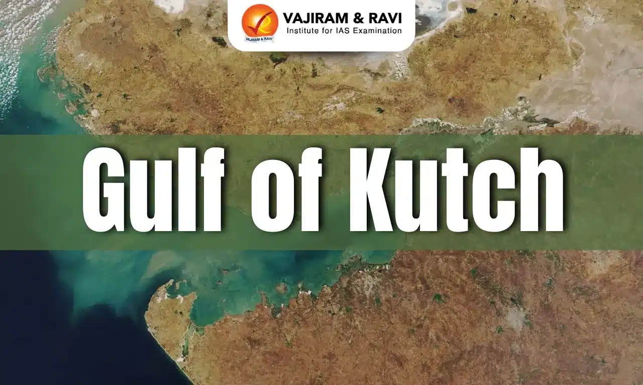
About Gulf of Kutch

  • It is an inlet of the Arabian Sea.
  • It is located along the west coast of India, in the Jamnagar district of Gujarat.
  • It divides Kutch and the Kathiawar peninsula regions of Gujarat.
  • It stretches for 99 miles and is famous for the coral reefs surrounding the 32 islands. 
  • A unique feature of this region is the tidal range, which generates fast currents of about 2.5 m per second. 
  • It is a region with the highest potential of tidal energy generation. 
  • It is rimmed with mudflats, and many small islands rise from its waters. 
  • The Gulf of Kutch, occupying an area of 7300 sq.km. is biologically one of the most productive and diversified habitats along the west coast of India. 
  • The southern shore has numerous islands and inlets which harbor vast areas of mangroves and coral reefs with living corals. 
  • The northern shore with numerous shoals and creeks also sustains large stretches of mangroves.
  • The western extremity of the Gulf consists of a vast complex of marshland criss-crossed by innumerous creeks. 
  • Marine National Park is situated on the southern shore of the Gulf of Kutch.  It is the 1st National Marine Park of India. 

Key Facts about Dugong

  • Dugongs are the only herbivorous mammals found in India’s marine ecosystems.
  • It is known as the sea cow but resembles a cross between a seal and a whale, and is distributed through the Indo-Pacific region.
  • Distribution
    • Dugongs range across 37 Indo-Pacific countries but have disappeared from many parts of their former range.
    • They are found along the Indian coastline, primarily inhabiting warm waters around the Andaman and Nicobar Islands, the Gulf of Mannar, Palk Bay, and the Gulf of Kutch. 
  • Habitat: Due to their dependence on seagrass beds for habitat and food, dugongs are restricted to shallow waters, where they spend the day feeding on seagrasses of the genera Cymodocea, Halophila, Thalassia, and Halodule.
  • The dugong is a long-lived species, able to live up to 70 years.
  • Conservation status:
    • IUCN Status: Vulnerable

Source: DTE

Gulf of Kutch FAQs

Q1: The Gulf of Kutch is located in which Indian state?

Ans: Gujarat

Q2: The Gulf of Kutch separates which two regions of Gujarat?

Ans: Kutch and Kathiawar

Q3: Which sea does the Gulf of Kutch form an inlet of?

Ans: Arabian Sea

Markanda River

Markanda River

Markanda River Latest News

The National Green Tribunal (NGT) recently directed the State Pollution Control Boards of Himachal and Haryana and the Sirmaur deputy commissioner to file detailed reports on the status of water pollution caused by industries in the Markanda River in the Sirmaur district of Himachal Pradesh.

About Markanda River

  • It is a tributary of the Ghaggar River.
  • It was historically known as Aruna and is linked to the mythological Saraswati River.
  • Course:  
    • It originates from the lower Shiwalik hills in the Nahan area of Sirmaur district, Himachal Pradesh. 
    • It flows through Kala Amb, entering at Bikram Bag and exiting at Sadhora Bridge. 
    • The river then enters Haryana, covering 130 km before joining the Ghaggar River at Ismailabad.
  • It is a rain-fed river and has extremely low flow in the winter and summer months but rises suddenly in the monsoon.
  • The Markandeshwar Temple, dedicated to Maharshi Markandeya, stands on its banks.
  • Tributaries: The Markanda River Basin consists of several small seasonal streams, mainly from the Shivalik Hills, which contribute to its flow during the monsoon.
    • Begna River
    • Nakati River
    • Ran River
    • Salani Nallah
    • Roon Nallah
    • Sukdoh Nallah

Source: TOI

Markanda River FAQs

Q1: The Markanda River is a tributary of which river?

Ans: Ghaggar River

Q2: From which region does the Markanda River originate?

Ans: It originates from the lower Shiwalik hills in the Nahan area of Sirmaur district, Himachal Pradesh.

Q3: Which famous temple is located on the banks of the Markanda River?

Ans: Markandeshwar Temple

Mount Lewotobi

Mount Lewotobi

Mount Lewotobi Latest News

Indonesia’s Mount Lewotobi Laki-laki erupted recently, shooting volcanic ash 10 kilometres (6.21 miles) into the sky.

About Mount Lewotobi

  • It is a twin-peaked active volcano located on the tourist island of Flores in eastern Indonesia.
  • It is situated along the famous ‘Ring of Fire’ in the Pacific region.
  • It is one of the most frequently active volcanoes in the region. 
  • It has two peaks arranged on a NW-SE line separated by 2 km and a 1232 m high saddle. This gave the twin volcano its name, Lewotobi, “husband and wife”.
  • The two peaks correspond to the Lewotobi Lakilaki (man) and Lewotobi Perempuan (woman) stratovolcanoes. 
    • Lewotobi Lakilaki (1584 m) has a summit crater of 400 m diameter open to the north. Lewotobi Perampuan (1703 m)’s crater is 700 m wide.
    • Lewotobi Lakilaki has been frequently active during the 19th and 20th centuries, while the taller and broader Lewotobi Perempuan has erupted only twice in historical time.
  • Small lava domes have grown during the 20th century in the summit craters of both volcanoes.

Source: TP

Mount Lewotobi FAQs

Q1: Where is Mount Lewotobi located?

Ans: Flores Island, eastern Indonesia.

Q2: What type of volcano is Mount Lewotobi?

Ans: Twin-peaked active stratovolcano.

Q3: Why is Mount Lewotobi referred to as a “husband and wife” volcano?

Ans: It has two peaks known as Lewotobi Lakilaki (man) and Lewotobi Perempuan (woman).

Gastroenteritis

Gastroenteritis

Gastroenteritis Latest News

A recent study on the impact of the indigenous rotavirus vaccine in India found marked reductions in rotavirus-based gastroenteritis in sites across the country.

About Gastroenteritis

  • Gastroenteritis is an inflammation of the lining of the stomach and intestines. 
  • It is usually not serious in healthy people, but it can sometimes lead to dehydration or cause severe symptoms.
  • What causes gastroenteritis? There can be many different causes of gastroenteritis:
    • Viruses
    • Bacteria
    • Parasites
    • Chemicals
    • Reactions to certain medicines and food
  • Viral gastroenteritis is the most common type. It can be caused by many different viruses, including noroviruses and rotaviruses.
  • When gastroenteritis is caused by consuming foods or drinks contaminated with viruses, bacteria, parasites, or chemicals, this is called food poisoning.
  • The viruses, bacteria, and parasites that cause gastroenteritis can also spread from person to person.
  • The symptoms of gastroenteritis include:
    • Diarrhea
    • Pain or cramping in your abdomen (belly)
    • Nausea
    • Vomiting
    • Sometimes fever
  • Treatment:
    • Usually, people with gastroenteritis get better on their own, with rest and plenty of fluids and electrolytes.
    • Your provider may suggest that you take a probiotic
    • Studies suggest that some probiotics may help shorten a case of diarrhea.
    • People with more severe symptoms may need medicines to control nausea or vomiting. 
    • Providers may also give other medicines for certain types of gastroenteritis, such as antibiotics for some bacterial types and antiparasitic medicines for some parasitic types.

Source: TH  

Gastroenteritis FAQs

Q1: What is gastroenteritis?

Ans: It is an inflammation of the lining of the stomach and intestines.

Q2: Which is the most common type of gastroenteritis?

Ans: Viral gastroenteritis

Q3: Which viruses are commonly responsible for viral gastroenteritis?

Ans: Noroviruses and rotaviruses.

International Union for the Protection of New Varieties of Plants (UPOV)

International Union for the Protection of New Varieties of Plants

International Union for the Protection of New Varieties of Plants (UPOV) Latest News

The report released by GRAIN documented how a growing number of FTAs compel countries to adopt plant variety protection standards set by the 1991 UPOV Convention.

About International Union for the Protection of New Varieties of Plants (UPOV)

  • UPOV is an intergovernmental organization established in 1961 to provide an effective system of plant variety protection. 
  • It administers the UPOV Convention, which provides a legal framework for plant variety protection implemented by its members.
  • Purpose: Under this framework, breeders of new plant varieties are granted an intellectual property right known as the breeder’s right, which incentivizes innovation in plant breeding.
  • The UPOV Convention entered into force in 1968 and was revised in 1972, 1978 and 1991, each time strengthening plant breeders’ rights.
  • Member countries: 80 members have become members of UPOV. (India is not a member of this organization)
  • Headquarter: Geneva (Switzerland).

Governance of International Union for the Protection of New Varieties of Plants (UPOV)

  • The UPOV member countries hold annual meetings of the UPOV Council, a permanent body under the UPOV Convention.
  • Other UPOV bodies include the Consultative Committee, the Administrative and Legal Committee, and the Technical Committee

Source: DTE

International Union for the Protection of New Varieties of Plants (UPOV) FAQs

Q1: Where is the headquarters of UPOV located?

Ans: Geneva, Switzerland

Q2: What is the purpose of the UPOV Convention?

Ans: To encourage the development of new plant varieties by granting breeders' rights.

State Mining Readiness Index

State Mining Readiness Index

State Mining Readiness Index Latest News

Recently, the Ministry of Mines released the State Mining Readiness Index (SMRI).

About State Mining Readiness Index

  • It serves as a tool for benchmarking State performance and encouraging healthy competition, accelerating the pace of mining reforms and sustainable resource management across India.
  • Published by: Ministry of Mines
  • The index evaluates States on parameters like: auction performance, early mine operationalisation, focus on exploration, and sustainable mining practices related to non-coal minerals.
  • These indicators aim to capture the overall readiness and efficiency of States in facilitating mining activity and implementing reforms.
  • Under the SMRI framework, States have been divided into three categories based on their mineral endowment:
    • Category A - States rich in mineral resources
    • Category B - States with moderate mineral resources
    • Category C - States with limited mineral resources

State Rankings of SMRI 2025

  • Category A: Madhya Pradesh, Rajasthan, and Gujarat secured the top three positions.
  • Category B: Goa, Uttar Pradesh, and Assam ranked in the top three.
  • Category C: Punjab, Uttarakhand, and Tripura achieved the top three ranks.

Source: BS

State Mining Readiness Index FAQs

Q1: Who released the State Mining Readiness Index (SMRI)?

Ans: Ministry of Mines, Government of India

Q2: - Which states topped the rankings in Category A of the SMRI 2025?

Ans: Madhya Pradesh, Rajasthan, Gujarat

Kolam Tribes

Kolam Tribe

Kolam Tribe Latest News

Recently, a pilot bamboo plantation project was initiated to restore traditional livelihoods of Kolam tribal people in Adilabad district of Telangana.

About Kolam Tribe

  • Kolam tribes, also known as Kolamboli, Kulme and Kolmi, occupy a major portion of Madhya Pradesh.
  • These tribal groups are reckoned as scheduled tribes and apart from Madhya Pradesh they reside in some parts of Maharashtra and Andhra Pradesh.
  • They are listed as Particularly Vulnerable Tribal Group (PVTG).
  • History:
    • Around the twelfth century, the Kolam served as priests for the Gond, representing some of their important gods.
    • It is generally accepted that the Kolam descended from the original population in the area.
    • Since they now live near the Gond, they have adopted much of the Gond lifestyle. 

Society and Tradition of Kolam Tribe

  • The Kolam people are divided into different clans, like Chal Deve, Pach Deve, Saha Deve, and Sat Deve.
  • Marriages between the same clans are not permissible.
  • The Kolams use the name of their clans as their surnames.
  • Their society is patrilineal, meaning that the line of descent is traced through the males.
  • Occupation: The Kolam are mainly farmers and forest workers. In times past, they used shifting cultivation on the hill slopes.
  • Language: They speak a Dravidian language called Kolami, and nearly all of the adults also speak Marathi, Telugu, or Gondi.
  • For writing they uses the famous Devnagari script.
  • The Kolam people celebrate different rituals that include Matya or Churaghali, Bai-Baki, Sati, Jaitur Pooja, Waghai Pooja etc.

Source: TH

Kolam Tribe FAQs

Q1: Where is the Kolam tribe mainly found?

Ans: Maharashtra and Madhya Pradesh

Q2: What is the primary occupation of the Kolam tribe?

Ans: Agriculture

South Atlantic Anomaly (SAA)

South Atlantic Anomaly (SAA)

South Atlantic Anomaly Latest News

A giant dent in Earth's magnetic field, called the South Atlantic Anomaly, is continuing to expand, according to the latest data from a trio of satellites monitoring our world.

About South Atlantic Anomaly

  • It is a unique location on Earth where the magnetic field is weaker than normal. 
  • It is southeast of South America and southwest of Africa. In this area, the planet's magnetic field dips down.
  • It was first identified in the 19th century.
  • Why does it occur?
    • Earth’s magnetic field acts like a protective shield around the planet, repelling and trapping charged particles from the Sun.
    • SAA exists because the Earth’s inner Van Allen radiation belt comes closest to the planet’s surface, causing an increased flux of energetic particles.
    • This leads to the penetration of solar energetic particles deep into Earth’s atmosphere, posing severe problems for airplanes and ships’ positioning systems as well as spacecraft electronic systems.

What are the Van Allen Radiation Belts?

  • The Van Allen radiation belt is a zone of energetic charged particles, most of which originate from the solar wind. 
  • The particles are captured by and held around a planet by that planet’s magnetic field.
  • It surrounds Earth, containing a nearly impenetrable barrier that prevents the fastest, most energetic electrons from reaching Earth.
  • The outer belt is made up of billions of high-energy particles that originate from the Sun and become trapped in Earth’s magnetic field, an area known as the magnetosphere.
  • The inner belt results from interactions of cosmic rays with Earth’s atmosphere.
  • The Van Allen belts are most intense over the Equator and are effectively absent above the poles.

Source :SA

South Atlantic Anomaly FAQs

Q1: What is the South Atlantic Anomaly (SAA)?

Ans: A region where the Earth’s magnetic field is weaker than normal.

Q2: Where is the South Atlantic Anomaly located?

Ans: Southeast of South America and southwest of Africa.

Q3: Why does the South Atlantic Anomaly occur?

Ans: Because the Earth’s inner Van Allen radiation belt comes closest to the Earth’s surface in this region.

Q4: What are the Van Allen radiation belts mainly composed of?

Ans: Energetic charged particles captured by Earth’s magnetic field.

Green Crackers

Green Crackers

Green Crackers Latest News

Recently, the Supreme Court has permitted only green crackers to be sold in Delhi-NCR region.

About Green Crackers

  • Green crackers are fireworks developed by the government’s Council of Scientific and Industrial Research-National Environmental Engineering Research Institute (CSIR-NEERI). 
  • Green crackers were developed after the Supreme Court banned conventional firecrackers in 2017.
  • Three types of green crackers have been developed – SWAS (Safe Water Releasable), STAR (Safe Thermite Cracker), and SAFAL (Safe Minimal Aluminium),

Features of Green Crackers

  • They are made by reducing the size of the shells, eliminating ash, using fewer raw materials, and adding dust-suppressing additives.
  • There are two main categories of green crackers: improved crackers that modify existing formulations to cut emissions; and new formulation crackers that replace polluting ingredients altogether.
  • Metals, which form part of particulate matter, are either minimized or eliminated to reduce toxicity.
  • Chemical composition of Green Crackers
    • Green crackers, on the other hand, exclude barium compounds, and have drastically-reduced aluminium and sulphur content.
    • They rely on cleaner oxidisers and formulations that limit the release of harmful particulates.
    • Conventional firecrackers use chemicals such as barium, sulphur, potassium nitrate, and aluminium, which produce bright colours and loud noises. They also release heavy metals and toxic gases into the air.

Advantage of Green Crackers

  • They produce brightness and sound comparable to conventional firecrackers (around 100 to120 dB) and reduce particulate matter (PM), SO2, and NO2 emissions by at least 30 per cent.

Identification of green crackers

  • Genuine green crackers can be identified through two mandatory features introduced by CSIR-NEERI which include  the official Green Fireworks logo printed on the packaging, and
  • a unique QR code that can be scanned using the ‘CSIR-NEERI Green QR Code’ mobile app.
  • Scanning the code provides details about the manufacturer, formulation, and NEERI certification status of the product.

Source: IE

Green Crackers FAQs

Q1: What are Green Crackers?

Ans: Environmentally friendly crackers designed to reduce pollution

Q2: Why were Green Crackers developed?

Ans: To reduce air and noise pollution during festivals

Codex Committee on Spices and Culinary Herbs

Codex Committee on Spices and Culinary Herbs

Codex Committee on Spices and Culinary Herbs Latest News

Recently, the 8th Session of the Codex Committee on Spices and Culinary Herbs (CCSCH8) concluded successfully in Guwahati.

About Codex Committee on Spices and Culinary Herbs

  • It is one of the subsidiary bodies under Codex Alimentarius Commission (CAC).
  • It is an exclusive committee for spices and culinary herbs to elaborate standards in harmonization with worldwide standards.
  • The committee was established in July 2013 by the CAC at its 36th meeting held at Rome. India is the host country and the Spices Board, Kochi acts as the secretariat for CCSCH.

Mandates of Codex Committee on Spices and Culinary Herbs

  • To elaborate worldwide standards for spices and culinary herbs in their dried and dehydrated state in whole, ground, and cracked or crushed form;
  • To consult, as necessary, with other international organizations in the standards development process to avoid duplication.

Key Facts about Codex Alimentarius Commission

  • It is the international food standards-setting body.
  • It was established jointly by the Food and Agriculture Organization (FAO) and the World Health Organization (WHO) in May 1963.
  • Objective: Protecting consumer’s health and ensuring fair practices in the food trade.
  • Headquarters: Rome.
  • Member Countries: Currently the CAC has 189 Codex Members made up of 188 Member Countries and 1 Member Organization (The European Union). 
  • India became a member of CAC in 1964.
  • The Commission meets in regular session once a year, alternating between Geneva and Rome.
  • Funding: It is funded through the regular budgets of WHO and FAO.

Source: PIB

Codex Committee on Spices and Culinary Herbs FAQs

Q1: Where is the Secretariat of the Codex Committee on Spices and Culinary Herbs located?

Ans: Kochi

Q2: What is the significance of the Codex Alimentarius Commission?

Ans: It sets global food standards

Enquire Now