
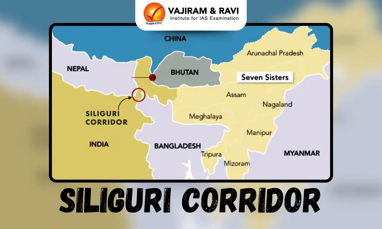
Siliguri Corridor Latest News
Amid shifting regional dynamics following the change of regime in Bangladesh and concerns over China’s growing presence near the vulnerable Siliguri corridor, the Indian Army has reinforced its eastern frontier by establishing three new garrison locations.
About Siliguri Corridor
- It is a narrow stretch of land in West Bengal that connects India’s mainland to its northeastern states.
- It is around 170 km long and 60 km in width, with its narrowest section being just 20-22 km.
- Overall, it is 12,200 sq.km. in area.
- This corridor shares its border with Nepal, Bhutan, and Bangladesh and is only 130 km away from China’s Chumbi Valley.
- Its geographical fragility and criticality have earned it the nickname “Chicken’s Neck” in strategic and military circles.
- It is the only land link between our Northeast region and the rest of the country.
- Any disruption in this corridor — be it from military conflict, natural disaster, or internal unrest — would sever India’s northeastern states from the rest of the country.
Source: TH
Siliguri Corridor FAQs
Q1: Which Indian state contains the Siliguri Corridor?
Ans: West Bengal
Q2: The Siliguri Corridor connects mainland India to which region?
Ans: Northeast India
Q3: What is the narrowest width of the Siliguri Corridor?
Ans: 20–22 km
Q4: Approximately how far is the Siliguri Corridor from China’s Chumbi Valley?
Ans: 130 km


