RBS-15 Missile

RBS-15 Missile

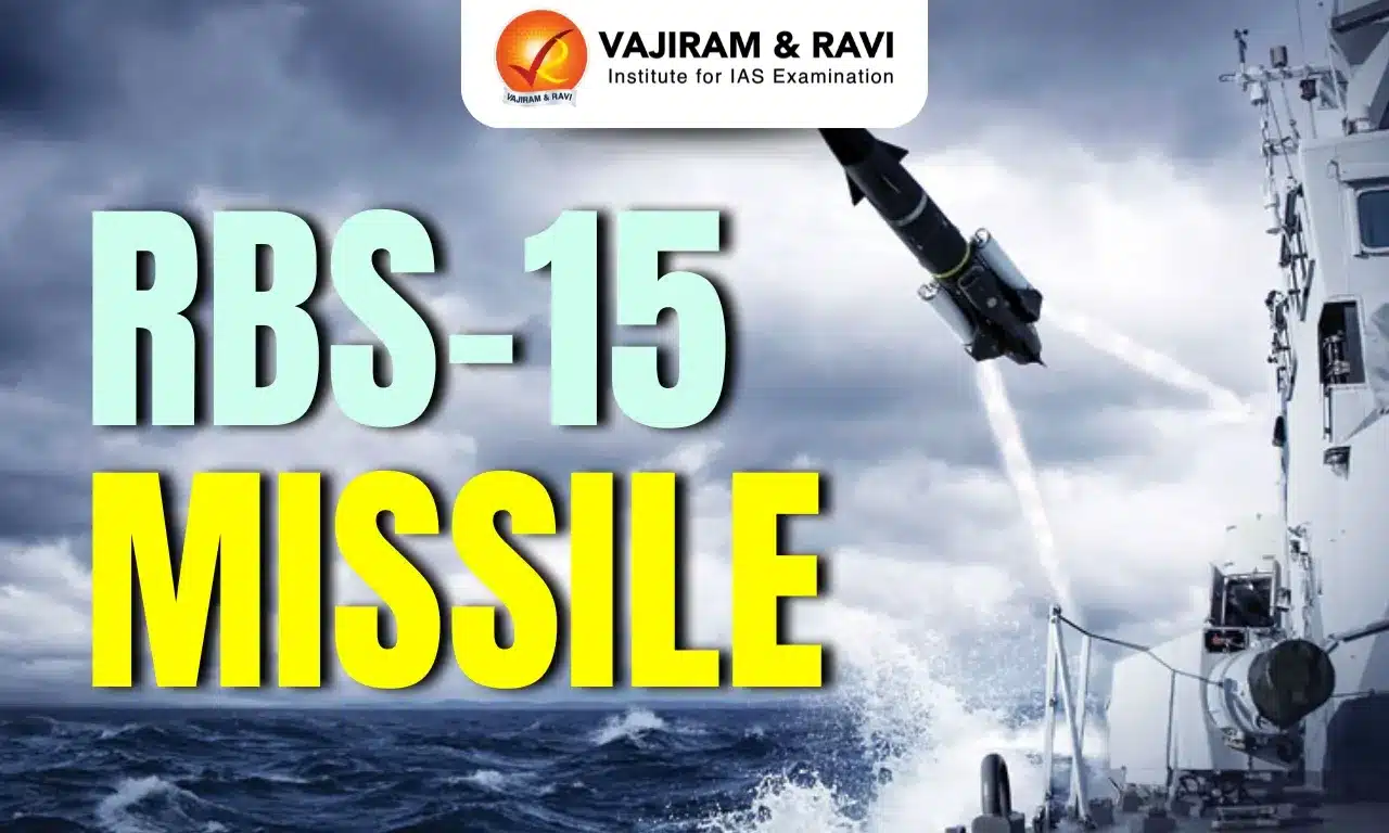
RBS-15 Missile Latest News

Swedish aerospace and defence company, Saab, has showcased the capabilities of its RBS-15 missile to destroy the components of the Russian S-400 system.

About RBS-15 Missile

  • The RBS-15 (Robotsystem 15) is a fire-and-forget surface-to-surface and air-to-surface anti-ship missile with land attack capability. 
  • The missile was developed by the Swedish company Saab Bofors Dynamics.

RBS-15 Missile Features

  • It has a length of 4.35 m, a fuselage diameter of 0.5 m, and a wingspan of 1.4 m.
  • The launch and in-flight weights of the missile are 800 kg and 650 kg, respectively. 
  • It can hit targets up to 200 km, moving at a subsonic speed of Mach 0.9.
  • Warhead: 200 kg high-explosive (HE) blast and pre-fragmented warhead.
  • It is a low sea-skimming missile performing unpredictable evasive manoeuvres. 
  • The RBS15 guidance and control system includes an inertial navigation system and a GPS receiver, a radar altimeter, and a Ku-band radar target seeker. 
  • The missile features a low radar cross section and IR signature. 
  • It has sophisticated target discrimination and selection capabilities. 
  • It is extremely resistant to chaff, active jammers, decoys, and other electronic countermeasures (ECM).
  • The missile engagement planning system (MEPS) provides an advanced user interface for generating plans for different scenarios.

Source: WEEK

RBS-15 Missile FAQs

Q1: What type of missile is the RBS-15?

Ans: It is a fire-and-forget surface-to-surface and air-to-surface anti-ship missile with land-attack capability.

Q2: Which company developed the RBS-15 missile?

Ans: It was developed by the Swedish company Saab Bofors Dynamics.

Q3: What is the maximum range of the RBS-15 missile?

Ans: It can hit targets up to 200 km.

Q4: What stealth features does the RBS-15 missile have?

Ans: It has a low radar cross section and low infrared signature.

Finke River

Finke River

Finke River Latest News

The Finke River, known to the Arrernte people as Larapinta, is believed to be the world’s oldest river system.

About Finke River

  • It is a major but intermittent river of central Australia.
  • Course:
    • It starts in the MacDonnell Ranges in the Northern Territory. 
    • The river forms where two smaller creeks, Davenport and Ormiston, meet. 
    • It flows for about 600 kilometers (370 miles) towards the Simpson Desert in South Australia.
  • It is often called "the oldest river in the world." 
    • A combination of geological records, weathering profiles, and radionuclide measurements in the surrounding sediments and rocks has enabled scientists to date this river system to the Devonian (419 million to 359 million) or Carboniferous (359 million to 299 million) period.
  • Most of the time, the Finke River looks like a series of waterholes. But after heavy rains, it can turn into a powerful, fast-flowing river. 
  • During big floods, its water can even reach the Macumba River and eventually Lake Eyre.
  • Some of its main smaller rivers that flow into it are Ellery Creek and the Palmer and Hugh Rivers.

Source: IT

Finke River FAQs

Q1: Where is the Finke River located?

Ans: It is a major but intermittent river of central Australia.

Q2: Where does the Finke River originate?

Ans: It originates in the MacDonnell Ranges.

Q3: What is the approximate length of the Finke River?

Ans: About 600 kilometres (370 miles).

Q4: Why is the Finke River often called the oldest river in the world?

Ans: Geological records, weathering profiles, and radionuclide measurements date the river system to the Devonian (419 million to 359 million) or Carboniferous (359 million to 299 million) period.

Gorakhnath Temple

Gorakhnath Temple

Gorakhnath Temple Latest News

A massive wave of devotion swept through the Gorakhnath Temple recently, a day ahead of the main Makar Sankranti festival, as lakhs of devotees gathered to offer khichdi to Mahayogi Guru Gorakhnath.

About Gorakhnath Temple

  • It is a Hindu temple situated in Gorakhpur, Uttar Pradesh. 
  • The temple belongs to the Nath monastic group of the Nath tradition (a Shaiva sub-sect in Hinduism), which was instituted by Guru Matsyendranath. 
  • It is named after the Guru Gorakhnath, who was one of the notable disciples of Guru Matsyendranath and well-known for his Hatha Yoga, a renowned branch of Yoga.
  • It serves as the epicenter of the Nath tradition.

Gorakhnath Temple Features

  • It is a blend of traditional and modern North Indian architectural styles, reflecting the heritage and simplicity of the Nath sect.
  • The heart of the Gorakhnath Temple is the central shrine, which houses a sacred image of Gorakhnath as a deity and a Shiva Linga, as the Nath sect sees Gorakhnath as an incarnation of Lord Shiva.
  • Intricate stonework and marble structures surround the inner shrine.
  • Carved pillars and symbolic motifs around the sanctum highlight the Nath sect’s emphasis on inner spirituality.
  • One of the striking features is the temple’s dome, which is tall and conical, visible from a distance. 
  • A significant feature of the Gorakhnath Temple is the Samadhi (final resting place) of Gorakhnath, which is a sacred spot within the temple complex.

Source: TOI

Gorakhnath Temple FAQs

Q1: Where is the Gorakhnath Temple located?

Ans: It is located in Gorakhpur, Uttar Pradesh.

Q2: To which religious tradition does the Gorakhnath Temple belong?

Ans: It belongs to the Nath monastic group of the Nath tradition (a Shaiva sub-sect in Hinduism).

Q3: Who instituted the Nath tradition?

Ans: Guru Matsyendranath.

Q4: What was Guru Gorakhnath well known for?

Ans: He was well known for Hatha Yoga.

Pufferfish

Pufferfish

Pufferfish Latest News

Recently, scientists have confirmed India’s first case of pufferfish poisoning.

About Pufferfish

  • Pufferfish belong to the order Tetraodontiformes.
  • Other names: They are locally known by names such as toadfish, patkafish, balloonfish and fugu.
  • Habitat: Pufferfish are omnivorous and benthic in habitat.
  • Distribution: It is primarily found in the Western Ghats and major basins such as the Ganga, Brahmaputra and Mahanadi. 
  • Freshwater pufferfish species reported from India are often endemic to specific geographical areas and serve as indicators of healthy river ecosystems.
  • They can inflate into a ball shape to evade predators.
  • Status in India: Indian waters currently support eight genera and 32 species of pufferfish.
  • Conservation Status :IUCN: Vulnerable 

Pufferfish Poisoning

  • Some puffer fish carry tetrodotoxin (TTX) which is one of the most potent neurotoxins known in nature.
    • Tetrodotoxin blocks nerve sodium channels and can cause paralysis, respiratory failure and death.
    • TTX consists of an oxygenated 2,4-dioxaadamantane core and a guanidinium group.
    • TTX is heat-stable, water-soluble, and a non-protein quinazoline derivative.
  • Evidence suggests that pufferfish do not synthesise the toxin themselves.
  • Instead, TTX is believed to originate from symbiotic or ingested bacteria such as Vibrio, Pseudomonas, Aeromonas and Bacillus.

 Source: DTE

Pufferfish FAQs

Q1: What is unique about pufferfish?

Ans: They can inflate their bodies with air or water

Q2: What is the effect of tetrodotoxin, the toxin found in pufferfish?

Ans: It paralyzes muscles and can be fatal.

Vrindavani and Karan Fries Cattle Breeds

Vrindavani and Karan Fries Cattle Breeds

Vrindavani and Karan Fries Cattle Breeds Latest News

Recently, India has registered two high-yielding synthetic cattle breeds namely Karan Fries and Vrindavani.

About Vrindavani and Karan Fries Cattle breeds

About Karan Fries

  • It is developed by the National Dairy Research Institute (NDRI) in Karnal, Haryana.
  • It is a cross between indigenous Tharparkar cows and Holstein-Friesian bulls.
  • It is capable of producing over 3,500 kg of milk in a 10-month lactation period.
  • The synthetic Karan Fries cow breed combines high productivity with resilience, delivering peak daily milk yields of up to 46.5 kg.

About Vrindavani

  • It is developed by ICAR-Indian Veterinary Research Institute (IVRI) in Bareilly, Uttar Pradesh.
  • It is a blend of exotic breeds - Holstein-Friesian, Brown Swiss, and Jersey - with the indigenous Hariana cattle.

Key Facts about Indian Council of Agricultural Research

  • It is an autonomous organisation under the Department of Agricultural Research and Education (DARE), Ministry of Agriculture and Farmers Welfare.
  • It is the apex body for coordinating, guiding, and managing research and education in agriculture, including horticulture, fisheries, and animal sciences, throughout the country.
  • History: Formerly known as the Imperial Council of Agricultural Research, it was established on 16 July 1929 as a registered society under the Societies Registration Act, 1860, in pursuance of the report of the Royal Commission on Agriculture. 
  • Headquarters: New Delhi.

Source: ET

Vrindavani and Karan Fries Cattle breeds FAQs

Q1: What is Karan Fries?

Ans: A synthetic cattle breed developed by NDRI, Karnal

Q2: What is the origin of Karan Fries?

Ans: Cross between Tharparkar and Holstein Friesian

Similipal Tiger Reserve

Similipal Tiger Reserve

Similipal National Park Latest News

The latest crocodile census has recorded an increase in the crocodile population in Odisha’s Similipal National Park.

About Similipal National Park

  • It is situated in the Mayurbhanj district of Odisha.
  • It covers an area of 2750 sq.km. 
  • The park is named after the Simul (silk cotton) tree, which grows in abundance here.
  • Not only a National Park, Similipal is also a Tiger Reserve, Wildlife Sanctuary, Biosphere Reserve, and also a part of the Mayurbhanj Elephant Reserve. 
  • Situated in the Deccan Peninsular Bio-geographic Zone, it harbours a unique blend of Western Ghats, Eastern Ghats, and eastern Himalayan biodiversity.
  • It has some beautiful waterfalls like Joranda and Barehipani.
  • It is surrounded by high plateaus and hills, the highest peak being the twin peaks of Khairiburu and Meghashini (1515 m above mean sea level).
  • It is also home to various tribes, including Kolha, Santhala, Bhumija, Bhatudi, Gondas, Khadia, Mankadia, and Sahara.
  • Vegetation: The forest is predominantly moist mixed deciduous forest with tropical semi-evergreen forest in areas with suitable microclimatic conditions and sporadic patches of dry deciduous forests and grasslands.
  • Flora:
    • Sal is the dominant tree species here. 
    • It houses 7% of the flowering plants and 8% of India's orchids.
    • The park also has extensive grasslands that are grazing grounds for many of the herbivores. 
  • Fauna:
    • It is known for the tiger, elephant, and hill mynah. 
    • It holds the highest tiger population in Odisha.
    • It is the only tiger reserve in the country to boast of melanistic tigers.
    • Apart from the tiger, the major mammals are the leopard, sambar, barking deer, gaur, jungle cat, wild boar, four-horned antelope, giant squirrel, and common langur.

Source: NOA

Similipal National Park FAQs

Q1: Where is Similipal National Park located?

Ans: It is located in the Mayurbhanj district of Odisha.

Q2: How did Similipal National Park get its name?

Ans: It is named after the Simul (silk cotton) tree found abundantly in the region.

Q3: Which bio-geographic zone does Similipal National Park belong to?

Ans: It lies in the Deccan Peninsular Bio-geographic Zone.

Q4: Which are the major waterfalls found in Similipal National Park?

Ans: Joranda and Barehipani waterfalls.

Jamma Bane Lands

Jamma Bane Land

Jamma Bane Lands Latest News

Recently, the Karnataka government has amended its land revenue law to modernise an age-old system of land records called Jamma Bane lands.

About Jamma Bane Lands

  • The word Jamma means hereditary.
  • The Jamma Bane tenure is a form of land holding prevalent in Kodagu district of Karnataka.
  • It is distinctly different from other classes of land holdings in the state.
  • History: These lands were originally granted by erstwhile kings of Coorg and the British — between 1600 and 1800 to local communities in return for military service.
  • These lands comprise both wetlands, used for paddy cultivation, and forested highlands, which have transformed into the now-famous coffee estates of Coorg.
  • Relevant Acts: The Coorg Land Revenue and Regulations Act, 1899 was in place to govern land ownership in the region till the introduction of the Karnataka Land Revenue Act, 1964.

Issue with Jamma Bane Lands

  • Ownership: The Jamma Bane land ownership is registered in the name of the original pattedar from a family.
  • Over generations, the names of the new owners are added alongside the name of the pattedar.
  • The land ownership name could not be changed to reflect new owners.

Source: IE

Jamma Bane Lands FAQs

Q1: Where is Jamma Bane land tenure prevalent?

Ans: Kodagu,Karnataka

Q2: What is a key issue with Jamma Bane land ownership?

Ans: Ownership name can't be changed to reflect new owners

Kawal Tiger Reserve

Kawal Tiger Reserve

Kawal Tiger Reserve Latest News

Forest officials are gearing up to conduct the wildlife census at the Kawal Tiger Reserve.

About Kawal Tiger Reserve

  • Location: It is located in the state of Telangana.
  • It is along the banks of river Godavari, forming part of the Deccan peninsula-central highlands.
  • The reserve is nestled in the Sahyadri Mountain Ranges.
  • The government of India declared Kawal Wildlife Sanctuary a Tiger Reserve in 2012.
  • Rivers: The reserve is the catchment for the rivers Godavari and Kadam, which flow towards the south of the sanctuary.
  • Geographically, the reserve is situated at the southernmost tip of the Central Indian Tiger Landscape, having linkages with the Tadoba-Andhari (Maharashtra) and Indravati (Chhattisgarh) tiger reserves.
  • Habitat: It has diverse habitats comprising dense forests, grasslands, rivers, streams and water bodies.
  • Vegetation: Southern Tropical Dry Deciduous Forest.
  • Flora: It consists of teak along with Bamboo and other species like Anogeissus latifolia, Mitragyna parviflora, Terminalia crenulata, Terminalia arjuna, Boswellia serrata, etc.
  • Fauna: The major wild animals include: nilgai, chousinga, chinkara, black buck, sambar, spotted deer etc.

Source: News India Express

Kawal Tiger Reserve FAQs

Q1: In which state is the Kawal Tiger Reserve located?

Ans: Telangana

Q2: Which river flows through the Kawal Tiger Reserve?

Ans: Godavari and Kadam

Lake Natron

Lake Natron

Lake Natron Latest News

Lake Natron in Tanzania glows blood-red, forged by volcanoes and extreme chemistry.

About Lake Natron

  • It is located in the Arusha region of Northern Tanzania. 
  • It is a soda and salty water lake very close to the Kenyan border in the Gregory Rift, which is the eastern part of the East African Rift.
  • It was designated as a Ramsar Site of International Importance in 2001.
  • The extinct Gelai Volcano, standing at 2942 m tall, is visible southeast of the lake.
  • Primarily, the lake is fed by the Ewaso Ng’iro River, which originates from the central region of Kenya.
  • Natron itself has a maximum width of 22 kilometres and a length of 57 kilometres. 
  • One of the most striking features of this lake is its striking red coloration. The primary reason for its hue lies in its extreme alkalinity.
  • As water cannot flow out of the lake, evaporation levels are very high, and this leaves behind natron (sodium carbonate decahydrate) and trona (sodium sesquicarbonate dihydrate).
  • The high concentration of natron gives the lake extreme alkaline levels, and it is one of the deadliest lakes on the planet. 
  • The saline waters make the lake inhospitable for many plants and animals, yet the surrounding saltwater marshes are a surprising habitat for flamingos. 
  • In fact, the lake is home to the highest concentrations of lesser and greater flamingos in East Africa, where they feed on spirulina – a green algae with red pigments.

Source: BT

Lake Natron FAQs

Q1: Where is Lake Natron located?

Ans: It is located in the Arusha region of northern Tanzania.

Q2: In which geological rift is Lake Natron found?

Ans: It lies in the Gregory Rift, the eastern part of the East African Rift.

Q3: Which volcano is visible southeast of Lake Natron?

Ans: The extinct Gelai Volcano.

Q4: Which river primarily feeds Lake Natron?

Ans: The Ewaso Ng’iro River.

Q5: What gives Lake Natron its striking red colour?

Ans: Its extreme alkalinity.

Voyager 1

Voyager 1

Voyager 1 Latest News

Voyager 1 is expected to become the first human-made object to reach a distance of one light-day from Earth.

About Voyager 1

  • It is a space probe launched by NASA in 1977.
  • Objective: To explore the outer planets in our solar system. 
  • It is the first spacecraft to travel beyond the solar system and reach interstellar space.
  • It is currently the most distant human-made object from Earth.
  • Voyager 1’s mission has included flybys of Jupiter and Saturn, with the goal of studying their moons, rings, and magnetic fields.
  • Instruments of Voyager 1: Cosmic Ray Subsystem, Plasma Wave Subsystem, Infrared Interferometer Spectrometer and Radiometer (IRIS) etc. 

Key Achievements of Voyager 1

  • It was the first spacecraft to cross the heliosphere, the boundary where the influences outside our solar system are stronger than those from our Sun.
  • It crossed into interstellar space in August 2012, making it the first human-made object to venture out of the solar system.
  • It discovered a thin ring around Jupiter and two new Jovian moons: Thebe and Metis.
  • It also found five new moons and a new ring called the G-ring at Saturn.

Source: LM

Voyager 1 FAQs

Q1: What is the primary objective of Voyager 1?

Ans: To explore the outer Solar System and interstellar space

Q2: What is unique about Voyager 1?

Ans: It is the first spacecraft to enter interstellar space.

Enquire Now