Copernicus Sentinel-2 Mission

Copernicus Sentinel-2 Mission

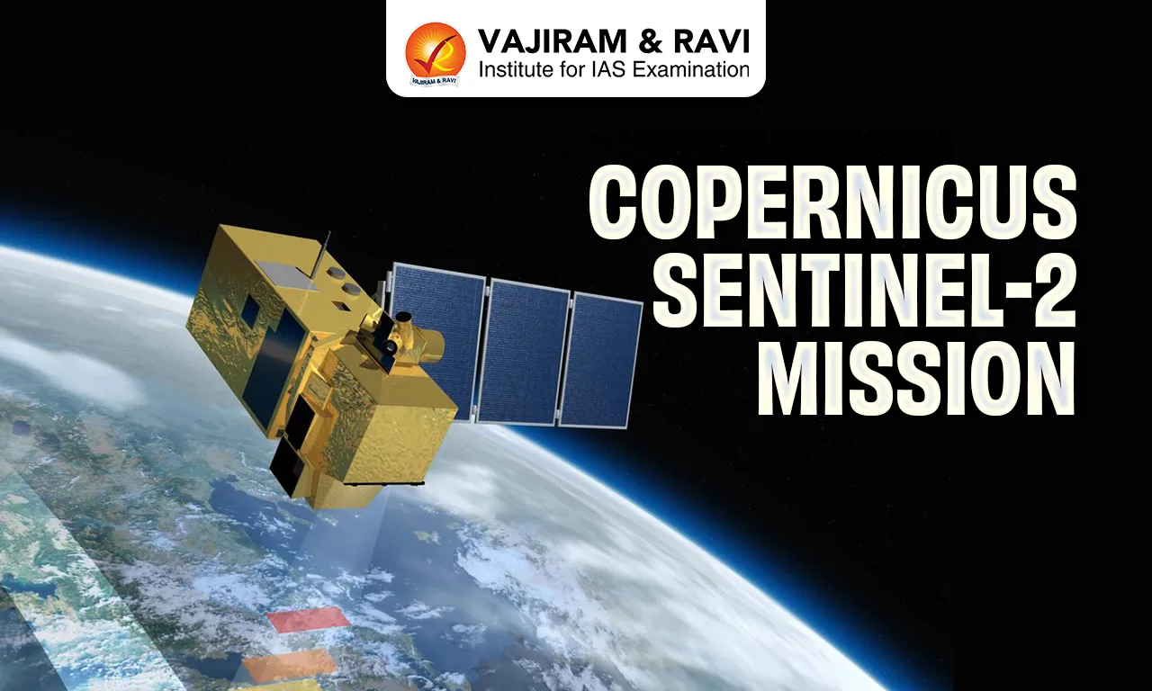
Copernicus Sentinel-2 Mission Latest News

The European Space Agency (ESA)'s Copernicus Sentinel-2 mission recently released a stunning high-resolution image of the 2026 Winter Olympic venues across northern Italy.

About Copernicus Sentinel-2 Mission

  • It is an Earth observation satellite mission developed by the European Space Agency (ESA).
  • It is part of Copernicus - the European Union’s Earth observation program.
  • It aims at monitoring variability in land surface conditions.
  • It comprises a land monitoring constellation of two polar-orbiting satellites placed in the same sun-synchronous orbit.
  • The twin satellites S-2B and S-2C have a wide swath width (290 km) and a high revisit time. This capability will support monitoring of changes on the Earth's surface.
  • It delivers high-resolution optical multispectral imagery across 13 spectral bands in the visible to shortwave infrared.
  • This data supports a wide range of applications, including precision agriculture, food security, ecosystems monitoring, disaster management (e.g., volcanoes, wildfires, floods, landslides), water quality assessment, and observing anthropogenic methane emissions.

Key Facts about Copernicus Programme

  • It is the Earth observation component of the European Union’s Space programme.
  • This initiative is headed by the European Commission (EC) in partnership with the European Space Agency (ESA).
  • It offers information services that draw from satellite Earth observation and in-situ (non-space) data.
  • The programme consists of a complex set of systems that collect data from multiple sources, including Earth Observation satellites, in-situ sensors like ground stations, and airborne and sea-borne sensors. 
  • Users have free and open access to a great deal of this data, which is also processed to provide a set of services based on reliable and near-real-time information.
  • ESA has developed a new family of satellites, called Sentinels, specifically for the operational needs of Copernicus.

Source: IT

Copernicus Sentinel-2 Mission FAQs

Q1: What is the Copernicus Sentinel-2 Mission?

Ans: It is an Earth observation satellite mission developed by the European Space Agency (ESA).

Q2: What is the primary objective of the Sentinel-2 Mission?

Ans: To monitor variability in land surface conditions.

Q3: What type of satellite constellation does Sentinel-2 use?

Ans: A land monitoring constellation of two polar-orbiting satellites.

Q4: What kind of imagery does Sentinel-2 provide?

Ans: High-resolution optical multispectral imagery.

Giant Phantom Jellyfish

Giant Phantom Jellyfish

 Giant Phantom Jellyfish Latest News

Scientists on a month-long deep-sea expedition off Argentina’s coast documented a rare giant phantom jellyfish recently.

About Giant Phantom Jellyfish

  • It is a rare and mysterious deep-sea jellyfish known for its ghostly, translucent appearance. 
  • It is among the largest jellyfish.
  • Scientific Name: Stygiomedusa gigantea
  • It is in the Ulmaridae family. 
  • It is believed to be widespread throughout the world’s oceans, except in the Arctic Ocean. 
  • Unlike most jellyfish, it lacks tentacles. Instead, they use ribbon-like arms to grab prey, typically plankton or small fish, and pull them into their mouths.
  • This mauve-coloured jellyfish can grow to a colossal size: the bell can be more than one metre (3.3 feet) across, and the animal's four ribbon-like 'oral arms' can reach lengths of more than 10 metres (33 feet).
  • But despite their massive size, the elusive creatures have been spotted only about 120 times since the first specimen was collected in 1899
  • That’s because they prefer to lurk in the “midnight zone,” a part of the ocean ranging from 3,300 to 13,100 feet deep, that is shrouded in complete darkness.
  • Their bodies being made of either spongy tissue or jelly allows the species to withstand the enormous deep ocean pressure of 40,000 kPa (5,800 pounds per square inch).

Source: NDTV

Giant Phantom Jellyfish FAQs

Q1: What is the Giant Phantom Jellyfish?

Ans: It is a rare deep-sea jellyfish known for its ghostly, translucent appearance.

Q2: Why is the Giant Phantom Jellyfish considered one of the largest jellyfish?

Ans: Because its bell can exceed one metre in diameter and its oral arms can grow over 10 metres long.

Q3: Does the Giant Phantom Jellyfish have tentacles like most jellyfish?

Ans: No, it lacks tentacles.

Q4: How does the Giant Phantom Jellyfish capture its prey?

Ans: By using ribbon-like oral arms to grab prey and pull it into its mouth.

Lyriothemis Keralensis

Lyriothemis Keralensis

Lyriothemis Keralensis Latest News

Researchers recently confirmed the discovery of a new species of dragonfly, Lyriothemis keralensis, from the low-lying coastal regions of Kerala.

About Lyriothemis Keralensis

  • It is a new species of dragonfly.
  • It was discovered in the low-lying coastal regions of Kerala.
  • Commonly called the Slender Bombardier, Lyriothemis keralensis was distinguished from its Northeast Indian relative, Lyriothemis acigastra, after extensive research. 
  • It has a slender abdomen, a uniquely shaped tail, and distinct genital structures. 
  • Males display a deep blood-red abdomen with black markings, while the slightly broader females show yellow and black colouration. 
  • The species measures about three centimetres in length.
  • Unlike many dragonflies found in forest areas, the Slender Bombardier prefers human-modified landscapes. 
  • It thrives in irrigation ecosystems such as pineapple and rubber plantations and is commonly seen in shaded canals and seasonal pools within agricultural areas.
  • It is a seasonal resident, emerging during the monsoon and retreating as rainfall declines.

Source: TOI

Lyriothemis keralensis FAQs

Q1: What is Lyriothemis keralensis?

Ans: It is a newly discovered species of dragonfly.

Q2: Where was Lyriothemis keralensis discovered?

Ans: In the low-lying coastal regions of Kerala.

Q3: What is the common name of Lyriothemis keralensis?

Ans: Slender Bombardier.

Q4: What key physical features distinguish Lyriothemis keralensis?

Ans: A slender abdomen, uniquely shaped tail, and distinct genital structures.

Q5: Which type of habitat does the Slender Bombardier prefer?

Ans: Human-modified landscapes rather than forest areas.

Kordofan Region

Kordofan Region

Kordofan Region Latest News

A drone attack by Sudan’s Rapid Support Forces struck a vehicle carrying displaced families near Rahad in North Kordofan, killing at least 24 people, including eight children and two infants.

About Kordofan Region

  • It is a region constituting the central and southern area of Sudan. 
  • It lies between the Darfur region on the west and the valley of the White Nile River on the east.
  • It covers an area of about 390,000 sq.km.
  • The region is divided into three federal states: North Kordofan (capital: El Obeid), South Kordofan (capital: Kadugli), and West Kordofan (capital: Al Fula).
  • The northern part of the region is desert and has sandy soils and little physiographic relief. 
  • There is some acacia scrub, desert grass, and thorny shrub; the landscape becomes increasingly more open and barren toward the north. 
  • The southern section of Kordofan is a level or gently undulating clay plain, with the scattered granitic Nuba Mountains rising in the east to an elevation of about 900 metres. 
  • Traditionally the area is known for the production of gum arabic. Other crops include groundnuts, cotton, and millet.
  • Most of the people in Kordofan are Arabs. Minorities include the Nubian, Beja, Daju, Zaghawa, and Darfunj peoples. 
  • It has been a conflict-prone area, especially since Sudan’s civil wars.
  • It is a strategic region due to:
    • Proximity to South Sudan.
    • Oil fields in West Kordofan.

Source: FPJ

Kordofan Region FAQs

Q1: What is the Kordofan Region?

Ans: It is a region constituting the central and southern area of Sudan.

Q2: Between which two major regions does Kordofan lie?

Ans: Between the Darfur region in the west and the White Nile River valley in the east.

Q3: What are the physical characteristics of northern Kordofan?

Ans: Desert landscape with sandy soils, little relief, and sparse vegetation.

Q4: Which ethnic group forms the majority population of Kordofan?

Ans: Arabs

Q5: Which minority communities live in the Kordofan Region?

Ans: Nubian, Beja, Daju, Zaghawa, and Darfunj peoples.

Paraleocrates Indica

Paraleocrates Indica

Paraleocrates Indica Latest News

Researchers recently discovered a new species of marine worm named Paraleocrates indica hiding in the muddy banks of the Champa Estuary in the Bay of Bengal.

About Paraleocrates Indica

  • It is a new species of marine worm discovered in the muddy banks of the Champa Estuary in the Bay of Bengal.
  • It marks the first time this rare group of creatures has ever been recorded in Indian waters.
  • It is a type of muddy bristle worm in the family Hesionidae, known for its colourful bodies and often symbiotic relationships with other sea life, such as starfish. 
  • This discovery is only the third known species within its specific genus worldwide.
  • To the naked eye, the worm appears reddish and measures between 14 and 35 millimetres in length.
  • The most striking characteristic of Paraleocrates indica is its eyes: its front pair of eyes is a staggering five times larger than the back pair. 
  • It also sports a pair of fang-shaped jaws, one on the top and one on the bottom, and a set of long, sensitive antennae that help it navigate its murky home.
  • It is distinguished from its closest relatives, P. djangkarensis and P. wesenberglundae, in Indonesia and the Gulf of Oman, by its specific bristle count
    • It has significantly fewer bristles (called neurochaetae) per bundle and features unique single-pointed blades on its appendages that lack the protective guards found on other species.

Source: RM

Paraleocrates Indica FAQs

Q1: What is Paraleocrates indica?

Ans: It is a newly discovered species of marine worm.

Q2: Where was Paraleocrates indica discovered?

Ans: In the muddy banks of the Champa Estuary in the Bay of Bengal.

Q3: What type of worm is Paraleocrates indica?

Ans: A muddy bristle worm belonging to the family Hesionidae.

Q4: What are Hesionidae worms generally known for?

Ans: Their colourful bodies and symbiotic relationships with other marine organisms such as starfish.

Q5: What is the most striking physical feature of Paraleocrates indica?

Ans: Its front pair of eyes is five times larger than the back pair.

Key Facts about Greece

Key Facts about Greece

Greece Latest News

Greek Defence Minister Nikos and Indian Defence Minister will hold a bilateral meeting at the Manekshaw Centre in New Delhi to enhance defence cooperation.

About Greece

  • Location: It is located on the southern edge of the Balkan Peninsula.
  • Bordering Countries: It is bordered by 4 nations namely, North Macedonia and Bulgaria in the north, Albania in the northwest, and Turkey in the northeast.
  • Bordering Seas: It is also bounded by the Aegean Sea in the east, Ionian Sea in the west and the Mediterranean Sea in the south.
  • Capital:  Athens

Geographical features of Greece

  • Terrain: It is predominantly mountainous, with approximately 80% of its terrain consisting of mountains or hills, making it one of the most mountainous countries in Europe. 
  • Climate: The climate of Greece is typically Mediterranean.
  • Major Mountain:  Pindus mountain range on the mainland contains one of the world's deepest gorges, Vikos Gorge, which plunges 3,600 feet (1,100 meters).
  • Highest Peak: The highest Greek mountain is Mount Olympus, rising to 2,918 meters.
  • Major Rivers: Maritsa, Struma and Vardar etc.
  • Natural Resources:  It mainly consists of petroleum, magnetite, lignite, bauxite, hydropower, and marble.

Source: TH

Greece FAQs

Q1: What is the capital of Greece?

Ans: Athens

Q2: Where is Greece located?

Ans: Southeast Europe

Sawalkote Hydroelectric Project

Sawalkote Hydroelectric Project

Sawalkote Hydroelectric Project Latest News

India recently started work on the Sawalkote Hydroelectric Project on the River Chenab in Jammu and Kashmir—the first such new project to get the green light from the government after the abrogation of the Indus Water Treaty.

About Sawalkote Hydroelectric Project

  • It is a 1,856-MW run-of-the-river hydropower project on the Chenab River in the Ramban District of Jammu and Kashmir. 
  • It will be the largest hydroelectric project in the Union Territory and one of the biggest in North India.
  • The project has been in the planning stage since the 1980s and has undergone multiple revisions to address environmental, ecological, and technical concerns.
  • The project will be built by the National Hydroelectric Power Corporation (NHPC).
  • It will comprise nine turbines and an underground power station. 
  • It will feature a Roller Compacted Concrete Gravity Dam at a height of 192.5 metres.
  • It will produce around 8000 million units of electricity every year.
  • The plant will ensure reliable power supply to the region, particularly during the harsh winter months, when electricity demand peaks and shortages are common.
  • It also has the potential to turn J-K into a power-surplus region, creating scope for exporting surplus energy to the national grid.
  • By regulating the flow of the Chenab River, the Sawalkote project could contribute to flood mitigation downstream, while also ensuring better water management for agriculture and domestic use.
  • It is a key part of India’s plan to fully utilise its share of water from the western rivers under the 1960 Indus Waters Treaty (IWT). 
  • It is the first major hydropower project on the Indus rivers to be accorded environmental clearance following India’s suspension of the Indus Waters Treaty (IWT) on April 23, 2025, following the Pahalgam terror attack.

Source: NEWS18

Sawalkote Hydroelectric Project FAQs

Q1: What is the Sawalkote Hydroelectric Project?

Ans: It is a 1,856-MW run-of-the-river hydropower project.

Q2: On which river is the Sawalkote project being built?

Ans: On the Chenab River.

Q3: Where is the Sawalkote Hydroelectric Project located?

Ans: In the Ramban District of Jammu and Kashmir.

Q4: Which organisation is responsible for constructing the Sawalkote project?

Ans: The National Hydroelectric Power Corporation (NHPC).

Indian National Centre for Ocean Information Services (INCOIS)

Indian National Centre for Ocean Information Services (INCOIS)

Indian National Centre for Ocean Information Services (INCOIS) Latest News

Indian National Centre for Ocean Information Services (INCOIS) will be launching three new ocean information services: JellyAIIP, SAMUDRA 2.0 Mobile App, and SIVAS along with a new logo during the foundation day celebrations.

About Indian National Centre for Ocean Information Services (INCOIS)

  • It was established as an autonomous body in 1999 under the Ministry of Earth Sciences (MoES).
  • It is located in Hyderabad, Telangana.
  • Mandate: It is mandated to provide ocean information and advisory services to society, industry, government agencies and the scientific community through sustained ocean observations and constant improvements through systematic and focussed research.
  • It is a permanent member of UNESCO's Intergovernmental Oceanographic Commission (IOC).
  • It established the Indian Tsunami Early Warning Centre (ITEWC) which provides tsunami alerts within 10 minutes, serving India and 28 Indian Ocean countries.
  • Initiatives of INCOIS:
    • It has developed the Search and Rescue Aided Tool (SARAT) to assist the Indian Coast Guard, Navy and Coastal Security Police, in locating individuals or objects lost at sea.
    • INCOIS has also established the SynOPS visualization platform which integrates real-time data to strengthen response coordination during extreme events.

What are JellyAIIP, SAMUDRA 2.0 Mobile App, and SIVAS?

  • JellyAIIP (Jellyfish Aggregation Information Interactive Portal): It is a national web-based platform for reporting and visualising jellyfish aggregation, swarming, and stranding events along the Indian coast, with geospatial mapping, hotspot analysis, and multilingual first-aid guidance.
  • SAMUDRA 2.0 Mobile App: It is an upgraded multilingual advisory platform delivering ocean information and early warnings to fishermen and maritime users.
  • SIVAS: Swell-Surge Inundation Vulnerability Advisory System, is a coastal inundation early warning service designed to provide advance alerts on swell-surge flooding events, currently operational for the Kerala coast, with multilingual forecast bulletins.

Source: TH

Indian National Centre for Ocean Information Services (INCOIS) FAQs

Q1: What is the primary objective of INCOIS?

Ans: To provide ocean information and advisory services

Q2: Where is INCOIS located?

Ans: Hyderabad

Sahyadri Tiger Reserve (STR)

Sahyadri Tiger Reserve (STR)

Sahyadri Tiger Reserve (STR) Latest News

In a significant boost to tiger conservation in western Maharashtra, a third tigress was released into the wild at the Sahyadri Tiger Reserve (STR) recently.

About Sahyadri Tiger Reserve (STR)

  • It is located in the Sahyadri Ranges of the Western Ghats in Maharashtra.
  • It is the northernmost tiger habitat in the Western Ghats.
  • It is the first tiger reserve of Western Maharashtra and the fourth tiger reserve of the State.
  • It is spread over two protected areas of Koyana Sanctuary (KWLS) and Chandoli National Park (CNP).
  • The central portion of STR is occupied by the “Shivsagar” reservoir of the Koyana River and the “Vasant Sagar” reservoir of the Warana River.
  • The habitat of Sahyadri is composed of woodlands, grasslands, and plateaus, the latter locally referred to as “Sadaa”, which are lateritic in nature with considerable habitat value. 
  • Vegetation
    • The forest cover here is that of moist evergreen, semi-evergreen, moist, and dry deciduous vegetation.
    • It is the only place where climax and near-climax vegetation are plentiful and prospects of adverse anthropogenic influence in the future are minimal.
  • Flora:
    • Dense tree cover includes species such as teak, bamboo, Indian laurel, and jamun.
    • Medicinal plants like Asparagus racemosus and Aegle marmelos grow abundantly.
    • Unique Western Ghats endemics, including rare orchids and shrubs, flourish in the reserve’s humid microclimates.
  • Fauna:
    • It is home to the endangered species of top carnivores such as Tiger, Wild dog, and Leopard. 
    • The herbivores include Gaur, Sambar, Four Horned Antelope, Mouse Deer, and Giant Squirrel. 
    • The habitat also supports hornbills, and many other endemic birds.

Source: HT

Sahyadri Tiger Reserve (STR) FAQs

Q1: Where is the Sahyadri Tiger Reserve located?

Ans: In the Sahyadri Ranges of the Western Ghats in Maharashtra.

Q2: What is the geographical significance of Sahyadri Tiger Reserve in the Western Ghats?

Ans: It is the northernmost tiger habitat in the Western Ghats.

Q3: Which two protected areas together form the Sahyadri Tiger Reserve?

Ans: Koyana Wildlife Sanctuary and Chandoli National Park.

Q4: Which major reservoirs occupy the central portion of Sahyadri Tiger Reserve?

Ans: Shivsagar reservoir on the Koyana River and Vasant Sagar reservoir on the Warana River.

Q5: What types of forest vegetation are present in Sahyadri Tiger Reserve?

Ans: Moist evergreen, semi-evergreen, moist deciduous, and dry deciduous forests.

Peregrine Falcon

Peregrine Falcon

Peregrine Falcon Latest News

Recently, a wildlife researcher has made a historic sighting of a Siberian peregrine falcon in central Australia, where this subspecies has never been recorded before.

About Peregrine Falcon

  • It is a large cosmopolitan raptor in the family Falconidae.
  • Distribution: It is found on all continents except Antarctica, and on many oceanic islands.
  • Habitat:
    • They prefer open habitats, such as grasslands, tundra, and meadows.
    • They are most common in tundra and coastal areas and rare in sub-tropical and tropical habitats. They nest on cliff faces and crevices.

Characteristics of Peregrine Falcon

  • It is renowned for its speed during its characteristic hunting stoop (high-speed dive), making it the fastest bird in the world, as well as the fastest member of the animal kingdom.
  • They are active during the day. When not breeding they are primarily solitary and establish and defend territories.
  • Ecological role: They are high level predators, peregrine falcons play an important role in regulating populations of their prey, particularly pigeons and doves.
  • Conservation status: IUCN Red List: Least Concern.

Source: Live Science

Peregrine Falcon FAQs

Q1: What is the IUCN conservation status of Peregrine Falcon?

Ans: Least Concern

Q2: Where do we find Peregrine Falcon?

Ans: In all continent except Antarctica.

Thwaites Glacier

Thwaites Glacier

Thwaites Glacier Latest News

Scientists have raised concerns over the Thwaites Glacier, as it is melting at an unprecedented rate because of climate change fueled by human activities. 

About Thwaites Glacier

  • Location: It is a large glacier in West Antarctica, about the size of a large country.
  • Scientists have often called it the “Doomsday Glacier”.
  • It’s a wide and fast-flowing glacier, roughly the size of Florida or Great Britain.
  • It is one of the most vulnerable and important glaciers in the world in terms of future global sea-level rise.
  • It contributes 4% to global annual sea-level rise, and its collapse could destabilise the West Antarctic Ice Sheet, which would cause catastrophic sea-level rise. 

Impact of Melting of Thwaites Glacier

  • It has been becoming thinner, retreating, and contributing to sea-level rise.
  • If it weakens beyond a point, other glaciers may lose ice faster as well, further increasing sea-level rise.
  • Higher sea levels will cause coasts to flood more easily, worsen erosion, increase storm surges, and threaten cities, low-lying islands, and ports.
  • Significance: It is one of the most important places on the earth for those trying to understand how sea levels will rise in future.

Source: NDTV

Thwaites Glacier FAQs

Q1: Where is Thwaites Glacier located?

Ans: West Antarctica

Q2: What is happening to Thwaites Glacier?

Ans: It's melting

Enquire Now