Sentinel Species

Sentinel Species

Sentinel Species Latest News

Recently, the International Union for Conservation of Nature (IUCN) declared the emperor penguin to be an endangered sentinel species.

About Sentinel Species

  • It is a species whose members’ health signals the condition of the ecosystem in which they live.
  • Characteristic: They are among the first to respond to stressors in their environment, such as pollution and disease.
  • Their response also tends to be more apparent than most other species.
  • They can provide early warnings of ecosystem decline.
  • These species tend to occupy a fixed territory and live long enough to accumulate toxins.
  • They also have physiologies that amplify the effects of environmental change. Thus, when something goes wrong in their habitat, they show it first.
  • Examples
    • Frog: Their skin is permeable and absorbs whatever enters the water or soil around them, making them very sensitive to pesticides and pathogens.
    • Canaries in coal mines worked on the same principle: the bird’s faster metabolism made it succumb to carbon monoxide before human miners could notice anything.
    • Honeybees: Researchers used this to track agricultural chemical loads.
    • Polar bears are observed to monitor Arctic contaminant accumulation

Source: TH

Sentinel Species FAQs

Q1: What is a sentinel species?

Ans: A species used to detect environmental hazards

Q2: What is a characteristic of a sentinel species?

Ans: High sensitivity to environmental changes

Exercise Dustlik

Exercise Dustlik

Exercise Dustlik Latest News

Recently, the Indian Army contingent departed for participating in the 7th edition of the Exercise Dustlik.

About Exercise Dustlik

  • It is a joint military exercise conducted between India and Uzbekistan.
  • It is a yearly event conducted alternatively in India and Uzbekistan.
  • Participating Forces: It mainly Indian Army’s Battalion of the MAHAR Regiment and 15 personnel from the Indian Air Force.
  • Aim: To foster military cooperation and enhance combined capabilities to execute joint operations in semi-mountainous terrain.
  • It will also establish a unified operational algorithm between the command-and-control structures of both the contingents for planning and execution of joint operations.
  • Key operational aspects to be practiced include land navigation, strike missions on enemy bases and seizure of enemy-held areas.
  • It will enable the two sides
    • To share their best practices in Tactics, Techniques and Procedures of conducting joint operations.
    • To further strengthen interoperability, operational synergy and joint command and control coordination between the contingents.

Source: PIB

Exercise Dustlik FAQs

Q1: What is the Dustlik exercise?

Ans: A joint military exercise between India and Uzbekistan

Q2: What is the aim of the Dustlik exercise?

Ans: To enhance military cooperation and combat readiness

Sagarmala Programme

Sagarmala Project

Sagarmala Programme Latest News

The Sagarmala Programme is implementing 845 projects worth ₹6.06 lakh crore, with 315 projects worth ₹1.57 lakh crore completed.

About Sagarmala Programme

  • It was launched in March, 2015 to promote port-led development.
  • It aims to improve logistics efficiency, reduce transportation costs, and support trade by increasing the use of coastal shipping and inland waterways alongside existing road and rail networks.
  • The overall projects under the Sagarmala Programme are divided into 5 pillars and 24 categories.

Components of Sagarmala Programme

  • Port Modernization and New Port Development: It focuses on upgrading existing ports and developing new ones to expand capacity and improve operational efficiency.
  • Port Connectivity Enhancement: It aims to strengthen connectivity between ports and the hinterland to facilitate faster and more cost-efficient cargo movement.
  • Port-Led Industrialization: It promotes the development of industrial clusters in port-proximate areas to support manufacturing and economic activity.
  • Coastal Community Development: It focuses on improving livelihoods and promoting sustainable development in coastal regions.
  • Coastal Shipping and Inland Waterways Transport: It encourages greater use of coastal shipping and inland waterways for cargo movement.

Institutional Backbone of Sagarmala 

  • It is supported by a multi-tier framework designed to enable coordinated planning, efficient implementation, and continuous monitoring across the Centre and States.
    • National Sagarmala Apex Committee (NSAC): Constituted in May 2015, NSAC is the apex body providing overall policy guidance and oversight for the programme.
    • Maritime States Development Council (MSDC): It is convened periodically to facilitate centre–state coordination. It brings together all stakeholders and promote coordinated development of ports and related infrastructure.
    • State Sagarmala Committees (SSCs): Constituted in coastal states and union territories (UTs), SSCs are responsible for identifying projects, coordinating implementation, and monitoring progress at the state level.
    • Sagarmala Finance Corporation Limited (SMFCL): Sagarmala Development Company Limited (SDCL), established in August 2016, has played an important role in advancing India’s maritime infrastructure.
      • In June 2025, SDCL restructured as the Sagarmala Finance Corporation Limited (SMFCL).

Source: PIB

Sagarmala Programme FAQs

Q1: How many major ports are covered under the Sagarmala Programme?

Ans: 12

Q2: What is the primary objective of the Sagarmala Programme?

Ans: Port-led development

South Atlantic Anomaly (SAA)

South Atlantic Anomaly (SAA)

South Atlantic Anomaly (SAA) Latest News

The  South Atlantic Anomaly is actually splitting into two zones now, making things trickier for satellites in low Earth orbit.

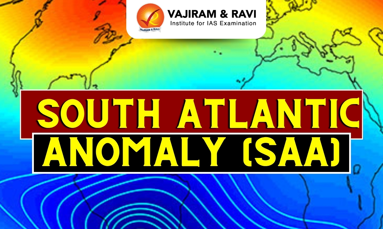
About South Atlantic Anomaly (SAA)

  • The South Atlantic Anomaly (SAA), or the "Bermuda Triangle of Space’’, is a dip in the Earth's magnetic field which allows cosmic rays and charged particles to reach lower into the atmosphere. 
  • It is southeast of South America and southwest of Africa. In this area, the planet’s magnetic field dips down.
  • It lies roughly between latitudes 5 and 40 degrees South and between longitudes 0 and 80 degrees West -- the precise strength, shape, and size of the SAA varies with the seasons.
  • It was first identified in the 19th century.
  • Why Does it Occur?
    • Earth’s magnetic field acts like a protective shield around the planet, repelling and trapping charged particles from the Sun.
    • SAA exists because the Earth’s inner Van Allen radiation belt comes closest to the planet’s surface, causing an increased flux of energetic particles.
    • This leads to the penetration of solar energetic particles deep into Earth’s atmosphere, posing severe problems for airplanes and ships’ positioning systems as well as spacecraft electronic systems.

What are the Van Allen Radiation Belts?

  • The Van Allen radiation belt is a zone of energetic charged particles, most of which originate from the solar wind. 
  • The particles are captured by and held around a planet by that planet’s magnetic field.
  • It surrounds Earth, containing a nearly impenetrable barrier that prevents the fastest, most energetic electrons from reaching Earth.
  • The outer belt is made up of billions of high-energy particles that originate from the Sun and become trapped in Earth’s magnetic field, an area known as the magnetosphere.
  • The inner belt results from interactions of cosmic rays with Earth’s atmosphere.
  • The Van Allen belts are most intense over the Equator and are effectively absent above the poles.
  • These radiation belts serve both protective and hazardous roles; while they shield Earth from harmful cosmic radiation, they can pose risks to satellites and human space missions, as the particles can interfere with electronic systems.
  • They were discovered in 1958 by James A. Van Allen, the American physicist who designed the instruments on board Explorer 1, the first spacecraft launched by the United States.

Source: NB

South Atlantic Anomaly (SAA) FAQs

Q1: What is the South Atlantic Anomaly (SAA)?

Ans: It is a dip in the Earth’s magnetic field that allows cosmic rays and charged particles to reach lower into the atmosphere.

Q2: What is the South Atlantic Anomaly popularly called?

Ans: The “Bermuda Triangle of Space”.

Q3: Where is the South Atlantic Anomaly located?

Ans: Southeast of South America and southwest of Africa.

Q4: Why does the South Atlantic Anomaly occur?

Ans: Because the inner Van Allen radiation belt comes closest to Earth’s surface in this region.

Q5: Does the South Atlantic Anomaly pose problems for navigation systems?

Ans: Yes, it affects airplanes and ships’ positioning systems.

Kali Tiger Reserve

Kali Tiger Reserve

Kali Tiger Reserve Latest News

The Union environment ministry proposes an Eco-Sensitive Zone around Karnataka's Kali Tiger Reserve, spanning 663.32 sq km.

About Kali Tiger Reserve

  • It is located in the central portion of the Uttara Kannada (North Canara) district of Karnataka.
  • The Tiger Reserve comprises two important protected areas of the region viz., Dandeli Wildlife Sanctuary (475.018 Km²) and Anshi National Park (339.866 Km²).
    • These two protected areas are contiguous to each other and form a single tract of the protected area located in the biologically sensitive Western Ghats. 
  • It shares a border with Bhimghad Wildlife Sanctuary in the north, which is further connected to Radhanagari and Koyna wildlife sanctuaries in Maharashtra. 
  • To the west, Kali Tiger Reserve shares borders with five protected areas in Goa.
  • The terrain is incredibly diverse, ranging from rolling hills and steep escarpments to riverine valleys and plateaus. 
  • River: The Kali River, which forms the major source of water for Uttara Kannada, flows through the tiger reserve, hence the name.
  • Vegetation: It is a blend of semi-evergreen and moist deciduous forests, interspersed with patches of bamboo and grasslands.
  • Flora: The reserve is rich in plant diversity, featuring species like teak, silver oak, eucalyptus, and various medicinal plants.
  • Fauna
    • Animals found in the Tiger Reserve include Tiger, Leopard, Elephant, Bison, Wild dog, Sambar, Spotted deer, Sloth bear, Wild boar, Hanuman langur, Bonnet macaque, etc.
    • The area holds one of the highest populations of Great Indian Hornbills in the Western Ghats.
    • It is also home to rare black panthers.

Source: DEV

Kali Tiger Reserve FAQs

Q1: Where is Kali Tiger Reserve located?

Ans: It is located in the central portion of Uttara Kannada district of Karnataka.

Q2: Which two protected areas together form the Kali Tiger Reserve?

Ans: Dandeli Wildlife Sanctuary and Anshi National Park.

Q3: Which river flows through Kali Tiger Reserve?

Ans: The Kali River.

Q4: What types of vegetation are found in Kali Tiger Reserve?

Ans: Semi-evergreen and moist deciduous forests with bamboo and grasslands.

Wular Lake

Wular Lake

Wular Lake Latest News

Conservation initiatives at Wular Lake in Kashmir have reclaimed 5 sq.km. of silted land, removed willows, and reinforced lake embankments to boost its ecological integrity and flood resistance.

About Wular Lake

  • It is the largest freshwater lake in India and the second largest freshwater lake in Asia.
  • Location
    • It is located in the Bandipore district of Jammu and Kashmir. 
    • It lies at the north end of the Vale of Kashmir, 32 km north-northwest of Srinagar.
    • The lake lies at an altitude of 1,580 m on the foothills of Haramuk Mountain.
  • The lake controls the flow of the Jhelum River, which runs through it.
  • It is 16 km long and 10 km wide. Its area varies from 30 to 260 sq.km. according to the season. 
  • The lake basin was formed as a result of tectonic activity.
  • It is also said to be a remnant of Satisar Lake that existed in ancient times. 
  • This lake also has a small island in its centre called the ‘Zaina Lank’. This island was constructed by King Zainul-Abi-Din.
  • It is an important habitat for fish and contributes about 60 percent of the fish yield of the Kashmir Valley.
  • In 1990, it was designated as a Wetland of International Importance under the Ramsar Convention.

Source: DEVD

Wular Lake FAQs

Q1: Which is the largest freshwater lake in India?

Ans: Wular Lake.

Q2: Where is Wular Lake located?

Ans: In Bandipore district of Jammu and Kashmir.

Q3: Which river flows through Wular Lake?

Ans: The Jhelum River.

Q4: How was the basin of Wular Lake formed?

Ans: Due to tectonic activity.

Q5: When was Wular Lake designated as a Ramsar site?

Ans: In 1990.

Vitamin D

Vitamin D

Vitamin D Latest News

A new study says that your vitamin D level in your 30s and 40s is a determining factor of your brain age in your 60s and 70s.

About Vitamin D

  • Vitamin D (also referred to as calciferol) is a fat-soluble vitamin that is naturally present in a few foods, added to others, and available as a dietary supplement.
  • It is also produced endogenously when ultraviolet (UV) rays from sunlight strike the skin and trigger vitamin D synthesis.
  • During periods of sunlight, vitamin D is stored in fat and then released when sunlight is not available.
  • Very few foods naturally contain vitamin D. Most people get vitamin D in their diet from foods that are fortified. This means that vitamin D is added to the food. These foods may include milk, cereal, and yogurt. 
  • Foods that naturally have vitamin D include egg yolks, saltwater fish, and liver.
  • The amount of vitamin D you need each day depends on your age.

Why is Vitamin D So Important?

  • Vitamin D promotes calcium absorption and helps maintain adequate levels of calcium and phosphorus in the blood, which is necessary for healthy bones and teeth.
  • Without sufficient vitamin D, bones can become thin, brittle, or misshapen.
  • Vitamin D has other roles in the body, including reduction of inflammation as well as modulation of such processes as cell growth, neuromuscular and immune function, and glucose metabolism.

Vitamin D Deficiency

  • In children, vitamin D deficiency causes rickets, a disease in which the bones become soft, weak, deformed, and painful. 
  • In teens and adults, vitamin D deficiency causes osteomalacia, a disorder that causes bone pain and muscle weakness.
  • Vitamin D deficiency may be more common in people with higher skin melanin content (darker skin) and who wear clothing with extensive skin coverage.

Can Vitamin D be Harmful?

  • Very high levels of vitamin D in your blood can cause nausea, vomiting, muscle weakness, confusion, pain, loss of appetite, dehydration, excessive urination and thirst, and kidney stones
  • Extremely high levels of vitamin D can cause kidney failure, irregular heartbeat, and even death. 

Source: NDTV

Vitamin D FAQs

Q1: Is Vitamin D fat-soluble or water-soluble?

Ans: It is a fat-soluble vitamin.

Q2: How is Vitamin D produced in the human body?

Ans: It is produced when UV rays from sunlight strike the skin.

Q3: What is the primary function of Vitamin D in the body?

Ans: Vitamin D promotes calcium absorption and helps maintain adequate levels of calcium and phosphorus in the blood.

Q4: What disease is caused by Vitamin D deficiency in children?

Ans: Rickets.

Khanij Bidesh India Limited (KABIL)

Khanij Bidesh India Limited (KABIL)

Khanij Bidesh India Limited (KABIL) Latest News

State-owned Khanij Bidesh India Limited (KABIL) recently received environmental clearance from the Argentine govt for deep exploration of five brine lithium blocks in the South American country.

About Khanij Bidesh India Limited (KABIL)

  • It is a joint venture company of three Central Public Sector Enterprises, namely, National Aluminium Company Ltd. (NALCO), Hindustan Copper Ltd. (HCL), and Mineral Exploration and Consultancy Ltd. (MECL) in the ratio of 40:30:30.
  • It was incorporated on 08.08.2019 under the Companies Act 2013, with an objective to identify, explore, and acquire overseas mineral deposits & bring strategic minerals into India. 
  • It is under the aegis of the Ministry of Mines, Government of India.
  • The company is currently focusing on two prime critical and strategic minerals, i.e., Lithium and Cobalt, and significant projects are underway in Argentina, Australia, and Chile. 
  • The authorized capital of the Company is Rs. 500 crore, and paid-up capital is Rs. 100 crore.
  • Amongst the three promoters, NALCO is one of the largest integrated primary producers of aluminum in Asia, HCL is India’s only vertically integrated copper producer, whereas MECL is one of the largest mineral exploration agencies of India.
  • The registered office of KABIL is situated in New Delhi and managed by the lead partner NALCO. 

Source: TOI

Khanij Bidesh India Limited (KABIL) FAQs

Q1: Which companies are the promoters of Khanij Bidesh India Limited (KABIL)?

Ans: National Aluminium Company Ltd. (NALCO), Hindustan Copper Ltd. (HCL), and Mineral Exploration and Consultancy Ltd. (MECL)

Q2: What is the main objective of Khanij Bidesh India Limited (KABIL)?

Ans: To identify, explore, and acquire overseas mineral deposits and bring strategic minerals into India.

Q3: Which ministry oversees Khanij Bidesh India Limited (KABIL)?

Ans: The Ministry of Mines, Government of India.

Q4: Which critical minerals is Khanij Bidesh India Limited (KABIL) primarily focusing on?

Ans: Lithium and Cobalt.

Nagarjunasagar–Srisailam Tiger Reserve

Nagarjunasagar–Srisailam Tiger Reserve

Nagarjunasagar–Srisailam Tiger Reserve Latest News

Recently, the torest Department officials have stepped up plans to resume the proposed tiger enclosure project in the Nallamala–Nagarjunasagar–Srisailam Tiger Reserve (NSTR) to care for injured, abandoned or orphaned tiger cubs.

About Nagarjunasagar–Srisailam Tiger Reserve

  • Location: It is located in the Nallamala hill ranges of Andhra Pradesh.
  • It is one of the largest tiger reserves in India.
  • It is named after two major dams in the area, Nagarjuna Sagar Dam and Srisailam Dam.
  • Two wildlife sanctuaries, namely Rajiv Gandhi Wildlife Sanctuary and Gundla Brahmeswaram Wildlife Sanctuary (GBM), constitute the NSTR.
  • Rivers: The River Krishna traverses through this reserve.
  • The reserve holds significant importance with ancient temples like the Mallikarjuna Swamy Temple at Srisailam and several archaeological sites, including Buddhist relics from the Nagarjuna Konda area.
  • Topography: It consists of plateaus, ridges, gorges, and deep valleys.
  • Vegetation: It mainly consists of Tropical dry deciduous forests having an undergrowth of bamboo and grass.
  • Flora: The habitat has several endemics like Andrographis nallamalayana, Eriolaena lushingtonii, Crotalaria madurensis Var, Dicliptera beddomei, and Premna hamiltonii.
  • Fauna: Tiger, Leopard, Wolf, Wild Dog and Jackal, Sambar, Chital, Chowsingha, Chinkara, Mouse Deer, Wild boar, and Porcupine etc.

Source: NIE

Nagarjunasagar–Srisailam Tiger Reserve FAQs

Q1: What is the main river flowing through the reserve?

Ans: Krishna

Q2: Where is the Nagarjunasagar-Srisailam Tiger Reserve located?

Ans: Andhra Pradesh

Enquire Now