Murchison Widefield Array Latest News
Using the Murchison Widefield Array (MWA), astronomers recently discovered a new millisecond pulsar as part of the ongoing Southern-sky MWA Rapid Two-metre (SMART) survey.
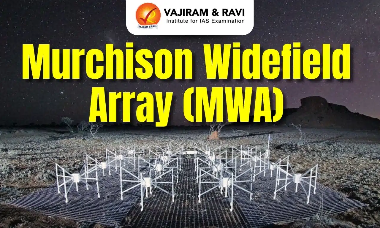
About Murchison Widefield Array
- It is a low-frequency radio telescope located at the Murchison Radio-astronomy Observatory (MRO) in Western Australia, where the future low-frequency Square Kilometre Array (SKA) will be built.
- It is a collaboration between 20 research institutions in five countries (Australia, Canada, China, Japan, and the United States) and is led by Curtin University, Australia.
- It is made of 4,096 spider-like antennas tuned to receive signals from the sky between 70 and 300 MHz.
- It is special for its very wide field of view, high angular resolution, nanosecond time resolution, and digital pointing agility.
- This makes the instrument invaluable for quickly mapping the sky and studying rare and faint events as they happen.
- The MWA is used to study:
- The early Universe, particularly the Epoch of Reionization, when the first stars and galaxies formed.
- The structure and evolution of galaxies and galaxy clusters.
- The Sun and space weather, including solar flares and coronal mass ejections.
- Transient radio sources, such as pulsars and fast radio bursts.
- The interstellar medium and cosmic magnetism.
Key Facts about Southern-sky MWA Rapid Two-metre (SMART)
- SMART pulsar survey is an ongoing project to discover new pulsars (neutron stars) in the southern sky using the MWA.
- This is the only pulsar survey capable of looking for pulsars in the Southern Hemisphere at low frequencies (140-170 MHz).
- Once complete, it is expected to discover hundreds of new pulsars.
- Apart from its inherent scientific value, it also serves as a valuable reference for future pulsar searches planned with the low-frequency SKA.
Key Facts about Square Kilometre Array
- It is an international effort to build the world’s largest and most sensitive radio telescope to help better understand the history of the universe.
- It is co-located in Australia (SKA-Low) and South Africa (SKA-Mid) with operational headquarters in the UK, and is expected to revolutionize radio astronomy.
- The construction of the project officially started on 5 December 2022.
- The telescope will consist of hundreds of antennas that will generate unprecedented data volumes.
- It is meant to observe the universe in a new way and probe questions related to the origins of the universe, the formation and evolution of galaxies, and seeking the origins of life.
- India became a member of SKA in December 2022.
- Other countries involved in this project are Australia, South Africa, the United Kingdom, Canada, China, France, Germany, Italy, Portugal, Spain, Sweden, Switzerland, and the Netherlands.
What are Pulsars?
- Pulsars are rapidly rotating neutron stars that blast out pulses of radiation at regular intervals ranging from seconds to milliseconds.
- Neutron stars are highly dense remnants of massive stars that have collapsed, composed mainly of neutrons and other elementary particles.
- Pulsars have very strong magnetic fields, which funnel jets of particles out along the two magnetic poles. These accelerated particles produce very powerful beams of light.
- Often, the magnetic field is not aligned with the spin axis, so those beams of particles and light are swept around as the star rotates.
- The periodicity of pulsars is caused by these beams of light crossing the line of sight on Earth, with the pulsar appearing to ‘switch off’ at points when the light is facing away from us. The time between these pulses is the ‘period’ of the pulsar.
- Pulsars have been primarily observed at radio wavelengths.
- Pulsar masses range between 1.18 and 1.97 times that of the Sun, but most pulsars have a mass 1.35 times that of the Sun.
News: PHYS
Murchison Widefield Array FAQs
Q1: What is the Murchison Widefield Array (MWA)?
Ans: It is a low-frequency radio telescope.
Q2: Where is the Murchison Widefield Array located?
Ans: It is located at the Murchison Radio-astronomy Observatory (MRO) in Western Australia.
Q3: Which countries participate in the Murchison Widefield Array (MWA) collaboration?
Ans: Australia, Canada, China, Japan, and the United States.
Q4: How many antennas make up the Murchison Widefield Array?
Ans: It consists of 4,096 spider-like antennas.