RVV BD Missile

RVV BD Missile

RVV BD Missile Latest News

To significantly enhance the beyond-visual-range (BVR) combat capabilities of the IAF, the Ministry of Defence is evaluating a critical proposal to equip the Su-30MKI fighter fleet with Russian-made RVV-BD long-range air-to-air missiles.

About RVV BD Missile

  • The RVV-BD (Raketa Vozduh-Vozduh Bolshoy Dalnosti) is a Russian-developed beyond-visual-range air-to-air missile. 
  • The RVV BD is the export version of the R-37M missile, one of the world’s longest-range air-to-air missiles.  
  • It is specifically designed to engage strategic targets such as Airborne Early Warning and Control (AEW&C) aircraft, airborne command platforms, and other critical aerial assets.  

RVV BD Missile Features

  • It is known that the missile has a maximum firing range in the forward hemisphere of up to 200 kilometres.  
  • The missile travels at hypersonic speeds of around Mach 6.  
  • It carries a 60 kg high-explosive fragmentation warhead and uses a radioactive proximity fuse plus contact sensor for assured detonation.  
  • At ~4 meters length and ~510 kg weight, it can be mounted under the Su-30MKI without compromising agility.  
  •  It is equipped with an active-passive radar homing head, an inertial guidance system, and a radio correction link.

News: DEF

RVV BD Missile FAQs

Q1: What is the RVV-BD missile?

Ans: The RVV-BD is a Russian-developed beyond-visual-range air-to-air missile.

Q2: Which country developed the RVV-BD missile?

Ans: Russia.

Q3: What is the maximum firing range of the RVV-BD in the forward hemisphere?

Ans: Up to 200 kilometres.

Q4: At approximately what speed can the RVV-BD missile travel?

Ans: Around Mach 6, which is hypersonic speed.

MatsyaMetri

MatsyaMetri

MatsyaMetri Latest News

A man was killed after being attacked by a wild buffalo while working in a jute field on a river island near the Burachapori Wildlife Sanctuary in Assam’s Nagaon district recently.

About MatsyaMetri

  • It is a smartphone application developed by the Central Marine Fisheries Research Institute (CMFRI), headquartered in Kochi.
  • It can measure the length and width of fish without physically handling them. 
  • The application, which has been designed for fisheries scientists, researchers, and field survey teams, facilitates rapid and systematic collection of biological data to support fisheries assessment and management. 
  • The application simplified biological data collection by automatically recording measurements and generating length-frequency datasets.
  • It allows multiple individuals of the same fish species or aquatic resource to be measured under a single sampling session. 
  • Once measurements are completed, the system automatically generates length-frequency distributions using appropriate class intervals.
  • The recorded measurements and the corresponding photographs can be saved along with the sampling session and subsequently exported as a CSV file for further analysis.

News: TH

MatsyaMetri FAQ's

Q1: What is MatsyaMetri?

Ans: MatsyaMetri is a smartphone application developed for the rapid and systematic collection of biological data from fish and other aquatic resources.

Q2: Which organisation developed MatsyaMetri?

Ans: The Central Marine Fisheries Research Institute (CMFRI).

Q3: Where is the headquarters of the Central Marine Fisheries Research Institute (CMFRI) located?

Ans: Kochi, Kerala.

Q4: What is the major advantage of MatsyaMetri in measuring fish?

Ans: It can measure fish length and width without physically handling the fish.

Q5: Who are the primary users of MatsyaMetri?

Ans: Fisheries scientists, researchers, and field survey teams.

Virtual Private Network (VPN)

Virtual Private Network (VPN)

Virtual Private Network Latest News

Authorities in Jammu and Kashmir's Doda recently ordered a complete ban on the use of Virtual Private Networks (VPNs) across the district for two months, citing concerns over cybersecurity, unlawful activities and maintaining public order.

About Virtual Private Network 

  • It is a service that creates a secure, encrypted connection between a user's device and the internet. 
  • It works by creating an encrypted connection, often called a tunnel, between your device and a secure server operated by the VPN provider. 
  • By routing web traffic through the isolated digital tunnel, it hides the user's actual IP address and protects their data from unauthorized interception. 
  • This ensures privacy and data security when accessing corporate networks or utilizing public internet connections. 
  • VPNs protect data from hackers, mask IP addresses, and are commonly used for secure remote access and bypassing geographic restrictions. 
  • However, VPNs don't provide total anonymity, as ISPs can still see the size of incoming and outgoing traffic, but not the content. 

What are VPNs Used for?

  • Regular internet users and organizations use VPNs for virtual privacy. 
    • Organizations deploy VPNs to ensure authorized users can access their data center using encrypted channels. 
    • VPNs also enable users to connect to a database from the same organization located in a different area.
  • VPNs provide remote employees, gig economy freelance workers, and business travelers with access to software applications hosted on proprietary networks. 
    • To gain access to a restricted resource through a VPN, the user must be authorized to use the VPN and provide one or more authentication factors. 
    • These can be passwords, security tokens, or biometric data.
  • When an internet user surfs the web, an attacker could access information, including browsing habits or IP addresses. 
    • If privacy is a concern, a VPN can provide users with peace of mind. 
    • Most users find value in VPNs’ encryption, anonymity, and ability to get around geographically blocked content.
  • For example, getting around blocked content from another country might be extremely useful for journalists. If a country is likely to block internet content from foreign entities, journalists could use a VPN to look like they're within that country.

News: NIE

Virtual Private Network FAQs

Q1: What is a Virtual Private Network (VPN)?

Ans: A VPN is a service that creates a secure, encrypted connection between a user's device and the internet.

Q2: What does a VPN hide from websites and online services?

Ans: The user's actual IP address.

Q3: How does a VPN protect data from unauthorized interception?

Ans: By routing internet traffic through an encrypted digital tunnel.

Q4: What is the primary purpose of a VPN?

Ans: To enhance privacy and data security by encrypting internet traffic and masking the user's IP address.

Shekhawati Havelis

Shekhawati Havelis

Shekhawati Havelis Latest News

The state government announced recently that the historic and richly frescoed havelis of Rajasthan’s Shekhawati region have been included in UNESCO’s tentative list.

What are Havelis?

  • Havelis are old mansions or large townhouses constructed around an open courtyard. 
  • The name comes from the Arabic hawali, a "private space," since they were originally enclosed family dwellings. 
  • This type of building is found throughout India, but particularly in northwestern India (Rajasthan, Punjab, and Gujarat), where large climatic variations pose challenges in terms of living comfort. 
  • These multi-story houses—frequently constructed by royalty or merchants—have central courtyards (generally with fountains) that bring in light and ventilation in the hot climate of India.
  • Contrary to Western mansions, havelis focus on inwardly facing design with intricately ornamented balconies (jharokhas), latticework screens, and frescoed walls. 
  • Originally busy family residences, numerous havelis now are "living museums" of India's history, restored as heritage hotels or cultural centers.

About Shekhawati Havelis

  • Located in the northeastern Rajasthan, the Shekhawati region is often associated with its magnificent havelis covered in intricate wall paintings. 
  • Towns and villages across the region feature historic mansions whose façades, courtyards and interiors showcase detailed frescoes.
  • These paintings depict a fascinating mix of themes, ranging from Hindu mythology and royal and local traditions to scenes influenced by everyday life and changing times. 
  • Some artworks also reflect the arrival of modern technology and foreign influences, creating a distinctive visual record of the region’s history.
  • The havelis themselves are equally notable for their architectural details, including ornate gateways, balconies, courtyards, carved elements, and decorative façades.
  • Together, the buildings and paintings create a unique urban landscape that sets Shekhawati apart from other heritage regions of Rajasthan.

News: TP

Shekhawati Havelis FAQs

Q1: Where is the Shekhawati region located?

Ans: Northeastern Rajasthan.

Q2: What type of paintings are prominently found on the havelis of Shekhawati?

Ans: Detailed fresco paintings.

Q3: What themes are commonly depicted in the frescoes of Shekhawati havelis?

Ans: Hindu mythology, royal and local traditions, everyday life, and changing times.

Q4: What architectural features are characteristic of Shekhawati havelis?

Ans: Ornate gateways, balconies, courtyards, carved elements, and decorative façades.

Barakuru

Barakuru

Barakuru Latest News

A historically significant Siditale hero stone has been recently discovered at Barakuru during an epigraphical survey of the Panchalingeshwara Temple.

About Barakuru

  • Barakuru, also known as Barkur, is an ancient historical port town located in Udupi district, Karnataka. 
  • It is situated on the banks of the river Sita. The town is about 5 km east of the Arabian Sea Coast.    
  • The place was called by several names in ancient times as Varakula, Barakanur, and Barahkanyapura.
  • History:
    • The port town was a busy commercial centre almost from the 2nd century B.C. 
    • Evidence of Megalithic and Mesolithic ages has been discovered recently.
    • The maritime port enjoyed massive economic prosperity, trading extensively with foreign nations across the wide Arabian Sea. 
    • The Alupa rulers converted this commercial centre into a political centre by making it their capital during the 10th-11th centuries A.D. 
    • It led to further development of socio-economic activities. With new vigour the city became the heart and hearth of the Tuluva culture.
    • In later times, the city became the provincial headquarters of the Hoysalas and then the Vijayanagara Empire. The city was expanded with a new fort during this period. 
    • Further, Barakur witnessed the rule of Keladi Nayaks, Haider, and Tipu of Mysore and the British.
  • The city had ten extensions called Keris–each being named after its professional residents. Each Keri had a tank and a number of temples. 
  • The town's main attractions are the temples with typical tiled roofs. 
    • It once housed an incredible network of exactly 365 temples. The deeply pious Alupa kings strictly visited one unique temple each day of the entire calendar year. 
    • The Panchalingeshwara Temple situated at the southern end of the town is the most famous among the temples here. 
  • Barkur was also a Jain settlement in the ancient days. 
  • The place abounds with history and has yielded a little over 100 stone and several copper plate inscriptions. 
    • They belong to the Alupa, the Hoysala, the Vijayanagara, and the Keladi periods. 

News: IS

Barakuru FAQs

Q1: Where is Barakuru, also known as Barkur, located?

Ans: Udupi district, Karnataka.

Q2: What type of historical settlement is Barakuru?

Ans: An ancient historical port town.

Q3: On the banks of which river is Barakuru situated?

Ans: River Sita.

Q4: By what other names was Barakuru known in ancient times?

Ans: Varakula, Barakanur, and Barahkanyapura.

Q5: Which dynasty made Barakuru its capital during the 10th–11th centuries A.D.?

Ans: The Alupa dynasty.

Mindoro bleeding-heart Pigeon

Mindoro bleeding-heart Pigeon

Mindoro bleeding-heart Pigeon Latest News

Recently, Mindoro bleeding-heart pigeon reappeared after 20 years which confirmed that it is still surviving in the wild. 

About Mindoro bleeding-heart Pigeon

  • It is a ground-dwelling pigeon endemic to Mindoro, Philippines.
  • It is one of seven species of bleeding-hearts, or “bleeding-heart” doves, five of which are endemic to the Philippines.
  • Appearance: It measures about 30 cm in length and has orange-red spot on white chest, together with the iridescent green plumage on its head and neck.
  • Habitat: It has generally been described as a lowland forest specialist, typically occurring at elevations of around 400 meters (1,300 feet), and occasionally up to 800 m (2,600 ft).
  • Behaviour: It is ground-dwelling and usually takes flight only when threatened.
  • Males and females look almost identical.
  • Conservation Status: IUCN Red List:  Critically Endangered (CR)
  • Threats: It is threatened by hunting and habitat loss.
    • Its habitat is affected by slash-and-burn agriculture, agricultural use, rattan harvesting, and marble quarrying.

Source: TOI

Mindoro bleeding-heart Pigeon FAQs

Q1: What is Mindoro bleeding-heart Pigeon ?

Ans: It is a ground-dwelling pigeon endemic to Mindoro, Philippines.

Q2: What is the IUCN status of Mindoro bleeding-heart Pigeon?

Ans: Critically endangered

Financial Fraud Risk Indicator

Financial Fraud Risk Indicator

Financial Fraud Risk Indicator Latest News

The Department of Telecommunications (DoT) has prevented suspected cyber fraud losses of more than ₹5,000 crore through its Financial Fraud Risk Indicator (FRI) in the 15 months since its launch. 

About Financial Fraud Risk Indicator

  • It was launched in May 2025 by the Department of Telecommunications (DoT’s) Digital Intelligence Unit (DIU).
  • It is a risk-based metric that classifies mobile numbers into three categories: Medium, High, and Very High Risk based on their likelihood of involvement in financial fraud.
  • The classification draws from a comprehensive analysis using inputs from various platforms, including the Indian Cybercrime Coordination Centre’s National Cybercrime Reporting Portal (NCRP), DoT’s Chakshu platform, and intelligence shared by banks and financial institutions.
  • This tool enables banks, non-banking financial companies (NBFCs), and UPI service providers to take appropriate measures for customer protection and transaction validation.

Key Facts about Digital Intelligence Unit

  • It was launched in 2024.
  • It is a secure, nationwide intelligence-sharing and coordination platform developed by DoT.
  • Purpose: To counter telecom-enabled cyber frauds and the misuse of telecom resources.
  • Functions
    • It enables real-time collaboration with telecom service providers, banks, financial institutions, law enforcement agencies and government departments, through the sharing of actionable intelligence on the Mobile Number Revocation List (MNRL), suspected fraudulent mobile numbers (FRI) and related digital identifiers.
    • By bringing these stakeholders onto a single platform, DIP has institutionalised a whole-of-ecosystem approach to fraud prevention.

Source: PIB

Financial Fraud Risk Indicator FAQs

Q1: Which organisation launched the Financial Fraud Risk Indicator?

Ans: It was launched in May 2025 by the Department of Telecommunications (DoT’s) Digital Intelligence Unit (DIU).

Q2: What is Digital Intelligence Unit?

Ans: It is a secure, nationwide intelligence-sharing and coordination platform developed by Department of Telecommunication.

Hindon River

Hindon River

Hindon River Latest News

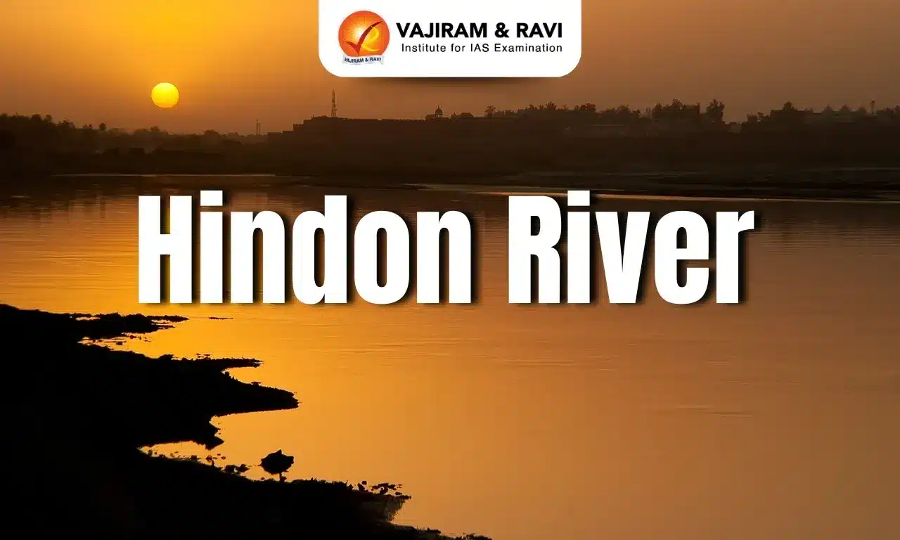
Two men in their 20s are feared to have drowned in the Hindon River near Haibatpur in Greater Noida recently.

About Hindon River

  • It is a tributary of the Yamuna River.
  • Course:
    • It originates in the Saharanpur district of Uttar Pradesh, in the Siwalik Hills, at an elevation of about 800 meters above sea level.
    • It flows across the industrial belt of Western Uttar Pradesh and Haryana before merging with the Yamuna River near Noida.
  • Total Length: 400 km
  • The river is entirely fed by rain, with a significant increase in water flow during the monsoon season.
  • Tributaries: The Kali (West) River and Krishni River are the main tributaries.
  • It is on the banks of this river that archeologists found traces of the Harappan civilization with sites dating back to as long as 2500 BC. 
  • The Hindon River was a site for several skirmishes between Indian troops and British soldiers in the first revolt of independence 1857, including the battle of Badli-ki-serai, and the graves of British soldiers and officers can still be seen. 
  • Due to urban, agricultural, and industrial waste which is being released without sufficient treatment into its waters, the Hindon is now one of the most polluted stretches in the Ganga basin.
  • In 2015, the Central Pollution Control Board (CPCB) found the Hindon’s pollution levels were so severe that it was declared a ‘dead river’ and ‘unfit’ even for bathing in several sections of the river.

News: HT

Hindon River FAQs

Q1: Hindon River is a tributary of which major river?

Ans: It is a tributary of the Yamuna River.

Q2: Where does the Hindon River originate?

Ans: It originates in the Siwalik Hills of Saharanpur district, Uttar Pradesh.

Q3: Through which region does the Hindon River flow?

Ans: It flows across the industrial belt of Western Uttar Pradesh and Haryana.

Q4: What is the total length of the Hindon River?

Ans: About 400 km.

Cell Broadcasting System

Cell Broadcasting system

Cell Broadcast System Latest News

Recently, the Cell Broadcast System (CBS) has been resumed in India, by the Centre for Development of Telematics (C-DoT). 

About Cell Broadcast System

  • It is a telecom-enabled public warning system that enables authorities to broadcast simultaneous, geo-targeted alerts to mobile devices within a defined area.
  • It is indigenous technology developed by the Centre for Development of Telematics (C-DOT) under the Department of Telecommunications (DoT), in collaboration with the National Disaster Management Authority and the Ministry of Home Affairs (MHA).

Features of Cell Broadcast System

  • It uses common messaging protocols that have been incorporated by all the major handset makers around the world. 
  • Unlike SMS alerts, CB messages are broadcast to all mobile phones in a specific area, ensuring rapid delivery even in congested networks.
  • Messages are delivered in near real-time, reaching users within seconds without any queuing delays.
  • It offers precise geo-targeting capabilities, enabling alerts to be disseminated at the level of individual cell towers or clusters.
  • It provides universal reach by covering all mobile users within the targeted area, including those who are roaming.
  • Supported across 2G to 5G networks, it ensures wide reach in both urban and rural areas, including last-mile and roaming populations.
  • These alerts are delivered as priority notifications, appearing as pop-up messages accompanied by distinct loud tones, with text messages with multilingual alerts read aloud on supported mobile handsets.

Source: TH

Cell Broadcast System FAQs

Q1: What is Cell Broadcast System?

Ans: is a telecom-enabled public warning system that enables authorities to broadcast simultaneous, geo-targeted alerts to mobile devices within a defined area.

Q2: Which organisation developed the Cell Broadcast System?

Ans: It is indigenous technology developed by the Centre for Development of Telematics.

e-FAST India Initiative

e-FAST India Initiative

e-FAST India Initiative Latest News

Recently, NITI Aayog launched the Platform for Aggregating Clean Transport (PACT) at the 5th e-FAST India Summit 2026. 

About e-FAST India Initiative

  • The e-FAST India (Electric Freight Accelerator for Sustainable Transport - India) is a NITI Aayog government–industry platform focused on moving medium- and heavy-duty freight towards zero-emission vehicles.
  • It brings together government and industry stakeholders
  • It includes OEMs, logistics service providers, financiers, shippers and charge point operators - to accelerate the transition to zero-emission freight in India, particularly in the medium- and heavy-duty vehicle segments.

What is the Platform for Aggregating Clean Transport (PACT)?

  • It is a flagship initiative under the e-FAST India platform.
  • It is designed to aggregate freight demand from shippers, Logistics Service Providers (LSPs) and other ecosystem stakeholders and translate it into deployment opportunities across identified freight corridors.
  • It brings together shippers, LSPs, vehicle manufacturers, financiers, charge point operators (CPOs) to improve demand visibility, support charging infrastructure planning and strengthen the commercial case for electric medium- and heavy-duty vehicles (e-MHDVs).

Source: PIB

e-FAST India Initiative FAQs

Q1: What is e-FAST India Initiative?

Ans: It is a NITI Aayog government–industry platform focused on moving medium- and heavy-duty freight towards zero-emission vehicles.

Q2: What is NITI Aayog?

Ans: NITI Aayog (National Institution for Transforming India) is the premier public policy think tank of the Government of India, established on January 1, 2015,

Bhitarkanika National Park

Bhitarkanika National Park

Bhitarkanika National Park Latest News

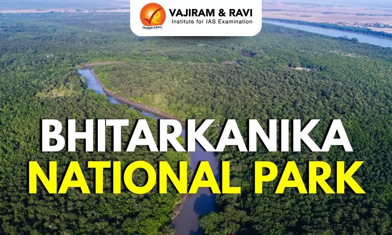
Recently, hundreds of saltwater crocodile hatchlings have begun emerging from nests in the Bhitarkanika National Park.

About Bhitarkanika National Park

  • Located: It is located in the state of Odisha.
  • It is surrounded by the Bhitarkanika Wildlife Sanctuary. Gahirmatha Beach and Marine Sanctuary lie to the east, and separates a swamp region covered with a canopy of mangroves from the Bay of Bengal. 
  • It is India’s second largest mangrove ecosystem after the Sunderbans. 
  • It is nestled in the estuary of Brahmani, Baitarani, and Dhamra rivers.
  • Vegetation: The vegetation and species of the sanctuary are those that are mainly found in the tropical and subtropical intertidal regions.
  • It is also designated as a Ramsar site.
  • Flora: Mangrove species, casuarinas, and grasses like the indigo bush.
  • Fauna
    • It is home to the largest congregation of saltwater crocodiles in the country.
    • The Gahirmatha Beach is the largest colony of the Olive Ridley Sea Turtles.
    • It is also home to numerous animals like hyenas, wild boar, Chitals, Sambar, Spotted Deer, Wild Boar, Jungle cat, Wild Pigs, etc., and migratory birds, which make it their home during the winter season, lending a vibrant hue to the ecosystem.

Source: DH

Bhitarkanika National Park FAQs

Q1: Where is Bhitarkanika National Park located?

Ans: Odisha

Q2: Bhitarkanika National Park is home to which type of crocodile?

Ans: It is home to the largest congregation of saltwater crocodiles in the country.

Enquire Now