
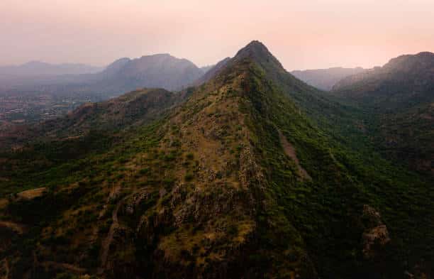
About Aravalli Range:
- It is one of the oldest fold mountains of the world.
- It runs approximately 670 km (430 mi) in a south-west direction, starting near Delhi, passing through southern Haryana and Rajasthan, and ending in Gujarat.
- The highest peak is Guru Shikhar at 1,722 metres (5,650 ft). Guru is a peak in the Arbuda Mountains of Rajasthan.
- Rivers: Three major rivers and their tributaries flow from the Aravalli, namely Banas and Sahibi rivers which are tributaries of Yamuna, as well as Luni River which flows into the Rann of Kutch.
- Formation:
- It is part of the Aravalli-Delhi orogenic belt, which is a large and complex geological structure formed due to the collision of tectonic plates during the Proterozoic era.
- It is part of the Indian Shield that was formed from a series of cratonic collisions.
- In ancient times, Aravalli were extremely high but since have worn down almost completely by millions of years of weathering.
- The range is rich in mineral resources like copper, zinc, lead, and marble.
- It is divided into two sections: the Sambhar-Sirohi ranges, taller and including Guru Shikhar; and the Sambhar-Khetri ranges, consisting of three ridges that are discontinuous.
Q1) What is a fold mountain?
A fold mountain is a type of mountain that forms when rock layers are subjected to compressive forces, causing them to bend and buckle. These mountains are created through the process of tectonic plate movements, specifically when two tectonic plates collide. The collision pushes the Earth’s crust upwards, leading to the formation of large, elongated mountain ranges with a series of parallel ridges and valleys.
Source: Aravalli Rejuvenation Board formed to curb illegal mining in Aravallis


Last updated on November, 2025
→ Check out the latest UPSC Syllabus 2026 here.
→ Join Vajiram & Ravi’s Interview Guidance Programme for expert help to crack your final UPSC stage.
→ UPSC Mains Result 2025 is now out.
→ UPSC Notification 2026 is scheduled to be released on January 14, 2026.
→ UPSC Calendar 2026 is released on 15th May, 2025.
→ The UPSC Vacancy 2025 were released 1129, out of which 979 were for UPSC CSE and remaining 150 are for UPSC IFoS.
→ UPSC Prelims 2026 will be conducted on 24th May, 2026 & UPSC Mains 2026 will be conducted on 21st August 2026.
→ The UPSC Selection Process is of 3 stages-Prelims, Mains and Interview.
→ UPSC Result 2024 is released with latest UPSC Marksheet 2024. Check Now!
→ UPSC Prelims Result 2025 is out now for the CSE held on 25 May 2025.
→ UPSC Toppers List 2024 is released now. Shakti Dubey is UPSC AIR 1 2024 Topper.
→ UPSC Prelims Question Paper 2025 and Unofficial Prelims Answer Key 2025 are available now.
→ UPSC Mains Question Paper 2025 is out for Essay, GS 1, 2, 3 & GS 4.
→ UPSC Mains Indian Language Question Paper 2025 is now out.
→ UPSC Mains Optional Question Paper 2025 is now out.
→ Also check Best IAS Coaching in Delhi