Long Range Anti-Ship Missile (LRAShM)

Long Range Anti-Ship Missile (LRAShM)

Long Range Anti-Ship Missile (LRAShM) Latest News

India’s indigenous LR-ASHM missile will be on display at the Republic Day parade on January 26, highlighting the country’s growing maritime strike capability.

About Long Range Anti-Ship Missile (LRAShM)

  • It is a hypersonic glide missile developed by the Defence Research and Development Organisation (DRDO).
    • Hypersonic glide vehicles (HGVs) like the LRAShM differ from traditional ballistic missiles, which follow a fixed trajectory.
    • HGVs are launched on a rocket, ascend to the upper atmosphere, and then glide towards their target in an unpredictable manner.
    • This combination of exceptional speed and maneuverability makes them extremely difficult to intercept with existing air defense technologies.
  • It outperforms similar missiles like China’s DF-17 in terms of range and technology.
  • It is being built for anti-ship roles (to target enemy warships and carrier groups) and may also evolve into a land-attack variant.

Long Range Anti-Ship Missile (LRAShM) Features

  • The missile’s standout feature is its incorporation of a delta-wing hypersonic glide vehicle (HGV), which allows it to follow highly complex and adaptive flight paths.
  • It is reported to have a range of over 1,500 kilometers.
  • This missile operates at 10 Mach, making it 10 times faster than the speed of sound.
  • This missile can obliterate an enemy ship or warship within 7 to 8 minutes of being launched.
  • The missile's radio frequency (RF) seeker, designed to operate effectively at hypersonic speeds, ensures accurate strikes against moving targets, such as warships, a capability that very few weapons possess.
  • It is configured for launches from both land-based platforms and naval vessels, offering versatility in combat scenarios.
  • It is capable of carrying various payloads, including both conventional and nuclear warheads,
  • The incorporation of special heat-resistant materials ensures the missile can withstand extreme temperatures without disintegrating during flight, setting a new benchmark in scramjet and glide technology.

Source: ZEE

Long Range Anti-Ship Missile (LRAShM) FAQs

Q1: What is the Long Range Anti-Ship Missile (LRAShM)?

Ans: It is a hypersonic glide missile developed by the Defence Research and Development Organisation (DRDO).

Q2: What is the primary role of Long Range Anti-Ship Missile (LRAShM)?

Ans: Anti-ship warfare, targeting enemy warships and aircraft carrier groups.

Q3: What is the reported range of Long Range Anti-Ship Missile (LRAShM)?

Ans: More than 1,500 kilometres.

Kamala Hydroelectric Project

Kamala Hydroelectric Project

Kamala Hydroelectric Project Latest News

The Public Investment Board (PIB) recently gave approval for the Rs 26,070-crore, 1,720 MW Kamala hydroelectric project in Arunachal Pradesh.

About Kamala Hydroelectric Project

  • It is a 1,720 MW hydroelectric project proposed on the Kamala River (a major tributary of the Subansiri River) in Arunachal Pradesh's Kamle district.
  • It is a storage-based scheme with a flood moderation component.
  • The project involves construction of a 216-metre-high concrete gravity dam and an underground powerhouse.
  • The project will generate 6,869.92 MU of green energy annually on completion.
  • In addition to power generation, the project also envisaged to provide flood relief in the Brahmaputra valley.
  • The project will be implemented on a Build-Own-Operate-Transfer (BOOT) basis through a joint venture company with 74% equity by NHPC and 26% by the Govt of Arunachal Pradesh (GoAP).
  • The completion cost of the project is estimated at Rs 26,069.50 crore.
  • The project’s financing structure reflects strong institutional backing, with a 70:30 debt-equity ratio, substantial Central grants—Rs 1,340 crore for enabling infrastructure and Rs 4,743.98 crore for flood moderation—and 100 percent SGST reimbursement by the Arunachal Pradesh Government.

Source: TOI

Kamala Hydroelectric Project FAQs

Q1: Where is the Kamala Hydroelectric Project proposed to be located?

Ans: It is proposed on the Kamala River in Kamle district of Arunachal Pradesh.

Q2: What is the total installed capacity of the Kamala Hydroelectric Project?

Ans: The project has an installed capacity of 1,720 MW.

Q3: Kamala River is a tributary of which major river?

Ans: The Kamala River is a tributary of the Subansiri River.

Q4: Does the Kamala Hydroelectric Project have a flood moderation component?

Ans: Yes, the project includes a flood moderation component.

North Island

North Island

North Island Latest News

A magnitude 5.5 earthquake struck the North Island region of New Zealand recently.

About North Island

  • It is one of the two main islands of New Zealand in the South Pacific Ocean. 
  • It is separated from the South Island by Cook Strait. 
  • It covers an area of about 113,729 sq.km. This makes it the 14th largest island in the world. 
  • The North Island is smaller than the South Island but has more people living on it.
    • About 77% of all New Zealand residents live on the North Island.
    • It is the most populated island in Polynesia.
  • The island’s terrain rises to a central mountain range (a continuation of the South Island range), which parallels the east coast. 
    • The range reaches its highest point at the volcanic Mount Ruapehu (2,797 metres) within Tongariro National Park (designated a UNESCO World Heritage Site in 1990).
  • Many important cities are found on the North Island. 
    • These include Auckland, which is the largest city. 
    • The capital city of New Zealand, Wellington, is also located here. 
    • Other major cities are Hamilton, Tauranga, and Rotorua.
  • Important bodies of water on the island include:
    • Lake Taupō
    • Waikato River
    • Whanganui River
  • The North Island has several active and dormant volcanoes:
    • Auckland Volcanic Field
    • Mount Ruapehu
    • Mount Taranaki (also called Taranaki Maunga)
    • Mount Tarawera
    • Whakaari/ White Island
    • North Island Volcanic Plateau

Source: IT

North Island FAQs

Q1: What is the North Island?

Ans: It is one of the two main islands of New Zealand located in the South Pacific Ocean.

Q2: Which strait separates the North Island from the South Island?

Ans: The Cook Strait separates the two islands.

Q3: What is the highest point on the North Island?

Ans: Mount Ruapehu at 2,797 metres.

Q4: Which is the largest city located on the North Island?

Ans: Auckland is the largest city.

Q5: Which capital city of New Zealand is located on the North Island?

Ans: Wellington is located on the North Island.

Weimar Triangle

Weimar Triangle

Weimar Triangle Latest News

India’s External Affairs Minister recently participated in India’s first-ever engagement in the Weimar Triangle, with French and Polish counterparts along with German representatives.

About Weimar Triangle

  • It is a regional political grouping of France, Germany, and Poland.
  • It was formed on 29 August 1991 by a joint declaration issued in Weimar, Germany, by the Foreign Ministers of the three countries.
  • It had three objectives: 
    • To involve France in German-Polish reconciliation by building on the Franco-German experience; 
    • To strengthen dialogue and political cooperation between the three countries.
    • To support Poland in its process of integration into NATO and the European Union (EU).
  • Regular meetings at levels including heads of government, foreign ministers, and European affairs ministers have enabled coordination on EU policies, with notable outcomes including Poland's accession to NATO in 1999 and the European Union in 2004.
  • Although the Weimar Triangle still has no institutional structure, it remains a framework of reference at the political level.
  • Beyond diplomacy, it encompasses civil society efforts like youth exchanges, academic collaborations, and business networks to promote intercultural dialogue and mobility.

Source: HT

Weimar Triangle FAQs

Q1: What is the Weimar Triangle?

Ans: It is a regional political grouping of France, Germany, and Poland.

Q2: When was the Weimar Triangle formed?

Ans: It was formed on 29 August 1991.

Q3: What was the primary purpose of involving France in the Weimar Triangle?

Ans: To involve France in German-Polish reconciliation using the Franco-German experience.

Q4: What role did the Weimar Triangle aim to play in European cooperation?

Ans: It aimed to strengthen dialogue and political cooperation among France, Germany, and Poland

Q5: How did the Weimar Triangle support Poland’s international integration?

Ans: It supported Poland’s integration into NATO and the European Union.

M-STrIPES

M-STrIPES

M-STrIPES Latest News

Forest staff who are to be involved in the census of tigers and other wild animals at Anamalai Tiger Reserve will be using the advanced Monitoring System for Tigers: Intensive Protection and Ecological Status (M-Stripes/MSTrIPES) app.

About M-STrIPES

  • The MSTrIPES (Monitoring System for Tigers: Intensive Protection and Ecological Status) is a software-based monitoring system created to assist patrol and protect tiger habitats. 
  • It was launched by the National Tiger Conservation Authority (NTCA) along with the Wildlife Institute of India in 2010.
  • It is designed to assist wildlife protection, monitoring, and management of Protected Areas.
  • The programme consists of two parts: an analytical engine with a central desktop software and an online analysis tool, and an Android-based mobile application that records field observations and tracks using real-time GPS.
  • It uses Global Positioning System (GPS), General Packet Radio Services (GPRS), and remote sensing, 
    • to collect information from the field
    • create a database using modern Information Technology (IT)-based tools
    • analyze the information using GIS and statistical tools 
    • to provide inferences that allow tiger reserve managers to better manage their wildlife resources.
  • Under MSTrIPES protocols, forest guards are expected to patrol their beats and record their tracks using a GPS, in addition to recording observations in site-specific data sheets.
    • Beat is the smallest unit of forest administration in India since British time and usually one forest guard is assigned for one beat.

Key Facts about Anamalai Tiger Reserve

  • It is located at an altitude of 1400 m in the Anamalai Hills of Pollachi and Coimbatore District of Tamil Nadu.
  • It lies south of the Palakkad gap in the Southern Western Ghats. 
  • It is surrounded by the Parambikulum Tiger Reserve on the east, Chinnar Wildlife Sanctuary, and Eravikulum National Park on the southwestern side.
  • It is inhabited by six indigenous communities, viz., Kadar, Muduvar, Malasar, Malai malasar, Eravalar, and Pulayar.
  • Vegetation
    • It supports diverse habitat types, viz. Wet evergreen forests, semi-evergreen forests, moist deciduous, dry deciduous, dry thorn, and shola forests. 
    • Other unique habitats like montane grasslands, savannah, and marshy grasslands are also present.
  • Flora: The reserve is rich in wild relatives of cultivated species like mango, jackfruit, wild plantain, ginger (Zingiber officinale), turmeric, pepper (Piper longum), cardamom, etc.
  • Fauna: The important wild animals of the reserve include: Tiger, Asiatic elephant, Sambar, Spotted deer, Barking deer, Jackal, Leopard, Jungle cat, etc.

Source: NIE

M-STrIPES FAQs

Q1: What does M-STrIPES stand for?

Ans: Monitoring System for Tigers: Intensive Protection and Ecological Status.

Q2: What is M-STrIPES?

Ans: It is a software-based monitoring system used for protecting and monitoring tiger habitats.

Q3: Which organisations launched M-STrIPES?

Ans: The National Tiger Conservation Authority (NTCA) and the Wildlife Institute of India (WII).

Q4: Which technologies are used by M-STrIPES to collect field data?

Ans: It uses Global Positioning System (GPS), General Packet Radio Services (GPRS), and remote sensing.

Barak River

Barak River

Barak River Latest News

The Senapati Forest Division recently launched Participatory Rural Appraisal (PRA) exercises as a pilot initiative to rejuvenate the Barak River watershed while simultaneously strengthening local livelihoods.

About Barak River

  • It is a river in northeastern India that flows through Manipur, Mizoram, and Assam before entering Bangladesh.
  • It is the second largest river in Northeast India after the Brahmaputra. 
  • Course:
    • It rises from the Manipur hills, south of Mao in the Senapati district of Manipur, at an elevation of 2,331 m.
    • It flows then along the Nagaland-Manipur border through hilly terrains and enters Assam.
    • In Assam, the Barak Valley gets its name from the river and includes the districts of Cachar, Hailakandi, and Karimganj, forming the southernmost part of the state.
    • Just before flowing into the neighboring country of Bangladesh, the Barak splits into the Surma River and the Kusiyara River. 
    • These two rivers meet to form the Meghna River, which flows southward, joins the Padma River, and finally drains into the Bay of Bengal. 
  • Length: It has a length of about 900 km. It spans 524 km in India, with a significant part along the Indo-Bangladesh border. 
  • The Barak River basin, formed by the Barak and its tributaries, drains India, Bangladesh, and Myanmar.
    • In India the basin spreads over states of Meghalaya, Manipur, Mizoram, Assam, Tripura, and Nagaland.
    • It is bounded by the Barail range separating it from the Brahmaputra basin on the north, by the Naga and Lushai hills on the east, and by the Mizo hills and the territory of Bangladesh on the south and west.
    • The entire basin falls in the Eastern Himalayan region of the Agro Climatic Zone. 
    • The major part of the basin is covered by forest.
    • Due to the hilly topography, terrace farming is common in this region.
  • Tributaries: The principal tributaries of the Barak are Jiri, Chiri, Modhura, Jatinga, Harang, Dhaleswari, Singla, Longai, Sonai, and Katakhal.
  • There are four major dams, namely Khoupum Dam, Mawphlang Dam, Gumti Hydro Dam, and Myntdu-Leshka Dam. 
  • The 121-km stretch of the river between Lakhipur and Bhanga in Assam was declared by the Government of India as National Waterway 16.

Source: ITNE

Barak River FAQs

Q1: In which part of India is the Barak River located?

Ans: The Barak River is located in northeastern India.

Q2: Which Indian states does the Barak River flow through before entering Bangladesh?

Ans: It flows through Manipur, Mizoram, and Assam.

Q3: From where does the Barak River originate?

Ans: It rises from the Manipur Hills south of Mao in the Senapati district of Manipur.

Q4: What is the total length of the Barak River?

Ans: The Barak River is about 900 km long.

Q5: Which countries are drained by the Barak River basin?

Ans: India, Bangladesh, and Myanmar.

Directorate General of Mines Safety (DGMS)

Directorate General of Mines Safety (DGMS)

Directorate General of Mines Safety (DGMS) Latest News

The Directorate General of Mines Safety (DGMS) recently celebrated its 125th Foundation Day at its Headquarters in Dhanbad, Jharkhand.

About Directorate General of Mines Safety (DGMS)

  • It is the Regulatory Agency under the Ministry of Labour & Employment, Government of India, in matters pertaining to occupational safety, health, and welfare of persons employed in mines.
  • It has its headquarters at Dhanbad (Jharkhand) and is headed by the Director-General of Mines Safety.
  • History:
    • For administering the provisions of the Indian Mines Act, 1901, the Government of India set up a "Bureau of Mines Inspection" on the 7th January 1902 with headquarters at Calcutta.
    • The name of the organization was changed to the Department of Mines in 1904, and its headquarters shifted to Dhanbad in 1908. 
    • On 01.01.1960, the organization was renamed as "Office of the Chief Inspector of Mines". 
    • Since 01.05.1967, the office has been redesignated as the DGMS.
  • The mission of the DGMS is to continually improve safety and health standards, practices, and performance in the mining industry and upstream petroleum industry by implementing:
    • proactive safety and health strategies;
    • continuous improvement of processes;
    • effective use of resources;
    • commitment and professional behaviour in its personnel.
  • Under the Constitution of India, the safety, welfare, and health of workers employed in mines are the concern of the Central Government (Entry 55-Union List-Article 246)
    • The objective is regulated by the Mines Act, 1952, and the Rules and Regulations framed thereunder. 
    • These are administered by the DGMS.

Source: PIB

Directorate General of Mines Safety (DGMS) FAQs

Q1: Which Ministry does the Directorate General of Mines Safety (DGMS) function under?

Ans: It functions under the Ministry of Labour & Employment, Government of India.

Q2: Where is the headquarters of the Directorate General of Mines Safety (DGMS) located?

Ans: The headquarters of DGMS is located at Dhanbad in Jharkhand.

Q3: What is the primary mission of the Directorate General of Mines Safety (DGMS)?

Ans: To continually improve safety and health standards and performance in the mining and upstream petroleum industries.

Vera C Rubin Observatory

Vera C Rubin Observatory

Vera C. Rubin Observatory Latest News

Scientists analyzing the first images from the Vera C. Rubin Observatory recently discovered the fastest-spinning asteroid in its size class yet named 2025 MN45.

About Vera C. Rubin Observatory

  • It is located 8,684 feet above sea level atop the Cerro Pachón mountain in the Chilean Andes, where dry air and dark skies provide one of the world's best observing locations.
  • It is named after American astronomer Vera C. Rubin, who provided evidence about dark matter for the first time in the 1970s.
  • It is jointly funded by the U.S. National Science Foundation and the U.S. Department of Energy's Office of Science.
  • The observatory has four main scientific goals:
    • Understand the nature of dark matter and dark energy.
    • Create an inventory of the asteroids, comets, and other objects in the solar system.
    • Map the Milky Way and help reconstruct its history.
    • Explore objects — like exploding stars and black holes — that change position or brightness over time.
  • The centrepiece of the observatory is the Simonyi Survey Telescope. 
    • The 8.4-meter telescope has the world’s largest digital camera, which is the size of a small car, weighs 2,800 kg, and boasts a staggering resolution of 3,200 megapixels.
    • It can capture about 45 times the area of the full moon in the sky with each exposure. 
    • It is the fastest-slewing telescope in the world and takes just five seconds to move and settle from one target to another. 
    • This speed is due to the telescope’s compact structure (owing to the three-mirror design) and its mount, which floats on a film of oil.
  • This observatory will provide comprehensive images of the night sky unlike anything astronomers have seen before.
  • It will constantly scan the sky of the southern hemisphere for 10 years, creating an ultra-wide, ultra-high-definition time-lapse record of the universe.
  • It will produce approximately 20 terabytes of data every night. The amount of data gathered by Rubin Observatory in its first year alone will be greater than that collected by all other optical observatories combined. 
  • It revealed its first images on June 23, 2025

Key Facts about 2025 MN45

  • It is a newly discovered asteroid.
  • It resides in the main asteroid belt between Mars and Jupiter. 
  • It measures about 0.4 miles (710 meters) across.
  • It completes one rotation every 1.88 minutes, making it "the fastest-spinning asteroid with a diameter over 500 meters that astronomers have found.

Source: LS

Vera C.Rubin Observatory FAQs

Q1: Where is the Vera C. Rubin Observatory located?

Ans: It is located atop Cerro Pachón mountain in the Chilean Andes at an elevation of 8,684 feet above sea level.

Q2: After whom is the Vera C. Rubin Observatory named?

Ans: It is named after American astronomer Vera C. Rubin, who provided evidence about dark matter for the first time in the 1970s

Q3: Which organisations jointly fund the Vera C. Rubin Observatory?

Ans: It is jointly funded by the U.S. National Science Foundation and the U.S. Department of Energy’s Office of Science.

Q4: What is the name of the main telescope at the Vera C. Rubin Observatory?

Ans: The Simonyi Survey Telescope.

Q5: Why is the camera of the Vera C. Rubin Observatory considered unique?

Ans: It is the world’s largest digital camera with a resolution of 3,200 megapixels.

Mayon Volcano

Mayon Volcano

Mayon Volcano Latest News

A series of mild eruptions at Mayon Volcano, the most active in the Philippines, has forced nearly 3,000 villagers to evacuate from its foothills recently.

About Mayon Volcano

  • It is an active stratovolcano located in Albay province on Luzon Island in the Philippines.
  • It is part of the Pacific Ring of Fire.
  • It is the Philippines' most active volcano. 
  • Called the world’s most perfect volcanic cone because of the symmetry of its shape, it has a base 130 km in circumference and rises to 2,462 metres from the shores of Albay Gulf.
  • It has steep upper slopes capped by a small summit crater. 
  • Popular with climbers and campers, the volcano is the centre of Mayon Volcano National Park.
  • There are large abaca plantations on its lower slopes. 
  • Historical eruptions date back to 1616 CE that have been characterized by Strombolian eruptions, lava flows, pyroclastic flows, and mudflows. 
    • Mayon's most violent eruption, in 1814, killed more than 1200 people and devastated several towns. 
    • An eruption in 1993 caused 79 deaths. 
    • Subsequent eruptions in 2000, 2006, 2009, 2014, 2018 and 2022 forced tens of thousands of people in nearby villages to evacuate. 

What is a Stratovolcano?

  • It is a tall, steep, and cone-shaped type of volcano.
  • Unlike flat shield volcanoes, they have higher peaks.
  • They are typically found above subduction zones, and they are often part of large volcanically active regions, such as the Ring of Fire that frames much of the Pacific Ocean.
  • Stratovolcanoes comprise the largest percentage (~60%) of the Earth’s individual volcanoes, and most are characterized by eruptions of andesite and dacite, lavas that are cooler and more viscous than basalt.
  • These more viscous lavas allow gas pressures to build up to high levels. Therefore, these volcanoes often suffer explosive eruptions. 
  • They are usually about half-half lava and pyroclastic material, and the layering of these products gives them their other common name of composite volcanoes.
  • At the peak, stratovolcanoes usually have a small crater.

Source: DEVD

Mayon Volcano FAQs

Q1: Where is Mayon Volcano located?

Ans: It is located in Albay province on Luzon Island in the Philippines.

Q2: What type of volcano is Mayon Volcano?

Ans: It is an active stratovolcano.

Q3: Why is Mayon Volcano called the world’s most perfect volcanic cone?

Ans: Because of the remarkable symmetry of its shape.

Q4: What type of eruptions commonly characterize Mayon Volcano?

Ans: Strombolian eruptions, lava flows, pyroclastic flows, and mudflows.

Agricultural and Processed Food Products Export Development Authority (APEDA)

Agricultural and Processed Food Products Export Development Authority (APEDA)

Agricultural and Processed Food Products Export Development Authority (APEDA) Latest News

The commerce ministry's arm, APEDA, recently launched an initiative to support agri-food and agri-tech startups, aimed at promoting innovation and creating new export opportunities for young entrepreneurs.

About Agricultural and Processed Food Products Export Development Authority (APEDA)

  • APEDA is a statutory body established by the Government of India under the Agricultural and Processed Food Products Export Development Authority Act passed by the Parliament in December, 1985.
  • The Authority replaced the Processed Food Export Promotion Council (PFEPC).
  • It works under the Ministry of Commerce and Industry.
  • Objective: To develop and promote the export of scheduled products.
  • The products specified under the APEDA Act are called scheduled products, and exporters of such scheduled products are required to register under APEDA.
  • Examples of scheduled products: Fruits, Vegetables, Meat, Poultry Products. Dairy Products, Confectionery, Biscuits, Bakery Products, Honey, Jaggery, etc.
  • APEDA is responsible for providing financial assistance, information, and guidelines for the development of scheduled products. 
  • In addition to this, APEDA has been entrusted with the responsibility of monitoring the import of sugar as well.
  • APEDA also functions as the Secretariat to the National Accreditation Board (NAB) for the implementation of accreditation of the Certification Bodies under National Programme for Organic Production (NPOP) for Organic exports.
  • Functions:
    • Setting the standards and specifications for the scheduled products.
    • Registration of exporters of the scheduled products on payment of required fees.
    • Improving packaging and marketing of the Scheduled products.
    • Carrying out an inspection of products to ensure the quality of such products.
    • Training in various aspects of the industries connected with the scheduled products.
    • Development of industries relating to the scheduled products and undertaking surveys, feasibility studies, etc.
    • Collection of statistics from the owners of factories or establishments and publication of such statistics.
  • APEDA is headed by a Chairman appointed by the Central Government.
  • Headquarters: New Delhi
  • APEDA has set up 15 Regional Offices at Mumbai, Bengaluru, Telangana, Kolkata, Guwahati, Ahmedabad, Varanasi, Chandigarh, Bhopal, Chennai, Kochi, Tripura, Srinagar, Jammu, and Ladakh.

Key Facts about BHARATI Startup Challenge

  • BHARATI—short for Bharat’s Hub for Agritech, Resilience, Advancement, and Incubation for Export Enablement was launched by the APEDA to encourage innovation and entrepreneurship in the agricultural and processed food export sector. 
  • The initiative aims to support export-ready startups by providing mentorship, market access, and policy facilitation. 
  • The top 10 startups emerging from the challenge will be provided international exposure through participation in Gulfood in Dubai and BIOFACH in Germany, enabling them to explore global market opportunities and strengthen India’s agri-export ecosystem.

Source: HBL

Agricultural and Processed Food Products Export Development Authority (APEDA) FAQs

Q1: What is APEDA?

Ans: APEDA is a statutory body established to develop and promote the export of agricultural and processed food products from India.

Q2: Under which Act was APEDA established?

Ans: It was established under the Agricultural and Processed Food Products Export Development Authority Act, 1985.

Q3: Which Ministry does APEDA function under?

Ans: It functions under the Ministry of Commerce and Industry.

Q4: What is the primary objective of APEDA?

Ans: To develop and promote the export of scheduled products.

Q5: Does APEDA provide financial assistance to exporters?

Ans: Yes, APEDA provides financial assistance, information, and guidelines for development of scheduled products.

Opening Monument Conservation to the Private Sector – India’s Shift towards a PPP Model

Monument Conservation

Monument Conservation Latest News

  • In a significant policy shift, the Government of India is set to allow private sector participation in the core conservation of protected monuments, a domain hitherto monopolised by the Archaeological Survey of India (ASI). 
  • This move aims to address capacity constraints, improve efficiency, and mobilise CSR funding for heritage conservation, while retaining regulatory oversight with the ASI.

Key Developments

  • The Ministry of Culture is empanelling private conservation architects and agencies through a Request for Proposal (RFP) process, closing on January 12.
  • Over 20 private heritage conservation agencies from across the country have applied.
  • After empanelment, corporate donors contributing via the National Culture Fund (NCF) will be allowed to directly engage conservation agencies of their choice.
  • The conservation work will be undertaken within ASI-prescribed frameworks and under its overall supervision.

How the New Model Will Work

  • Eligibility criteria for conservation architects:
    • Experience in conservation or restoration of centrally protected monuments under ASI, State Archaeology Departments, CPWD or State PWD.
    • Experience in heritage projects of PSUs, municipal corporations, and private palaces or buildings (minimum 100 years old).
  • Role of donors and agencies:
    • Donors provide funds to the NCF under CSR provisions.
    • Donors have independence to select empanelled conservation architects.
    • Projects must adhere to approved Detailed Project Reports (DPRs), timeframes fixed by donors, and established conservation norms.
    • Execution will be carried out by private agencies, under guidance of conservation architects, supervision of ASI or concerned government agencies.

Reasons for the Shift - Limitations of the Existing ASI Model

  • Monopoly and capacity constraints:
    • ASI is responsible for conserving around 3,700 protected monuments.
    • It has been the sole agency for preparing DPRs, executing conservation works.
    • This led to slow project implementation, delays in utilisation of CSR funds.
  • Performance of the NCF:
    • Established in 1996 with an initial corpus of ₹20 crore, the fund has received ₹140 crore in donations so far.
    • It has funded about 100 conservation projects - 70 completed, almost 20 ongoing.
    • The corporate donors faced difficulties due to weak compliance timelines.

What is News Compared to Earlier Initiatives

  • The earlier ‘Adopt a Heritage’ scheme allowed corporates to become Monument Mitras but was limited to tourist amenities (toilets, ticketing, cafes, signage).
  • For the first time, private donors are being allowed into core conservation work of monuments.
  • The Ministry has identified 250 monuments requiring conservation. Donors may choose from the list, or propose monuments based on regional or thematic preference (subject to approval).

Global Parallels (Best Practices)

  • United Kingdom: Churches Conservation Trust with strong private participation.
  • United States: Active involvement of private organisations and funding in heritage protection.
  • Germany and Netherlands: Heritage foundations supported by private funding.
  • These models reflect Public–Private Partnerships (PPP) under strong state regulation.

Challenges and Way Ahead

  • Risk of commercialisation of heritage: Transparent audits and periodic reviews of projects. Promote community and academic involvement alongside corporates.
  • Ensuring uniform conservation: Develop clear conservation guidelines and SOPs.
  • Potential conflicts: Between donor preferences and archaeological integrity.
  • Need for robust monitoring mechanisms: To prevent dilution of ASI’s authority. Strengthen ASI’s role as a regulator and knowledge authority.
  • Capacity constraints: Capacity-building and certification of conservation professionals. 

Conclusion

  • Opening monument conservation to the private sector marks a paradigm shift in India’s heritage governance, moving towards a PPP-based, capacity-enhancing model. 
  • While the ASI retains supervisory control, private participation is expected to accelerate conservation, improve fund utilisation, and create a national talent pool in heritage management. 
  • Success, however, will depend on strong regulation, accountability, and adherence to conservation ethics.

Source: IE

Monument Conservation FAQs

Q1: What is the rationale behind allowing private sector participation in the core conservation of protected monuments?

Ans: It aims to address ASI’s capacity constraints, improve efficiency, ensure timely utilisation of CSR funds, etc.

Q2: How does the new monument conservation model balance private participation with state control?

Ans: Private agencies execute conservation through donor funding, while ASI retains regulatory oversight.

Q3: What is the difference between the ‘Adopt a Heritage’ scheme and the new private participation framework?

Ans: ‘Adopt a Heritage’ focused on tourist amenities, whereas the new framework allows private donors to engage in core conservation work.

Q4: What challenges could arise from corporatisation of heritage conservation in India?

Ans: Risks include commercialisation of heritage, uneven conservation standards, donor influence over archaeological integrity, etc.

Q5: How do global practices support India’s move towards a PPP model in heritage conservation?

Ans: Countries like the UK, US, Germany and the Netherlands successfully use private funding and foundations for heritage management.

ISRO’s Space Programme – Building Industrial-Scale Capability

Space Programme

Space Programme Latest News

  • India’s space programme is at a crucial juncture as the national space agency faces the challenge of sustaining high-frequency, complex missions at an industrial scale.

India’s Space Programme: A Phase of Maturity

  • Over the past decade, India’s space programme has achieved a remarkable breadth of accomplishments despite operating with modest budgets compared to global peers. 
  • Reliable launch services using the Polar Satellite Launch Vehicle (PSLV) have become routine, while heavier and more complex missions have been executed using the GSLV and LVM-3 platforms. 
  • Successful lunar landing capabilities, a dedicated solar observatory, and advanced Earth observation collaborations have positioned India among a select group of spacefaring nations.
  • These achievements reflect a shift from experimental missions to operational reliability. 
  • However, sustained success has also raised expectations, pushing the space programme into a phase where the ability to execute missions consistently and at scale has become as important as technological breakthroughs. 

Rising Mission Complexity and Capacity Constraints

  • As India prepares for upcoming programmes such as human spaceflight, advanced lunar exploration, and next-generation launch vehicles, mission complexity is increasing rapidly. 
  • These programmes demand higher launch frequencies, parallel project execution, and faster turnaround times.
  • However, the current launch cadence and integration capacity have emerged as structural bottlenecks. 
  • A limited number of launches in recent years has highlighted constraints in testing infrastructure, manufacturing depth, and project scheduling. 
  • When delays or anomalies occur in one mission, they often cascade across unrelated programmes, slowing the overall pace of development.
  • This challenge underlines the need for greater industrial integration, expanded testing facilities, and a workflow capable of absorbing setbacks without disrupting the entire mission pipeline.

Need for Industrial-Scale Execution

  • The next phase of India’s space journey requires a transition from mission-centric execution to system-level industrial performance. 
  • This involves separating design, integration, and operational roles more clearly and expanding the industrial supply chain for structures, avionics, and propulsion systems.
  • An industrial-scale approach would allow routine missions to proceed independently of experimental or research-oriented projects. 
  • It would also reduce dependence on a single institutional bottleneck and enable higher mission throughput. 
  • Such a shift is essential for achieving long-term goals such as reusable launch systems and high-payload capabilities.

Governance Challenges in a Liberalised Space Sector

  • India’s space sector has undergone liberalisation in recent years, with the creation of new institutions to promote private participation and commercialisation. 
  • While roles have been outlined on paper, practical governance challenges remain.
  • The absence of a comprehensive national space law has led to ambiguity in authorisation, liability, insurance, and dispute resolution. 
  • As a result, the national space agency often continues to function as a default regulator, technical certifier, and problem-solver, even in areas that should ideally be handled by specialised bodies.
  • Clear statutory backing for regulatory and commercial institutions would reduce institutional overload and allow the core space agency to focus on frontier technologies and strategic missions.

Competitiveness in a Rapidly Evolving Global Space Economy

  • Globally, the space sector is shifting towards higher launch frequencies, partial reusability, and rapid satellite manufacturing. 
  • Competitiveness now depends not only on engineering excellence but also on cost efficiency, production depth, and access to capital.
  • India’s future launch systems are being designed with reusability and heavy-lift capability in mind, reflecting this changing environment. 
  • However, building and operating such systems requires advanced manufacturing ecosystems, robust qualification infrastructure, and sustained investment.
  • Recent declines in private investment highlight the difficulty of financing long-gestation space hardware projects, underscoring the need for targeted funding mechanisms and long-term policy stability.

Way Forward for India’s Space Programme

  • The success of India’s space ambitions will depend on whether its institutions can evolve from executing individual landmark missions to functioning as a resilient industrial system. 
  • Engineering capability, regulatory clarity, manufacturing depth, and financial support must mature together.
  • If this transition is achieved, India will be able to deliver complex missions routinely, strengthen its global competitiveness, and unlock new opportunities in science, security, and commercial space activities.

Source: TH

Space Programme FAQs

Q1: Why is industrial-scale capability important for India’s space programme?

Ans: It enables consistent, high-frequency mission execution without systemic delays.

Q2: What are the main capacity challenges facing India’s space sector?

Ans: Limited launch cadence, testing infrastructure constraints, and supply chain bottlenecks.

Q3: Why is governance reform important in the space sector?

Ans: Clear legal authority reduces institutional overload and improves role clarity.

Q4: How is global competition changing space operations?

Ans: Emphasis has shifted to cost efficiency, reusability, and rapid manufacturing.

Q5: What determines the future success of India’s space ambitions?

Ans: The ability to transition from mission-based achievements to sustained industrial performance.

Trump Pulls US Out of Global Bodies: How US Exit from Global Bodies Reshapes World Order

US Exit from Global Bodies

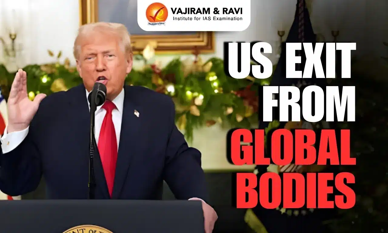
US Exit from Global Bodies Latest News

  • President Donald Trump has ordered the United States to withdraw from 66 international organisations, including several UN agencies and the International Solar Alliance led by India and France. 
  • Calling these bodies “redundant” and contrary to US interests, Trump directed immediate action through a formal memorandum to all federal agencies.
  • India’s assessment is that the immediate fallout will be reduced funding and weakened leadership across these institutions, from the World Health Organization to UNESCO. 
  • The resulting vacuum is expected to create space for China, which has the resources and institutional capacity to expand its influence within global governance structures.

Why the US Is Pulling Out of International Organisations

  • Trump’s Core Argument: Cost Without Control - Since beginning his second term, Donald Trump has argued that the United States contributes disproportionately to global organisations while having limited influence over their agenda.
    • He describes this as “globalist” and misaligned with US interests.
  • Allegations of Pro-China Bias - Trump has repeatedly accused international bodies of favouring China, despite Washington being the largest or among the largest financial contributors. He claims US funding indirectly supports institutions that shield or empower Beijing.
  • The WHO Exit as a Precedent - This reasoning underpinned the US withdrawal from the World Health Organization in January 2025. The US cited WHO’s failure to reform and its alleged inability to remain independent of political influence from member states.
  • Funding Disparities Highlighted - The US pointed to payment imbalances, noting that China—despite having over three times the US population—contributes nearly 90% less to the WHO, reinforcing Trump’s view that the burden-sharing system is unfair.
  • Broader Policy Direction - The WHO exit set the template for a wider retreat from international organisations, reflecting Trump’s preference for unilateral action and transactional global engagement over multilateral governance.

US Exit from the Global Climate Framework

  • President Donald Trump’s memo lists the UN Framework Convention on Climate Change (UNFCCC) among bodies the US will exit. 
    • The UNFCCC underpins global climate cooperation and led to later accords such as the Paris Agreement.
  • The US would be the first country to leave the UNFCCC, forfeiting influence over negotiations that shape major economic policy and opportunities.
  • The move follows a broader retreat: last year, the United States skipped the UN’s annual climate summit for the first time in nearly 30 years, signalling reduced engagement in multilateral climate action.

Withdrawal from UN Women and UNFPA

  • The US will also exit UN Women and the UN Population Fund (UNFPA), which supports family planning and maternal and child health in over 150 countries. US funding for UNFPA was cut last year.

Funding Cuts and UN Impact

  • Exiting these bodies entails further funding reductions. 
  • President Trump has already curtailed most voluntary US contributions, diminishing both American involvement and financial support across the United Nations system.

How Trump Seeks to Project Power Outside Global Institutions

  • Tariffs and Military Power as Primary Tools - Despite withdrawing from major international organisations, President Donald Trump is unlikely to step back from global influence. His administration continues to rely on tariff threats and military power as key instruments. 
    • In 2025 alone, the US carried out military actions in Syria, Iraq, Nigeria, Somalia, Yemen, and Iran, signalling readiness to use force when deemed necessary.
  • Selective Multilateral Engagement - US officials have indicated that a complete withdrawal from the United Nations is unlikely. Washington wants to remain part of forums that set global standards, especially because China holds veto power at the UN. Staying engaged allows the US to counter Chinese influence from within.
  • Strategic Retention of Key Bodies - Trump is expected to maintain ties with technical and regulatory bodies such as the International Telecommunication Union, International Maritime Organization, and International Labour Organization, where standards shape global commerce and technology—and where rivalry with China is intense.
  • Diplomacy Backed by Force - Diplomacy is preferred, but military action remains an option—citing Venezuela’s Nicolás Maduro as an example where diplomacy failed.
  • NATO and Strategic Posturing - Trump’s push to acquire Greenland has raised concerns within NATO, but he has insisted the US will remain committed to the alliance. 
    • His broader message underscores a belief that US power—economic and military—remains the ultimate guarantor of influence, even as institutional engagement narrows.

Source: IE | IE | TH

US Exit from Global Bodies FAQs

Q1: Why did Trump order a US exit from global bodies?

Ans: The US exit from global bodies reflects Trump’s belief that America pays disproportionately while multilateral institutions pursue agendas misaligned with US interests.

Q2: Which major organisations are affected by the US exit from global bodies?

Ans: The US exit from global bodies includes WHO, UNESCO, UNFCCC, UN Women, UNFPA, and the International Solar Alliance led by India and France.

Q3: How does the US exit from global bodies affect the UN system?

Ans: The US exit from global bodies reduces funding and leadership capacity, creating institutional gaps and weakening global governance mechanisms across health, climate, and development.

Q4: Why is China expected to benefit from the US exit from global bodies?

Ans: China may benefit as the US exit from global bodies creates leadership and funding vacuums that Beijing can fill using its financial resources and diplomatic influence.

Q5: Can the US still exert global power despite the US exit from global bodies?

Ans: Yes, despite the US exit from global bodies, Washington continues using tariffs, military power, and selective participation in strategic institutions to shape global outcomes.

Gadgil Report on Western Ghats: Why the Gadgil Report Still Shapes Environmental Debate

Gadgil Report

Gadgil Report Latest News

  • Eminent ecologist Madhav Gadgil passed away at 83 in Pune, leaving behind a lasting environmental legacy. 
  • Among his many contributions, his role as chair of the Western Ghats Ecology Expert Panel (WGEEP) remains the most influential. 
  • Although the panel’s report was rejected by the then government, Gadgil consistently advocated for safeguarding the fragile Western Ghats from unregulated development. 
  • Years on, the report’s warnings and recommendations continue to resurface in public debate, especially after landslides and ecological disasters in the region, underscoring its enduring relevance.

A Prescription for Protecting the Western Ghats

  • The Western Ghats stretch from Gujarat to Kerala and Tamil Nadu and act as the water tower of peninsular India. 
  • Major rivers like the Cauvery, Godavari, Krishna, Periyar and Netravathi originate here. 
  • The region is a global biodiversity hotspot with high endemism, hosting species found nowhere else.

Why the WGEEP Was Set Up

  • In March 2010, the Western Ghats Ecology Expert Panel (WGEEP) was constituted due to the region’s ecological sensitivity, complex geography and growing threats from climate change and unregulated development.
  • The panel’s formation was triggered by a 2010 meeting of the Save Western Ghats movement in the Nilgiris, attended by then Environment Minister Jairam Ramesh. The deliberations led to the creation of WGEEP.
  • The panel was tasked with: 
    • assessing the ecology of the Western Ghats, identifying ecologically sensitive areas, 
    • recommending ecologically sensitive zones, and 
    • proposing conservation, rejuvenation and governance mechanisms for sustainable development.

Recommendations of the Gadgil Panel

  • Entire Western Ghats as Ecologically Sensitive - The Gadgil-led panel designated the entire 1,29,037 sq km of the Western Ghats as an Ecologically Sensitive Area (ESA), reflecting the region’s overall ecological fragility.
  • Three-Tier Sensitivity Zoning - The Ghats were divided into three categories — ESZ 1, ESZ 2 and ESZ 3 — based on levels of ecological sensitivity, with stricter controls in the more fragile zones.
  • Restrictions on Development Activities - The panel proposed banning genetically modified crops, new special economic zones and new hill stations across ESZs. 
    • It called for no new mining licences and the phase-out of existing mines within five years in ESZ 1 and 2, and a complete ban on new quarrying in ESZ 1.
  • Limits on Infrastructure Expansion - New railway lines and major roads were to be avoided in ESZ 1 and 2, except where absolutely essential, to minimise ecological disruption.
  • Creation of a Statutory Authority - The report recommended setting up a 24-member Western Ghats Ecology Authority (WGEA) under the Environment Protection Act to regulate, manage and plan activities across all ecologically sensitive zones in the six Western Ghats States.
  • Composition of the Authority - The proposed authority was to include domain and resource experts, along with representatives from key nodal ministries, ensuring coordinated, multi-state environmental governance.

Political Opposition to the Gadgil Panel Report

  • The Gadgil panel submitted its draft report in March 2011 and the final version in August 2011. 
  • The report was not made public and was instead shared with State governments for comments.
    • Environmental groups challenged the secrecy through RTI applications. 
    • After intervention by the Chief Information Commissioner and subsequent court proceedings, the report was finally made public in May 2012.
  • Gadgil argued that the report promoted inclusive development and recommended placing its proposals before Gram Sabhas to move away from exclusionary models of conservation and growth.

State-Level Resistance

  • The report faced strong opposition from Kerala and Maharashtra. 
  • Maharashtra objected to the proposed Western Ghats Ecology Authority, calling it a parallel structure to existing institutions.
  • Kerala argued that declaring large areas as ecologically sensitive would hurt agriculture and livelihoods in districts such as Idukki and Wayanad. 
  • Political leaders and the Catholic Church warned of economic disruption and displacement of local communities.

The Kasturirangan Panel and the Scaled-Down Western Ghats Plan

  • After widespread opposition to the Gadgil report, the Environment Ministry set up a High-Level Working Group in 2012 under space scientist K. Kasturirangan to review the recommendations.

Key Recommendations of the 2013 Report

  • The Kasturirangan panel proposed declaring about 56,825 sq km of the Western Ghats as ecologically sensitive. 
  • It supported curbs on mining, polluting industries, thermal power plants, and large townships, but adopted a narrower approach than the Gadgil panel.
  • Unlike the earlier report, the panel identified specific villages as ecologically sensitive and released state-wise lists, making the proposal more targeted and administratively feasible.

Policy Deadlock Continues

  • Based on the report, the Centre has issued six draft ESA notifications, the latest in August 2024. 
  • However, disagreements with States persist, and a committee led by former Director General of Forests Sanjay Kumar is still working to finalise the boundaries.

Source: IE | TH

Gadgil Report FAQs

Q1: What is the Gadgil Report and why is it significant?

Ans: The Gadgil Report is a landmark environmental study that classified the entire Western Ghats as ecologically sensitive, shaping India’s conservation debates despite political rejection.

Q2: Why was the Gadgil Report prepared?

Ans: The Gadgil Report was prepared to assess ecological fragility of the Western Ghats and recommend sustainable development amid rising threats from mining, infrastructure, and climate change.

Q3: What were the key recommendations of the Gadgil Report?

Ans: The Gadgil Report recommended classifying the Western Ghats into sensitivity zones, banning mining and destructive projects, and creating a statutory Western Ghats Ecology Authority.

Q4: Why did States oppose the Gadgil Report?

Ans: States opposed the Gadgil Report fearing restrictions on agriculture, infrastructure, hydropower, and livelihoods, arguing it would harm regional economies and create parallel authorities.

Q5: How does the Gadgil Report remain relevant today?

Ans: The Gadgil Report resurfaces after landslides and floods, as its warnings highlight how ignoring ecological limits worsens disasters in the Western Ghats.

Enquire Now