Flexible Inflation Targeting (FIT) Framework, Background, Significance

Flexible Inflation Targeting (FIT) Framework

The Government of India has retained the flexible inflation targeting (FIT) framework, keeping the retail inflation target at 4%, with an upper tolerance of 6% and a lower tolerance of 2%, for another five years, from April 1, 2026, to March 31, 2031. This decision follows the second five-year review of the framework, held in the national capital in March 2026, reflecting the government’s commitment to price stability amid global uncertainties.

Flexible Inflation Targeting (FIT) Framework Background

The flexible inflation targeting framework was introduced in May 2016 through an amendment to Section 45ZA of the Reserve Bank of India (RBI) Act, 1934, empowering the central bank to maintain inflation within a specified target range. The framework is anchored on the following principles:

  • Inflation is measured through the Consumer Price Index (CPI).
  • The Monetary Policy Committee (MPC) of the RBI is mandated to ensure CPI inflation remains at 4% ± 2%.
  • The Monetary Policy Committee has six-members -  three from RBI (including the RBI Governor) and 3 appointed by the Government of India. All the members have one vote and in the event of equality of votes, the Governor gets a second or casting vote.
  • The government and RBI are required to review the FIT framework every five years, with the first review conducted in March 2021.
  • The RBI shall be seen to have failed to meet the Target if inflation is more than 6% or less than 2% for three consecutive quarters. 
  • In case RBI fails to meet the target, it will have to give a written report to Government of India explaining the reasons of failure, remedial actions to be taken and an estimated time period within which the Target would be achieved

Flexible Inflation Targeting (FIT) Framework Performance

An analysis by the RBI shows that the flexible inflation-targeting framework has helped reduce inflation significantly:

  • Average Consumer Price Index (CPI) inflation declined from 6.8% (2012-16) to 4.9% in the years following the adoption of the framework.
  • Between 2016 and 2021, retail inflation remained within the target band of 2-6% for roughly three-fourths of the time, and for about two-thirds of the time thereafter.

In February 2026, CPI inflation reached 3.21%, up from 2.74% in the previous month, remaining well within the targeted range, reflecting the effectiveness of the framework in maintaining moderate inflation. 

Flexible Inflation Targeting (FIT) Framework Significance

The flexible inflation targeting framework plays a critical role in India’s macroeconomic policy:

  • Price Stability: Ensures inflation remains within a predictable range, protecting the purchasing power of citizens.
  • Policy Coordination: Encourages alignment between monetary policy (RBI) and fiscal policy (government) to maintain overall economic stability.
  • Accountability: The RBI is answerable to Parliament if targets are missed, enhancing transparency and credibility.
  • Flexibility: The “flexible” nature allows the RBI to respond to supply shocks, global disruptions, and unforeseen economic risks without abandoning the price stability objective.

Flexible Inflation Targeting (FIT) Framework FAQs

Q1: What is the Flexible Inflation Targeting (FIT) Framework?

Ans: The Flexible Inflation Targeting (FIT) Framework is a monetary policy regime under which the Reserve Bank of India aims to maintain retail inflation at 4% with a tolerance band of ±2%, ensuring price stability while allowing flexibility to respond to economic shocks.

Q2: What is the legal basis of the Flexible Inflation Targeting (FIT) Framework?

Ans: The Flexible Inflation Targeting (FIT) Framework is based on an amendment to the Reserve Bank of India Act, 1934 (Section 45ZA) in 2016, which mandates the RBI to maintain inflation within a specified target range set in consultation with the government.

Q3: How does the Flexible Inflation Targeting (FIT) Framework operate in India?

Ans: The Flexible Inflation Targeting (FIT) Framework is implemented by the Monetary Policy Committee (MPC), which uses tools like the repo rate to keep Consumer Price Index (CPI) inflation within the target band, while ensuring accountability through parliamentary oversight in case of persistent deviations.

Q4: What has been the performance of the Flexible Inflation Targeting (FIT) Framework?

Ans: The Flexible Inflation Targeting (FIT) Framework has contributed to a decline in average inflation from 6.8% (2012-16) to about 4.9% post-2016, with inflation largely remaining within the 2-6% range, indicating improved macroeconomic stability.

Q5: Why is the Flexible Inflation Targeting (FIT) Framework significant?

Ans: The Flexible Inflation Targeting (FIT) Framework is significant because it ensures price stability, enhances policy credibility, promotes fiscal-monetary coordination, and provides flexibility to address supply-side shocks while maintaining a stable inflation environment.

Jampui Hills, Location, Culture, Biodiversity, Tourism Significance

Jampui Hills

Jampui Hills in Tripura is a serene hill landscape known for its cool climate, rich flora including rare orchids, flourishing orange gardens, and the distinctive way of life of its tribal communities, combining ecological and cultural significance.

About Jampui Hills

Jampui Hills, the highest hill range in Tripura, is known as the ‘Eternal Hills of Spring’ for its scenic beauty, mild climate, rich biodiversity, orange orchards, and vibrant tribal culture.

  • Jampui Hills Location: Jampui Hills is the highest hill range in North Tripura, rising to about 3,200-3,600 feet above sea level. It is located around 210- 220 km from Agartala, bordering Mizoram, and offers panoramic views of the Chittagong Hill Tracts in Bangladesh.
  • Climate: Known as the “Eternal Hills of Spring,” Jampui Hills enjoys a mild and pleasant climate year-round. Minimal temperature variation makes it suitable for tourism, horticulture, and comfortable living.
  • Flora and Biodiversity: Jampui hills are home to over 50 species of orchids, including the rare Vanda coerulea, earning it the title “Orchid Paradise of India.” Evergreen and semi-evergreen forests cover much of the area, supporting a variety of plant species and wildlife.
  • Horticulture and Economy: Orange cultivation is the primary occupation. Orange plantations cover nearly 1,000 hectares, forming a major source of income for local villagers.
  • Culture: Jampui hill range is home to about 8,000 people across 11 villages, predominantly from the Lushai (Mizo) and Reang tribes, who maintain a distinctive tribal heritage and lifestyle and the majority of the population follows Christianity.

Jampui Hills FAQs

Q1: What are Jampui Hills known for?

Ans: Jampui Hills are known for their cool climate, lush greenery, rich orchid diversity, and extensive orange gardens, making them a unique ecological and cultural destination in Tripura.

Q2: Where are Jampui Hills located?

Ans: Jampui Hills are located in North Tripura, about 210–220 km from Agartala, along the border with Mizoram, offering panoramic views of the Chittagong Hill Tracts in Bangladesh.

Q3: What is the elevation of Jampui Hills?

Ans: The hills rise to approximately 3,200-3,600 feet above sea level, with Betlingchhip being the highest peak in Tripura.

Q4: What kind of flora and fauna are found in Jampui Hills?

Ans: Jampui Hills host over 50 species of orchids, including the rare Vanda coerulea, and dense evergreen and semi-evergreen forests supporting diverse plant and wildlife species.

Q5: What is the main economic activity in Jampui Hills?

Ans: Orange cultivation is the primary occupation, with the sweet Jampui oranges, locally called Jampui Kamola, covering nearly 1,000 hectares and providing a major source of income for villagers.

Naga Hills, Location, Ophiolites, Wildlife, and Cultural Significance

Naga Hills

The Naga Hills, situated in Nagaland and adjoining areas of northeast India and northwestern Myanmar, form a key segment of the Indo-Myanmar Ranges. Characterized by rugged hill terrain, rich biodiversity, and unique geological formations, the region represents an important convergence of tectonic, ecological, and cultural systems in South and Southeast Asia.

Naga Hills Location and Extent

  • The Naga Hills are part of a complex mountain system in northeast India and northwestern Myanmar.
  • Inside India, they are mainly in Nagaland, with extensions into Manipur and parts of Arunachal Pradesh.
  • In Myanmar, they extend into the Sagaing region.
  • The hills are part of the Arakan Range and rise up to 12,552 feet in the north.
  • They trend NE–SW as part of the Indo-Myanmar Ranges (IMR) and are considered extensions of the Andaman–Indonesian Island arc southwards and Tiding ophiolites of the eastern Himalayas northwards.

Read about: Purvanchal Hills

Naga Hills Topography and Geological Features

  • The Naga Hills consist of low-lying hill ranges in the IMR, with narrow segments of ophiolitic rocks.
  • Ophiolites: Pieces of oceanic plate thrusted onto continental edges, providing a window into mid-ocean ridge processes.
  • The Naga Ophiolites near Pungro, Nagaland are declared a National Geological Monument by the Geological Survey of India.
  • The ophiolite sequence shows Mesozoic to Cenozoic magmatic and sedimentary rocks, accretionary wedge metasediments, and post-orogenic sediments.
  • Tectonically, the region displays NE-SW trending en-echelon slices of ophiolite, bordered by the Naga Metamorphic Complex and the Disang flysch.

Naga Hills Biodiversity

The Naga Hills lie within one of the 18 mega-biodiversity hotspots of the world and include four Key Biodiversity Areas (KBAs) and four Important Bird Areas (IBAs), such as Satoi Range, Mount Ziphu, Fakim Wildlife Sanctuary & Saramati Area and Pfutsero-Chizami. The region hosts numerous endemic and red-listed species, including:

  • Birds: Blyth’s Tragopan (Ayigah), Rufous-necked Hornbill
  • Mammals: Western hoolock gibbon (Hoolock hoolock)
  • Reptiles: Asian Brown Tortoise (Manouria emys), Mouhot’s Box Turtle (Cuora mouhotii)
  • Amphibians: Megophrys wuliangshanensis, Amolops viridimaculatus, Rana humeralis, Rhacophorus gongshanensis
  • Plants: Areca nagansis, Begonia wattii, Rhododendron wattii, Capillipedium nagense, and several other species endemic to Nagaland

Read about: Lushai Hills

Naga Hills Culture

The Naga Hills are inhabited by various Naga tribes, known for their rich oral traditions, folklore, and cultural practices. These traditions historically helped communities understand and respect nature, guiding conservation of forests, wildlife, and natural resources. Over time, modernization has led to a decline in these oral traditions, weakening the connection between people and the environment. Despite this, areas like Fakim Wildlife Sanctuary and other community reserves continue to protect both the cultural heritage and natural biodiversity.

Naga Hills FAQs

Q1: What are the Naga Hills and where are they located?

Ans: The Naga Hills are a hilly region forming part of the Indo-Myanmar Ranges, mainly in Nagaland, with extensions into Manipur, Arunachal Pradesh, and northwestern Myanmar.

Q2: What is the topography and geological significance of the Naga Hills?

Ans: The Naga Hills feature low-lying hill ranges with narrow segments of ophiolitic rocks, including the Naga Ophiolite near Pungro, Nagaland, a National Geological Monument that represents obducted oceanic lithosphere and tectonic processes.

Q3: Why is the Naga Hills region important for biodiversity?

Ans: The Naga Hills lie within a global mega-biodiversity hotspot, hosting endemic and vulnerable species across four Key Biodiversity Areas (KBAs) and Important Bird Areas (IBAs), including Blyth’s Tragopan, Rufous-necked Hornbill, and several unique amphibians, reptiles, and plants.

Q4: How does Naga culture relate to the Naga Hills environment?

Ans: The Naga Hills are home to tribes with rich oral traditions and folklore that historically guided the sustainable use of forests and natural resources, though modernization has led to a decline in these practices.

Q5: What makes the Naga Hills globally significant?

Ans: The Naga Hills are a geo-bio-cultural landscape, combining geological uniqueness, rich biodiversity, and traditional cultural practices, making it significant for research, conservation, and heritage preservation.

IIED Food Security Index, Key Findings, Implications for India

IIED Food Security Index

The International Institute for Environment and Development (IIED) has developed a Food Security Index (FSI). The IIED Food Security Index highlights the increasing vulnerability of global food systems in the face of climate change. It shows that rising temperatures are likely to undermine not just food production, but also access, nutrition, and the resilience of food systems.

What is the IIED Food Security Index?

The IIED Food Security Index evaluates food security across 162 countries, measuring the vulnerability of entire food systems under different climate scenarios such as 1.5°C, 2°C, and higher warming levels.

It assesses food security based on four key pillars:

  • Availability: Sufficient production and supply of food
  • Accessibility: Economic and physical access to food
  • Utilisation: Nutritional quality and the body’s ability to absorb nutrients
  • Sustainability (Resilience): Capacity of food systems to withstand shocks

This multidimensional approach makes the index more comprehensive than traditional measures focused only on production or consumption.

Key Findings of IIED Food Security Index

The IIED Food Security Index highlights the growing vulnerability of global food systems under climate change, revealing that rising temperatures could significantly undermine food availability, accessibility, nutrition, and resilience particularly in developing countries like India.

  • India among the most vulnerable large economies: India’s food security position is already below the global average, with a baseline score of 5.31 compared to 6.74 globally, and is projected to decline further under warming scenarios. This indicates increasing risks in ensuring adequate, affordable, and nutritious food, especially for vulnerable populations.
  • Sharp decline in food security under warming scenarios: The index projects that India’s food security score could fall to 4.96 at 1.5°C warming and 4.52 at 2°C, showing that even moderate temperature increases can significantly weaken food systems and access to nutrition.
  • Widening global inequality in food security: Climate change is expected to widen the gap between rich and poor countries, with low-income nations in South Asia and Sub-Saharan Africa experiencing the steepest decline.
  • Large global population already food insecure: Currently, about 4.56 billion people (59% of the global population) live in countries with below-average food security. With 2°C warming, an additional 291 million people could fall into this category, intensifying global hunger and malnutrition.
  • Climate change affects all four pillars of food security: Rising temperatures and climate shocks impact availability, accessibility, utilisation, and sustainability of food systems. However, sustainability and utilisation are the most climate-sensitive, leading to early impacts on nutrition, health, and resilience.
  • Decline in food availability and dietary diversity: Under higher warming scenarios, countries, especially poorer ones will face reduced food production and lower dietary diversity, increasing the risk of malnutrition and hunger.
  • Economic growth alone is insufficient: The study finds that while higher income improves food access marginally, it does not ensure resilience. A $1,000 increase in per capita GDP raises food security only slightly (around 0.2 points), with minimal improvement in sustainability, showing limits of growth-led solutions.
  • Interconnected global food systems amplify risks: Climate shocks in one major agricultural region can disrupt global supply chains, causing price volatility and shortages worldwide, meaning even developed countries are indirectly vulnerable.
  • Increase in countries facing critical food insecurity: The number of countries facing severe food insecurity could nearly triple to 24 under a 2°C warming scenario, indicating a potential rise in humanitarian crises.
  • Disproportionate burden on low-income countries: Low-income countries, which contribute only about 1% of global emissions, are projected to see food insecurity rise by around 22%, compared to a much smaller increase in high-income nations, highlighting issues of climate justice.
  • Risk of global instability and migration: Severe food insecurity in fragile and conflict-prone regions may lead to state instability, forced migration, and geopolitical tensions, making food security a national and global security concern.

IIED Food Security Index Implications for India

For India, the findings of the IIED Food Security Index carry serious policy implications, as structural vulnerabilities combined with climate stress could significantly weaken the country’s food security landscape.

  • High dependence on monsoon-based agriculture increases vulnerability
  • Large population and existing issues of malnutrition and poverty worsen risks
  • Climate change may impact food affordability and nutritional outcomes
  • Regional disparities could deepen, affecting rural and marginal communities the most

Way Forward

Addressing the growing threat of food insecurity in a warming world requires a comprehensive and resilience-oriented policy approach that integrates social protection, sustainable agriculture, and global cooperation.

  • Strengthen social safety nets to protect vulnerable populations
  • Promote climate-resilient agriculture (crop diversification, drought-resistant seeds)
  • Improve water management and soil conservation
  • Invest in sustainable and resilient food systems
  • Enhance global cooperation due to interconnected risks

IIED Food Security Index FAQs

Q1: What is the IIED Food Security Index?

Ans: The IIED Food Security Index is a global measure developed by the International Institute for Environment and Development to assess food security across countries under different climate change scenarios.

Q2: How many countries are covered in the IIED Food Security Index?

Ans: The index evaluates food security across 162 countries, making it one of the most comprehensive global assessments of food systems.

Q3: What are the four pillars of food security in the index?

Ans: The index is based on four pillars: availability, accessibility, utilisation, and sustainability (resilience), covering both production and nutritional aspects.

Q4: Why is the IIED Food Security Index important?

Ans: It highlights how climate change affects not just food production but also access, nutrition, and long-term sustainability of food systems worldwide.

Q5: How does climate change impact food security according to the index?

Ans: Rising temperatures, extreme weather events, and climate shocks reduce crop yields, increase food prices, affect nutrition, and weaken resilience of food systems.

Thermosphere, Location, Temperature, Karman Line, Features

Thermosphere

The Thermosphere is a major upper layer of the Earth’s atmosphere located above the mesosphere and below the exosphere, beginning around 80 km altitude. The term originates from the Greek word “thermos” meaning heat. It shows a sharp rise in temperature with height due to absorption of high energy solar radiation. This layer contains most of the ionosphere, where ultraviolet radiation causes photoionization, producing electrically charged particles that influence radio communication and atmospheric processes.

Thermosphere Features

The Thermosphere exhibits extreme temperatures, low density, ionization and dynamic energy interactions driven by solar radiation and atmospheric processes. The major features of the Thermosphere has been highlighted below:

  • Location: The Thermosphere starts near 80 km above sea level and extends up to about 600-700 km. It lies between the mesopause and thermopause, with the exosphere beginning around 600 km, merging into outer space.
  • Temperature: Temperature increases with altitude due to solar XUV radiation absorption, reaching 2,000 °C or more. Despite this, low gas density prevents heat transfer, so objects experience extremely cold conditions.
  • Low Density and Pressure: Atmospheric density decreases exponentially with height. Gas particles are widely spaced, creating near vacuum conditions with negligible pressure.
  • Composition: Above the Turbopause (~90 km), gases separate by molecular mass. Lighter gases like atomic oxygen, helium and hydrogen dominate above 200 km, replacing nitrogen and oxygen as primary components.
  • Ionosphere: The Thermosphere hosts most of the Ionosphere, where ultraviolet radiation ionizes particles. This enables radio wave refraction, allowing long distance communication beyond the Earth’s horizon.
  • Solar Radiation Effects: Solar X ray and extreme ultraviolet radiation are absorbed here, causing heating and ionization. Variations in solar activity can significantly change temperature and density, especially during solar flares.
  • Sound Transmission: Above 160 km lies the anacoustic zone where molecular collisions are too infrequent to transmit sound, making this region completely silent.
  • Space Stations and Human Presence: The Thermosphere is nearly uninhabited except for spacecraft. The International Space Station orbits at about 408-410 km, while the Tiangong station operates between 340-450 km.
  • Electrical Conductivity: Charged particles create high electrical conductivity, generating currents in the ionospheric dynamo region. These currents are important for geomagnetic and auroral phenomena.
  • Sodium Layer Presence: A thin sodium layer exists between 80-100 km with about 400,000 atoms per cubic centimeter, formed from meteors and used in astronomical observations for adaptive optics.
  • Karman Line: The Karman line at 100 km marks the boundary of space. A large portion of the Thermosphere lies above this limit, making it part of outer space.
  • Thermospheric Storms: Disturbances caused by solar wind and geomagnetic activity lead to thermospheric storms, altering temperature, density and ionospheric electron concentration, affecting communication systems.
  • Minimal Atmospheric Interaction: Due to extremely low mass and density, the Thermosphere has negligible impact on lower atmospheric layers and does not significantly influence weather or climate systems.

Also Read: Stratosphere

Thermosphere FAQs

Q1: What is the Thermosphere?

Ans: The Thermosphere is an upper layer of Earth’s atmosphere above the mesosphere, starting around 80 km, where temperature increases rapidly due to solar radiation.

Q2: Which objects are found in the Thermosphere?

Ans: Spacecraft like the International Space Station and satellites orbit within this layer, typically between 340 km and 410 km above Earth.

Q3: What is the Karman line and its relation to the Thermosphere?

Ans: The Karman line at 100 km marks the boundary of space and a large part of the Thermosphere lies above it, making it part of outer space.

Q4: Why is there no sound in the Thermosphere?

Ans: Due to extremely low density, gas molecules rarely collide, making it impossible for sound waves to travel in this region.

Q5: What gases are found in the Thermosphere?

Ans: Lighter gases like atomic oxygen, helium and hydrogen dominate at higher altitudes, as heavier gases settle below due to molecular separation.

Mesosphere, Location, Extent, Temperature, Exploration, Features

Mesosphere

The Mesosphere is the third atmospheric layer above Earth’s surface. It is located after the troposphere and stratosphere. It extends roughly from 50 to 85 km altitude and lies between the Stratopause and Mesopause. This layer is known for decreasing temperature with height and is considered the coldest region of the atmosphere. It also acts as a transition zone before the thermosphere and plays a key role in atmospheric structure and processes.

Mesosphere Features

The Mesosphere is a cold, thin and less explored atmospheric layer marked by falling temperatures, meteor burning and unique high altitude phenomena.

  • Location: It begins at the stratopause and ends at the mesopause, forming part of the “middle atmosphere” along with the stratosphere and spans roughly 12 to 80 km above Earth.
  • Altitudinal Extent: The Mesosphere extends from about 50-65 km to nearly 85-100 km. Its limits vary with latitude and season, being higher in winter and tropics and lower in summer and polar regions.
  • Temperature Characteristics: Temperature decreases with height due to reduced ozone absorption and CO2 cooling. At the mesopause, temperatures can fall below -90°C, making it the coldest atmospheric region.
  • Meteor Activity: Most meteors burn up in this layer due to friction with gases, producing visible “shooting stars.” Around 40,000 tons of meteoric material enter Earth’s atmosphere daily.
  • Low Density and Pressure: The Mesosphere has extremely thin air with very low pressure, nearly 1/100000th of surface atmospheric pressure.
  • Chemical Composition: Gases like oxygen, nitrogen and carbon dioxide exist in mixed form. Metal atoms like iron and potassium are present due to meteoric disintegration.
  • Noctilucent Clouds Formation: Rare high altitude clouds called noctilucent or polar mesospheric clouds form near the poles at very low temperatures, appearing as blue white luminous clouds during twilight.
  • Electrical Phenomena: Unique discharges such as sprites and ELVES occur above thunderclouds, appearing as red flashes or expanding rings in the upper Mesosphere region.
  • Atmospheric Circulation: Strong zonal winds, gravity waves and planetary waves influence circulation. These waves transfer energy from lower layers and drive mesospheric dynamics.
  • Exploration: The Mesosphere is difficult to study as aircraft and balloons cannot reach it, while satellites orbit above it. This makes it the least explored layer, sometimes called the “Ignorosphere.” 

Mesosphere FAQs

Q1: What is the Mesosphere?

Ans: The Mesosphere is the third layer of Earth’s atmosphere, located between the stratosphere and thermosphere, extending from about 50 to 85 km above the surface.

Q2: Why is the Mesosphere the coldest layer?

Ans: Temperature decreases with height due to less ozone absorption and cooling by carbon dioxide, making the mesopause the coldest region with temperatures below -90°C.

Q3: Where do meteors burn up in the Mesosphere?

Ans: Most meteors burn up in the Mesosphere due to friction with atmospheric gases, producing bright streaks of light known as shooting stars.

Q4: What are noctilucent clouds found in the Mesosphere?

Ans: Noctilucent clouds are rare, high altitude clouds formed in the Mesosphere near the poles at extremely low temperatures, visible during twilight.

Q5: Why is the Mesosphere called the “Ignorosphere”?

Ans: It is called the “Ignorosphere” because it is difficult to study, as aircraft and balloons cannot reach it and satellites orbit above it.

Stratosphere, Location, Temperature, Ozone Layer, Aviation, Features

Stratosphere

The Stratosphere is the second lowest layer of Earth’s atmosphere. It is situated above the troposphere and below the mesosphere. The term comes from Ancient Greek “strōtós” meaning layer. It is characterized by stratified temperature zones where temperature increases with altitude due to absorption of ultraviolet radiation by the ozone layer, creating a temperature inversion unlike the cooling pattern seen in the troposphere.

Stratosphere Features

The Stratosphere is a stable atmospheric layer with distinct thermal structure, strong winds and vital ozone chemistry that supports life on Earth.

  • Location: The Stratosphere lies above the troposphere, starting around 20 km at the equator and extending up to about 50 km near the stratopause.
  • Temperature: Temperatures rise from about -51°C near the tropopause to around -15°C near the mesosphere, reaching nearly 270 K at the top due to ozone absorbing ultraviolet radiation.
  • Dry and Stable Nature: Air entering the Stratosphere is freeze dried, making it extremely dry with minimal water vapor. This dryness leads to very few clouds and almost no weather phenomena.
  • Stratopause: The stratopause marks the upper boundary of the Stratosphere, above which temperature again decreases with altitude as the mesosphere begins.
  • Tropopause: The tropopause marks the lower boundary of the Stratosphere, acting as a temperature minimum zone and separating decreasing temperature trends below from increasing trends above.
  • Ozone Layer Presence: Around 90% of atmospheric ozone exists here, mainly between 15-35 km. Ozone absorbs harmful UV radiation and converts it into heat, making this layer essential for protecting life on Earth.
  • Winds: Stratospheric winds can reach 60 m/s, especially in the Southern polar vortex, with seasonal variations causing extremely low temperatures during polar winters.
  • Aviation Significance: Aircraft cruise at 9-12 km in the lower Stratosphere to avoid turbulence, benefiting from low air density and stable conditions that improve fuel efficiency and flight speed.
  • Seasonal Variations: Temperatures vary with seasons, with extremely low values during polar winters. Phenomena like quasi-biennial oscillation, sudden stratospheric warming and planetary wave breaking influence weather patterns and cause rapid atmospheric changes at mid latitudes.
  • Life: Despite extreme dryness and low pressure, bacterial life has been detected at about 41 km altitude, confirming that the stratosphere is part of the biosphere.

Also Read: Composition and Structure of Atmosphere

Stratosphere FAQs

Q1: What is the Stratosphere?

Ans: The Stratosphere is the second layer of Earth’s atmosphere, located above the troposphere and below the mesosphere, known for its stable and stratified temperature structure.

Q2: Why does temperature increase in the Stratosphere?

Ans: Temperature rises due to the absorption of ultraviolet radiation by ozone, which releases heat and creates a temperature inversion in this layer.

Q3: What is the importance of the ozone layer in the Stratosphere?

Ans: The ozone layer absorbs harmful ultraviolet radiation, protecting living organisms on Earth from DNA damage and health risks like skin cancer.

Q4: Why are there no clouds in the Stratosphere?

Ans: The Stratosphere is extremely dry with very little water vapor, preventing cloud formation and weather activities.

Q5: Why do aircraft fly in the Stratosphere?

Ans: Aircraft fly in the lower Stratosphere to avoid turbulence, benefit from stable conditions and improve fuel efficiency due to lower air density.

Security and Growth for All in the Region (SAGAR), Background, Significance

Security and Growth for All in the Region (SAGAR)

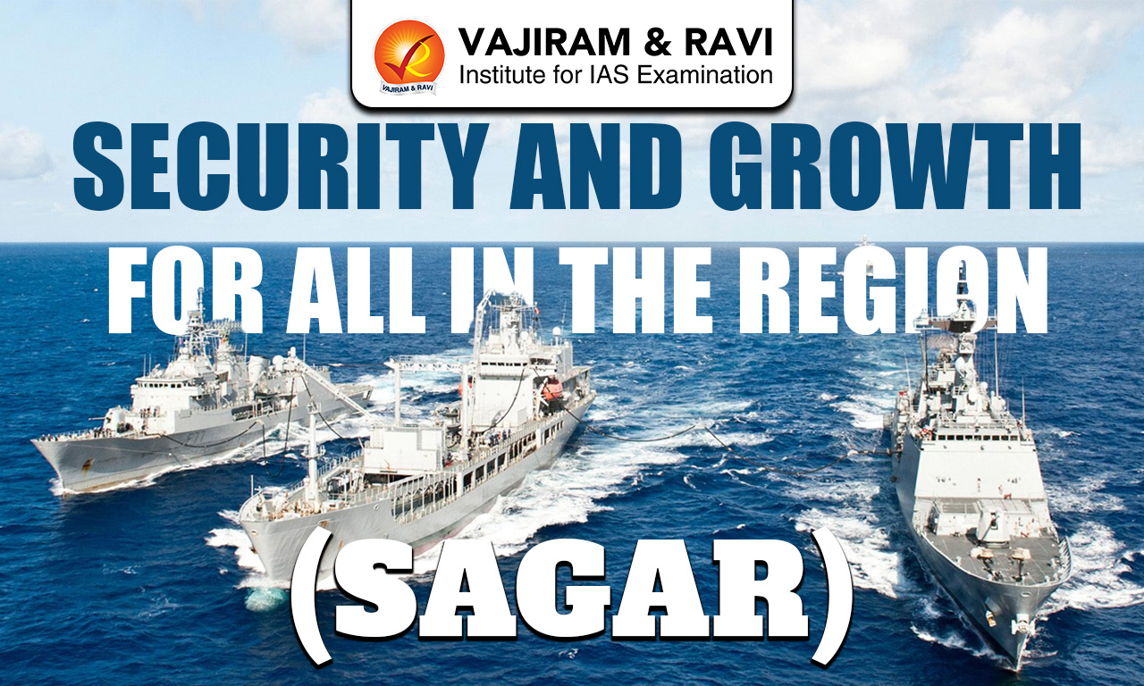
Security and Growth for All in the Region (SAGAR) is India’s strategic maritime initiative that reflects its vision of a safe, secure, and prosperous Indian Ocean Region (IOR). It underscores India’s role as a responsible maritime power, focusing on cooperation, capacity building, and sustainable development among littoral states.

Security and Growth for All in the Region (SAGAR) Background 

SAGAR (Security and Growth for All in the Region) emerged as India’s response to the increasing strategic and economic importance of the Indian Ocean Region, which carries a major share of global trade and energy flows. The rise of non-traditional threats such as piracy, maritime terrorism, and illegal fishing, along with frequent natural disasters, highlighted the need for a coordinated maritime security framework. 

Simultaneously, China’s expanding footprint particularly through its “String of Pearls” strategy of developing ports and strategic nodes across the Indian Ocean raised concerns about strategic encirclement and influence, prompting India to articulate a cooperative and inclusive alternative. The vast yet underutilised potential of the Blue Economy further necessitated a sustainable development approach for regional countries. In addition, the need to uphold a rules-based maritime order under the United Nations Convention on the Law of the Sea became crucial to ensure stability and prevent conflicts. Overall, SAGAR reflects India’s intent to act as a responsible maritime power by ensuring security, fostering cooperation, and promoting inclusive growth in the Indian Ocean Region.

Core Pillars of Security and Growth for All in the Region (SAGAR) 

Core pillars of Security and Growth for All in the Region (SAGAR) reflect an integrated approach.

Maritime Security and Safety

This pillar forms the foundation of SAGAR, as secure seas are essential for stability and economic activity. India acts as a “net security provider” in the Indian Ocean Region, extending support not only to its own maritime boundaries but also to neighbouring littoral and island states. This includes: 

  • Surveillance of sea lanes, 
  • Prevention of piracy and trafficking, and 
  • Rapid response during natural disasters through humanitarian assistance. 
  • India also focuses on strengthening the capabilities of smaller nations by providing training, equipment, and technical support. 

Economic Development and Blue Economy

Security and Growth for All in the Region (SAGAR) promotes the concept of the Blue Economy, which focuses on the responsible use of marine resources for development. 

It includes sectors such as fisheries, marine biotechnology, offshore energy, and coastal tourism. India supports Indian Ocean countries by helping them build infrastructure, improve fisheries management, and develop marine-based industries. 

Connectivity and Trade

Recognising the Indian Ocean as a major global trade corridor, this pillar emphasises improving maritime connectivity and infrastructure. Efficient ports, shipping routes, and logistics networks are vital for economic integration and regional prosperity. 

Respect for International Law and Rules-Based Order

A key principle of SAGAR is adherence to international maritime laws to ensure peace and stability. 

  • India advocates for freedom of navigation, peaceful resolution of disputes, and respect for sovereignty. 
  • The United Nations Convention on the Law of the Sea provides the legal framework governing ocean use and maritime rights. 

By supporting such norms, India promotes a rules-based order and counters unilateral or aggressive actions in maritime regions.

Cooperative and Inclusive Regional Architecture

This pillar reflects the idea that maritime security and development should be based on cooperation rather than competition. India works with regional and global partners to build an inclusive framework for the Indian Ocean Region. 

It actively participates in organisations such as the Indian Ocean Rim Association and the Indian Ocean Naval Symposium, while also engaging in strategic groupings like the Quadrilateral Security Dialogue. These efforts strengthen trust, coordination, and collective security.

Key Initiatives under Security and Growth for All in the Region (SAGAR)

Security and Growth for All in the Region (SAGAR) is operationalised through a range of strategic, security, connectivity, and developmental initiatives that collectively strengthen India’s role as a net security provider and a key partner in the Indian Ocean Region.

Information Fusion Centre – Indian Ocean Region (IFC-IOR): 

  • The Information Fusion Centre – Indian Ocean Region is a flagship initiative to enhance Maritime Domain Awareness (MDA) in the Indian Ocean Region. 
  • It acts as a nodal hub for real-time information sharing on shipping movements, maritime threats, and illegal activities. 
  • By integrating inputs from multiple countries and agencies, it enables coordinated responses to piracy, trafficking, and security challenges.

It operationalises India’s role as a “net security provider” and strengthens trust among partner nations.

Coastal Surveillance Radar System (CSRS): 

  • India has established an extensive network of coastal surveillance radars across Indian Ocean littoral states such as Maldives, Mauritius, Seychelles, and Sri Lanka. 
  • These radars monitor vessel movements within Exclusive Economic Zones (EEZs) and help detect suspicious activities. 

Humanitarian Assistance and Disaster Relief (HADR) Missions: 

  • HADR showcases India’s capacity as a first responder in the region.
  • Missions such as Operation Dost (2023) for earthquake relief and Operation Kaveri (2023) for evacuation from Sudan highlight India’s rapid deployment capability. 
  • These efforts not only provide immediate relief but also enhance India’s soft power and credibility as a reliable partner in times of crisis.

Sagarmala Project: 

The Sagarmala Project is a domestic initiative with strong external implications under SAGAR. 

  • It focuses on port modernisation, coastal economic zones, and improved logistics connectivity. 
  • By enhancing port efficiency and reducing logistics costs, it strengthens India’s position as a maritime trade hub and supports regional connectivity in the Indian Ocean.

Project Mausam: 

  • The Project Mausam aims to revive ancient maritime trade routes and cultural linkages across the Indian Ocean. 
  • It highlights India’s historical connections with East Africa, the Middle East, and Southeast Asia, thereby reinforcing cultural diplomacy alongside economic engagement under SAGAR.

Mission SAGAR (from 2020 onwards): 

  • Mission SAGAR was launched during the COVID-19 pandemic to provide food, medicines, and medical assistance to Indian Ocean countries. 
  • It has since expanded to include multiple phases of outreach, covering nations such as Maldives, Mauritius, Madagascar, and Comoros. 
  • This initiative reflects India’s commitment to inclusive growth and regional solidarity.

Indo-Pacific Oceans Initiative (IPOI)

  • IPOI complements SAGAR by providing a broader Indo-Pacific framework focusing on maritime security, disaster risk reduction, sustainable marine resource use, and capacity building. 
  • It brings together like-minded countries to cooperate in managing common maritime challenges and strengthens India’s strategic outreach beyond the Indian Ocean.

Chabahar Port Development

India’s development of Chabahar Port in Iran is a strategically significant initiative that enhances connectivity to Afghanistan and Central Asia, bypassing Pakistan. It strengthens India’s trade and strategic access to Eurasia while contributing to regional economic integration under SAGAR.

QUAD Cooperation: 

  • Through the Quadrilateral Security Dialogue, India collaborates with the US, Japan, and Australia on maritime security, resilient supply chains, and disaster response. 
  • QUAD initiatives such as maritime domain awareness and infrastructure coordination reinforce SAGAR’s objectives in the Indo-Pacific.

Indian Ocean Rim Association (IORA) Engagement

  • India plays an active role in the Indian Ocean Rim Association, promoting economic cooperation, maritime safety, and sustainable development. 
  • Through IORA, India supports capacity building, trade facilitation, and policy coordination among member states.

MAHASAGAR Doctrine (2024-2025)

  • MAHASAGAR stands for Mutual and Holistic Advancement for Security Across the Regions. It is the operational framework of SAGAR, designed to translate India’s strategic maritime vision into practical, action-oriented measures.

Security and Growth for All in the Region (SAGAR) Significance 

SAGAR is significant as it: 

  • Ensures Regional Maritime Security: India acts as a “net security provider,” safeguarding sea lanes, combating piracy, and providing humanitarian assistance, thus enhancing stability in the Indian Ocean Region.
  • Promotes Economic Growth and Blue Economy: SAGAR supports sustainable development of fisheries, ports, marine resources, and renewable ocean energy, helping littoral states utilise their Exclusive Economic Zones productively.
  • Strengthens Regional Connectivity and Trade: Through initiatives like the Sagarmala Project and port development assistance, SAGAR improves maritime trade, logistics, and cultural linkages across the region.
  • Upholds a Rules-Based Maritime Order: SAGAR reinforces adherence to international law, freedom of navigation, and peaceful dispute resolution under the United Nations Convention on the Law of the Sea, countering unilateral or aggressive claims.
  • Enhances Multilateral and Bilateral Cooperation: By engaging with IORA, IONS, and the Quad, SAGAR fosters collective security, joint capacity building, and stronger diplomatic partnerships.
  • Boosts India’s Strategic Influence: SAGAR consolidates India’s leadership in the Indian Ocean Region, projecting it as a reliable partner for smaller nations while countering extra-regional influence.
  • Strengthens Disaster Response and Humanitarian Outreach: Through HADR operations and initiatives like Mission SAGAR, India provides timely assistance to crisis-affected countries, enhancing regional goodwill and soft power.

Security and Growth for All in the Region (SAGAR) Challenges 

Despite its strategic coherence, SAGAR faces several implementation challenges that limit its effectiveness in the Indian Ocean Region.

  • Limited Financial Capacity: India’s financial resources are constrained compared to China’s BRI-scale infrastructure investments. Delays in port development, connectivity projects, and capacity-building initiatives allow China to fill the strategic gap. For example, Sri Lanka’s decision to lease Hambantota Port to China for 99 years partly reflects India’s slower delivery of alternative offers.
  • Political Volatility in Neighbouring Countries: Domestic political dynamics in regional states can disrupt SAGAR initiatives. Anti-India sentiment in the Maldives during the Yameen era, Bangladesh’s balancing act between India and China, and Nepal’s drift toward China have periodically affected the continuity of India’s maritime engagements.
  • Perception Challenges: India’s approach is sometimes perceived as interventionist, generating mistrust among smaller neighbours and weakening the cooperative spirit envisioned under SAGAR.
  • Weak Multilateral Institutional Framework: The Indian Ocean Region lacks a dedicated regional organisation with binding commitments.  Unlike ASEAN or the EU, platforms such as the Indian Ocean Rim Association have limited enforcement capacity, making SAGAR largely a bilateral initiative rather than a fully institutionalised multilateral framework.
  • Naval and Operational Constraints: SAGAR’s ambition to act as a “net security provider” strains India’s naval capacity. The Indian Navy is still modernising and faces resource constraints in sustaining deployments across the vast Indian Ocean. 

Security and Growth for All in the Region (SAGAR) FAQs

Q1: What is Security and Growth for All in the Region (SAGAR)?

Ans: Security and Growth for All in the Region (SAGAR) is India’s strategic maritime initiative aimed at ensuring a secure, stable, and prosperous Indian Ocean Region through cooperation, capacity building, and sustainable development.

Q2: Why was Security and Growth for All in the Region (SAGAR) launched?

Ans: SAGAR was launched in response to increasing strategic and economic importance of the Indian Ocean, rising non-traditional threats, and China’s expanding influence.

Q3: What are the core pillars of Security and Growth for All in the Region (SAGAR)?

Ans: The core pillars include maritime security and safety, economic development through the Blue Economy, connectivity and trade, adherence to international law, and cooperative regional architecture.

Q4: What are the key initiatives under Security and Growth for All in the Region (SAGAR)?

Ans: Key initiatives include the Information Fusion Centre – Indian Ocean Region (IFC-IOR), Coastal Surveillance Radar System (CSRS), Mission SAGAR, Sagarmala Project, Project Mausam, Indo-Pacific Oceans Initiative (IPOI), Chabahar Port development, QUAD cooperation, and active engagement in IORA.

Q5: What challenges does Security and Growth for All in the Region (SAGAR) face?

Ans: SAGAR faces challenges such as limited financial capacity compared to China, political volatility in neighbouring states, perception issues, weak multilateral institutional frameworks, and constraints on India’s naval and operational capabilities.

Exosphere, Location, Composition, Key Characteristics, Significance

Exosphere

The exosphere is the outermost layer of the Earth’s atmosphere and forms the boundary between the atmosphere and outer space. It is called “exo” (meaning outside) because it is the last layer before space begins. In this region, the atmosphere becomes extremely thin and gradually merges into space.

Exosphere Location and Extent

  • The exosphere lies above the thermosphere.
  • It begins at the exobase, which is located roughly between 2,300,000 ft to 3,280,000 ft (about 700–1000 km) above the Earth’s surface.
  • It extends up to around 10,000 km (about 6,200 miles), gradually merging into outer space.
  • It also interacts with the magnetosphere, linking Earth’s atmosphere with space environment processes.

Composition of Exosphere

The exosphere is mainly composed of very light gases such as hydrogen and helium, which dominate due to their ability to rise to higher altitudes. Near the lower boundary, called the exobase, small traces of heavier gases like oxygen, nitrogen, and carbon dioxide may also be present. However, the overall density of gases is extremely low, and the particles are widely spaced, with vast empty spaces between them. Due to this sparse distribution, the gases rarely collide with each other, giving the exosphere a near-vacuum-like condition.

Key Characteristics of Exosphere 

The exosphere is characterised by extremely low density and unique physical conditions, which distinguish it from all other layers of the atmosphere.

  • Extremely Low Density: The exosphere has very few gas particles, making it almost like a vacuum. The density is so low that it cannot support life, and there is no breathable air.
  • Free Movement of Particles: Particles are so far apart that they can travel hundreds of kilometers without colliding. Because of this, the exosphere does not behave like a typical gas layer.
  • Atmospheric Escape: Due to the weak gravitational pull at such high altitudes, light gases like hydrogen and helium move at high speeds and can escape into outer space. This process is important for understanding the evolution of Earth’s atmosphere.
  • Absence of Weather Phenomena: There are no clouds, winds, or weather activities in this layer because of its extremely low density and lack of air.
  • Region of Satellites: Most artificial satellites orbit the Earth in this layer. The lack of friction (air resistance) allows satellites to move smoothly and maintain stable orbits.

Exosphere Significance

The exosphere holds significant scientific importance as it plays a crucial role in understanding the interaction between Earth’s atmosphere and outer space.

  • The exosphere helps in understanding atmospheric escape processes, which are crucial for studying the evolution of planetary atmospheres.
  • It acts as a transition zone between Earth’s atmosphere and outer space, making it important for space missions and satellite operations.
  • Interaction with the magnetosphere influences space weather phenomena and radiation dynamics.

Exosphere FAQs

Q1: What is the Exosphere?

Ans: The Exosphere is the outermost layer of the Earth’s atmosphere, forming the boundary between the atmosphere and outer space where gases gradually fade into the vacuum of space.

Q2: Where is the Exosphere located?

Ans: The Exosphere lies above the thermosphere, beginning at the exobase around 700-1000 km and extending up to nearly 10,000 km, merging gradually into outer space.

Q3: What is the composition of the Exosphere?

Ans: The Exosphere is mainly composed of light gases like hydrogen and helium, with traces of oxygen, nitrogen, and carbon dioxide near the lower boundary, all present in extremely low densities.

Q4: Why is the Exosphere important?

Ans: The Exosphere is important because it helps in understanding atmospheric escape, supports satellite operations, and acts as a transition zone between Earth and outer space.

Q5: Why are there no weather phenomena in the Exosphere?

Ans: The Exosphere has no weather because its extremely low density means there are very few particles, preventing the formation of clouds, winds, or any climatic processes.

Cryolite, Properties, Distribution, Applications, Aluminium Extraction

Cryolite

Cryolite is a rare mineral chemically known as Sodium Aluminium Fluoride (Na₃AlF₆) or Sodium Hexafluoroaluminate. Its name comes from Greek words “kryos” (cold) and “lithos” (stone) due to its ice like appearance. It was first discovered in 1799 and later found in large deposits in Greenland, which were exhausted by 1987. Today, it is almost entirely produced synthetically for industrial purposes. It plays a crucial role in aluminium production by reducing melting temperature and improving conductivity during electrolysis.

Cryolite Types

Cryolite occurs naturally but is now mainly produced artificially due to depletion of natural reserves.

  • Natural Cryolite: Found mainly at Ivigtut (Greenland), it was once the only major commercial source globally, mined from the nineteenth century until exhaustion in 1987. Smaller deposits occur in Spain, Colorado, Russia and Canada.
  • Synthetic Cryolite: Manufactured using Aluminium Fluoride and Sodium Compounds, or from Fluorite. It replaces natural Cryolite in industries. Examples include Sodium Cryolite (Na₃AlF₆) used in Aluminium Extraction and Potassium Cryolite (K₃AlF₆, KAlF₄) used in welding, abrasives and pyrotechnics.

Also Read: Conglomerate Rock

Cryolite Features

Cryolite shows unique physical, optical and chemical properties that make it industrially valuable.

  • Physical Properties: It appears colourless or white, sometimes grey or black due to impurities, has monoclinic structure and specific gravity 2.95-3.0, making it relatively soft and lightweight.
  • Optical Behaviour: Cryolite has a refractive index close to water (~1.34), making it nearly invisible when immersed in water, an unusual and distinctive mineral property useful in optics.
  • Chemical Properties: It melts between 950-1012 °C, dissolves alumina efficiently and slightly reacts with acids releasing hydrogen fluoride gas under certain conditions.

Cryolite Distribution

Cryolite is one of the rarest minerals, with very limited natural occurrence worldwide.

  • Major Deposit: The Ivigtut (Ivittuut) deposit in southwestern Greenland was the only large scale commercial source supplying industries globally for over a century before depletion.
  • Minor Occurrences: Smaller deposits exist in Spain, Colorado (USA), Quebec (Canada), Russia and Norway, but none matched Greenland’s scale or purity.
  • Present Scenario: Due to exhaustion of natural deposits, modern industries rely entirely on synthetic Cryolite produced using fluorite and chemical processes.

Also Read: Rock Systems of India

Aluminium Extraction through Cryolite

Cryolite plays a central role in the industrial production of Aluminium through electrolysis.

  • Hall-Héroult Process: Alumina (Al₂O₃) is dissolved in molten Cryolite, which acts as both solvent and electrolyte, enabling electrolysis to extract aluminium efficiently at industrial scale.
  • Melting Point Reduction: Cryolite reduces alumina’s melting point from about 2000-2500 °C to nearly 950-1000 °C, making the process energy efficient and economically feasible.
  • Electrochemical Function: It improves electrical conductivity, allowing aluminium ions to deposit at the cathode while oxygen reacts with carbon anodes to form carbon dioxide gas.

Cryolite Applications

Cryolite has wide industrial importance beyond aluminium metallurgy due to its unique properties.

  • Metallurgical Uses: It acts as a flux in aluminium production, welding, steel aluminization and metal remelting, improving conductivity and reducing melting temperatures.
  • Industrial Applications: Used in glass and ceramics as an opacifier, in enamels for better coating and in abrasives to enhance grinding efficiency and reduce heat generation.
  • Chemical and Other Uses: Applied in insecticides, pyrotechnics for colour effects, optical coatings for ultraviolet reflectivity and as a filler in various chemical and industrial products. 

Cryolite FAQs

Q1: What is Cryolite?

Ans: Cryolite is a rare mineral composed of sodium aluminium fluoride (Na₃AlF₆), mainly used in aluminium extraction and industrial applications.

Q2: Where is Cryolite mainly found?

Ans: It was mainly found at Ivigtut in Greenland, the only major commercial deposit, which was exhausted by 1987.

Q3: Why is Synthetic Cryolite used today?

Ans: Natural Cryolite is almost unavailable, so industries produce synthetic Cryolite from fluorite and other compounds for large scale use.

Q4: What is the role of Cryolite in Aluminium Extraction?

Ans: Cryolite lowers the melting point of alumina and improves conductivity, making electrolysis feasible in the Hall-Héroult process.

Q5: What are the main uses of Cryolite?

Ans: Cryolite is used in aluminium production, glass and ceramics, welding, abrasives, insecticides and optical coatings.

Potassium Carbonate, Formula, Properties, Features, Applications

Potassium Carbonate

Potassium Carbonate is an important inorganic compound formed from potassium, carbon and oxygen elements. It consists of potassium cations (K⁺) and carbonate anion (CO₃²⁻), giving the formula K₂CO₃. It is commonly known as Pearl Ash or Carbonate of Potash and is widely used in industries. This compound is white, hygroscopic and reacts based on the chemical nature of its constituent elements.

Potassium Carbonate Features

Potassium Carbonate shows distinct physical and chemical characteristics due to its ionic structure and strong basic nature in aqueous solutions.

  • Chemical Formula: The formula for Potassium Carbonate is K₂CO₃.
  • Composition: It contains two potassium ions and one carbonate ion. 
  • Structure: It has an ionic structure made of K⁺ cations and CO₃²⁻ anion. 
  • Existence: The compound exists as a crystalline solid below -47°C.
  • Solubility: Potassium Carbonate is highly soluble in water, forming a basic solution, but remains insoluble in ethanol, acetone and similar organic solvents.
  • Physical Properties: It is a white, hygroscopic and deliquescent solid with molar mass 138.205 g/ mol, density 2.43 g/ cm³ and melting point 891°C. 
  • Chemical Properties: It behaves as a strong base in aqueous medium and forms carbonate ions through deprotonation of Carbonic Acid (H₂CO₃).

Also Read: Carbon Cycle

Potassium Carbonate Applications

Potassium Carbonate is widely used across industries due to its alkaline nature, solubility and chemical stability.

  • Industrial Manufacturing: It is used in producing soaps, detergents, glass and fertilizers, where it improves efficiency and enhances product quality through its alkaline properties.
  • Food and Chemical Processing: It acts as a baking agent and is used in alkalization processes like Dutch chocolate preparation, improving texture, taste and pH balance.
  • Water Treatment: It helps in softening hard water by reacting with dissolved salts, making water suitable for domestic and industrial use.
  • Drying and Chemical Agent: It works as a mild drying agent by absorbing moisture and is used in laboratories where gentle dehydration is required.
  • Specialized Applications: It is used in production of grass jelly, wire manufacturing and as a raw material in chemical, light and medicinal industries for various formulations.

Also Read: Carbon Dioxide

Potassium Carbonate FAQs

Q1: What is the chemical formula of Potassium Carbonate?

Ans: The chemical formula of Potassium Carbonate is K₂CO₃, consisting of two potassium ions (K⁺) and one carbonate ion (CO₃²⁻).

Q2: What are the common names of Potassium Carbonate?

Ans: It is commonly known as pearl ash, carbonate of potash, salt of tartar and salt of wormwood.

Q3: Is Potassium Carbonate soluble in water?

Ans: Yes, it is highly soluble in water and forms a basic alkaline solution, but it is insoluble in ethanol and acetone.

Q4: What are the main uses of Potassium Carbonate?

Ans: It is used in making soaps, detergents, glass, fertilizers, as a baking agent and for softening hard water.

Q5: What are the major physical properties of Potassium Carbonate?

Ans: It is a white, hygroscopic solid with molar mass 138.205 g/ mol, density 2.43 g/ cm³ and melting point 891°C.

Calcite, Characteristics, Formation, Uses, Importance

Calcite

Calcite is one of the most abundant and widely distributed minerals on Earth. It is a naturally occurring form of calcium carbonate (CaCO₃) and plays a crucial role in geology, industry, and even biological systems. Found in sedimentary rocks like limestone and marble, calcite is known for its unique crystal structure and remarkable physical properties.

About Calcite

Calcite is a common and widely distributed mineral made of calcium carbonate (CaCO₃), forming a major part of rocks like limestone and marble. It is found in sedimentary, metamorphic, and hydrothermal environments and plays a key role in both natural processes and human industries.

  • Shows perfect cleavage in three directions forming rhomb-shaped fragments
  • Exhibits effervescence when reacts with dilute acids due to release of CO₂
  • Displays double refraction (birefringence) splitting light into two rays
  • Forms from accumulation of shells and skeletons of marine organisms in sedimentary rocks
  • Precipitates from calcium-rich water in caves forming stalactites and stalagmites
  • Develops during metamorphism when limestone converts into marble
  • Also forms through hydrothermal processes from mineral-rich fluids
  • Widely used in cement and lime production in construction industry
  • Acts as raw material for marble and limestone building stones
  • Used as filler in paper, plastic, paint, and rubber industries
  • Helps in agriculture by neutralizing acidic soils and improving fertility
  • Plays vital role in carbon cycle by acting as long-term carbon sink
  • Stores atmospheric carbon in sedimentary rocks over geological time scales
  • Releases carbon dioxide back during weathering and geological processes
  • Forms shells and skeletons of marine organisms like corals and mollusks
  • Contributes to formation of karst landscapes such as caves and sinkholes
  • Maintains ecological balance by regulating soil and water chemistry 

About Karst Topography

Karst topography is a distinctive landscape formed by the dissolution of soluble rocks like limestone, mainly composed of calcite. It is shaped by the action of slightly acidic water, leading to unique surface and underground landforms.

  • Formed due to chemical weathering of limestone, dolomite, and gypsum by carbonic acid
  • Characterized by underground drainage systems with very little surface runoff
  • Presence of sinkholes (dolines) formed by collapse or dissolution of rock
  • Development of caves and caverns through continuous rock dissolution
  • Features stalactites and stalagmites formed by deposition of calcium carbonate
  • Includes large depressions like poljes and limestone pavements with clints and grikes
  • Ecologically and economically important for groundwater storage, tourism, and carbon cycle processes

Calcite FAQs

Q1: What is calcite made of?

Ans: Calcite is made of calcium carbonate (CaCO₃).

Q2: Where is calcite commonly found?

Ans: It is commonly found in limestone, marble, caves, and ocean sediments.

Q3: Why does calcite react with acid?

Ans: Because it contains carbonate, which releases carbon dioxide gas when reacting with acids.

Q4: What are the major uses of calcite?

Ans: It is used in construction, agriculture, manufacturing, and optical instruments.

Q5: Is calcite important for the environment?

Ans: Yes, it plays a key role in the carbon cycle and helps maintain ecological balance.

Government Securities (G-Secs), Types, Role of RBI, Importance

Government Securities

Government Securities (G-Secs) are the backbone of India’s debt market and play a crucial role in financing government expenditure and maintaining economic stability. They are widely used by policymakers, banks, and investors as safe financial instruments, making them an important topic for competitive exams and economic understanding.

In India, G-Secs are issued by the Central and State Governments to manage fiscal deficit, support development projects, and ensure smooth functioning of the financial system.

What are Government Securities (G-Secs)?

Government Securities (G-Secs) are tradable debt instruments issued by the government to borrow money from the public. These securities represent a formal obligation of the government to repay the borrowed amount (principal) along with interest on a specified date. They are considered risk-free instruments because they are backed by the sovereign guarantee of the Government of India.

Types of Government Securities in India

Government Securities in India are classified based on their maturity period, purpose, and interest structure. These instruments help the government manage both short-term liquidity needs and long-term funding requirements efficiently.

1. Treasury Bills (T-Bills)

Treasury Bills are short-term debt instruments issued by the Government of India to meet immediate funding requirements. They are highly liquid and widely used by banks and financial institutions for short-term investments.

  • Maturity periods of 91 days, 182 days, and 364 days
  • Zero-coupon securities (do not pay periodic interest)
  • Issued at a discount and redeemed at face value
  • Considered highly liquid and safe investment instruments
  • Commonly used for short-term liquidity management by banks and institutions

2. Cash Management Bills (CMBs)

Cash Management Bills are ultra short-term instruments introduced to address temporary mismatches in the government’s cash flows. They provide flexibility in managing sudden funding needs.

  • Introduced in 2010 in consultation with the Reserve Bank of India
  • Maturity period is less than 91 days
  • Issued on an as-needed basis, not regularly scheduled
  • Similar in nature to Treasury Bills but more flexible
  • Help manage temporary cash shortages of the government

3. Dated Government Securities

Dated G-Secs are long-term bonds issued by the government with a fixed or floating interest rate. These are the most common type of government securities used for long-term borrowing.

  • Maturity ranges from 5 years to 40 years
  • Carry fixed or floating coupon rates
  • Interest is paid semi-annually
  • Suitable for long-term investors like banks, insurance companies, and pension funds
  • Includes variants like Fixed Rate Bonds, Floating Rate Bonds, and Inflation-Indexed Bonds

4. State Development Loans (SDLs)

State Development Loans are securities issued by State Governments to finance their fiscal deficits and development activities. They are similar to central government bonds but issued at the state level.

  • Issued by individual State Governments through auctions
  • Managed by the Reserve Bank of India
  • Offer slightly higher interest rates compared to central G-Secs
  • Used for financing infrastructure and state-level projects
  • Considered relatively safe with low default risk

5. Special Government Securities

Special securities are issued to specific entities such as banks, public sector institutions, or international organizations. These are not always available for general public investment.

  • Issued for special purposes like bank recapitalisation or oil bonds
  • Often non-tradable or have limited liquidity
  • Help manage specific policy or fiscal objectives
  • May carry fixed or concessional interest rates
  • Used as a tool for targeted financial interventions

How are G-Secs Issued?

Government Securities (G-Secs) in India are issued through a transparent and market-driven process managed by the Reserve Bank of India on behalf of the Government of India. This system ensures efficient borrowing, fair price discovery, and participation from both institutional and retail investors.

  • G-Secs are issued through electronic auctions conducted by the RBI based on a pre-announced borrowing calendar of the government
  • Various participants such as banks, primary dealers, financial institutions, mutual funds, and retail investors take part in the bidding process
  • Two types of auctions are used: uniform price auction where all bidders get the same price and multiple price auction where bidders pay their quoted price
  • Investors participate in the primary market through competitive bidding (quoting yield/price) or non-competitive bidding (accepting cut-off price)
  • After issuance, G-Secs are traded in the secondary market, providing liquidity and enabling investors to buy or sell before maturity
  • Retail investors can directly invest through the RBI Retail Direct Gilt (RDG) platform with a minimum investment, and securities are held in demat or SGL accounts with secure settlement mechanisms

Role of RBI in G-Sec Market

The Reserve Bank of India plays a central role in managing and regulating the Government Securities (G-Sec) market in India. It ensures smooth functioning of the debt market, maintains liquidity, and supports overall financial stability in the economy.

  • Acts as the debt manager of the Government of India by issuing G-Secs, conducting auctions, and managing public debt efficiently
  • Conducts Open Market Operations (OMOs) by buying G-Secs to inject liquidity and selling them to absorb excess liquidity from the system
  • Maintains market stability by ensuring orderly trading and preventing excessive volatility in G-Sec yields
  • Facilitates liquidity in the secondary market through platforms like NDS-OM and supports active participation of financial institutions
  • Uses G-Secs as a key tool for implementing monetary policy along with repo rate, CRR, and SLR to control inflation and money supply
  • Promotes retail participation through initiatives like Retail Direct Gilt (RDG) accounts, making G-Secs accessible to individual investors

RBI Surplus Transfer to Government

The Reserve Bank of India transfers its surplus profits to the Government of India under the provisions of Section 47 of the RBI Act, 1934. This transfer is an important source of non-tax revenue for the government and helps in managing fiscal deficit effectively.

  • RBI transfers surplus after maintaining provisions for reserves, contingency funds, and asset revaluation buffers as per its economic capital framework
  • Major sources of RBI income include interest earned on government securities, foreign exchange reserves, lending operations, earnings from printing currency, and fees or commissions
  • RBI’s expenditure includes currency printing, staff salaries and pensions, interest payments, and operational costs of its offices and branches
  • The surplus amount varies each year depending on RBI’s earnings, global financial conditions, exchange rate movements, and monetary policy operations
  • Higher surplus transfer reduces the government’s borrowing requirements and supports fiscal consolidation efforts
  • The surplus distribution policy was reviewed by committees such as the Bimal Jalan Committee to ensure a balanced approach between risk provisioning and profit transfer

Importance of G-Secs in Indian Economy

Government Securities (G-Secs) are a vital component of India’s financial system, supporting government borrowing, monetary policy, and overall economic stability.

  • Help finance the fiscal deficit of the government by mobilising large-scale funds for development and welfare expenditure
  • Provide a risk-free investment option backed by sovereign guarantee, attracting banks, institutions, and retail investors
  • Act as a benchmark for interest rates in the economy, influencing lending and deposit rates across financial markets
  • Enable effective implementation of monetary policy by the Reserve Bank of India through tools like Open Market Operations (OMOs)
  • Support financial market development by creating a deep and liquid debt market in India
  • Help banks meet statutory requirements like Statutory Liquidity Ratio (SLR), ensuring financial stability
  • Facilitate infrastructure financing and long-term capital formation, contributing to economic growth

Government Securities FAQs

Q1: What are Government Securities (G-Secs)?

Ans: Government Securities are debt instruments issued by the government to borrow money with a promise to repay the principal along with interest.

Q2: Are Government Securities risk-free?

Ans: Yes, G-Secs are considered risk-free as they are backed by the sovereign guarantee of the Government of India.

Q3: Who issues Government Securities in India?

Ans: G-Secs are issued by the Central and State Governments and managed by the Reserve Bank of India.

Q4: What is the difference between Treasury Bills and G-Sec bonds?

Ans: Treasury Bills are short-term zero-coupon instruments, while G-Sec bonds are long-term securities that pay periodic interest.

Q5: Can retail investors invest in Government Securities?

Ans: Yes, individuals can invest through the RBI Retail Direct platform, banks, or brokers in both primary and secondary markets.

Qader Cruise Missile

Qader Cruise Missile

Qader Cruise Missile Latest News

Recently, Iran  fired Qader cruise missiles at the USS Abraham Lincoln aircraft carrier.

About Qader cruise Missile

  • It is a medium-range shore-based anti-ship cruise missile developed by Iran and deployed by its naval forces.
  • Features
    • It is used by naval forces to target ships.
    • It is an upgraded version of the Noor missile, which is based on Chinese missile design.
    • Range: The missile has a reported range between 120 and 300 kilometres.
    • It is designed for sea targets such as warships and tankers.
    • It carries a warhead of about 200 kilograms of high explosive.
  • Working
    • It uses a turbojet engine.
    • It flies at low altitude over the sea. This is called sea-skimming.
    • This flight path helps the missile avoid radar detection.
    • It flies only a few metres above the sea surface. This reduces the reaction time for defence systems.

What are Cruise Missiles?

  • A cruise missile is a guided missile that flies at low altitudes, often following the contours of the terrain to avoid radar detection.
  • Features
    • It flies at low altitude, powered by jet engines, can maneuver around obstacles
    • Guidance System: GPS, terrain contour matching, inertial navigation
    • Speed: Subsonic to supersonic (Mach 0.8-3);
    • Range Short to medium (50-2,500 km)
    • Launch Platforms: Air, sea, and land platforms.
    • Examples: BrahMos, Nirbhay, Tomahawk

Source: ET

Qader Cruise Missile FAQs

Q1: What is the warhead capacity of the Qader cruise missile?

Ans: 200 kg

Q2: What is the primary purpose of the Qader cruise missile?

Ans: Anti-ship warfare

Rural-Urban Divide, Meaning, Causes, Governement Initiatives

Rural-Urban Divide

The rural-urban divide refers to the gap between rural and urban areas in terms of income, infrastructure, education, healthcare, employment, and quality of life. It is a critical issue in developing countries like India, where a large population still resides in villages while economic growth is concentrated in cities.

What is Rural-Urban Divide?

The rural-urban divide refers to the gap between rural and urban areas in terms of income, infrastructure, education, healthcare, and overall quality of life. It highlights the unequal distribution of resources and opportunities, where urban regions are generally more developed than rural ones. This divide is a major challenge for balanced and inclusive development in countries like India.

Rural-Urban Divide Causes

The rural-urban divide arises due to multiple economic, social, and policy-related factors that have developed over time. These causes are interconnected and reinforce inequalities between villages and cities. Understanding them is essential for designing effective development strategies.

  • Uneven Economic Development: Industrialization and service sector growth are concentrated in urban areas, while rural regions remain dependent on low-income agriculture
  • Agricultural Dependence: A large rural population relies on agriculture, which is often affected by monsoon variability, low productivity, and price fluctuations
  • Infrastructure Deficit: Rural areas lack proper roads, electricity, irrigation, sanitation, and digital connectivity compared to well-developed urban infrastructure
  • Educational Disparities: Limited access to quality schools, colleges, and skilled teachers in villages restricts human capital development
  • Healthcare Inequality: Shortage of hospitals, doctors, and medical facilities in rural regions leads to poor health outcomes
  • Migration and Urban Bias: Continuous migration of youth to cities for better jobs and lifestyles increases urban growth while weakening rural economies
  • Policy and Investment Imbalance: Greater focus of government and private investment on urban development projects leads to neglect of rural areas
  • Digital Divide: Limited internet access and low digital literacy in rural areas restrict participation in the modern economy
  • Social Inequality: Factors like caste, gender, and land ownership patterns further deepen rural disadvantages
  • Lack of Industrialization in Rural Areas: Absence of manufacturing and small-scale industries limits employment opportunities outside agriculture

Impact of Rural-Urban Divide

The rural-urban divide has far-reaching consequences on economic growth, social equity, and overall development. It creates imbalances that affect not only rural populations but also the sustainability of urban areas.

Economic Inequality:

  • Average monthly per capita consumption is about ₹4,122 in rural areas vs ₹6,996 in urban areas, showing a wide income gap
  • Annual household income in urban areas is nearly 59% higher than in rural areas
  • Slower growth in rural consumption compared to urban regions highlights widening disparities

Unemployment and Underemployment:

  • Rural areas face disguised unemployment due to over-dependence on agriculture
  • Seasonal nature of agriculture leads to unstable incomes and poverty
  • Lack of non-farm jobs limits economic mobility

Migration and Urban Overcrowding:

  • Large-scale migration from villages to cities in search of jobs
  • Rapid urbanization leads to growth of slums and informal settlements
  • By 2030, urban population is expected to rise significantly, increasing pressure on infrastructure

Poverty and Living Standards:

  • Poverty levels, though declining, remain higher in rural areas
  • Rural households have lower access to basic amenities like housing, sanitation, and clean water
  • Earlier studies show many rural households lacked proper sanitation facilities, highlighting quality-of-life issues

Education Gap:

  • Limited access to quality schools and higher education in rural areas
  • Lower literacy and skill levels reduce employability
  • Urban students benefit from better institutions and coaching facilities

Healthcare Inequality:

  • Shortage of doctors and hospitals in rural regions
  • Higher infant and maternal mortality rates compared to urban areas
  • Rural populations often travel long distances for treatment

Regional Imbalance in Development:

  • Economic growth is concentrated in urban and industrial regions
  • Example: regions near cities show much higher income due to industrialization, while rural districts lag behind
  • Leads to uneven development across states and districts

Social Inequality:

  • Gender and caste disparities are more pronounced in rural areas
  • Limited access to opportunities restricts social mobility
  • Marginalized communities face multiple disadvantages

Environmental Stress:

  • Urban overcrowding leads to pollution, waste generation, and resource depletion
  • Rural areas face issues like land degradation and water scarcity
  • Climate change impacts agriculture, worsening rural distress

Governance and Policy Challenges:

  • Unequal implementation of government schemes across regions
  • Administrative inefficiencies in rural areas
  • Regional disparities can lead to dissatisfaction and migration pressures

Governement Initiatives to tackle Rural-Urban Divide

The Viksit Bharat Guarantee for Rozgar and Ajeevika Mission (Gramin) (VB G RAM G) Act, 2025, introduced in Dec 2025, replaces MGNREGA 2005. It increases guaranteed rural employment to 125 days/household annually (up from 100), focuses on water security and infrastructure, and mandates tech-driven auditing (AI/GPS) to curb fraud.

Pradhan Mantri Jan Dhan Yojana (PMJDY)

  • Over 56.16 crore bank accounts have been opened under the Pradhan Mantri Jan Dhan Yojana (PMJDY), with total deposits reaching ₹2.67 lakh crore as of mid-August 2025.
  • 56% Jan Dhan accounts belong to women, highlighting the scheme’s role in promoting gender equality in financial access.
  • Provides access to banking, insurance, and direct benefit transfers (DBT)
  • Reduces financial exclusion in rural areas

PM-WANI

  • Aims to expand public Wi-Fi hotspots across rural and urban areas
  • Enables low-cost internet access, especially in villages
  • Promotes digital inclusion and supports small entrepreneurs

Pradhan Mantri Gram Sadak Yojana

  • Since its inception, the Pradhan Mantri Gram Sadak Yojana (PMGSY) has sanctioned a total of 8,25,114 km of rural roads, of which 7,87,520 km have been completed, reflecting nearly 95 percent physical progress as of December 2025.
  • Boosts access to markets, education, and healthcare

Pradhan Mantri Awas Yojana (Gramin & Urban)

  • More than 3 crore houses sanctioned under PMAY-Gramin
  • Focus on basic amenities like toilets, electricity, and LPG
  • Improves rural living standards significantly

Digital India

  • BharatNet aims to connect 2.5 lakh Gram Panchayats with broadband
  • Over 2 lakh Gram Panchayats connected so far
  • Promotes e-governance, online education, and telemedicine

National Rural Health Mission

  • Strengthened rural healthcare infrastructure through Sub-Centres, PHCs, and CHCs
  • Deployment of ASHA workers (~10 lakh) across villages
  • Improved maternal and child health indicators

Shyama Prasad Mukherji Rurban Mission

  • Development of 300+ rural clusters with urban-like facilities
  • Focus on economic growth, skill development, and infrastructure

Deen Dayal Upadhyaya Grameen Kaushalya Yojana

  • Targets rural youth aged 15-35 years
  • Provides placement-linked skill training
  • Millions of candidates trained and placed in jobs

National Rural Livelihood Mission

  • Covers over 9 crore women under Self Help Groups (SHGs)
  • Promotes financial independence and entrepreneurship
  • Strengthens rural household incomes

Jal Jeevan Mission

  • Over 15.62 crore rural households provided tap water connections (2025)
  • Coverage increased from 17% (2019) to over 70%+
  • Improves health and reduces rural hardship

Saubhagya Scheme

  • Achieved near 100% household electrification
  • Improved quality of life and enabled rural economic activities

Rural-Urban Divide Challenges

Bridging the rural-urban divide remains a complex task due to structural, administrative, and socio-economic barriers. Despite multiple initiatives, disparities persist because of uneven development and implementation gaps. These challenges continue to hinder inclusive growth.

  • Implementation Gaps in Schemes: Poor execution, delays, and lack of monitoring reduce the effectiveness of government programmes
  • Infrastructure Deficit: Inadequate roads, electricity, irrigation, and digital connectivity in rural areas
  • Digital Divide: Limited internet access and low digital literacy restrict rural participation in the digital economy
  • Low Agricultural Productivity: Dependence on monsoon and traditional farming practices leads to low income
  • Unemployment and Limited Opportunities: Lack of non-farm jobs results in underemployment and poverty
  • Migration Pressure: Continuous migration to cities creates urban overcrowding and weakens rural economies
  • Education and Skill Gap: Poor quality education and lack of skill training reduce employability
  • Healthcare Inequality: Shortage of medical facilities and professionals in rural regions
  • Regional Imbalance: Development is concentrated in urban and developed regions, leaving backward areas behind
  • Social Inequality: Caste, gender, and income disparities are more pronounced in rural areas
  • Climate Change Impact: Changing weather patterns and natural disasters affect rural livelihoods
  • Financial Exclusion: Limited access to banking, credit, and insurance services in rural areas

Way Forward

Bridging the rural-urban divide requires a holistic and long-term strategy focused on inclusive growth, infrastructure development, and equal access to opportunities. 

  • Strengthening Rural Economy: Promote agro-based industries, rural entrepreneurship, and diversification beyond agriculture to increase income
  • Infrastructure Development: Improve roads, electricity, irrigation, housing, and digital connectivity to enhance rural productivity
  • Bridging Digital Divide: Expand internet access, promote digital literacy, and encourage use of technology in governance and education
  • Quality Education and Skill Development: Ensure better schools, vocational training, and industry-relevant skills in rural areas
  • Healthcare Improvements: Strengthen rural healthcare systems through better facilities, doctors, and telemedicine services
  • Balanced Regional Development: Promote industrialization in backward regions and develop small towns as growth centers
  • Promoting Non-Farm Employment: Encourage MSMEs, startups, and service sector jobs in rural areas
  • Financial Inclusion: Expand access to banking, credit, insurance, and digital payment systems
  • Sustainable Agriculture: Promote modern farming techniques, irrigation, crop diversification, and climate-resilient practices
  • Effective Governance: Ensure proper implementation, transparency, and monitoring of government schemes

Rural-Urban Divide FAQs

Q1: What is the rural-urban divide?

Ans: The rural-urban divide refers to the gap between rural and urban areas in terms of income, infrastructure, education, healthcare, and overall quality of life, especially in countries like India.

Q2: What are the main causes of the rural-urban divide?

Ans: The major causes include uneven economic development, lack of infrastructure in rural areas, limited access to education and healthcare, and policy and investment bias toward urban regions.

Q3: How does migration affect the rural-urban divide?

Ans: Migration from rural to urban areas increases pressure on cities while reducing the workforce in villages, thereby widening the development gap.

Q4: What are the impacts of the rural-urban divide?

Ans: It leads to income inequality, unemployment, poor living standards in rural areas, urban overcrowding, and regional imbalance in development.

Q5: What steps has the government taken to reduce the rural-urban divide?

Ans: The government has launched schemes for rural development, digital connectivity, housing, healthcare, and financial inclusion to ensure balanced growth.

Organisation for Economic Cooperation and Development

Organisation for Economic Cooperation and Development

Organisation for Economic Cooperation and Development Latest News

Recently, the Organisation for Economic Cooperation and Development (OECD)  projected India’s economy to grow at 6.1% in 2026-27.

About Organisation for Economic Cooperation and Development

  • The OECD was established on Dec. 14, 1960, by 18 European nations, plus the United States and Canada.
  • OECD members are typically democratic countries that support free-market economies.
  • Members: It is an international organisation of 38 countries committed to democracy and the market economy.
  • Goal: The stated goal of the OECD is to shape policies that foster prosperity, equality, opportunity and well-being for all.
  • The OECD publishes economic reports, statistical databases, analyses, and forecasts on the outlook for economic growth worldwide.
  • The organization also seeks to eliminate bribery and other financial crime worldwide.
  • The OECD maintains a so-called “black list” of nations that are considered uncooperative tax havens.
  • India is one of the many non-member economies with which the OECD has working relationships in addition to its member countries.
  • India has been an OECD Key Partner since 2007. 
  • Headquarters: Paris, France.

Source: NIE

Organisation for Economic Cooperation and Development FAQs

Q1: Where is the OECD headquartered?

Ans: Paris, France

Q2: How many member countries does the OECD have?

Ans: 38

Gruha Sugam Portal

Gruha Sugam Portal

Gruha Sugam Portal Latest News

Recently, the National Housing Bank (NHB) launched the Gruha Sugam Portal.

About Gruha Sugam Portal

  • It enables Defence / Government personnel to avail home loans with ease from the location of their posting.
  • It will accelerate digital lending adoption and financial inclusion.
  • It will facilitate increased home ownership through improved access to housing loans, strengthening the mission of promoting affordable and sustainable housing finance

Salient features of the Portal

  • Defence Personnel, Members of Paramilitary Forces, Government Employees (State and Central) can apply for housing loans digitally through their respective administrative units. 
  • No need to visit the banks and financial institutions for loan approvals and processing.
  • Unified Digital Marketplace which enables market transparency and discovery of best suited offer
  • Seamless digital integration with NHB and lending institutions to ensure ease of operations
  • Enhanced Loan Processing Efficiency
  • Grievance Redressal and Consumer Protection
  • Online Chat facility for quick query resolution
  • National Housing Bank launches Gruh Sugam Portal focusing on Defence, Paramilitary & Government Personnel

Key Facts about National Housing Bank

  • It is an apex agency established to promote housing finance companies (HFCs) in India. 
  • It is an All-India Financial Institution (AIFl) wholly owned by the Government of India (GoI).
  • NHB supervises HFCs, while regulation of HFCs is with the Reserve Bank of India (RBI).
  • NHB is wholly owned by the GoI post the 24 April 2019 notification of RBI i.e. The entire paid-up capital of NHB is held by the government.
  • Functions of NHB
    • Supervision and grievance redressal regarding HFCs
    • Financing
    • Promotion and Development
  • Head Office: New Delhi.

Source: PIB

Gruha Sugam Portal FAQs

Q1: What is Gruha Sugam Portal?

Ans: A home loan portal

Q2: Which organization launched Gruha Sugam Portal?

Ans: National Housing Bank

CALM Brain

CALM Brain

CALM Brain Latest News

Researchers at the Rohini Nilekani Centre for Brain and Mind (CBM), a partnership between the National Institute of Mental Health and Neuro Sciences (NIMHANS) and the National Centre for Biological Sciences (NCBS) - TIFR, have developed CALM-Brain.

About CALM Brain

  • It is a first-of-its-kind digital repository of data in India on brain structure and function from a range of psychiatric disorders.
  • It was initiated in 2016 as part of the Accelerator program for Discovery in Brain disorders using Stem cells (ADBS project).
  • Funding: It was jointly funded by the Department of Biotechnology and the Pratiksha Trust.
  • Goal: To better understand neuropsychiatric disorders, disease onset, progression, and underlying biological changes.
  • It will be made open source, thereby opening it up for clinicians and researchers aiming to study neuropsychiatric disorders and to better understand disease onset, progression and underlying biological changes leading to disease symptoms.
  • It collects clinical, neuro-imaging, behavioural, genetic and other datasets on five disorders – addiction, bipolar disorder, dementia, obsessive compulsive disorder (OCD) and schizophrenia.
  • CALM-Brain will help clinicians and researchers
    • To understand the onset of neuropsychiatric disease
    • Check progression
    • Decode underlying biological changes
    • Provide better diagnosis
    • Plan personalized treatments for patients.

Source: TH

CALM Brain FAQs

Q1: Who funded the CALM Brain initiative?

Ans: Department of Biotechnology and Pratiksha Trust.

Q2: How many psychiatric disorders does CALM Brain focus on?

Ans: 5

Neoloboptera Peninsularis

Neoloboptera Peninsularis

Neoloboptera Peninsularis Latest News

Researchers from the Zoological Survey of India (ZSI) recently uncovered a new cockroach species, Neoloboptera peninsularis, in the Deccan Peninsula.

About Neoloboptera Peninsularis

  • It is a new species of cockroach.
  • It was discovered in the Deccan Peninsula in Pune, Maharashtra.
  • The insect was found among palm shrubs and dry leaf litter near farmland in Nathachiwadi.
  • Its name, "peninsularis," serves as a nod to its native region of Peninsular India.
  • It marks the first use of modern DNA technology in India to identify a cockroach species. 
  • It is only the third known member of the genus Neoloboptera recorded from India. 
  • The other two, Neoloboptera indica (described in 1865) and Neoloboptera chakrabortyi (described in 1995), had been recorded earlier, with no new specimen-based records reported since then.
  • It is characterised by its glossy, yellowish-brown body and fully developed wings. 
  • Key features include its asymmetrical cerci (paired appendages) at the rear and a uniquely structured, whip-like male genital component.

Source: NDTV

Neoloboptera peninsularis FAQs

Q1: What is Neoloboptera peninsularis?

Ans: It is a newly discovered species of cockroach.

Q2: Where was Neoloboptera peninsularis discovered?

Ans: It was discovered in the Deccan Peninsula in Pune, Maharashtra.

Q3: What are the key physical characteristics of Neoloboptera peninsularis?

Ans: It has a glossy, yellowish-brown body and fully developed wings.

Honshu Island

Honshu Island

Honshu Island Latest News

An earthquake measuring magnitude 6.2 struck off the east coast of Japan’s largest island, Honshu, recently.

About Honshu Island

  • Honshu, historically known as Akitsushima, is the largest of the four main islands of Japan.
  • It lies between the Pacific Ocean (east) and the Sea of Japan (west). 
  • It forms a northeast–southwest arc extending about 1,287 km and varies greatly in width. 
  • It has an area of 227,898 sq.km. It is the world's seventh-largest island. 
  • It has a population of around 104 million, accounting for more than 80% of the total population of Japan.  
  • It is the second-most populous island in the world after the Indonesian island of Java.
  • It contains the main cities of Japan, including the capital Tokyo, Osaka, Hiroshima, Nagoya, Kyoto, and Yokohama. 
  • The island is dominated by the Central Trough, a central mountainous spine that contains the majority of Japan’s highest peaks. 
  • It contains Japan’s highest mountain, Mount Fuji (an active stratovolcano), and its largest lake, Lake Biwa.
  • Earthquakes often occur, as there are several tectonic plates located on this island.

Source: FP

Honshu Island FAQs

Q1: Which country does Honshu Island belong to?

Ans: Honshu belongs to Japan.

Q2: Between which two water bodies is Honshu located?

Ans: It lies between the Pacific Ocean (east) and the Sea of Japan (west).

Q3: What percentage of Japan’s population lives on Honshu?

Ans: More than 80% of Japan’s population lives on Honshu.

Q4: Which is the highest mountain in Japan located on Honshu?

Ans: Mount Fuji is the highest mountain.

Sonowal Kacharis

Sonowal Kacharis

Sonowal Kacharis Latest News

A new study has identified 39 plants used by the Sonowal Kachari community to treat ailments ranging from fever and cough to kidney stones and skin diseases.

About Sonowal Kacharis

  • They are an indigenous people who live in northeast India. 
  • The vast majority of the Sonwal live in Assam. They are the third-largest plain tribe in Assam and one of the oldest tribes of Assam. 
  • Smaller groups live in Arunachal Pradesh and Meghalaya.
  • They are recognized as a Scheduled Tribe (Plains) in Assam.
  • They are of Mongoloid origin, and linguistically, the Sonowal Kachari people belong to the Tibetan language family. 
  • The name ‘’Sonowal’’ comes from the word for gold. The traditional occupation of the Sonwal was panning for gold during the Ahom kingdom.
  • Today the Sonowal are primarily engaged in agriculture. They grow rice, betel nut, sweet potatoes, and cotton. 
  • The Sonowal are believed to have a very rich traditional knowledge of indigenous medicine.
  • The primary language of the Sonowal is Assamese. Many also speak Hindi so they can communicate with outsiders.
  • Religion
    • The Sonowal practices Hinduism strongly influenced by folk religion. 
    • They have their own village shrines and generally do not visit Hindu temples.
    • Sonowal considers Shiva, the destroyer god, to be their primary deity.

Source: TOI

Sonowal Kacharis FAQs

Q1: Who are the Sonowal Kacharis?

Ans: They are an indigenous people living in Northeast India.

Q2: In which state do the majority of Sonowal Kacharis live?

Ans: The majority live in Assam.

Q3: What is the ethnic origin of the Sonowal Kacharis?

Ans: They are of Mongoloid origin.

Q4: What was the traditional occupation of the Sonowal Kacharis?

Ans: They were engaged in gold panning during the Ahom kingdom.

Q5: What religion do the Sonowal Kacharis follow?

Ans: They practice Hinduism influenced by folk traditions.

Thunderstorm, Formation, Types, Damage Caused

Thunderstorm

A thunderstorm is an intense weather disturbance characterized by lightning, thunder, heavy rainfall, strong winds, and sometimes hail or tornadoes. It is associated with towering cumulonimbus clouds, which are vertically developed clouds reaching great heights in the atmosphere. 

Thunderstorm Formation

Thunderstorm formation is a complex atmospheric process that requires three key ingredients: moisture, instability, and a lifting mechanism. The life cycle of a thunderstorm occurs in three main stages:

  • Cumulus (Developing) Stage: Warm, moist air near the Earth’s surface gets heated and begins to rise rapidly due to convection. As the air rises, it cools and condenses to form cumulus clouds. Strong updrafts dominate this stage, and the cloud continues to grow vertically.
  • Mature Stage: This is the most intense stage of the thunderstorm. The cloud develops into a cumulonimbus cloud with a characteristic anvil-shaped top. Both updrafts and downdrafts are present. Heavy rainfall, lightning, thunder, strong winds, and sometimes hail occur in this stage. Inside the cloud, collisions between ice crystals and water droplets create electrical charges, leading to lightning.
  • Dissipating Stage: In this stage, downdrafts dominate the system, cutting off the supply of warm moist air. Rainfall decreases, winds weaken, and the storm gradually dies out.

Additional Factors in Formation:

  • Humidity: High moisture content fuels cloud formation
  • Temperature Gradient: Greater difference between surface and upper air temperatures increases instability
  • Lifting Mechanisms: Includes surface heating, frontal lifting, orographic lifting (mountains), and convergence of winds
  • Wind Shear: Changes in wind speed and direction with height can organize storms and make them more severe 

Thunderstorm Types

Thunderstorms vary in intensity, structure, and duration. The main types include:

  • Single-Cell (Air Mass) Thunderstorms: These are small, short-lived storms that typically last 20-30 minutes. They are common in summer afternoons and usually produce light to moderate rain with minimal severe weather.
  • Multi-Cell Thunderstorms: These consist of a cluster of storm cells at different stages of development. New cells continuously form while old ones dissipate, allowing the system to last for several hours. They can produce heavy rain, gusty winds, and occasional hail.
  • Squall Line Thunderstorms: These are organized lines of thunderstorms that often form along cold fronts. They extend over hundreds of kilometers and are associated with strong straight-line winds, heavy rain, and sometimes tornadoes. They are particularly dangerous due to their widespread impact.
  • Supercell Thunderstorms: The most severe and highly organized type of thunderstorm. They contain a rotating updraft called a mesocyclone, which gives them long life and high intensity. Supercells can produce large hail, destructive winds, flash floods, and tornadoes.

Damage Caused by Thunderstorms

Thunderstorms can have widespread and sometimes devastating impacts on human life, infrastructure, agriculture, and the environment: 

  • Lightning Hazards: Lightning can strike buildings, trees, and people, causing fires, injuries, and fatalities. It also damages electrical systems and leads to power outages.
  • Heavy Rainfall and Flash Flooding: Intense rainfall over a short duration can overwhelm drainage systems, leading to urban flooding and waterlogging. In rural and hilly areas, it may trigger flash floods.
  • Strong Winds and Storm Gusts: Thunderstorms produce high-speed winds that can uproot trees, damage houses, and disrupt transport networks. Flying debris can cause injuries and property damage.
  • Hailstorms: Hailstones formed in strong updrafts can damage crops, break windows, dent vehicles, and harm livestock.
  • Tornadoes (in severe cases): Some powerful thunderstorms, especially supercells, can produce tornadoes, which are extremely destructive rotating columns of air.
  • Agricultural Losses: Crops can be destroyed by heavy rain, hail, and strong winds, affecting farmers’ income and food supply.
  • Infrastructure Damage: Roads, power lines, communication systems, and buildings may be damaged, leading to economic losses and disruption of services.
  • Environmental Impacts: Soil erosion, landslides in hilly regions, and damage to ecosystems can occur due to intense storms. 

Thunderstorm FAQs

Q1: What causes thunder in a thunderstorm?

Ans: Thunder is caused by the rapid expansion of air heated by lightning. This sudden expansion creates a loud sound wave.

Q2: Are thunderstorms dangerous?

Ans: Yes, thunderstorms can be dangerous due to lightning, strong winds, hail, and heavy rainfall that may cause flooding.

Q3: When are thunderstorms most common in India?

Ans: They are most common during the pre-monsoon (March–May) and monsoon seasons.

Q4: Can thunderstorms occur in winter?

Ans: Yes, although less common, thunderstorms can occur in winter due to western disturbances in northern India.

Q5: What is thunderstorm outflow?

Ans: It refers to cool air pushed outward from a storm by downdrafts, often causing sudden gusty winds at the surface.

Shaurya Squadrons

Shaurya Squadrons

Shaurya Squadrons Latest News

The Indian Army recently began fielding Shaurya Squadrons, dedicated drone sub-units embedded within armoured regiments.

About Shaurya Squadrons

  • Shaurya Squadrons are dedicated drone sub-units being inducted into the Indian Army’s armoured regiments.
  • They give tank commanders real-time surveillance and precision-strike capability at the unit level.
  • Each squadron comprises 20 to 30 personnel trained in drone and counter-drone operations. 
  • They operate a mix of surveillance drones, attack drones, swarm drones, first-person view (FPV) drones, and loitering munitions.
    • The FPV drones can strike enemy armour and logistics nodes, allowing commanders to act without routing requests up the chain of command.
  • The aim is to compress the sensor-to-shooter cycle and push drone capability down to the unit level for faster targeting and engagement.
    • The sensor-to-shooter cycle refers to the time between detecting a target and destroying it, which is the problem Shaurya Squadrons directly address.
  • The Army intends to compress this gap from minutes to seconds.
  • Five Army commands have already inducted these units, with plans to equip all 67 armoured regiments to ensure each has a dedicated drone wing. 
  • The Shaurya Squadron draws from the Army’s prior deployment of Ashni Platoons within infantry battalions. 
    • Ashni units are also 25 to 30 personnel strong and carry the same blend of surveillance drones, attack drones, and loitering munitions, and are now an integral part of all infantry battalions.

Source: MC

Shaurya Squadrons FAQs

Q1: What are Shaurya Squadrons?

Ans: They are dedicated drone sub-units being inducted into the Indian Army’s armoured regiments.

Q2: What capability do Shaurya Squadrons provide to tank commanders?

Ans: They provide real-time surveillance and precision-strike capability at the unit level.

Q3: How do Shaurya Squadrons improve battlefield decision-making?

Ans: They allow commanders to act quickly without routing requests up the chain of command.

Lyme Disease

Lyme Disease

Lyme Disease Latest News

The U.S. drugmaker Pfizer and France's Valneva recently said their experimental Lyme disease vaccine showed more than 70% efficacy in a late-stage trial.

About Lyme Disease

  • Lyme disease, also known as Lyme borreliosis, is an infectious illness caused by a type of bacteria called Borrelia burgdorferi. 
  • It primarily affects the skin, nervous system, heart, and joints.
  • It was named after the town of Lyme, Connecticut, United States, where it was first identified in children in 1976.
  • It is most commonly reported in North America, Europe, and some parts of Asia.

Lyme Disease Transmission

  • It’s transmitted (spread) to humans through a tick bite. 
  • Not all tick bites cause Lyme disease. Only deer ticks (also called black-legged ticks) can spread the bacteria that cause Lyme disease.
  • These ticks are often found in grassy, wooded, or bushy areas, and they can attach to the skin without being noticed.
  • Once the bacteria enter the bloodstream, they can travel to different parts of the body and cause a wide range of symptoms.
  • It cannot spread between humans or from pets to humans, through air, food, or water.  Lice, mosquitoes, fleas, and flies also do not transmit it.

Lyme Disease Symptoms

  • Lyme disease occurs in stages. The signs and symptoms of each stage can overlap.
  • In many cases, Lyme disease begins with a red circular rash around the site of the tick bite, often described as looking like a bull’s-eye. 
  • Other early signs may include fever, body aches, fatigue, and swollen lymph nodes.
  • Untreated Lyme disease can cause severe arthritis and damage the heart and nervous system.

Lyme Disease Treatment

  • Most cases are treatable with antibiotics, although recovery can take time, especially for those who are left undiagnosed in the early stages.
  • Even after treatment, some symptoms may linger.

Source: MD

Lyme Disease FAQs

Q1: What is Lyme disease?

Ans: It is an infectious illness caused by a type of bacteria called Borrelia burgdorferi.

Q2: Which parts of the body are affected by Lyme disease?

Ans: It primarily affects the skin, nervous system, heart, and joints.

Q3: How is Lyme disease transmitted to humans?

Ans: It is transmitted through the bite of infected ticks.

Q4: Which type of ticks spread Lyme disease?

Ans: Deer ticks (black-legged ticks) spread the disease.

Q5: How is Lyme disease treated?

Ans: It is treated with antibiotics.

India’s Forex Reserves: A Real Cushion or Overstated Comfort Explained

Forex Reserves

Forex Reserves Latest News

  • The RBI has stated that India’s forex reserves remain adequate to cushion external shocks, even as heavy foreign investor outflows ($12.1 billion in March) have weakened the rupee to record lows. 
  • Although reserves stand at a robust $710 billion—close to the recent peak of $728 billion—the headline figure needs closer examination to assess true strength.

Components of India’s Forex Reserves

  • India’s forex reserves comprise four elements:
    • Foreign Currency (FX) Assets 
    • Gold Holdings 
    • Special Drawing Rights (SDRs) 
    • Reserve Tranche Position with the IMF

Minor Components: Limited Immediate Use

  • Special Drawing Rights (SDRs)
    • Valued at $18.7 billion 
    • Based on a basket of global currencies 
    • Serve as a buffer that can be exchanged during crises
  • IMF Reserve Tranche Position
    • Worth $4.8 billion 
    • Functions as an emergency credit line with the IMF

Major Components: Real Strength of Reserves

  • Foreign Currency (FX) Assets
    • Valued at $556 billion 
    • Primary tool for RBI to manage currency volatility 
    • Most liquid and usable component 
  • Gold Holdings
    • Valued at $131 billion 
    • Acts as a long-term store of value 
    • Not easily deployable for routine currency defence
  • While total reserves appear large, FX assets are the most relevant measure of the RBI’s ability to defend the rupee in the short term, though even this requires further adjustments.

Dual Strategy for Defending the Rupee

  • The RBI can stop the rupee from falling in two ways. 
  • The RBI uses a balanced approach, combining spot and forward interventions to stabilise the rupee while managing liquidity and interest rate pressures in the domestic economy.

Spot Market Intervention

  • The RBI sells foreign exchange (FX) in the spot market, immediately reducing forex reserves and supporting the rupee.
  • Impact
    • Strengthens or stabilises the rupee 
    • Reduces rupee liquidity in the system 
    • Leads to higher domestic interest rates

Forward Market Intervention

  • The RBI sells FX in the forward market, agreeing to deliver dollars at a future date rather than immediately.
  • Impact
    • Helps defend the rupee without immediate reserve depletion 
    • Avoids tightening of rupee liquidity 
    • Prevents upward pressure on interest rates

RBI’s Forex Reserves: Adjusted Reality Raises Concerns

  • Although headline FX assets appear strong, RBI’s net forward sales of $68 billion (as of January) reduce effective reserves to below $500 billion. 
  • With continued rupee pressure, this gap may have widened further. 
  • Analysts warn that reserve adequacy—measured by import cover—is nearing 2013 BoP stress levels, raising concerns about external vulnerability.

RBI’s Dilemma: Defend the Rupee or Preserve Forex Reserves

  • Despite selling $94 billion in FX since October 2024, the rupee has weakened sharply, highlighting limits of intervention amid global pressures and capital outflows. 
  • Analysts warn the rupee could fall to 97–98 if conditions persist. 
  • With rising oil prices and investor exits increasing the import bill, economists suggest the RBI may need to allow a controlled depreciation to conserve reserves during a prolonged crisis.

Source: IE

Forex Reserves FAQs

Q1: Why are India’s forex reserves called a real cushion or overstated comfort?

Ans: India’s forex reserves a real cushion or overstated comfort debate arises because headline reserves look strong, but adjusted FX assets and forward liabilities reduce actual usable buffers.

Q2: What are the main components of India’s forex reserves?

Ans: India’s forex reserves include FX assets, gold, SDRs, and IMF reserve tranche, but FX assets are the most liquid and crucial for defending the rupee.

Q3: How does RBI defend the rupee using forex reserves?

Ans: RBI uses spot sales to directly support the rupee and forward contracts to avoid liquidity tightening, balancing currency stability with domestic interest rate management.

Q4: Why are adjusted forex reserves lower than reported figures?

Ans: Adjusted reserves fall below $500 billion due to RBI’s forward dollar sales, which reduce effective FX availability despite higher headline reserve numbers.

Q5: What is the RBI’s dilemma regarding forex reserves?

Ans: India’s forex reserves a real cushion or overstated comfort question reflects RBI’s dilemma—either defend the rupee aggressively or allow depreciation to preserve reserves during prolonged global stress.

Social Media Addiction Trial: Why Meta and YouTube Were Found Liable Explained

Social Media Addiction Trial

Social Media Addiction Trial Latest News

  • A U.S. jury in Los Angeles found Meta and YouTube guilty of designing addictive platforms that harmed a young user. 
  • The companies were deemed negligent and accused of malice and fraud, with $6 million in damages awarded—Meta liable for 70% and YouTube 30%.

Background: Landmark Case Links Social Media Design to Youth Harm

  • The case highlights allegations that Meta (Facebook, Instagram) and YouTube intentionally designed addictive platforms that harmed young users. 
  • A 20-year-old plaintiff argued that early exposure led to anxiety, depression, and body dysmorphia. 
  • The lawsuit treats social media as a product, comparing its design to “digital casinos” that exploit dopamine-driven engagement.

Overcoming Section 230: The Legal Shift in Social Media Liability

  • Past lawsuits against social media companies often failed due to Section 230 of the Communications Decency Act, which protects platforms from liability for user-generated content.
  • Plaintiffs bypassed Section 230 by focusing on product design, arguing that harm arose from platform architecture—such as feeds and engagement mechanisms—rather than specific content.
  • The jury examined whether harm stemmed from platform design (not third-party content) and whether companies met negligence criteria: duty of care, breach, causation, and harm.
  • Despite arguments about external factors, the jury applied the “substantial factor” test and concluded that platform design significantly contributed to the harm.
  • The jury found evidence of conscious disregard for user safety, supported by internal research showing companies were aware of risks but continued harmful design practices.

Parallel Verdict Highlights Platform Safety Concerns

  • A New Mexico jury found Meta liable under consumer protection law for misleading users about platform safety, awarding $375 million in damages. 
  • The case focused on decisions like expanding end-to-end encryption despite internal warnings about child exploitation risks. 
  • Together with the Los Angeles verdict, it signals a broader shift toward holding platforms accountable for design choices and safety practices, not just user content.

India’s regulatory framework for children on the internet

  • Information Technology Act, 2000
    • Prohibits harmful and explicit content involving children. 
    • Mandates quick removal (within 2–3 hours) of unlawful content. 
    • Requires reporting offences under relevant laws like POCSO.
  • Digital Personal Data Protection Act, 2023
    • Requires verifiable parental consent for processing children’s data. 
    • Prohibits tracking, behavioural monitoring, and targeted advertising directed at children.
  • Information Technology (Reasonable Security Practices and Procedures and Sensitive Personal Data or Information) Rules, 2011, (SPDI Rules)
    • Ensure data is collected for specific purposes with consent.
    • Restrict disclosure of sensitive personal data.
  • Awareness and Capacity Building
    • CERT-In Initiatives - Provides safety advisories, awareness campaigns, and cybersecurity guidance. 
    • Information Security Education and Awareness (ISEA) - Conducted thousands of workshops covering lakhs of participants. Trained teachers, police personnel, and volunteers as cybersecurity trainers.
  • Technical and Enforcement Measures
    • Blocking of child sexual abuse material (CSAM) through global databases. 
    • Collaboration with international agencies like NCMEC (USA). 
    • Promotion of parental control filters and cyber safety awareness.
  • Overall Significance
    • India has adopted a multi-layered approach combining legal provisions, regulatory frameworks, awareness programmes, and institutional mechanisms to mitigate risks from AI and protect children in the digital ecosystem.

Source: IE | IE | PIB

Social Media Addiction Trial FAQs

Q1: Why were Meta and YouTube found liable in the social media addiction trial?

Ans: Social media addiction trial why Meta and YouTube were found liable centres on addictive design features that caused harm, with the jury finding negligence, malice, and failure to warn users.

Q2: How did plaintiffs overcome Section 230 protections?

Ans: They reframed the case around product design rather than user content, arguing that platform architecture caused harm, placing the claim outside Section 230 immunity.

Q3: What role did platform design play in the verdict?

Ans: The jury focused on features like endless scrolling and engagement algorithms, concluding these design choices acted like “digital casinos” that encouraged addiction.

Q4: What is the significance of the parallel Meta verdict in New Mexico?

Ans: It found Meta misled users about safety while weakening protections, awarding $375 million and reinforcing accountability for platform design and corporate transparency.

Q5: What does this trial mean for future tech regulation?

Ans: Social media addiction trial why Meta and YouTube were found liable signals a shift toward holding platforms accountable for design and safety, not just user-generated content.

WTO Ministerial Conference – Key Issues and India’s Trade Priorities

WTO Ministerial Conference

WTO Ministerial Conference Latest News

  • The 14th Ministerial Conference of the World Trade Organisation has begun amid debates on global trade reforms and India’s policy stance. 

World Trade Organization

  • The World Trade Organisation (WTO) is a global international body established in 1995 to regulate and facilitate international trade among nations.
  • Objectives
    • Promote free and fair global trade. 
    • Ensure predictability and transparency in trade rules. 
    • Provide a platform for negotiation and dispute settlement. 
    • Support development through trade integration. 
  • Key Principles
    • Most-Favoured Nation (MFN): Equal treatment to all member countries in trade. 
    • National Treatment: Imported goods should be treated equally with domestic goods. 
    • Consensus-based decision-making: Decisions are typically taken with agreement from all of the members. 
  • Institutional Mechanisms
    • Ministerial Conference: The highest decision-making body, held every two years. 
    • Dispute Settlement Body: Resolves trade disputes among member countries. 
    • Trade Policy Review Mechanism: Monitors trade policies of member countries. 
  • Significance
    • The WTO plays a crucial role in maintaining a stable global trade system.
    • However, in recent years, it has faced challenges such as weakening dispute settlement mechanisms and rising protectionism.

News Summary

  • The ongoing WTO Ministerial Conference (MC14) takes place in a context of a changing global trade order and growing tensions among major economies.
  • Crisis of Relevance
    • The WTO is facing a crisis of relevance due to disruptions in global trade rules.
    • The dispute settlement mechanism has become ineffective because of the blocking of judge appointments by the United States. 
  • Push for WTO Reforms
    • The United States is advocating significant reforms, including reconsideration of the MFN principle.
    • There is also a push to incorporate plurilateral agreements, which involve a subset of countries instead of all members. 
    • This represents a shift away from the WTO’s traditional consensus-based approach.
  • E-commerce Moratorium
    • One of the key issues is the continuation of the moratorium on customs duties on electronic transmissions. It has been in place since 1998. 
    • Developed countries support its continuation. 
    • India, along with countries like Indonesia and South Africa, opposes it. 
    • India argues that:
      • It may lead to significant revenue loss. 
      • It restricts policy space in the digital economy. 
      • Developing countries lack the technological capacity to benefit equally. 
  • Investment Facilitation Agreement
    • Another major issue is the China-backed Investment Facilitation for Development (IFD) Agreement.
    • Supported by over 120 countries. 
    • Aims to improve the flow of foreign direct investment. 
    • India opposes this agreement because:
      • It is being introduced through a plurilateral route. 
      • It undermines the multilateral and consensus-based structure of the WTO. 
      • It may have strategic implications linked to global investment networks. 
  • Public Stockholding for Food Security
    • India continues to push for a permanent solution on public stockholding.
    • WTO rules limit agricultural subsidies to 10% of production value. 
    • India seeks flexibility to support farmers and ensure food security. 
    • This is crucial because:
      • India supports millions of small farmers through MSP. 
      • Around 80 crore people receive free food grains under welfare schemes. 
  • Fisheries Subsidies and Livelihood Concerns
    • India advocates a balanced approach to fisheries subsidies.
    • It supports sustainability in fishing practices. 
    • It emphasises the protection of small fishers’ livelihoods. 
    • It calls for greater responsibility from developed nations engaged in distant water fishing. 
  • India’s Broader Trade Strategy
    • India’s approach to the WTO is guided by the need to preserve policy space.
    • India has a relatively low share in global trade but high growth potential. 
    • Past experiences, such as the Information Technology Agreement (ITA-1), influence its cautious approach. 
  • India aims to ensure that:
    • Development concerns remain central to WTO reforms. 
    • Trade rules do not constrain domestic policy flexibility. 
    • Emerging sectors like digital trade are regulated fairly. 

Source: IE

WTO Ministerial Conference FAQs

Q1: What is the WTO Ministerial Conference?

Ans: It is the highest decision-making body of the WTO that reviews and sets global trade rules.

Q2: Why is the WTO facing a crisis of relevance?

Ans: Due to a dysfunctional dispute settlement system and rising protectionism.

Q3: What is the e-commerce moratorium issue?

Ans: It concerns whether countries can impose customs duties on digital transactions.

Q4: Why does India oppose the Investment Facilitation Agreement?

Ans: It undermines multilateralism and limits policy flexibility for developing countries.

Q5: What is India’s key demand at the WTO?

Ans: A permanent solution for public stockholding for food security.

Daily Editorial Analysis 27 March 2026

Daily-Editorial-Analysis

Energy Insecurity to Energy Sovereignty - Reimagining India’s Energy Architecture

Context:

  • The ongoing geopolitical turbulence in West Asia highlights a structural reality for India: energy insecurity is systemic, not episodic.
  • With over 85% dependence on crude oil imports, India remains highly vulnerable to supply disruptions, price shocks, and regional conflicts—leading to inflationary pressures, fiscal strain, and current account deficits.
  • However, this crisis also presents a strategic opportunity to transform vulnerability into long-term energy resilience and leadership.

Structural Challenge - Import Dependence and Vulnerability:

  • Heavy reliance on imported fossil fuels exposes India to geopolitical risks, volatile oil prices, and macroeconomic instability.
  • Energy security is thus directly linked to economic stability, strategic autonomy, and climate commitments (NDCs).

Scaling Renewable Energy - From Incrementalism to Transformation:

  • Need for ambition reset:

    • India’s existing target of 500 GW of RE by 2030 was bold when announced, but it's no longer sufficient today. A revised target of 1,500 GW by 2030 is both necessary and achievable.
    • For example, China added almost 1,600 GW in clean energy (solar and wind) in 2025, whereas India added a mere 49 GW.
  • Policy imperatives:

    • Strengthening procurement mechanisms: Central agencies must aggregate and contract at least 200 GW+ annually, complemented by aggressive state-level procurement.
    • Strengthening: Renewable Purchase Obligations (RPOs), and Renewable Consumption Obligations (RCOs).

Grid Infrastructure and Storage - The Missing Link:

  • Transmission bottlenecks:

    • Renewables-rich states: Gujarat, Rajasthan, Karnataka, and Tamil Nadu.
    • Last year, over 50GW of energy capacity remained stranded due to a lack of evacuation and over 35GW is likely to be curtailed this year.
    • As storage is equally critical, grid infrastructure must be treated as a national priority.
  • Key reforms:

    • Develop high-capacity transmission corridors that are seamlessly integrated with storage systems.
    • Expand Renewable Energy Management Centres (REMCs).
    • Integrate Battery Energy Storage Systems (BESS) and Pumped Hydro Storage
    • Make storage mandatory in RE tenders.
    • Reduce GST on storage systems.

Household Energy Transition - From LPG to Electrification:

  • Issues with LPG: Significant import dependence, which increased further with the success of schemes like PM Ujjwala Yojana.
  • Suggestions:
    • Promote electric induction cooking.
    • Replicate UJALA model (demand aggregation for affordability).
    • Use Ujjwala database for targeted distribution.

Transport Electrification as Economic Strategy:

  • Clear and time-bound roadmap: Full electrification of new two-wheelers and three-wheelers by 2030, buses in the near term, and cars and trucks by 2035.
  • Challenges: Weak battery ecosystem, and underperformance of PLI for Advanced Chemistry Cells.
  • Solutions: Restructure PLI scheme, expand charging infrastructure, and create viable business models and standards.

Nuclear Energy - Backbone of Grid Stability:

  • Strategic role: As nuclear power provides the firm, non-intermittent supply that is essential for grid stability, it must be scaled as a long-term backbone of India’s energy mix.
  • Targets and innovations: India’s ambition to reach 100 GW of nuclear capacity by 2047 is strategic and necessary. Small modular reactors offer a scalable pathway.
  • Policy priorities: Enable private sector participation, strengthen global partnerships, and streamline regulatory processes.

Critical Minerals - Securing the Supply Chain:

  • Core issues: Overdependence on concentrated global supply chains, lack of domestic processing and refining capacity.
  • Strategic measures: Develop end-to-end domestic capabilities; secure assured offtake agreements, price support mechanisms, deepen partnerships with resource-rich countries, and invest in human capital (battery tech, mineral processing).

Clean Energy Manufacturing Hub - India’s Next Growth Engine:

  • Key sectors: Solar modules, batteries, electrolysers, grid technologies and green hydrogen represent the next wave of global manufacturing.
  • Policy direction: Align PLI schemes across sectors, reduce logistics costs, and boost export competitiveness. Leverage domestic demand, policy incentives, and scale advantage.

Financing the Energy Transition:

  • Challenges: High capital requirements, risk perception in emerging sectors.
  • Best practice:
    • India's renewable sector has attracted private capital from across the world, thanks to predictable policies and actions through the Solar Energy Corporation of India (SECI).
    • Similar policy frameworks are necessary across sectors to enable the private sector to attract capital and technology.
  • Solutions:
    • India must deepen its green finance ecosystem, including green bonds, blended finance structures, and sovereign-backed risk mitigation instruments.
    • Strengthen role of domestic financial institutions, Multilateral Development Banks (MDBs), and develop robust carbon markets.

Governance and Execution - Whole-of-Government Approach:

  • Execution must be anchored in institutional coordination and accountability.
  • India has demonstrated its ability to deliver at scale, whether through digital public infrastructure (DPI), financial inclusion, or RE deployment.
  • Therefore, energy transition now requires an integrated action across centre, states, and municipal bodies.

Conclusion:

  • The instability in West Asia is both a warning and an opportunity.
  • India stands at a critical juncture where it can either remain vulnerable to external shocks or emerge as a global leader in clean energy and energy security.
  • By adopting a holistic, ambitious, and execution-driven approach, India can transition from energy dependence to energy sovereignty, shaping not just its own future but also contributing to global energy transformation.

Energy Insecurity to Energy Sovereignty FAQs

Q1. Why is energy insecurity in India systemic rather than episodic?

Ans. India’s heavy dependence on imported fossil fuels makes it structurally vulnerable to recurring geopolitical shocks.

Q2. What is the need for scaling up India’s renewable energy targets?

Ans. A higher target (e.g., 1,500 GW by 2030) is essential to ensure energy sovereignty, meet climate commitments, etc.

Q3. What is the role of grid infrastructure and storage systems in India’s energy transition?

Ans. They are critical to manage intermittency, prevent curtailment, and enable large-scale renewable energy integration.

Q4. How can transport electrification contribute to India’s economic and energy security goals?

Ans. It reduces oil imports, lowers emissions, and drives domestic manufacturing and battery ecosystem development.

Q5. What is the strategic importance of critical minerals in India’s clean energy transition?

Ans. It is vital for building resilient supply chains and supporting technologies like batteries, renewables, and electric mobility.

Source: IE

Daily Editorial Analysis 27 March 2026 FAQs

Q1: What is editorial analysis?

Ans: Editorial analysis is the critical examination and interpretation of newspaper editorials to extract key insights, arguments, and perspectives relevant to UPSC preparation.

Q2: What is an editorial analyst?

Ans: An editorial analyst is someone who studies and breaks down editorials to highlight their relevance, structure, and usefulness for competitive exams like the UPSC.

Q3: What is an editorial for UPSC?

Ans: For UPSC, an editorial refers to opinion-based articles in reputed newspapers that provide analysis on current affairs, governance, policy, and socio-economic issues.

Q4: What are the sources of UPSC Editorial Analysis?

Ans: Key sources include editorials from The Hindu and Indian Express.

Q5: Can Editorial Analysis help in Mains Answer Writing?

Ans: Yes, editorial analysis enhances content quality, analytical depth, and structure in Mains answer writing.

Enquire Now