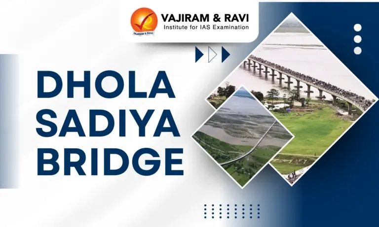
Dhola Sadiya Bridge, officially known as Bhupen Hazarika Setu, is India’s longest bridge over water. It is built across the Lohit River, a tributary of the Brahmaputra. It is constructed to improve connectivity in the Northeast. The bridge links Dhola in Assam with Sadiya near Arunachal Pradesh. It was initiated in 2011 under a public-private partnership. It plays a key role in regional development and strategic defense movement near the India-China border.
Dhola Sadiya Bridge Features
Dhola Sadiya Bridge is a major engineering structure with strategic design, long span, high load capacity and modern construction techniques. The key features of this bridge include:
- Location: The bridge connects Dhola in Assam’s Tinsukia district to Sadiya near Arunachal Pradesh, located about 540 km from Dispur and 300 km from Itanagar, close to the China border within 100 km aerial distance.
- Length: The total bridge length is 3.55 km which makes it the longest bridge over water in India.
- Construction: Construction started in 2011 under the Ministry of Road Transport and Highways with Navayuga Engineering Company Limited under PPP model.
- Inauguration: The project was completed after 5 years in 2017 after facing delays due to several reasons. The bridge was inaugurated by Prime Minister of India Narendra Modi and Nitin Gadkari (Minister of Road Transport and Highways).
- Naming of Bridge: It is named after an artist and filmmaker from Assam- Bhupen Hazarika.
- Structural Design: It consists of 183 spans of 50 metres each with external post tensioned structure, supported by 182 piers equipped with seismic buffers suitable for high earthquake zone conditions.
- Load Capacity: The bridge is designed to carry 60 tonne battle tanks, enabling heavy military vehicle movement, which no previous bridge in the region could support effectively.
- Connectivity Improvement: It reduces travel time from 6 to 8 hours to around 30 minutes, replacing ferry dependence and cutting distance by about 165 km between key routes.
Also Read: Longest Bridge in India
Dhola Sadiya Bridge Significance
The Dhola Sadiya Bridge plays a major role in improving connectivity, boosting economy and strengthening defense preparedness in the northeastern region.
- Strategic Importance: Located near the India-China border, it enables rapid movement of troops and artillery, strengthening India’s defense infrastructure and supporting border road development initiatives.
- Regional Connectivity: It provides 24×7 road connectivity between Assam and Arunachal Pradesh, replacing unreliable ferry services and linking remote regions with major transport networks.
- Economic Development: The bridge supports trade, agriculture and local industries by improving transport of goods, reducing fuel costs and promoting economic integration in backward areas.
- Social Benefits: It improves access to healthcare, education, and markets for people of Arunachal Pradesh by connecting them quickly to railheads in Tinsukia and airport in Dibrugarh.
- Infrastructure Expansion: The bridge is part of a larger road development plan including 73 strategic border roads, enhancing overall infrastructure growth in the Northeast region.


Dhola Sadiya Bridge Challenges
The Dhola Sadiya Bridge Project faced multiple engineering, environmental, and logistical challenges due to difficult terrain and climatic conditions.
- Seismic Risk: The region falls under a high seismic zone, requiring advanced engineering solutions like seismic buffers in piers to ensure stability during earthquakes and long term durability.
- Flood Conditions: Construction over the Lohit River faced strong currents and seasonal floods, making foundation work difficult and requiring use of heavy hydraulic rigs and advanced techniques.
- Remote Location: Transporting materials and machinery to the remote Northeast region posed logistical challenges, increasing construction complexity and slowing progress during initial phases.
- Construction Delays: Though planned earlier, actual work began in 2011 and faced delays due to environmental conditions and technical difficulties before final completion and opening in 2017.
- Harsh Climate: Continuous rainfall, humidity, and unstable riverbed conditions affected construction pace and required specialized materials and methods to ensure structural strength and longevity.
![]() Last updated on April, 2026
Last updated on April, 2026
→ UPSC Final Result 2025 is now out.
→ UPSC has released UPSC Toppers List 2025 with the Civil Services final result on its official website.
→ Anuj Agnihotri secured AIR 1 in the UPSC Civil Services Examination 2025.
→ UPSC Marksheet 2025 is now out.
→ UPSC Notification 2026 & UPSC IFoS Notification 2026 is now out on the official website at upsconline.nic.in.
→ UPSC Calendar 2026 has been released.
→ Check out the latest UPSC Syllabus 2026 here.
→ UPSC Prelims 2026 will be conducted on 24th May, 2026 & UPSC Mains 2026 will be conducted on 21st August 2026.
→ The UPSC Selection Process is of 3 stages-Prelims, Mains and Interview.
→ Prepare effectively with Vajiram & Ravi’s UPSC Prelims Test Series 2026 featuring full-length mock tests, detailed solutions, and performance analysis.
→ Enroll in Vajiram & Ravi’s UPSC Mains Test Series 2026 for structured answer writing practice, expert evaluation, and exam-oriented feedback.
→ Join Vajiram & Ravi’s Best UPSC Mentorship Program for personalized guidance, strategy planning, and one-to-one support from experienced mentors.
→ Shakti Dubey secures AIR 1 in UPSC CSE Exam 2024.
→ Also check Best UPSC Coaching in India
Dhola Sadiya Bridge FAQs
Q1. Where is Dhola Sadiya Bridge located? +
Q2. What is the length of Dhola Sadiya Bridge? +
Q3. When was Dhola Sadiya Bridge inaugurated? +
Q4. How does the Dhola Sadiya Bridge benefit Arunachal Pradesh? +
Q5. Why is Dhola Sadiya Bridge strategically important? +
Tags: dhola sadiya bridge general knowledge geography