What’s in Today’s Article?
- ESA Biomass Satellite Latest News
- Biomass Mission
- How the Biomass Mission Will Monitor Forests
- The Earth Explorer Programme
- ESA Biomass Satellite FAQs
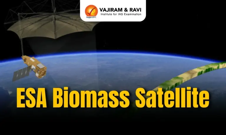
ESA Biomass Satellite Latest News
- The European Space Agency (ESA) is set to launch its seventh Earth Explorer mission, Biomass, aboard the Vega C rocket from French Guiana. The satellite will be placed in a sun-synchronous orbit at an altitude of around 666 km.
- The mission aims to map the world’s forests, providing crucial data on their condition and changes over time. This will enhance understanding of the role forests play in the global carbon cycle.
- The Biomass mission is part of ESA’s broader Earth Explorer programme, which studies various components of the Earth’s system.


Biomass Mission
- The Biomass mission aims to address the lack of large-scale data on forest above-ground biomass and forest height, which is critical for understanding forests’ role in the carbon cycle and climate regulation.
Importance of Forests
- Forests absorb around 16 billion metric tonnes of CO₂ annually.
- They store about 861 giga tonnes of carbon in branches, leaves, roots, and soils.
- Accurate data on biomass is essential to assess their health and carbon storage capacity.
Tracking Deforestation and Carbon Emissions
- In 2023, the world lost 3.7 million hectares of tropical forests — about 10 soccer fields per minute.
- This deforestation contributed to 6% of global CO₂ emissions.
- The mission will help monitor how carbon levels are changing due to deforestation and human activity.
Technological Approach
- The mission will create 3D images of forests, from the canopy to the ground, using advanced radar imaging.
- It will improve understanding of forest quality, diversity, and carbon storage.
Additional Objectives
- Monitor ice sheet movements in Antarctica.
- Produce digital terrain models in areas covered by dense vegetation.
How the Biomass Mission Will Monitor Forests
- Use of Synthetic Aperture Radar (SAR)
- The Biomass satellite will employ Synthetic Aperture Radar (SAR) technology to map the Earth’s surface.
- Unlike optical sensors, SAR can operate day and night and through clouds, making it ideal for consistent forest monitoring.
- The SAR will operate in the P-band frequency range with a wavelength of 70 cm.
- This long wavelength allows the radar to penetrate dense forest canopies, enabling scientists to measure biomass from the tree canopy to the forest floor.
- This capability is unique to Biomass, as it is the first satellite globally to use P-band SAR.
- Estimating Forest Biomass and Carbon Storage
- The radar will estimate above-ground biomass — the total mass of living vegetation in forests.
- From this, researchers can calculate carbon content, as roughly half of forest biomass is carbon.
- Key Technological Feature
- The satellite is equipped with a 12-meter antenna that will unfold once in orbit, enabling high-resolution radar imaging across wide forested regions.
- Importance of the Data
- The mission will “weigh” forests from space, helping to determine how much carbon is stored and how this changes over time.
- This will improve our understanding of the carbon balance between forests and the atmosphere — a critical factor in addressing climate change.
The Earth Explorer Programme
- The Earth Explorer programme by the European Space Agency (ESA) is designed to enhance understanding of the Earth system by launching satellites that study various components of the planet, including:
- Earth’s interior
- Cryosphere (frozen regions)
- Hydrosphere (water bodies)
- Atmosphere
- Ionosphere (charged particles)
- Land surface
Key Missions Under the Programme
- GOCE (2009–2013): The Gravity Field and Steady-State Ocean Circulation Explorer was the first mission. It advanced research in ocean circulation and the physics of Earth’s interior.
- EarthCARE (Launched May 2024): The Earth Cloud Aerosol and Radiation Explorer aims to improve our understanding of Earth’s radiative balance, which is vital for climate studies.
Broader Impact
- The Earth Explorer missions provide critical data to support scientific research on climate change, natural resources, and environmental monitoring across the globe.
ESA Biomass Satellite FAQs
Q1. What is the ESA Biomass satellite mission?
Ans. It’s a mission to map global forests using radar, helping assess carbon storage and monitor deforestation.
Q2. How does the Biomass satellite measure forests?
Ans. It uses P-band Synthetic Aperture Radar to scan tree canopies and forest floors in 3D, even through clouds.
Q3. Why is forest biomass data important?
Ans. It helps determine how much carbon forests store and how they’re changing due to deforestation or climate impact.
Q4. What makes Biomass different from past satellites?
Ans. It’s the first satellite globally to use P-band radar, enabling deep penetration of dense forest cover.
Q5. What else will Biomass monitor besides forests?
Ans. It will track Antarctic ice sheet movements and produce digital terrain models of dense vegetative areas.
![]() Last updated on April, 2026
Last updated on April, 2026
→ UPSC Final Result 2025 is now out.
→ UPSC has released UPSC Toppers List 2025 with the Civil Services final result on its official website.
→ Anuj Agnihotri secured AIR 1 in the UPSC Civil Services Examination 2025.
→ UPSC Marksheet 2025 is now out.
→ UPSC Notification 2026 & UPSC IFoS Notification 2026 is now out on the official website at upsconline.nic.in.
→ UPSC Calendar 2026 has been released.
→ Check out the latest UPSC Syllabus 2026 here.
→ UPSC Prelims 2026 will be conducted on 24th May, 2026 & UPSC Mains 2026 will be conducted on 21st August 2026.
→ The UPSC Selection Process is of 3 stages-Prelims, Mains and Interview.
→ Prepare effectively with Vajiram & Ravi’s UPSC Prelims Test Series 2026 featuring full-length mock tests, detailed solutions, and performance analysis.
→ Enroll in Vajiram & Ravi’s UPSC Mains Test Series 2026 for structured answer writing practice, expert evaluation, and exam-oriented feedback.
→ Join Vajiram & Ravi’s Best UPSC Mentorship Program for personalized guidance, strategy planning, and one-to-one support from experienced mentors.
→ Shakti Dubey secures AIR 1 in UPSC CSE Exam 2024.
→ Also check Best UPSC Coaching in India