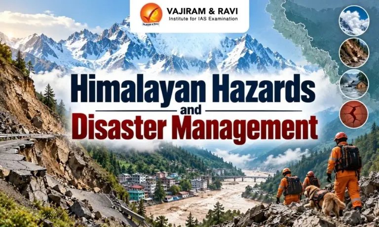
The Himalayas are a young and fragile mountain system facing earthquakes, landslides, flash floods, cloudbursts, avalanches and Glacial Lake Outburst Floods. Climate change, glacier retreat and rapid infrastructure growth are increasing disaster risks. Himalayan Hazards and Disaster Management therefore requires hazard mapping, early warning systems, resilient infrastructure, community preparedness and cooperation among countries sharing Himalayan rivers, glaciers and weather systems.
Himalayan Hazards and Disaster Management
Himalayan Hazards and Disaster Management focuses on reducing risks from interconnected natural and human induced hazards across the mountain region. The Himalayas are tectonically active and have steep slopes, fragile rocks and rapidly changing glaciers. Effective management needs scientific monitoring, real time information sharing, coordinated response and community participation across vulnerable Himalayan landscapes.
What are Himalayan Hazards and Disasters?
Himalayan Hazards and Disasters include geological, hydrological, climatic and cryospheric disasters that can interact and create cascading impacts on people, infrastructure and river systems.
- Landslides: Fragile rocks, steep slopes, intense rainfall, earthquakes and slope cutting make landslides common. Road construction, tunnels, poor drainage and improper disposal of excavated material can further destabilise mountain slopes.
- Flash Floods: Steep Himalayan rivers can carry water, rocks, ice and debris at high speed through narrow valleys. Cloudbursts, intense rainfall, landslides and sudden glacial events can trigger destructive flash floods.
- Glacial Lake Outburst Floods: Melting glaciers can create unstable glacial lakes dammed by weak moraines. South Lhonak Lake in the Eastern Himalayas expanded by 45.5% between 2016 and 2023, increasing GLOF risk.
- Cloudbursts: Short duration and high intensity rainfall can produce sudden runoff in steep valleys. Changes in rainfall patterns, including fewer rainy days with more intense rainfall, can increase flash floods and landslides.
- Earthquakes: The Himalayas lie along the active collision zone of the Indian and Eurasian plates. Accumulated tectonic stress and locked faults can produce major earthquakes, which may trigger landslides, avalanches and other secondary hazards.
- Avalanches and Debris Flows: Rapid movement of snow, ice, rock and loose material can affect remote mountain settlements and infrastructure. A rock ice collapse can also transform into a debris flow and flood downstream.
- Cascading Hazards: A single event can trigger several hazards. An earthquake may cause landslides, while a glacier or slope collapse can generate debris flows, floods and damage to infrastructure.
- Recent Developments: Recent floods in Nepal’s Bhotekoshi-Trishuli River 2026 highlighted the need for real time monitoring, cross border data sharing, early warning systems and coordinated disaster response for Himalayan hazards.


Why are the Himalayas Prone to Disasters?
The disaster vulnerability of the Himalayas results from the interaction of geological instability, extreme terrain, changing climate and growing human pressure across fragile mountain ecosystems.
- Young Fold Mountains: The Himalayas are young and tectonically active mountains. The Indian Plate moves northward into the Eurasian Plate at roughly 4-5 cm per year, creating seismic stress and fractured terrain.
- Steep Topography: Sharp slopes and narrow river valleys increase the speed and destructive force of flowing water, rocks and debris. Limited flat land also concentrates settlements and infrastructure in vulnerable valleys.
- Fragile Geological Material: Weak and unconsolidated rock strata are highly vulnerable to erosion and slope failure. Earthquakes and heavy rainfall can further reduce slope stability.
- Glacier Retreat: Rising temperatures contribute to glacier retreat and the formation or expansion of glacial lakes. Unstable lakes and changing ice conditions increase the possibility of sudden floods.
- Permafrost Melting: Higher temperatures can thaw high altitude permafrost that helps stabilise mountain slopes. Its weakening can contribute to rockfalls, landslides and avalanches.
- Changing Rainfall: Rising temperatures are pushing the snowline higher in some areas. More precipitation falling as rain can increase runoff, erosion and slope instability at high elevations.
- Infrastructure Pressure: Roads, railway tunnels, dams, hydropower projects and settlements can increase exposure when construction ignores local carrying capacity. Slope cutting and poor drainage can further raise landslide risks.
- Unplanned Urbanisation: Construction in old landslide zones, inadequate drainage and excessive water infiltration can cause land subsidence and structural damage. Joshimath illustrates the risks associated with development in fragile mountain areas.
Himalayan Hazards and Disaster Management Measures
Himalayan Disaster Management requires a shift from isolated disaster response towards continuous monitoring, prevention, preparedness and coordinated action across vulnerable landscapes and river basins.
- National GLOF Risk Mitigation Programme: NDMA initiated the programme following the Sikkim disaster. It targets 195 high risk glacial lakes across Sikkim, Uttarakhand, Himachal Pradesh, Arunachal Pradesh, Jammu & Kashmir and Ladakh with an outlay of ₹150 crore.
- Hazard Mapping: Hazard and vulnerability mapping identifies areas exposed to GLOFs, landslides, earthquakes, avalanches and flash floods. Micro level maps can support safer land use planning and emergency evacuation.
- Early Warning Systems: Remote sensing, satellites, weather monitoring, river sensors and ground based systems can improve warnings. Automated alerts are especially important because some high altitude debris flows can develop within minutes.
- Scientific Himalayan Study: The Himalay Unnati Mission announced a study involving scientists, ecologists, research institutions and disaster management experts. It will examine cloudbursts, landslides, glacier collapses and other recurring Himalayan Hazards.
- Himalayan Authority Proposal: HUM has called for a Himalayan Authority at the Centre to coordinate conservation, sustainable development, climate resilience and disaster risk reduction across Himalayan states and the North East.
- Community Preparedness: Local communities need training in early evacuation, emergency communication, first response and safe evacuation routes. Community based warning systems can provide valuable response time in downstream villages.
- Existing Regional Cooperation: ICIMOD provides a regional knowledge platform involving Afghanistan, Bangladesh, Bhutan, China, India, Myanmar, Nepal and Pakistan. The SAARC Agreement on Rapid Response to Natural Disasters was established in 2011.
- Bilateral Mechanisms: India-Nepal joint committees address flood management and shared water resources. India-China mechanisms support hydrological data sharing for the Brahmaputra and Sutlej. India-Bangladesh cooperation covers water level, rainfall and discharge data across 54 transboundary rivers.
- Ecosystem Based Measures: Forests, wetlands and natural drainage channels can support disaster risk reduction. Excessive slope cutting and riverbed encroachment should be controlled to maintain natural landscape stability.
- HUM Field Initiatives: Since 2021, Mission Green Himalayas has planted more than 22 lakh trees across over 20 landscapes. HUM has also installed 613 solar microgrids and solar powered digital classrooms in 356 border schools, benefiting more than 1.95 lakh people.
- Disaster Relief Experience: HUM’s Samvedana programme involved more than 1,000 volunteers supporting 7,248 families and over 45,000 people affected by floods and landslides. More than 5,450 young people received training at over 43 skill development centres in India and Nepal.
- Integrated Monitoring: A regional system should combine satellite observations, weather forecasts, seismic monitoring, hydrological data and ground sensors. Such integration can improve identification of cascading hazards and support faster emergency decisions.
Himalayan Hazards and Disaster Management Challenges
Himalayan Disaster Management faces difficult terrain, limited monitoring, fragmented institutions, transboundary risks and rapidly changing hazard patterns that require stronger regional preparedness.
- Remote Mountain Terrain: Many hazard sources are located in high altitude and inaccessible areas. Difficult terrain limits installation of monitoring systems and delays rescue, relief and communication after disasters.
- Very Short Warning Time: Sudden rock ice collapses and debris flows can develop extremely quickly. In one recent Nepal disaster, instruments detected a tremor at 8:37 am, while an emergency SMS was sent around 9:15 am.
- Limited Cross Border Data Sharing: Himalayan Hazards can begin in one country and affect downstream communities in another. Formal and real time exchange of hydrological, glacial and hazard information remains limited.
- Fragmented Governance: Disaster management involves NDMA, State Disaster Management Authorities, Border Roads Organisation, Central Water Commission, Geological Survey of India, Armed Forces and district administrations. Coordination can become difficult during sudden disasters.
- Changing Climate Risks: Historical disaster assessments may become less reliable as temperatures, glaciers and rainfall patterns change. New combinations of hazards require continuous monitoring and updated risk assessments.
- Development Ecology Conflict: Roads, hydropower projects, tunnels, tourism and settlements increase economic opportunities but can also increase exposure in fragile valleys. Development planning must consider mountain carrying capacity and disaster resilience.
- Need for Regional Framework: Himalayan rivers, glaciers and weather systems cross national boundaries. Effective disaster management therefore requires 365 day data sharing, joint monitoring, coordinated warnings, basin level planning and regular disaster response exercises.

 Last updated on Oct, 2026
→ UPSC 2027 Notification will be released on 13 January 2027 at upsconline.nic.in.
→ Asian Games 2026 are being held in Aichi-Nagoya, Japan, from 19 September to 4 October.
→ Check Nobel Prize 2026 Winners List here.
→ Download PIB PRiSM Monthly Magazine 2026 here.
→ Check UPSC Monthly Current Affairs Magazine The Recitals here.
→ Check out the latest UPSC Syllabus here.
→ Download UPSC Model Answers for Mains 2026
→ UPSC Mains Question Paper 2026 is out now for Essay & GS Paper 1, 2, 3 & 4.
→ UPSC Calendar 2027 has been released.
→ Enroll in Vajiram & Ravi’s UPSC Mains Test Series 2027 for structured answer writing practice, expert evaluation, and exam-oriented feedback.
→ Join Vajiram & Ravi’s UPSC Mentorship Program 2027 for personalized guidance, strategy planning, and one-to-one support from experienced mentors.
→ Go through the UPSC Mains Previous Year Papers to enhance your preparation.
→ UPSC has released UPSC Toppers List 2025 with the Civil Services final result on its official website.
→ Also check Best UPSC Coaching in India
Himalayan Hazards and Disaster Management FAQs
Q1. What are the major Hazards in the Himalayas?+
Q2. Why are the Himalayas prone to Disasters?+
Q3. What is Himalayan Disaster Management?+
Q4. What are the major challenges in Himalayan Disaster Management?+
Q5. How can Himalayan Disasters be managed effectively?+
Tags: disaster management himalayan hazards himalayan hazards and disaster management