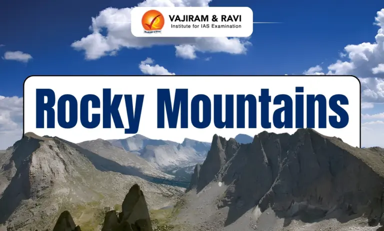
The Rocky Mountains are also called the Rockies. They form the eastern part of the North American Cordillera. They extend about 4,800 km from northern British Columbia and Alberta to New Mexico. The range is the largest mountain system in North America. It contains more than 100 distinct ranges and includes some of the continent’s highest peaks, major rivers, glaciers, forests, mineral deposits, national parks and diverse wildlife.
Rocky Mountains Features
The Rocky Mountains form a major north-south mountain system across western North America. Their physical features vary greatly with latitude, elevation, geology, climate and drainage patterns.
- Location: The Rocky Mountains extend from northern British Columbia and Alberta in Canada to New Mexico in the United States. They lie between the Great Plains and western mountain and plateau systems.
- Extent: The rocky mountain range stretches about 3,000 miles or 4,800 km. Its width varies from about 110 to 480 km, with some sections extending more than 300 miles across.
- Major divisions: The Rockies include the Canadian and Northern Rockies, Middle Rockies, Southern Rockies and Colorado Plateau. These divisions differ in geology, landforms, drainage, soils and elevation.
- Rocky Mountains USA: The United States portion includes major ranges in Montana, Idaho, Wyoming, Utah, Colorado and New Mexico. Colorado contains the largest concentration of the highest summits.
- Highest peak: The rocky mountains highest peak is Mount Elbert in Colorado’s Sawatch Range. It reaches 4,401 metres or about 14,440 feet above sea level.
- Rocky Mountains Canada: Mount Robson in British Columbia is the highest peak of the Canadian Rockies. It rises to 3,954 metres or 12,972 feet.
- Rocky Mountains height: Many peaks exceed 4,000 metres. Southern Rockies generally contain higher summits than the northern and middle sections.
- Continental Divide: The Continental Divide passes through the Rockies. It separates drainage flowing towards the Atlantic and Pacific oceans and connects with major headwater systems.
- Rivers: Important rivers include the Colorado, Columbia, Missouri, Arkansas, Rio Grande, Snake, Green, San Juan, Athabasca and Fraser. The mountains act as major water sources for western North America.
- Glaciers: The Columbia Icefield lies on the Continental Divide in the Canadian Rockies. It covers elevations of about 3,000 to 4,000 metres and includes the Athabasca Glacier.
- Climate: Climate varies from Arctic conditions in the north to subtropical influences in the south. Winters are cold, summers are generally cool at high elevations and precipitation increases towards the north.
- Soil: Rocky Mountain soils are generally thin, young, shallow and nutrient poor. Some valley soils support irrigation based agriculture, while grazing is more widespread.
- Mountain Division: Rocky Mountains on map appear as a long north-south belt along western North America. They form the easternmost major division of the North American Cordillera.
How Were The Rocky Mountains Formed?
The presentRocky Mountains (Rockies) developed through long term tectonic activity, uplift, erosion, volcanic processes and repeated glaciation across western North America.
- Ancient rocks: The foundation includes Precambrian metamorphic and sedimentary rocks. Some exposed rocks are more than 3.3 billion years old and form ancient continental cores.
- Laramide Orogeny: The main modern mountain building occurred about 80 to 55 million years ago during the Laramide orogeny. Plate movement produced broad uplift and crustal deformation.
- Shallow subduction: The Farallon Plate moved beneath the North American Plate at a relatively shallow angle. This transferred compressional forces far inland and helped raise the Rocky Mountain region.
- Erosion and glaciers: After uplift, rivers, weathering and glaciers reshaped the mountains. Pleistocene glaciations carved U shaped valleys, cirques, ridges and other distinctive landforms.


Rocky Mountains Biodiversity
The Rocky Mountains support varied ecosystems because elevation, latitude, moisture and temperature create several distinct habitats across the range.
- Flora: Lower areas contain grasslands and shrubs. Montane forests include aspen, ponderosa pine, Douglas fir and lodgepole pine. Higher zones contain spruce, fir, krummholz and alpine tundra.
- Fauna: Major mammals include grizzly bears, black bears, wolves, mountain lions, wolverines, elk, moose, bighorn sheep, mountain goats, mule deer, pronghorn and white tailed deer.
- Birdlife: Bald eagles, golden eagles, peregrine falcons, ospreys, turkey vultures, grouse, ptarmigan, cranes, herons, ducks and trumpeter swans occur across different habitats.
- Aquatic life: Mountain rivers and lakes support trout, including rainbow trout and northern waters contain Arctic grayling. Several native aquatic species face pressure from habitat alteration.
- Indigenous people: Indigenous communities have inhabited the Rockies for thousands of years. Major groups include Blackfoot, Crow, Cheyenne, Shoshone, Ute, Arapaho, Kutenai, Flathead, Bannock and Coeur d’Alene.
- Protected areas: Major protected landscapes include Yellowstone, Glacier, Grand Teton, Rocky Mountain, Banff, Jasper, Yoho, Kootenay and Waterton Lakes national parks.
- Rocky Mountain National Park: The rocky mountains national park area in Colorado protects high elevation ecosystems, alpine landscapes, forests, wildlife and important headwaters.
- Conservation: Protected forests and parks conserve wildlife habitat and watersheds. Wolf, grizzly bear, bald eagle and peregrine falcon populations have benefited from conservation and recovery measures.
- Environmental threats: Mining, logging, grazing, oil exploration, roads and reservoirs can increase erosion, alter streams, damage habitats and release harmful metals into water systems.
Rocky Mountains Significance
The Rocky Mountains are important for water security, biodiversity, minerals, energy, tourism, forests, agriculture, recreation and the physical geography of North America.
- Water resources: The mountains receive substantial precipitation and store water as snow and ice. Their rivers supply water for irrigation, domestic use, industry, hydropower and flood management.
- Mineral wealth: The Rockies contain copper, gold, silver, lead, zinc, molybdenum, uranium, beryllium, tungsten, phosphate rock, gypsum, limestone and other mineral resources.
- Energy resources: Major basins contain coal, petroleum, natural gas, oil shale and coalbed methane. The Powder River Basin and San Juan Basin are important energy producing regions.
- Agriculture: Mountain valleys and adjoining plains support livestock grazing and irrigated farming. Seasonal movement between high summer pastures and lower winter areas is known as transhumance.
- Tourism: Millions of visitors travel to the Rockies for hiking, camping, mountaineering, fishing, hunting, skiing, snowboarding, mountain biking and wildlife viewing.
- Forestry: Canadian Rocky forests contribute significantly to timber production. Forest resources support sawmills and pulp and paper industries, while recreational uses dominate many U.S. national forests.
- Geographic importance: The Rockies form a major physical barrier in western North America. Their elevation influences precipitation, river systems, climate patterns, settlement, transport and regional ecosystems.
- Economic importance: Mining, energy production, forestry, agriculture, tourism, recreation and service industries create substantial economic activity across communities surrounding the mountain system.
- Cultural importance: Indigenous histories, exploration routes, mining settlements, railways, parks and mountain communities have shaped the cultural landscape of the Rockies.

 Last updated on Oct, 2026
→ UPSC 2027 Notification will be released on 13 January 2027 at upsconline.nic.in.
→ Check Nobel Prize 2026 Winners List here.
→ Download PIB PRiSM Monthly Magazine 2026 here.
→ Check UPSC Monthly Current Affairs Magazine The Recitals here.
→ Check out the latest UPSC Syllabus here.
→ Download UPSC Model Answers for Mains 2026
→ UPSC Mains Question Paper 2026 is out now for Essay & GS Paper 1, 2, 3 & 4.
→ UPSC Calendar 2027 has been released.
→ Enroll in Vajiram & Ravi’s UPSC Mains Test Series 2027 for structured answer writing practice, expert evaluation, and exam-oriented feedback.
→ Join Vajiram & Ravi’s UPSC Mentorship Program 2027 for personalized guidance, strategy planning, and one-to-one support from experienced mentors.
→ Go through the UPSC Mains Previous Year Papers to enhance your preparation.
→ UPSC has released UPSC Toppers List 2025 with the Civil Services final result on its official website.
→ Also check Best UPSC Coaching in India
Rocky Mountains FAQs
Q1. Where are the Rocky Mountains located?+
Q2. What is the highest peak of the Rocky Mountains?+
Q3. Which national parks are located in the Rocky Mountains?+
Q4. In What 6 States Are The Rocky Mountains Located?+
Q5. Why Are They Called Rocky Mountains?+
Q6. What Are 5 Facts About The Rocky Mountains?+
Q7. How Were The Rocky Mountains Formed?+
Q8. How Long Are The Rocky Mountains?+
Tags: mountains rocky rocky mountains