C-FLOOD Platform

C-FLOOD Platform

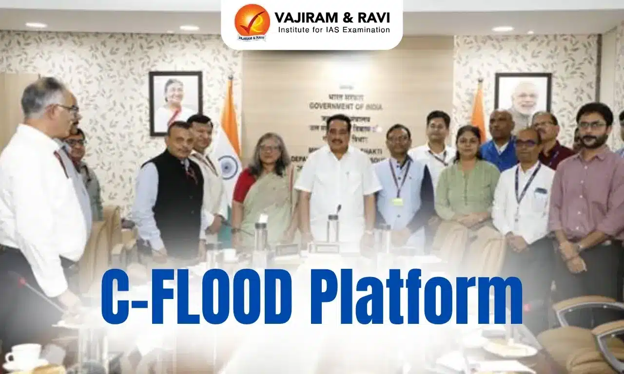
C-FLOOD Platform Latest News

Recently, the Union Minister of Jal Shakti inaugurated the C-FLOOD platform.

About C-FLOOD Platform

  • It is a Unified Inundation Forecasting System.
  • It is collaboratively developed by the Centre for Development of Advanced Computing (C-DAC), Pune and Central Water Commission (CWC), Department of Water Resources, River Development & Ganga Rejuvenation (DoWR, RD & GR), Ministry of Jal Shakti.
  • This initiative, executed under the National Supercomputing Mission (NSM) jointly steered by the Ministry of Electronics and Information Technology (MeitY) and Department of Science and Technology (DST), marks a transformative step towards strengthening India’s flood management and disaster response framework.

Features of C-FLOOD

  • It is a web-based platform that provides two-days advance inundation forecasts up to village level in the form of flood inundation maps and water level predictions.
  • The platform will act as a unified system integrating flood modelling outputs from national and regional agencies, offering a comprehensive decision-support tool for disaster management authorities.
  • At present, the system covers the Mahanadi, Godavari, and Tapi river basins, with more river basins to be incorporated in the future.
  • The C-FLOOD platform uses advanced 2-D hydrodynamic modelling to simulate flood scenarios.
  • The simulations for Mahanadi Basin are run on High Performance Computing (HPC) infrastructure under NSM at C-DAC Pune, with integration of outputs for Godavari and Tapi Basins, which have been developed by National Remote Sensing Centre (NRSC) under the National Hydrology Project (NHP).

Source: PIB

C-FLOOD Platform FAQs

Q1: What is the motto of the Central Water Commission?

Ans: The mission statement of CWC aims to promote integrated and sustainable development and management of India's water resources by using state-of-the-art technology and competency and by coordinating all stakeholders.

Q2: What is the definition of a hydrodynamic model?

Ans: A hydrodynamic model is defined as a model that describes the kinetic process of spreading in systems with a large dependence on fluid viscosity, where the equilibrium contact angle is eventually reached.

Financial Fraud Risk Indicator (FRI)

Financial Fraud Risk Indicator

Financial Fraud Risk Indicator (FRI)Latest News

Recently, the Reserve Bank of India’s (RBI) directed all Scheduled Commercial Banks, Small Finance Banks, Payments Banks, and Co-operative Banks to integrate the Financial Fraud Risk Indicator (FRI) developed by the Department of Telecommunications (DoT) into their systems.      

About Financial Fraud Risk Indicator

  • It was launched by DoT’s Digital Intelligence Unit (DIU).
  • It is a risk-based metric that classifies a mobile number to have been associated with Medium, High, or Very High risk of financial fraud.
  • This classification is an outcome of inputs obtained from various stakeholders including reporting on Indian Cyber Crime Coordination Centre (I4C’s) National Cybercrime Reporting Portal (NCRP), DoT’s Chakshu platform, and Intelligence shared by banks and financial institutions.
  • It empowers stakeholders-especially banks, NBFCs, and UPI service providers- to prioritize enforcement and take additional customer protection measures in case a mobile number have high risk.
  • The Digital Intelligence Unit (DIU) of DoT regularly shares the Mobile Number Revocation List (MNRL) with stakeholders, detailing numbers disconnected due to cybercrime links, failed re-verification, or misuse—many of which are tied to financial frauds.
  • Banks and financial institutions can use FRI in real time to take preventive measures such as declining suspicious transactions, issuing alerts or warnings to customers, and delaying transactions flagged as high risk.
  • The system’s utility has already been demonstrated with leading institutions such as PhonePe, Punjab National Bank, HDFC Bank, ICICI Bank, Paytm, and India Post Payments Bank actively using the platform.
  • Significance: The FRI allows for swift, targeted, and collaborative action against suspected frauds in both telecom and financial domains.

Source: PIB

Financial Fraud Risk Indicator (FRI) FAQs

Q1: What is a financial fraud risk indicator?

Ans: The FRI is a risk-based metric that classifies mobile numbers into three categories Medium, High, and Very High based on their likelihood of involvement in financial fraud.

Q2: What is meant by digital intelligence?

Ans: Digital intelligence is the sum of social, emotional, and cognitive abilities that enable individuals to face the challenges and adapt to the demands of life in the digital world.

RECLAIM Framework

RECLAIM Framework

RECLAIM Framework Latest News

The Coal Ministry is set to launch the RECLAIM framework on 4th July, 2025.

About RECLAIM Framework

  • It is a community engagement and development framework designed specifically for mine closures.  
  • The Coal Controller Organisation, under the Ministry of Coal, in partnership with the Heartfulness Institute, has developed this comprehensive Community Development Framework.
  • It recognizes that mine closures significantly impact both landscapes and local livelihoods; this framework is a key step toward ensuring a just and sustainable transition for communities that have developed alongside mining operations over decades.

Features of the RECLAIM Framework

  • The framework—referred to as the RECLAIM—serves as a structured guide for inclusive community engagement and development throughout the mine closure and post-closure phases.
  • It offers a practical, step-by-step approach to institutionalizing community participation in the transition process.
  • It is supported by a suite of actionable tools, templates, and field-tested methodologies tailored to the Indian context. Special emphasis is placed on gender inclusivity, the representation of vulnerable groups, and alignment with Panchayati Raj Institutions, ensuring that the transition is equitable and locally relevant.
  • Ultimately, the RECLAIM Framework aspires to facilitate a seamless and resilient transition for mining communities—grounded in trust, ecological restoration, and long-term socio- economic well-being.

Source: PIB

RECLAIM Framework FAQs

Q1: What is the role of the coal controller organization?

Ans: It collects and maintains coal production data of all private and public sector coal mines in the country. The information is collected monthly. It has been made the statistical authority concerning coal and lignite statistics.

Q2: Is coal controller organization a statutory body?

Ans: Coal Controller's Organization is a subordinate statutory organization under the administrative control of Ministry of Coal.

Genome

Genome

Genome Latest News

Researchers recently sequenced the first whole ancient Egyptian genome from an individual who lived 4,500 to 4,800 years ago — the oldest DNA sample from Egypt to date.

About Genome

  • A genome is an organism’s complete set of genetic information. 
  • A genome includes all of the hereditary instructions for creating and maintaining life, as well as instructions for reproduction. 
  • The human genome, like all other cellular life forms, consists of DNA (deoxyribonucleic acid) and includes both the nuclear and mitochondrial DNA. This is in contrast to ribonucleic acid (RNA) viruses, whose genome is composed of RNA.
  • From Genome to Genes:
    • The instructions in our genome are made up of DNA.
    • Within DNA is a unique chemical code that guides an organism’s growth, development and health.
    • This code is determined by the order of the four nucleotide bases that make up DNA: adenine, thymine, cytosine, and guanine.
    • DNA has a twisted structure in the shape of a double helix.
    • Single strands of DNA are coiled up into structures called chromosomes.
    • Within chromosomes, sections of DNA are organised into genes.
    • Genes control different characteristics such as eye colour and height.
    • All living things have a unique genome.
  • There are 23 pairs of chromosomes in the human genome
  • Between 1990 and 2003, all twenty-three pairs were fully sequenced through an international research undertaking known as the Human Genome Project. 
  • The study and analysis of genomes is called genomics.

Where is the Genome Found?

  • In organisms known as eukaryotes (which includes humans, other mammals, plants and fungi), most of the genome is contained within a membrane-bound structure called the nucleus
  • In humans and other complex multicellular organisms, a copy of the genome is found in nearly every cell in the body. 
  • The exception to this is mammalian red blood cells, which do not contain a genome as they do not have a nucleus or mitochondria.
  • Furthermore, human reproductive cells (eggs and sperm) each contain half the DNA from that person’s genome, which then combines to form a whole genome at fertilisation.
  • Organisms known as Prokaryotes, which contain no inner membranes, store their genome in a region of the cytoplasm called the nucleoid. 

How long is a genome?

  • The length of the genome varies between species and doesn’t necessarily reflect the size of the organism from which it came.
  • The human genome is approximately 3 billion base pairs (3.2 to be exact) in length.
  • While 3 billion is a big number, the rare Japanese flower called Paris japonica has a genome size of roughly 150 billion nucleotides, making it 50 times the size of the human genome.

Source: TH

Genome FAQs

Q1: What do you mean by genome?

Ans: A genome is an organism’s complete set of genetic information.

Q2: What is a genome vs. gene?

Ans: Genes are the fundamental units of heredity, and the genome is the organism's ensemble of genes.

Q3: What are the four nucleotide bases that make up DNA?

Ans: Adenine, Thymine, Cytosine, Guanine

Q4: In eukaryotic cells, where is most of the genome located?

Ans: Nucleus

Q5: How many base pairs are in the human genome (approx.)?

Ans: 3 billion

Santhal Rebellion

Santhal Rebellion

Santhal Rebellion Latest News

June 30 marked the 170th anniversary of the Santhal rebellion, or ‘Hul’ – literally, revolution – one of the earliest tribal uprisings against the British.

About Santhal Rebellion

  • The Santhal rebellion, or ‘Hul’–literally, revolution–began in 1855, two years before the uprising of 1857, often referred to as “the first war for Indian independence”.
  • The Santhal rebellion occurred in the Rajmahal hills of the Santhal region in Jharkhand. 
  • It was an “organised war against colonialism” led by the Santhals, standing against the myriad forms of oppression–economic and otherwise–they were subjected to by the British and their collaborator zamindars and corrupt moneylenders.
  • The seeds of the Santhal rebellion, however, were sown in 1832 when the East India Company created the Damin-i-Koh region in the forested belt of the Rajmahal hills. 
    • The area was allocated to the Santhals displaced from Birbhum, Murshidabad, Bhagalpur, Barabhum, Manbhum, Palamau, and Chhotanagpur, all areas of the Bengal Presidency.
    • While the Santhals were promised settlement and agriculture in Damin-i-Koh, what followed was the repressive practice of land-grabbing and begari (bonded labour) of two types: kamioti and harwahi. 
    • Over the years, Santhals found themselves at the receiving end of exploitative practices aided by the British.
  • Led by two brothers, Sidhu and Kanhu, the Santhal Rebellion saw the participation of as many as 32 castes and communities rallying behind them.
    • The brothers spread word about their plan through uniquely folded sal leaves, a communication system called Dharwak, and mobilised 10,000 people and declared a rebellion. 
    • Their brothers, Chand and Bairab, and sisters Phulo and Jhano Murmu, joined forces. 
    • With Phulo and Jhano joining the rebellion, more women took up arms against the British.
  • After the rebellion broke out in 1855, both sides continued clashing till the uprising was crushed in 1856. 
  • The British defeated the Santhals using modern firearms and war elephants in a decisive action in which both Sidho and Kanho died.

Who were the Santhal Tribes?

  • The Santhals were one of the largest tribal communities in India, predominantly residing in the states of Jharkhand, Bihar, West Bengal, and Odisha. 
  • They were known for their rich cultural heritage, distinct language (Santhali), and deep connection to the land they inhabited.
  • Traditionally, the Santhals had been agriculturists, depending on the land for their livelihood. 
  • Their spiritual practices were closely linked to their agricultural lifestyle.
  • The Santhal community had a strong social structure, with their society being organised into various clans known as ‘parhas.’
  • They followed animism, a belief system deeply rooted in nature worship. They honoured spirits associated with the earth, water, and forests.

Source: IE

Santhal Rebellion FAQs

Q1: In which year did the Santhal Rebellion begin?

Ans: 1855

Q2: The Santhal Rebellion took place in which present-day Indian state?

Ans: Jharkhand

Q3: Who were the main leaders of the Santhal Rebellion?

Ans: Sidhu and Kanhu

Q4: What was Damin-i-Koh, mentioned in the context of the Santhal Rebellion?

Ans: A forested region allocated to Santhals for settlement

Namdapha National Park and Tiger Reserve

Namdapha Tiger Reserve

Namdapha National Park and Tiger Reserve Latest News

The elusive and endangered white-eared night heron has been camera-trapped in Namdapha National Park and Tiger Reserve in Arunachal Pradesh recently.

About Namdapha National Park and Tiger Reserve

  • Namdapha, a national park and tiger reserve,  lies on the international border between India and Myanmar within Changlang District in the state of Arunachal Pradesh.
  • It covers an area of 1985.23 sq.km.
  • It is located at the junction of the Indian subcontinent and Indo-China biogeographic Regions.
  • It is nestled between the Dapha Bum ridge of the Mishmi Hills of the northeastern Himalayas and the Patkai Ranges.
  • It has a common boundary with Kamlang Wildlife Sanctuary (Arunachal Pradesh).
  • River: The Namdapha River (a tributary of Noa-Dihing River) flows right across in a north-south direction of this reserve, and hence the name Namdapha has been given.
  • Vegetation: It consists of Northern Tropical Evergreen Forest, North Indian Tropical Moist Deciduous Forests, East Himalayan Moist Temperate Forests, Moist Alpine Scrub Forests.
  • Flora:
    • It consists of species like Pinus Merkusi and Abies Delavavi being exclusive to the park.
    • It is home to the Blue Vanda, which is a rare and endangered orchard.
    • It also consists of medicinal plants like Mishimi Teeta (Copti teeta), which is used by the local tribes to treat different types of diseases.
  • Fauna: 
    • Elephants, Himalayan Black Bear, Himalayan Sun Bear, Hoolock Gibbon (only ape in India), Slow Loris, etc.
    • It is the only park in the world to have the four feline species of big cats, namely the Tiger (Panthera Tigris), Leopard (Panthera Pardus), Snow Leopard (Panthera Uncia), and Clouded Leopard (Neofelis Nebulosa) and numbers of Lesser cats. 

Key Facts about White-Eared Night Heron

  • It is a medium brown heron with a brown-streaked breast and a white patch on the side of the head.
  • Scientific Name: Oroanassa magnifica
  • It is primarily found in southern China and northern Vietnam and has an estimated global population of fewer than 1,000 individuals.
  • Known for being extremely secretive and nocturnal, the white-eared night heron is rarely observed in the wild.
  • It is listed as Endangered on the IUCN Red List.

Source: DH

Namdapha National Park and Tiger Reserve FAQs

Q1: Namdapha National Park is located in which Indian state?

Ans: Arunachal Pradesh

Q2: Namdapha National Park shares its international border with which country?

Ans: Myanmar

Q3: What is the total area covered by Namdapha National Park?

Ans: 1985.23 sq. km

Q4: Which river flows through Namdapha National Park?

Ans: Namdapha River (a tributary of Noa-Dihing River)

Volume Weighted Average Price (VWAP)

Volume Weighted Average Price

Volume Weighted Average Price Latest News

To make trading easier for institutional investors and market participants, SEBI recently made it mandatory to issue a Common Contract Note with a single volume weighted average price.

About Volume Weighted Average Price

  • The Volume Weighted Average Price (VWAP) is, as the name suggests, is the average price of a stock weighted by the total trading volume. 
  • The VWAP is used to calculate the average price of a stock over a period of time.
  • It helps compare the current price of the stock to a benchmark, making it easier for investors to decide when to enter and exit the market. 
  • Also, the VWAP can assist investors in determining their approach towards a stock (active or passive) and make the right trade at the right time.

How to Calculate Volume Weighted Average Price ?

  • The VWAP is calculated for each day. 
  • It starts when the markets open and ends when the markets close for the day. Since it is done every day, the calculation uses intraday data. 
  • The formula for calculating VWAP is as follows:
    • VWAP = Typical Price*Volume / Cumulative Volume
  • Here, the numerator indicates the total value of all the trades for any specific period, and the denominator indicates the total trading volume for the same duration. 
  • The typical price is the average of the high price, the low price, and the closing price of the stock for that day. 
  • The VWAP ratio is then presented on a chart as a line. 
  • It has been likened to a moving average, in that when the price is above the VWAP line, the market is seen as in an uptrend, and when the price is below the VWAP, the market is in a downtrend.

Pros of Volume Weighted Average Price

  • VWAP ratios are used in algorithmic trading to help traders and investors to determine the best price at which to buy or sell, in line with the volume of the market. 
  • By ensuring high liquidity, traders can usually expect lower transaction costs and best execution.
  • VWAP is particularly useful when trading large numbers of shares. Attempting to buy a large volume of a single stock on the market could artificially increase its price — by using VWAP, traders can ensure that they aren't overinflating the trading volume for the asset they want to buy.

Cons of Volume Weighted Average Price

  • Most of the problems stem from the fact that a VWAP is a culminative indicator, meaning it relies on a vast amount of data points that will only increase in quantity throughout the day. 
  • Having such a large data set can cause lags in the VWAP line, in a similar way to moving average lags, which is why most traders and investors only use one-minute and five-minute timeframes.

Source: NDTV

Volume Weighted Average Price FAQs

Q1: What type of data is used to calculate Volume Weighted Average Price (VWAP)?

Ans: Intraday trading data

Q2: What is the formula for calculating Volume Weighted Average Price (VWAP)?

Ans: VWAP = Typical Price*Volume / Cumulative Volume

Q3: When the stock price is above the VWAP line, it is generally interpreted as:

Ans: An uptrend

Q4: What is a major limitation of VWAP?

Ans: It can lag behind real-time prices due to accumulation of data.

Q5: VWAP is most commonly used in which kind of trading?

Ans: Algorithmic and intraday trading.

Facciolella Smithi

Facciolella Smithi

Facciolella Smithi Latest News

Indian scientists recently discovered a new deep-sea eel species, Facciolella smithi (Smith’s witch eel), in the Arabian Sea.

About Facciolella Smithi

  • Facciolella smithi (Smith’s witch eel) is a new species of deep-sea eel.
  • It was discovered by the scientists at the ICAR–National Bureau of Fish Genetic Resources, Lucknow.
  • The specimen was collected at a depth ranging from 260 to 460 meters off the Kerala coast in the Arabian Sea.
  • It belongs to the family Nettastomatidae.
  • The eel likely inhabits the seafloor or burrows into soft sediments, navigating the pitch-black waters with the help of its sensory adaptations rather than sight.
  • The species has been named in honour of eminent ichthyologist Dr. David G. Smith for his significant contributions to eel taxonomy.

Facciolella Smithi Anatomical Characteristics

  • Body Structure: The eel has an elongate, ribbon-like body that reaches just over two feet in length. This slender shape allows it to glide smoothly through deep-sea waters.
  • Coloration: One of the most striking visual features is its two-tone body. The upper half is a rich brown, while the underside is described as “milky white.” This contrast may aid in camouflage in the dim oceanic depths.
  • Head and Snout: The eel has a notably large head with a duckbill-like snout, giving it a peculiar, almost prehistoric look.
  • Eyes and Vision: Despite its large head, the eyes of Facciolella smithi are relatively small, an adaptation to the low-light environment of the deep sea where visual cues are limited.
  • Teeth: The mouth contains cone-shaped teeth, likely used to grasp slippery or soft-bodied prey.
  • Gills: The gill openings are crescent-shaped, positioned behind the head, consistent with many species of the eel family.
  • Tail Regeneration: Remarkably, most of the specimens showed evidence of regrown or regenerated tails, indicating either predator encounters or natural loss due to environmental factors. This regenerative trait is crucial for survival in the harsh and competitive deep-sea ecosystem.

Source: KRISHI

Facciolella smithi FAQ's

Q1: What is Facciolella smithi?

Ans: A deep-sea eel species.

Q2: Where was Facciolella smithi discovered?

Ans: Off the Kerala coast in the Arabian Sea.

Q3: To which family does Facciolella smithi belong?

Ans: Nettastomatidae

Q4: Which institution discovered Facciolella smithi?

Ans: ICAR–National Bureau of Fish Genetic Resources, Lucknow

Q5: Who was Facciolella smithi named after?

Ans: Dr. David G. Smith, an ichthyologist

Terbium

Terbium

Terbium Latest News

Scientists from Indian Institute of Science (IISc) have developed a simple, glowing paper sensor that could help detect liver cancer early — using the green glow of a rare earth metal called terbium.

About Terbium

  • It is a rare-earth metal of the lanthanide series of the periodic table.
  • It occurs in many rare-earth minerals but is almost exclusively obtained from bastnasite and from laterite ion-exchange clays. It is also found in the products of nuclear fission. 

Properties of Terbium

  • It is a moderately hard, silvery white metal that is stable in air when in pure form.
  • The metal is relatively stable in air even at high temperatures, because of formation of a tight, dark oxide layer that can be represented as a mixed oxide composed of Tb2O3 and TbO2.
  • It readily reacts with diluted acids, but it is insoluble in hydrofluoric acid (HF) because the presence of the fluoride ion protects the metal from further reaction by forming a protective layer of TbF3.
  • It exhibits strong paramagnet above 230 K and antiferromagnetic between 220 K and 230 K, and it becomes ferromagnetic below 220 K.
  • Uses: Terbium compounds are used as green phosphors in fluorescent lamps, computer monitors, and TV screens that use cathode-ray tubes. Another major use is with dysprosium and iron in the magnetostrictive alloy.

Source: TOI

Terbium FAQs

Q1: What is terbium used for?

Ans: Terbium is used to dope calcium fluoride, calcium tungstate and strontium molybdate,

Q2: Where can I find terbium?

Ans: Terbium is one of the rarer "rare earth" metals; a minor component of major ores monazite and euxenite which are actively mined, especially in China

Kariyachalli Island

Kariyachali Island

Kariyachalli Island Latest News

Recently, the Tamil Nadu government has started an initiative to save the sinking Kariyachalli island.

About Kariyachalli Island

  • It is located in the Gulf Of Mannar region which is one of India’s most ecologically sensitive marine zones.
  • Kariyachalli is one of the 21 islands in the Gulf of Mannar Marine National Park region, located on the southeastern coast of India between Rameshwaram and Thhothukudi. The gulf is home to one of the four major coral reefs in India. 
  • Kariyachalli island possess beaches, sand dunes, spit and sandy plains.
  • The uninhabited island has sunk significantly over the past few decades due to rapid erosion, rising sea levels and degradation of the surrounding coral reef and seagrass meadows. 
  • According to a report by the Indian Institute of Technology Madras’s (IIT Madras), Department of Ocean Engineering island’s landmass shrank by over 70 per cent in 2024 compared to 1969.
  • About a third of the coral around the island has bleached on average and further degradation and disappearance of coral reefs would make the island more vulnerable to erosion, the report stated.
  • At the current rate of erosion, the island is expected to be submerged by 2036. With just a decade left, government authorities are now racing to save it from disappearing.
  • The Tamil Nadu Sustainably Harnessing Ocean Resources (TNSHORE) project, expected to start in August 2025, will try to restore the reefs with artificial modules, planting seagrass beds and reviving marine life. 

Source: DTE

Kariyachalli Island FAQs

Q1: Which Indian islands are called coral islands?

Ans: Lakshadweep

Q2: Where is the Gulf of Mannar Biosphere Reserve located?

Ans: The Gulf of Mannar Biosphere Reserve (GOMBR) is located in the southeastern tip of Tamil Nadu extending from Rameswaram in the North to Kanyakumari in the south.

Enquire Now