Mithi River

Mithi River

Mithi River Latest News

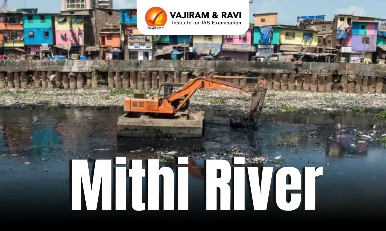
The Economic Offences Wing (EOW) of the Mumbai Police recently arrested a 49-year-old contractor in connection with the multi-crore Mithi river desilting fraud that has caused losses of over ₹65 crore to the Brihanmumbai Municipal Corporation (BMC).

About Mithi River

  • Mithi river is one of the four rivers flowing through the Mumbai city, Maharashtra. 
  • The river originates from the overflow of Vihar Lake and also receives the overflows from the Powai Lake about 2 km downstream.
  • It flows for 18 km before discharging into the Arabian Sea at Mahim Creek, flowing through residential and industrial complexes of Powai, Saki Naka, Kurla, Kalina, Vakola, Bandra Kurla Complex, Dharavi and Mahim.
  • The river has an average width of 5 metres in the upper reaches, has been widened to 25 m in the middle reaches and up to 70 m in the lower reaches after the 26 July 2005 deluge (944 mm in 24 h on 26 July 2005)
  • It is a seasonal river, which feeds on the monsoons.

Source: HT

Mithi River FAQs

Q1: Mithi River flows through which Indian city?

Ans: Mumbai

Q2: Into which water body does the Mithi River discharge?

Ans: Arabian Sea at Mahim Creek

Q3: What is the approximate total length of the Mithi River?

Ans: 18 km

Jeju Island

Jeju Island

Jeju Island Latest News

Following complaints from locals about misbehaviour by foreign visitors, police in South Korea's Jeju Island have printed a special type of multilingual notice.

About Jeju Island

  • Jejudo (also known as Jeju Island) is a volcanic island.
  • With a surface area of 1,846 sq.km., it is the largest island 130 km off the coast of the Korean Peninsula and the main island of Jeju Province of South Korea.
  • It lies in the East China Sea 60 miles (100 km) southwest of South Jeolla province, of which it once was a part. The provincial capital is the city of Jeju.
  • Oval in shape, Jeju Island measures 40 miles (64 km) from east to west and 16 miles (26 km) from north to south. 
  • The island contains the natural World Heritage Site Jeju Volcanic Island and Lava Tubes. 
  • A central feature of Jeju is Hallasan, the tallest mountain in South Korea and a dormant volcano, which rises 1,950 m above sea level. 360 satellite volcanoes are around the main volcano.

Source: NDTV

Jeju Island FAQs

Q1: Jeju Island (Jejudo) is located in which country?

Ans: South Korea

Q2: What is the total area of Jeju Island?

Ans: 1,846 sq.km

Q3: What is the name of the tallest mountain in South Korea, located on Jeju Island?

Ans: Hallasan

Euglena

Euglena

Euglena Latest News

In India, Euglena and its relatives are now widespread indicators of deteriorating water quality. 

About Euglena

  • Euglena is a unicellular, flagellated microorganism belonging to the group Euglenophyta.
  • These are commonly found in stagnant or slow-moving freshwater ponds, ditches, and urban lakes.
  • Characteristics: These protists are highly adaptable, capable of both photosynthesis (like plants) and feeding on organic matter (like animals).
  • This flexibility helps them thrive in nutrient-rich, oxygen-poor environments.
  • Three of the most common euglenoid genera observed in Indian water bodies are: Euglena, Phacus, Trachelomonas sp. These species often dominate surface waters, especially during warmer months.
  • The striking red or pink colour seen during blooms is due to a pigment called astaxanthin, produced by many euglenoids.
  • Astaxanthin is a fat-soluble xanthophyll that gives these organisms their bright red colour.

Impact of Euglena on Biodiversity

  • Oxygen depletion: Euglena photosynthesises, but at night it consumes oxygen, leading to diurnal oxygen fluctuations. This can result in hypoxia (low oxygen levels), which is dangerous for fish and other aquatic life.
  • Dense surface scums: Euglenoid blooms form thick mats on the water surface, which block sunlight from reaching submerged plants. This reduces the lake’s productivity and alters its ecological balance.
  • Fish mortality: Euglenophyte blooms can stick to fish gills, making it hard for them to breathe. Some species also produce toxins like euglenophycin, which directly kill fish or indirectly affect them by disrupting the food chain and oxygen levels.

Source: DTE

Euglena FAQs

Q1: What are the uses of Euglena?

Ans: They can be used for production of a range of compounds for use in cosmeceuticals and nutraceuticals.

Q2: What do euglenas eat?

Ans: Euglena eat green algae, amoebas, parameciums and rotifer.

Exercise Samanvay Shakti

Exercise Samanvay Shakti

Exercise Samanvay Shakti Latest News

Recently, the Exercise Samanvay Shakti 2025 was inaugurated at Laipuli, in Tinsukia district of Assam.

About Exercise Samanvay Shakti

  • It is initiated by Indian Army collaboration with state officials of Assam & Manipur to foster efficient cooperation, cohesion and mutual understanding.
  • It is a military-civil Integration exercise aimed at fostering synergy between security forces, government departments and civil institutions to address the region’s complex challenges through a unified and coordinated approach.
  • The inaugural session witnessed participation from the Indian Army, Indian Air Force, District Administration, Police, Intelligence Agencies, NDRF, SDRF, Medical Officials, BRO & GREF, Railways, educational institutions and security officials from OIL India, IOCL and Coal India alongwith representatives of the local media.

Objectives of Exercise Samanvay Shakti

  • To take concrete steps towards achieving an improved state of readiness, supported by unhindered channels of communication and refined standard operating procedures through practical rehearsals.
  • It seeks to further strengthen the bond of trust between the people of upper Assam & Manipur and the institutions that serve them, thereby contributing towards preparedness for security challenges, development towards nation building, and reinforcing national integration.

Source: News On Air

Exercise Samanvay Shakti FAQs

Q1: What is National Disaster Response Force?

Ans: It was established under section 44 of the Disaster Management Act, 2005. It is aimed at specialized response to natural and man-made disasters.

Q2: Is Border Roads Organisation under the army?

Ans: It is a road construction executive force in India that provides support to and is a part of the Indian Armed Forces.

Charge-Coupled Device

Charge-Coupled Device

Charge-Coupled Device Latest News

A charge-coupled device (CCD) is a remarkable electronic component whose invention marked a significant milestone in technology and influenced many fields.

About Charge-Coupled Device

  • It was a pioneering technology that converted light into electrical signals using an array of capacitors that transferred electric charges in a sequence.
  • A CCD consists of an integrated circuit made up of an array of small picture elements called pixels.
  • Each pixel acts like a small light sensor that collects photons (the particles of light) and converts them into electrical charges.
  • These charges are then transferred across the device, one pixel at a time, to be read and processed into a digital image.

Working of Charge-Coupled Device

  • It operates using the photoelectric effect, where light that falls on the device generates electron-hole pairs in the semiconductor material.
  • Specifically, when photons enter a CCD, they strike the semiconductor material beneath each pixel.
  • This energy knocks electrons loose, creating a small group of electrons proportional to the intensity of light in that pixel.
  • Each pixel is essentially a small capacitor that holds these electrons. The amount of charge in each pixel varies depending on how much light the pixel has received.
  • A voltage is applied to electrodes placed over the pixels in a sequence that moves the charges from one pixel to the next, like passing buckets of water along a line.
  • This is why it’s called a “charge-coupled” device, and this process continues until all the charge has reached a readout register.
  • The accumulated charge from each pixel is then converted into a voltage signal, which can be amplified and digitised by connected electronics to form a digital image.
  • This sequential transfer and reading process allows the CCD to create a precise and high-quality representation of a scene being captured.

Applications of Charge-Coupled Device

  • Household: CCDs made possible the rise of digital cameras by replacing film with sensors that captured images electronically. They’re also used in CCTV cameras to provide high-quality video feeds for security in places like banks, shopping malls, and hospitals.
  • Medical diagnostics: CCDs play a vital role in medical diagnostics, including in X-ray imaging, computed tomography (CT) scans, and endoscopy.
  • These CCDs are also used in microscopes, spectrometers, and particle detectors where they allow scientists to analyse images in detail.
  • Astronomy: Telescopes fit with CCDs can capture faint and distant celestial objects with more sensitivity and accuracy than traditional photographic plates.

Source: TH

Charge-Coupled Device FAQs

Q1: What is the Charge Coupled Device?

Ans: It is a light-sensitive integrated circuit that captures images by converting photons to electrons.

Q2: Why are Charge Coupled Devices used in telescopes?

Ans: It is because astronomical sources are usually very faint, astronomers allow CCDs to collect light for time intervals ranging from a fraction of a second to several hours.

Blue Carbon

Blue Carbon

Blue Carbon Latest News

Seaweed farming has emerged as a potential Blue Carbon strategy, yet empirical estimates of carbon burial from such farms remain lacking in the literature.

About Blue Carbon

  • Blue Carbon refers to organic carbon captured and stored by the ocean in vegetated coastal ecosystems such as mangrove forests, saltmarshes, or seagrass meadows. 
  • “Blue” refers to the watery nature of this storage. 
  • The vast majority of blue carbon is carbon dioxide that has dissolved directly into the ocean. 
  • Much smaller amounts are stored in underwater sediments, coastal vegetation, and soils; carbon-containing molecules, such as DNA and proteins; and ocean life from whales to phytoplankton.
  • These ecosystems store massive amounts of carbon, making them an integral part of global efforts to combat climate change.
  • They cover just 2% of the total ocean surface but account for 50% of the ocean’s carbon absorption.

Source: RG

Blue Carbon FAQs

Q1: What does the term Blue Carbon refer to?

Ans: Organic carbon stored in vegetated coastal ecosystems.

Q2: Blue Carbon ecosystems cover about what percentage of the total ocean surface?

Ans: 2%

Q3: Why are Blue Carbon ecosystems important in combating climate change?

Ans: They store massive amounts of carbon.

Indian Council of Social Science Research

Indian Council of Social Science Research

 Indian Council of Social Science Research Latest News

The Indian Council of Social Science Research (ICSSR) recently issued a show cause notice to the Centre for the Study of Developing Societies (CSDS), asking it to disclose the source of funding for its studies on the Election Commission’s Special Intensive Revision (SIR) exercise and the Maharashtra Assembly polls.

About Indian Council of Social Science Research 

  • It is the apex body of the Government of India for research in the social and human sciences.
  • It was established in the year 1969 by the Government of India on the recommendation of Prof. V. K. R. V. Rao Committee.
  • It is an autonomous organisation working under the aegis of the Department of Higher Education, Ministry of Education.
  • ICSSR plays a pivotal role in advancing knowledge and understanding of various social issues and challenges, and providing research-based solutions to policymakers and stakeholders in the development of the nation through initiatives and schemes such as 
    • research projects
    • doctoral, postdoctoral, senior fellowships, and national fellowships
    • research internships; training and capacity building of early career researchers
    • publication grants
    • national and international seminars, conferences, and workshops
    • publication of cutting-edge research
    • national and international collaboration
    • promotion of social science and humanities research through research institutes, recognised institutes, and regional centres.
  • An all-India network of 24 frontline research institutes and six regional centres is maintained, and five recognized institutes are programmatically supported by the ICSSR. 
  • The Documentation center of ICSSR – National Social Science Documentation Centre (NASSDOC)-provides library and information support services to researchers in social sciences.
  • ICSSR has developed the ICSSR Data Service to serve as a national data service for promoting a powerful research environment through sharing and reuse of data among the social science community in India.

Source: TOI

Indian Council of Social Science Research FAQs

Q1: Indian Council of Social Science Research (ICSSR) was established on the recommendation of which committee?

Ans: Indian Council of Social Science Research (ICSSR) functions under which Ministry of the Government of India?

Q2: Ministry of Education

Ans: What is the role of the National Social Science Documentation Centre (NASSDOC) under Indian Council of Social Science Research (ICSSR)?

Huntington’s Disease

Huntington’s Disease

Huntington's Disease Latest News

The union and state governments have yet to include Huntington’s disease in the rare category under the National Policy for Rare Diseases, a demand raised by patients and caregivers in 2024.

About Huntington's Disease

  • It is a genetic condition that affects the cells in your brain.
  • It is an inherited condition that causes brain cells to slowly lose function and die. 
  • If one of your parents has HD, you have a 50% chance of also developing it.
  • It affects the cells in parts of your brain that regulate voluntary movement and memory. 
  • What causes Huntington’s disease?
  • A genetic mutation of the HTT gene causes Huntington’s disease.
    • The HTT gene makes a protein called huntingtin. This protein helps your nerve cells (neurons) function.
    • If you have HD, your DNA doesn’t have all the information needed to make the huntingtin protein.
    • As a result, these proteins grow in an abnormal shape and destroy (instead of help) your neurons.
    • Your neurons die because of this genetic mutation.
    • The destruction of nerve cells happens in the basal ganglia, or the region of your brain that regulates your body’s movements.
    • It also affects the brain cortex (surface of your brain) that regulates your thinking, decision-making, and memory.
  • How common is HD?
    • Huntington’s disease affects an estimated 3 to 7 out of every 100,000 people, most often people of European ancestry (biological family comes from European descent).
  • Symptoms:
    • Common symptoms include uncontrollable dance-like movements (chorea) and abnormal body postures, as well as problems with behavior, emotion, thinking, and personality.
    • Other symptoms may include tremor (unintentional back-and-forth movement in the person’s muscles) and unusual eye movements. The eye movements can happen early in the disease.
    • These symptoms get worse over time.
    • As HD progresses, you will need constant assistance and supervision because of the debilitating nature of the disease.
    • People usually die from the disease within 15 to 20 years of developing symptoms.
  • Treatment:
    • There is no treatment that can stop or reverse HD, but health care providers can offer medications to help with certain symptoms.

Source: DH

Huntington's Disease FAQs

Q1: What is Huntington's Disease?

Ans: It is a genetic condition that affects the cells in your brain.

Q2: Which part of the brain is most affected in Huntington’s disease?

Ans: If one parent has Huntington’s disease, what is the chance of a child inheriting it?

Dal Lake

Dal Lake

Dal Lake Latest News

Recently, the iconic Dal Lake in Srinagar hosted the first-ever races under rowing, kayaking, and canoeing categories under the Khelo India Water Sports Festival.

About Dal Lake

  • Location: It is a mid-altitude urban lake located in Srinagar, Jammu and Kashmir.
  • It is surrounded by the Pir Panjal mountains.
  • It is integral to tourism and recreation in Kashmir and is named the “Jewel in the crown of Kashmir” or “Srinagar’s Jewel”.
  • It is one of the world’s largest natural lakes and also  known as the Lake of Flowers.
  • The shoreline of the lake is encompassed by a boulevard lined with Mughal-era gardens, parks, houseboats, and hotels. 
  • The wetland is divided by causeways into four basins; Gagribal, Lokut Dal, Bod Dal, and Nagin (although Nagin is also considered an independent lake).
  • Lokut-dal and Bod-dal each have an island in the centre, known as Rup Lank (or Char Chinari) and Sona Lank, respectively.
  • Dal Lake is also popular for the floating market where vendors have their own Shikaras/wooden boats and approach tourists.

Key Facts about Khelo India Water Sports Festival

  • It is organised jointly by the Sports Authority of India (SAI) and the J&K Sports Council under the government’s ‘Khelo Bharat’ policy.
  • It is aimed at boosting grassroots sports, generating livelihoods, and rejuvenating local infrastructure.
  • It is the first consolidated Open-age category championships where all 14 kayaking and canoeing events and the 10 rowing events are Olympic events.

Source: TH

Dal Lake FAQs

Q1: Is Dal Lake the largest freshwater lake in India?

Ans: No, Dal Lake is not the largest freshwater lake in India.

Q2: Which lake is known as lake of Flowers?

Ans: Dal Lake in Srinagar, Jammu and Kashmir is often referred to as the "Lake of Flowers"

Q3: Which mountain range surrounds Dal Lake?

Ans: Pir Panjal Mountains

Lipulekh Pass

Lipulekh Pass

Lipulekh Pass Latest News

India rejects Nepal’s claims over Lipulekh after India, China restart trade through border points.

About Lipulekh Pass

  • Location: It is a high-altitude mountain pass located in the Kumaon region of Uttarakhand, near the trijunction of India, Nepal, and China.
  • It links the Indian state of Uttarakhand with the Tibet region of China.
  • Altitude: It lies at an altitude of approximately 5,334 meters (17,500 feet).
  • Its elevation and strategic location make it a gateway to the higher reaches of the Himalayas.
  • It is the first Indian border post opened for trade with China in 1992.
  • This was followed by the opening of Shipki La Pass, Himachal Pradesh in 1994 and Nathu La Pass, Sikkim in 2006.

Significance of Lipulekh Pass

  • Ancient Trade Route: Lipulekh Pass has been utilized for centuries as a trade route, connecting the Indian subcontinent with the Tibetan plateau.
  • Religious Significance: The pass also has religious significance, being an integral part of the Kailash Mansarovar Yatra, a sacred pilgrimage for Hindus.

Source: TH

Lipulekh Pass FAQs

Q1: Which countries share the Lipulekh Pass with India?

Ans: Nepal, and China

Q2: Where is Kumaon Himalaya?

Ans: It lies between the Sutlej River in the west and the Kali River in the East.

Enquire Now