Multi-Lane Free Flow (MLFF) Tolling System

Multi-Lane Free Flow (MLFF) Tolling System

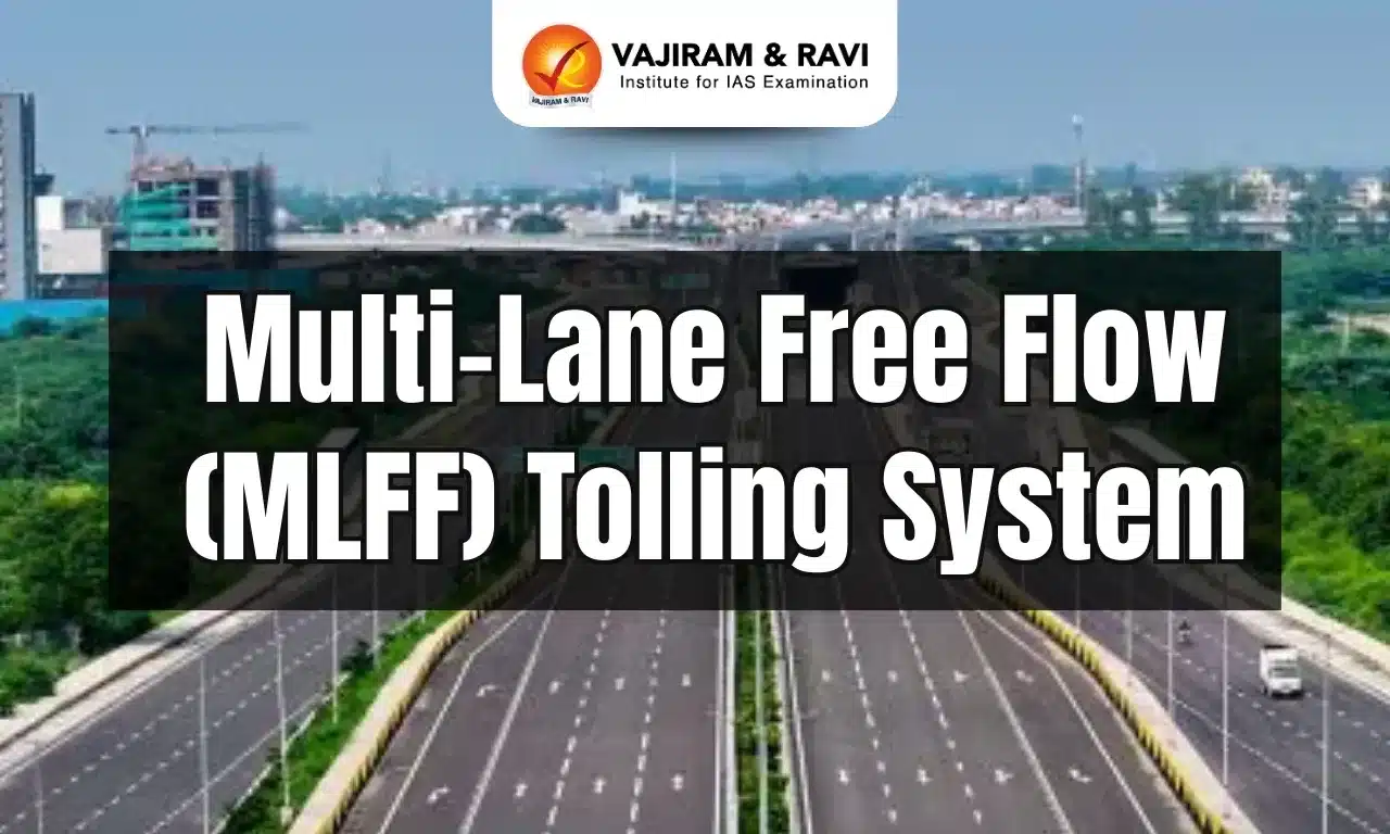
Multi-Lane Free Flow (MLFF) Tolling System Latest News

Recently, the Indian Highways Management Company Limited (IHMCL), a company promoted by NHAI has signed an agreement with ICICI Bank to implement country’s first comprehensive Multi-Lane Free Flow (MLFF) tolling system at Choryasi Fee Plaza in Gujarat on NH-48. 

About Multi-Lane Free Flow (MLFF) Tolling System

  • It is a barrier-less tolling system that enables transactions through reading of FASTag and Vehicle Registration Number (VRN) by High performance RFID Readers and ANPR Cameras.

Significance Multi-Lane Free Flow (MLFF) Tolling System

  • It enables seamless toll collection without stopping vehicles at fee plazas, reducing congestion and travel time leading to enhanced fuel efficiency and lowering emissions.
  • Implementation of MLFF will also contribute towards improving toll revenue collection and creating a smarter, faster and more efficient National Highway network across the country.

Key Facts about NHAI

  • It is India’s premier highway infrastructure creator entrusted with developing, maintaining, and managing National Highways.
  • It is a statutory body under the administrative control of the Ministry of Road Transport and Highways.
  • It was constituted under National Highways Authority of India Act, 1998 and made operational in February 1995.
  • Composition: It consists of a full time Chairman, and not more than five full time Members and four part time Members who are appointed by the Central Government.
  • The part time Members are the Secretary (RT&H), Secretary (Expenditure), Secretary (Planning) and DG (RD) & SS.

Source: PIB

Multi-Lane Free Flow (MLFF) Tolling System FAQs

Q1: What is the purpose of MLFF?

Ans: The Multi-Lane-Free-Flow (MLFF) system is an electronic tolling technology that enables smooth traffic flow.

Q2: What do you mean by RFID technology?

Ans: Radio Frequency Identification (RFID) technology uses radio waves to identify people or objects.

Mauritania

Mauritania

Mauritania Latest News

A migrant boat sank off Mauritania’s coast earlier recently, leaving at least 49 people dead and around 100 missing.

About Mauritania

  • It is a country in northwest Africa.
  • It occupies an area of 1,030,000 sq. km.
  • It is a country of the Sahel region (a belt across Africa between the arid Sahara to the north and the humid savannas to the south).
  • It borders four other nations: West Sahara, Senegal, Algeria, and Mali. The Atlantic Ocean lies to the west.
  • Approximately 90% of its landmass is located within the Sahara Desert.
  • The most prominent feature of this region is the Guelb er Richat, also known as the Eye of the Sahara, which is a deeply eroded dome consisting of a variety of intrusive and extrusive igneous rocks.
  • The Senegal River is the most important waterway in the country. 
  • People
    • Most of the people are Moors
    • These are the descendants of Arabs and Berbers (the original inhabitants of North Africa). 
  • Much of the population clings to the coastal cities or by the Senegal River in the south. 
  • Mauritania became independent from France in 1960.
  • In 1981, Mauritania became the last country in the world to outlaw slavery.
  • Capital: Nouakchott 
  • Language: 
    • The main language is Arabic. 
    • The Fulani, Soninke, Wolof, and French languages are also common. 
  • Islam is the national religion.
  • Economy:
    • Mauritania has an abundance of natural resources, including iron ore, gold, copper, gypsum, and phosphate. 
    • Extractive commodities make up 75 percent of Mauritania's total exports (exploration for oil is ongoing), with fishing making up another 20 percent.
    • The nation's coastal waters are said to be among the richest fishing areas in the world.

Source: TOI

Mauritania FAQs

Q1: Mauritania is located in which part of Africa?

Ans: Northwest Africa

Q2: Mauritania shares its borders which countries?

Ans: West Sahara, Senegal, Algeria, and Mali

Q3: Which natural feature of Mauritania is also known as the “Eye of the Sahara”?

Ans: Guelb er Richat

Q4: Mauritania gained independence from which colonial power in 1960?

Ans: France

Clopidogrel

Clopidogrel

Clopidogrel Latest News

Doctors now believe that clopidogrel, a well-known antiplatelet medication, could be more effective than aspirin for long-term prevention of heart attacks—especially in those at high risk. 

About Clopidogrel

  • Clopidogrel is a medication that belongs to the class of antiplatelet agents that prevent blood clots from forming. 
  • It is commonly prescribed to reduce the risk of heart attacks and strokes in people and those with peripheral arterial disease or unstable angina.
  • Clopidogrel works by blocking the action of platelets, which are blood cells that play a key role in forming blood clots, to reduce the risk of serious cardiovascular events.
  • Some of the common uses of Clopidogrel include:
    • Preventing heart attacks
    • Preventing strokes
    • Treating peripheral artery disease
    • Preventing blood clots after certain medical procedures
    • Preventing blood clots in patients with atrial fibrillation.
  • Clopidogrel is usually taken orally, with or without food. 
  • However, the dosage and frequency of the medication will depend on the individual's medical condition, age, and response to treatment.
  • Clopidogrel is typically taken once daily, preferably at the same time each day, to maintain consistent levels of the medication in the body.

Source: ITV

Clopidogrel FAQs

Q1: Clopidogrel belongs to which class of drugs?

Ans: Antiplatelet agents

Q2: What is the primary function of Clopidogrel?

Ans: Preventing blood clot formation.

Q3: Which cells does Clopidogrel primarily act upon?

Ans: Platelets

Q4: Clopidogrel is usually administered in which form?

Ans: Clopidogrel is usually taken orally, with or without food.

Air Quality Life Index (AQLI)

Air Quality Life Index

Air Quality Life Index Latest News

Air pollution has emerged as India’s most severe health threat, reducing the country’s average life expectancy by 3.5 years, according to the Air Quality Life Index (AQLI) 2025 report .

About Air Quality Life Index

  • It measures particulate air pollution's impact on life expectancy.
  • Developed by Michael Greenstone and Energy Policy Institute (EPIC) at the University of Chicago, the AQLI quantifies pollution's effects.
  • The AQLI combines research on long-term air pollution exposure with global particulate pollution measurements.
  • It provides insight into the true cost of air pollution on communities worldwide.

Highlights of the Air Quality Life Index 2025 Report

  • Air pollution has emerged as India’s most severe health threat, reducing the country’s average life expectancy by 3.5 years.
  • Toxic air robs Indians of nearly twice as many years as childhood and maternal malnutrition and more than five times the impact of unsafe water, sanitation, and handwashing.
  • All 1.4 billion Indians live in areas where pollution levels exceed the World Health Organization’s (WHO’s) safe limit of 5 µg/m³ for PM2.5. 
  • The northern belt is still the world’s most polluted zone, with 544.4 million people (38.9 percent of India’s population) living under severe air pollution.
  • Delhi-NCR is the worst hit, with residents facing a loss of 8.2 years in life expectancy (based on WHO’s standard). 
    • Bihar: 5.6 years lost 
    • Haryana: 5.3 years lost 
    • Uttar Pradesh: 5 years lost
  • Even by India’s weaker PM2.5 standard of 40 µg/m³, Delhi-NCR residents would still lose 4.74 years of life expectancy.
  • Shockingly, the report notes that 46 percent of Indians live in areas that exceed even India’s own PM2.5 standards.
  • If pollution levels were reduced to meet this national benchmark, Indians could gain an average of 1.5 years of life expectancy. 
  • Meeting WHO’s stricter 5 µg/m³ guideline could add up to 9.4 months even in cleaner regions.
  • The AQLI report underlines that South Asia is the most polluted region globally, with PM2.5 concentrations rising 2.8 percent in 2023 after a brief dip in 2022.
    • Air pollution:
      • Cuts 3 years off average life expectancy across the region.
      • Reduces life by more than 8 years in the most affected zones

Source: BS

Air Quality Life Index FAQs

Q1: The Air Quality Life Index (AQLI) was developed by which institution?

Ans: Energy Policy Institute at the University of Chicago (EPIC)

Q2: Who led the development of the Air Quality Life Index (AQLI)?

Ans: Michael Greenstone

Q3: According to the Air Quality Life Index (AQLI) 2025 Report, by how many years has India’s average life expectancy been reduced due to air pollution?

Ans: 3.5 years

Q4: Residents of Delhi-NCR are projected to lose how many years of life expectancy due to air pollution (based on WHO standards)?

Ans: 8.2 years

Q5: What percentage of Indians live in areas that exceed India’s own PM2.5 standards (40 µg/m³)?

Ans: 46%

Swarnamukhi River

Swarnamukhi River

Swarnamukhi River Latest News

The Tirupati Urban Development Authority (TUDA) recently announced Operation SWARNA, a massive plan to rescue the River Swarnamukhi from the clutches of land grabbers, revive its flow area and rejuvenate it to ensure sustenance.

About Swarnamukhi River

  • It is a river in Andhra Pradesh.
  • It is an east-flowing river basin having a small catchment area of 3,225 sq.km.
  • Course
    • It rises at an elevation of 300 m in the Eastern Ghat ranges near Pakala village in the Chittur district of Andhra Pradesh.
    • It runs generally in the northeastern direction passing through the famous Tirupati hills before joining into the Bay of Bengal. 
    • Its total length is 130 km. 
  • It flows through the sacred regions of Tirumala and Srikalahasti, where notable Hindu temples like the Srikalahasteeswara Temple are located.
  • Unlike larger river systems, the Swarnamukhi is independent, meaning it does not join or receive water from major river networks. Its flow is heavily dependent on rainfall, particularly in its upper catchment.
  • The average annual rainfall in the Swarnamukhi basin decreases from 1270 mm at the eastern extremity of the basin to 762 mm at the western extremity.
  • Its main tributary is the Kalyani River, across which the Kalyani Dam was constructed in 1977.

Source: TH

Swarnamukhi River FAQs

Q1: The Swarnamukhi River is located in which Indian state?

Ans: Andhra Pradesh

Q2: What is the total length of the Swarnamukhi River?

Ans: 130 km

Q3: The Swarnamukhi River originates from which mountain ranges?

Ans: Eastern Ghats

Q4: Into which water body does the Swarnamukhi River finally drain?

Ans: Bay of Bengal

Typhon Missile System

Typhon Missile System

Typhon Missile System Latest News

A joint U.S. and Japanese military exercise will see the temporary deployment of the “Typhon” intermediate-range missile in Japan, Japanese and U.S. officials said recently.

About Typhon Missile System

  • Typhon, also called the Mid-Range Capability (MRC), is a surface-to-surface missile system.
  • Manufactured by U.S. firm Lockheed Martin, the Typhon Weapon System leverages a modular design that allows it to fire various missile types.
  • It is equipped to launch SM-6 and Tomahawk cruise missiles.
    • The SM-6 missile provides engagement ranges beyond 320 kilometers, while the Tomahawk cruise missile offers deep-strike capability out to 1,500 kilometers.
  • Typhon is containerized, road-mobile, and highly survivable, enabling U.S. forces to disperse precision-strike assets across allied territory and quickly target both land and maritime threats in contested environments. 
  • The system's dual capability makes it particularly effective for both sea denial missions and precision land attacks. 
  • A full Typhon Weapon System battery comprises four launchers, a command post, and reload and support vehicles, all on trailers.

Source: TP

Typhon Missile System FAQs

Q1: Which company manufactures the Typhon Weapon System?

Ans: U.S. firm Lockheed Martin

Q2: Which missiles can the Typhon system launch?

Ans: It is equipped to launch SM-6 and Tomahawk cruise missiles.

Q3: What is the approximate engagement range of the SM-6 missile launched from Typhon?

Ans: 320 km

Q4: What is the maximum strike range of the Tomahawk missile in the Typhon system?

Ans: 1,500 km

Killer whales

Killer Whales (Orcas)

Killer whales Latest News

A new study has found that killer whales may be exploring human behaviour by offering them whole prey and waiting for them to respond.

About Killer whales

  • It is also known as Orcas which is found across the world and it is the ocean’s top predator.
  • It is the largest member of the Delphinidae family, or dolphins and are the most widely distributed of all cetaceans.
  • Members of this family include all dolphin species, as well as other larger species, such as long-finned pilot whales and short-finned pilot whales, whose common names also contain “whale” instead of “dolphin”.
  • Behavior: Killer whales are highly social, and most live in social groups called pods (groups of maternally related individuals seen together more than half the time).
  • Killer whales rely on underwater sound to feed, communicate, and navigate.
  • Appearance: They are one of the most recognizable marine mammals, with their distinctive black and white bodies.
  • Habitat: Globally, killer whales occur in a wide range of habitats, in both open seas and coastal waters.
  • Threats: Killer whales are at high risk of becoming entangled in fishing gear. Also habitat loss is a major concern.
  • Conservation Status: IUCN: Data Deficient

Source: TH

Killer whales FAQs

Q1: Are killer whales aggressive to humans?

Ans: In the vast majority of encounters, killer whales have shown no aggression towards people.

Q2: What is special about killer whales?

Ans: They are highly intelligent and able to coordinate hunting tactics.

Srivilliputhur Megamalai Tiger Reserve

Srivilliputhur Megamalai Tiger Reserve

Srivilliputhur–Meghamalai Tiger Reserve Latest News

Recently, concerns have been raised over the unauthorised construction and repair of three roads in Theni district within the Srivilliputhur–Meghamalai Tiger Reserve (SMTR).

About Srivilliputhur–Meghamalai Tiger Reserve

  • It is spread across the districts of Theni, Virudhunagar and Madurai in Tamil Nadu.
  • It lies in the ecologically sensitive Western Ghats region.
  • It was formed in February 2021 by combining Grizzled Squirrel Wildlife Sanctuary and Megamalai Wildlife Sanctuary.
  • It will function as a connecting link between Kerala’s Periyar Tiger Reserve and Tamil Nadu’s Southern Kalakkad-Mundanthurai Tiger Reserve.
  • The Srivilliputhu Megamalai Tiger Reserve (SMTR) area primarily relies on three perennial rivers: Vaigai, Suruliyaru, and Shanmuganathi. 

Flora and Fauna of Srivilliputhur–Meghamalai Tiger Reserve

  • It’s a blend of tropical evergreen and semi-evergreen forests, dry deciduous and moist mixed deciduous woods, and grasslands.
  • Mammals: Elephants, Tiger, Leopard, Nilgiri Tahr, Gaur, Spotted Deer, Barking Deer, Sambar Deer, Wild Boar, Porcupine, Nilgiri Langur, Lion-Tailed Macaque etc.
  • Birds: Red-Whiskered Bulbul, Common Iora, White-Browed Wagtail, Grey Wagtail, Pied Bush Chat etc.
  • Reptiles: Wood Snake, Monitor Lizard, Chameleon, etc.

Source: TH

Srivilliputhur–Meghamalai Tiger Reserve FAQs

Q1: Which river flows through Srivilliputhur-Megamalai Tiger Reserve?

Ans: The Srivilliputhu Megamalai Tiger Reserve (SMTR) area primarily relies on three perennial rivers: Vaigai, Suruliyaru, and Shanmuganathi.

Q2: When was Srivilliputhur-Megamalai Tiger Reserve established?

Ans: It was formed in February 2021 by combining Grizzled Squirrel Wildlife Sanctuary and Megamalai Wildlife Sanctuary.

Exercise Yudh Abhyas

Exercise Yudh Abhyas

Exercise Yudh Abhyas Latest News

Recently, an Indian Army contingent has departed for Fort Wainwright, Alaska, USA, to participate in the 21st edition of the Exercise Yudh Abhyas.

About Exercise Yudh Abhyas

  • It is the joint military exercise held between India and USA.
  • The Indian contingent, comprising personnel from a battalion of the Madras Regiment is taking part in this exercise.
  • Over two weeks, troops will rehearse a spectrum of tactical drills including heliborne operations, employment of surveillance resources and unmanned aerial systems, rock craft, mountain warfare, casualty evacuation, combat medical aid and the integrated use of Artillery, Aviation and Electronic Warfare systems.
  • In addition, subject-matter experts from both armies will conduct working groups on critical domains such as UAS and Counter-UAS operations, information warfare, communications and logistics.
  • The exercise will culminate in jointly planned and executed tactical manoeuvres, ranging from live-fire exercises to high-altitude warfare scenarios, with a focus on improving capabilities for United Nations peacekeeping operations and strengthening preparedness for multi-domain challenges.

Other Exercises between India and USA

  • Army:  Vajra Prahar
  • Navy: MALABAR (Multilateral)
  • Air Force: Cope India, Red Flag (Multilateral)

Source: PIB

Exercise Yudh Abhyas FAQs

Q1: What is the Yudh Abhyas exercise?

Ans: Yudh Abhyas is a bilateral military exercise between the Indian Army and the United States Army.

Q2: What is the aim of the Yudh Abhyas?

Ans: The primary objective of Yudh Abhyas is to enhance interoperability and cooperation between the two armies.

PRATUSH Telescope

PRATUSH Telescope

PRATUSH Telescope Latest News

Scientists at the Raman Research Institute have proposed a pioneering mission called PRATUSH designed to unlock the Cosmic Dawn.

About PRATUSH Telescope

  • Probing ReionizATion of the Universe using Signal from Hydrogen (PRATUSH) is a radio telescope to be sited on the moon’s far side.
  • It is built by the Raman Research Institute (RRI) in Bengaluru with active collaboration from the Indian Space Research Organisation (ISRO).
  • PRATUSH will carry a wideband frequency-independent antenna, operating over the frequency band 30-250 MHz, a self-calibratable analog receiver, and a digital correlator with high spectral resolution.
  • The observing strategy of PRATUSH will be to continually observe large sky regions, and recording spectra of the beam-averaged radio emission with a high spectral resolution of 100 kHz.
  • The nominal lifetime of the payload will be two years for achieving high signal-to-noise ratio with sufficient sky-coverage.
  • The preferred orbit for the payload will be a circumlunar orbit to enable a measurement of radio sky spectrum from the dark and far side of the Moon.
  • At the heart of PRATUSH’s innovative design lies an unexpectedly modest piece of technology: a compact single-board computer (SBC). Built initially around a Raspberry Pi, the SBC is serving as the master controller for the radiometer system.
  • The SBC coordinates PRATUSH’s entire operation:
    • Managing the antenna that collects cosmic signals
    • Overseeing the analog receiver that amplifies them
    • Controlling the Field Programmable Gate Array (FPGA) that converts these signals into digital fingerprints, mapping the brightness of the sky at different frequencies
    • Recording and storing high-speed data streams while also carrying out preliminary data processing and calibrations.

Source: PIB

PRATUSH Telescope FAQs

Q1: What is Pratush telescope?

Ans: PRATUSH is a future radiometer in lunar orbit that will reveal the Cosmic Dawn of our Universe.

Q2: Which organization developed the Pratush telescope?

Ans: PRATUSH (Probing ReionizATion of the Universe using Signal from Hydrogen) is being built by the Raman Research Institute (RRI) in Bengaluru.

Enquire Now